Morning Miami Weather Report
Miami, October 5 — Mostly Sunny
Automated weather summary from official sources; factual templates with validated source timestamps. Follow NWS Miami and NHC for current guidance.
Manual setup preview. These are real source data from the publication time below.
Forecast for Miami / Brickell
This Afternoon: 88°F. Mostly Sunny. Wind 8 mph SE. Rain chance: 6%.
Mostly sunny, with a high near 88. Heat index values as high as 100. Southeast wind around 8 mph.
Tonight: Partly cloudy, with a low around 79. South wind 2 to 7 mph.
Hourly forecast — rain chances and timing
| Eastern time | Temperature | Rain chance | Wind | Forecast |
|---|---|---|---|---|
| Oct 5, 2026 · 5:00 PM EDT | 86°F | 6% | 8 mph SE | Mostly Sunny |
| Oct 5, 2026 · 6:00 PM EDT | 86°F | 8% | 7 mph SE | Partly Cloudy |
| Oct 5, 2026 · 7:00 PM EDT | 85°F | 8% | 5 mph SE | Partly Cloudy |
| Oct 5, 2026 · 8:00 PM EDT | 83°F | 11% | 5 mph SE | Partly Cloudy |
| Oct 5, 2026 · 9:00 PM EDT | 83°F | 11% | 3 mph SE | Partly Cloudy |
| Oct 5, 2026 · 10:00 PM EDT | 83°F | 11% | 3 mph SE | Mostly Cloudy |
| Oct 5, 2026 · 11:00 PM EDT | 83°F | 9% | 3 mph SE | Mostly Cloudy |
Observed nearby
Miami International Airport (KMIA), Oct 5, 2026 · 5:20 PM EDT: Mostly Clear. Temperature 88°F; wind 9 mph. This airport observation does not measure conditions at your exact location in Brickell.
Alerts and outdoor plans
Miami / Brickell: no active alerts returned by the official query at collection time. This is not a statement that conditions are safe.
Biscayne Bay and the Miami-Dade coast: no active alerts returned by the official query at collection time. This is not a statement that conditions are safe.
Running: Use the temperature, rain and wind forecast above to plan your window. If thunderstorms are forecast or you hear thunder, postpone outdoor activity and seek a substantial building. This briefing does not certify a safe running window.
Paddleboarding — official Biscayne Bay forecast
Tonight: SE winds around 5 kt (6 mph). Smooth.
Tue: S winds around 5 kt (6 mph). Smooth.
Tue Night: SW winds around 5 kt (6 mph). Smooth.
Wind speeds in the source use knots (1 knot = 1.151 mph). Check current marine alerts and local conditions before launching; no safe launch window is inferred.
Official coastal Miami-Dade beach and rip-current guidance
FLZ173-061000-
Coastal Miami-Dade-
Including the beaches of Miami
431 PM EDT Mon Oct 5 2026

.REST OF TODAY...
Rip Current Risk*...........Low.
Surf Height.................1 foot or less.
Thunderstorm Potential**....None.
Water Temperature...........In the mid 80s.
Weather.....................Mostly sunny.
High Temperature............In the upper 80s.
Max Heat Index..............Up to 100.
Winds.......................Southeast winds around 5 mph.
Tides...
   Miami Harbor Entrance....High at 05:17 PM EDT.
Sunrise.....................7:14 AM.
Sunset......................7:04 PM.

.TUESDAY...
Rip Current Risk*...........Low.
Surf Height.................1 foot or less.
Thunderstorm Potential**....Moderate.
Weather.....................Mostly sunny. A chance of showers and
                            thunderstorms.
High Temperature............In the upper 80s.
Max Heat Index..............Up to 100.
Winds.......................Southwest winds around 5 mph, becoming
                            southeast in the afternoon.
Tides...
   Miami Harbor Entrance....Low at 11:35 AM EDT.
Sunrise.....................7:15 AM.
Sunset......................7:03 PM.

&&

Rip Current Risk Category
* Low Risk - The risk for rip currents is low, however,
life-threatening rip currents often occur in the vicinity of groins,
jetties, reefs, and piers.
* Moderate Risk - Life-threatening rip currents are possible in the
surf zone.
* High Risk - Life-threatening rip currents are likely in the surf
zone.

** For thunderstorm, waterspout, and UV definitions see:
https://www.weather.gov/beach/mfl
Satellite and radar
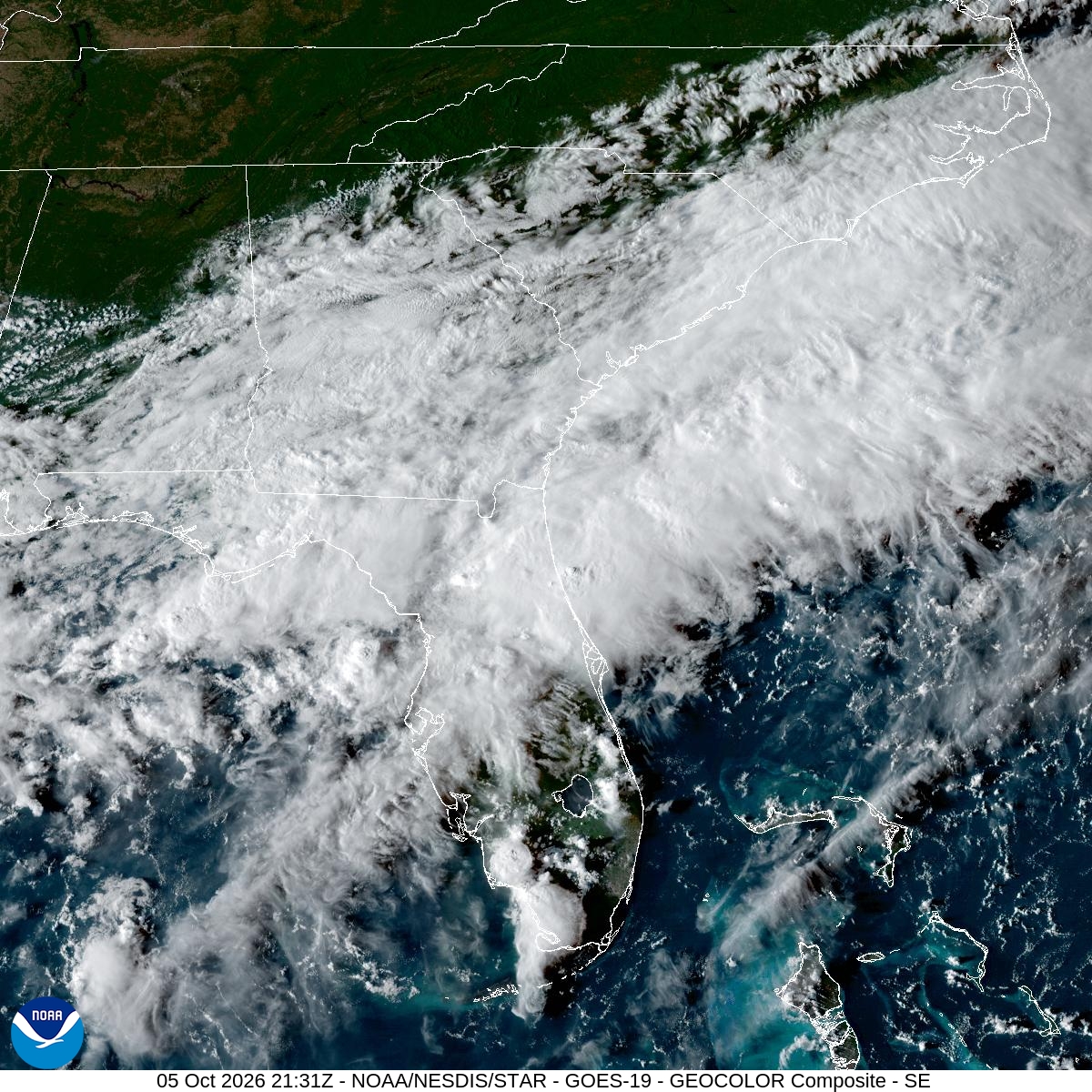
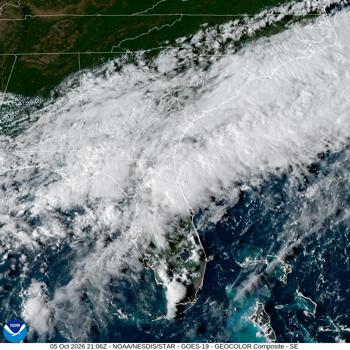
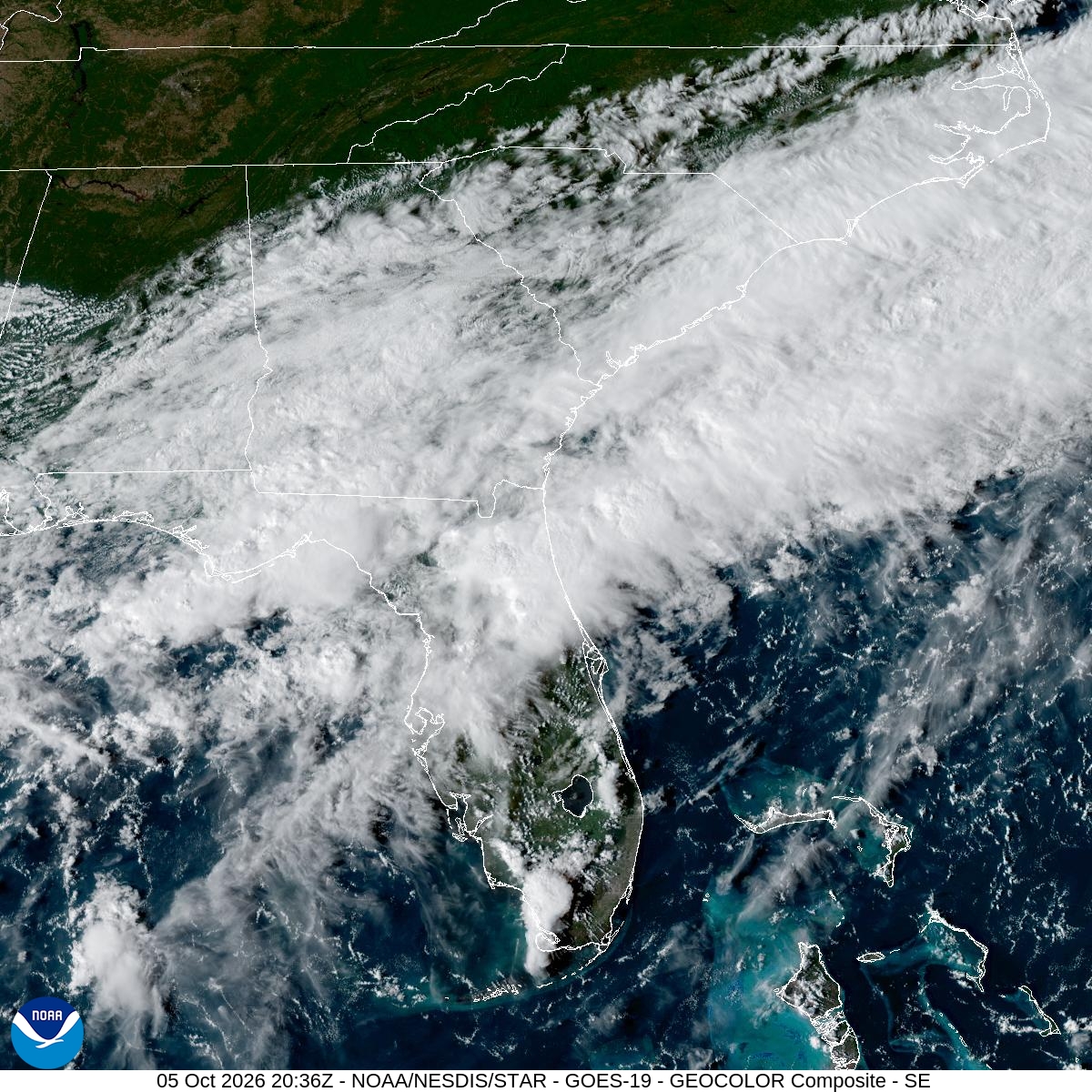
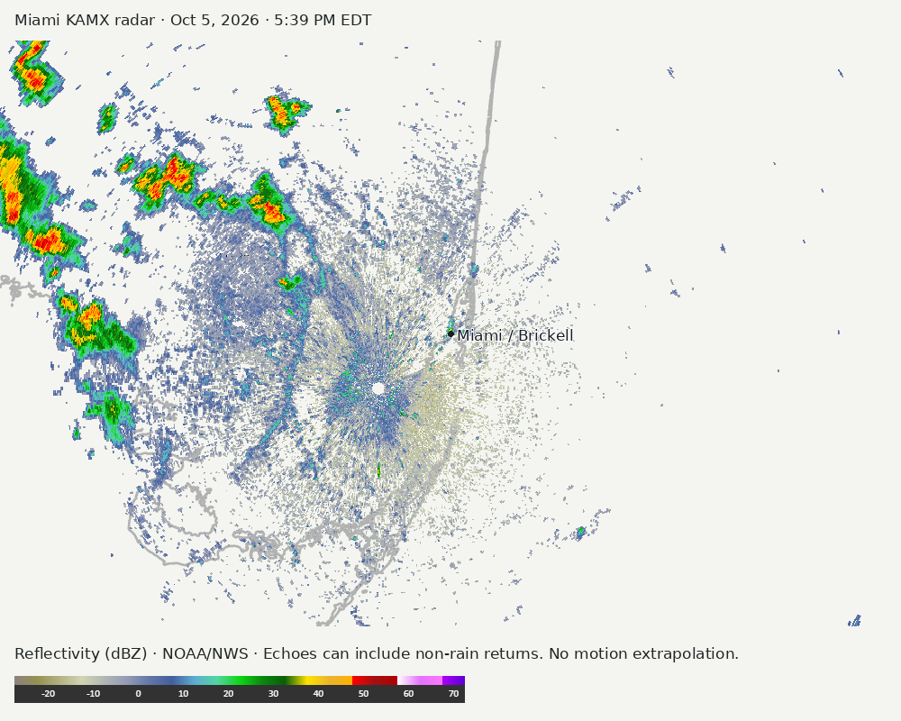
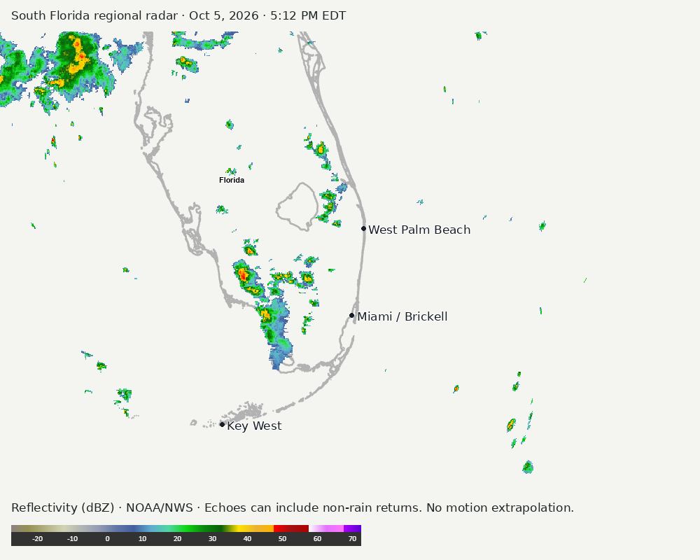
Archived frames show what the instruments captured at their labeled times. Radar echoes can include non-rain returns. No movement or future arrival is inferred automatically from these frames.
Southeast GeoColor satellite
GeoColor shows the Southeast, including Florida. The timestamped sequence below preserves cloud detail without automatically interpreting cloud cover at street level.

Earlier timestamped frames


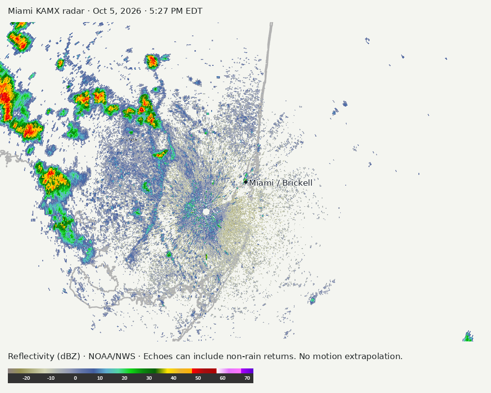
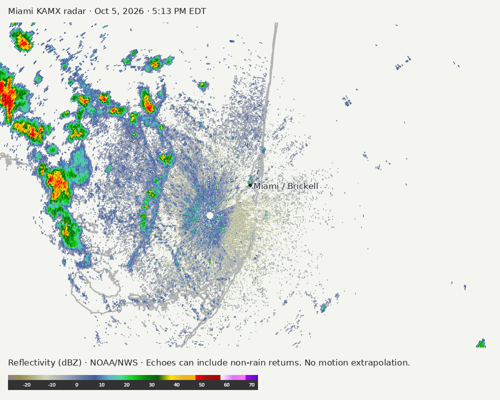
Detailed Miami radar — official KAMX fallback
Colored reflectivity echoes are concentrated west of Miami, northwest of Miami relative to Miami in the latest frame. These are echo locations, not confirmation of rain at the surface.
Earlier timestamped frames
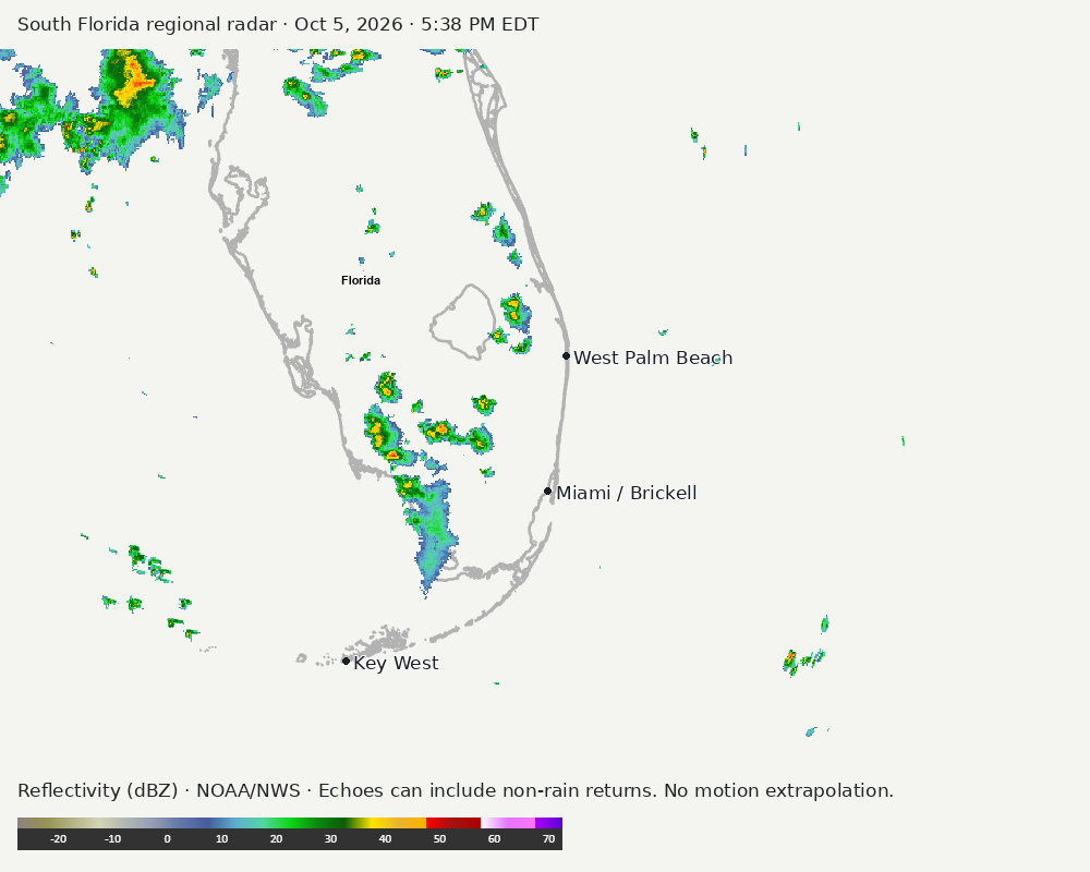
Regional South Florida radar
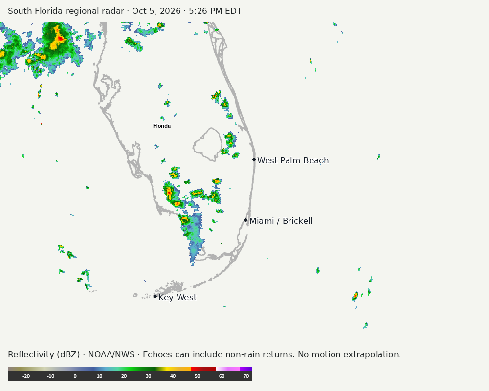
Colored reflectivity echoes are concentrated northwest of Miami, west of Miami relative to Miami in the latest frame. These are echo locations, not confirmation of rain at the surface.
Earlier timestamped frames
NWS Miami morning briefing
Authorized X API access is not configured; using the NWS fallback.
NWS fallback: This briefing uses the official Miami point forecast, alert queries, and the forecast discussion when available. It does not imply that an X morning post was retrieved.
Tropical outlook
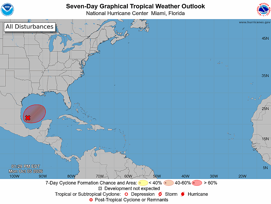
The Atlantic outlook describes development potential, not a forecast of impacts in Miami. No local hurricane impact is inferred here.
Read official source text
000
ABNT20 KNHC 051728
TWOAT

Tropical Weather Outlook
NWS National Hurricane Center Miami FL
200 PM EDT Mon Oct 5 2026

For the North Atlantic...Caribbean Sea and the Gulf of America:

Southwestern Gulf of America (AL92):
A trough of low pressure over the southwestern Gulf of America is
producing disorganized showers and thunderstorms. Although
environmental conditions appear to be marginally conducive, gradual
development is becoming more likely, and a tropical depression is
expected to form during the middle portion of the week. This system
is expected to drift eastward over the next couple of days, before
it turns northward. It is too early to determine the specific
impacts to the northern Gulf Coast, but interests there should
closely monitor the progress of this system.
* Formation chance through 48 hours...medium...60 percent.
* Formation chance through 7 days...high...80 percent.

$$
Forecaster Cangialosi
Miami forecast discussion
Read official source text
000
FXUS62 KMFL 051911
AFDMFL

Area Forecast Discussion
National Weather Service Miami FL
311 PM EDT Mon Oct 5 2026

...New SHORT TERM, LONG TERM, MARINE...

.KEY MESSAGES...
Updated at 309 PM EDT Mon Oct 5 2026

 - Showers and thunderstorms today will likely favor interior
   areas of South Florida.

 - Excessive rainfall chances increase this week as a frontal
   boundary stalls across central Florida.

 - Higher-than-normal high tides return with the new moon later
   this week

&&

.SHORT TERM...
(Rest of today through Tuesday)
Issued at 309 PM EDT Mon Oct 5 2026

An area of low pressure is proceeding eastward across eastern Canada
early this week. An associated frontal boundary extends from the
Maritimes south off the east coast of the United States across
northern Florida into the northern Gulf of Mexico. With the frontal
boundary moving south, it will serve as a focusing agent for
abundant tropical moisture which will enable to potential for more
widespread convective coverage. Another factor will be the
lightening easterly flow with the surface wind flow becoming more
southerly to southwesterly. This could enable repeated south to
north storm motions across portions of South Florida and potentially
pin any Atlantic sea breeze closer to the coast if the western
component to the wind flow develops.

The Weather Prediction Center has extended the Day 2 Excessive
Rainfall Outlook for Tuesday further south to include the Lake
Okeechobee region and portions of urban Palm Beach and Broward
Counties. Many portions of the area, particularly portions of metro
Palm Beach and Broward Counties already have antecedent saturation
from previous rainfall last week.

&&

.LONG TERM...
(Tuesday night through next Sunday)
Issued at 309 PM EDT Mon Oct 5 2026

As we head into the middle of the week, the area grows in the Day 3
ERO for Wednesday to include most of South Florida from the Tamiami
Trail/US 41 corridor northward. The trough that had helped propel
the frontal boundary south early in the week will eject into the
Atlantic which will cause the boundary to settle somewhere over the
central to south central peninsula of Florida. Saturation from
antecedent rainfall events, slower drainage along the coast due to
higher than normal high tides with the new moon, and the potential
for several rounds of excessive rainfall require monitoring of the
forecast through the week.

This all stands independent of an area in the southwestern Gulf that
the National Hurricane Center is monitoring. This afternoon's
Tropical Weather Outlook currently has a 60% chance of development
through 48 hours and an 80% chance of development through the next 7
days. It is too early to know the precise impacts from this
potential disturbance, but several guidance suites allow the frontal
boundary to remain somewhere around the central peninsula of Florida
with abundant tropical moisture capable of producing excessive
rainfall through at least late in the week.

Atlantic high pressure building in, the potential development, and
then movement of the disturbance introduce some potential for the
frontal boundary to retreat northward this weekend but a plume of
moisture from the Caribbean could follow which could keep the rain
around a bit longer. There is some consensus on the potential for a
pocket of drier air to move into South Florida from the east along
with the high shifting closer to the Bahamas for Sunday. It's still
too early to take complete stock in the extended forecast, but the
current trends do appear to remain wet with the potential for a few
windows of excessive rainfall through the week.

&&

.AVIATION...
(18Z TAFS)
Issued at 139 PM EDT Mon Oct 5 2026

Generally VFR through the period though some brief bouts of sub-
VFR is possible with showers and storms. ESE 7-11 kt wind flow
this afternoon will become lighter and more directionally variable
overnight. A more southerly flow will emerge for Tuesday except at
APF which will be more southwesterly to westerly with the onshore
Gulf breeze.

&&

.MARINE...
Issued at 309 PM EDT Mon Oct 5 2026

The moderate to fresh east southeasterly flow will weaken and
could become southerly to southwesterly during the forecast
period as a frontal boundary approaches central Florida.
Increasing showers and thunderstorms are expected through the
forecast period, with periods of gusty winds and rough seas
accompanying any thunderstorm that forms.

&&

.PRELIMINARY POINT TEMPS/POPS...
Miami            77  89  76  89 /  10  40  30  80
West Kendall     76  89  75  89 /  10  40  20  80
Opa-Locka        77  90  76  89 /  10  40  30  80
Homestead        77  89  76  89 /  10  30  20  70
Fort Lauderdale  77  89  76  89 /  20  40  30  80
N Ft Lauderdale  77  89  76  89 /  20  40  30  90
Pembroke Pines   76  89  75  89 /  10  40  30  80
West Palm Beach  76  89  74  89 /  20  50  40  90
Boca Raton       76  89  75  89 /  20  40  40  90
Naples           75  87  75  86 /  30  30  30  70

&&

.MFL WATCHES/WARNINGS/ADVISORIES...
FL...None.
AM...None.
GM...None.
&&

$$

SHORT TERM...RAG
LONG TERM....RAG
AVIATION...RAG
Sources and freshness
Supplementary failures do not replace missing data with reassuring conclusions. All source times below are Eastern; source metadata and original downloads are archived with this report.
Alerts · available
Source. Retrieved Oct 5, 2026 · 5:41 PM EDT.
Beach · available
Source. Retrieved Oct 5, 2026 · 5:41 PM EDT. Issued Oct 5, 2026 · 4:31 PM EDT.
Coastal Alerts · available
Source. Retrieved Oct 5, 2026 · 5:41 PM EDT.
Discussion · available
Source. Retrieved Oct 5, 2026 · 5:41 PM EDT. Issued Oct 5, 2026 · 3:11 PM EDT.
Forecast · available
Source. Retrieved Oct 5, 2026 · 5:41 PM EDT. Issued Oct 5, 2026 · 4:31 PM EDT.
Hourly · available
Source. Retrieved Oct 5, 2026 · 5:41 PM EDT. Issued Oct 5, 2026 · 4:31 PM EDT.
Local Radar · available
Source. Retrieved Oct 5, 2026 · 5:41 PM EDT. Issued Oct 5, 2026 · 5:39 PM EDT.
Marine · available
Source. Retrieved Oct 5, 2026 · 5:41 PM EDT. Issued Oct 5, 2026 · 4:16 PM EDT.
Mcnoldy · unavailable
Source. Retrieved Oct 5, 2026 · 5:41 PM EDT. URLError: transport or certificate failure
Nhc · available
Source. Retrieved Oct 5, 2026 · 5:41 PM EDT. Issued Oct 5, 2026 · 1:29 PM EDT.
Nws X · unavailable
Source. Retrieved not retrieved. Authorized X API access is not configured; using the NWS fallback.
Observation · available
Source. Retrieved Oct 5, 2026 · 5:41 PM EDT. Issued Oct 5, 2026 · 5:20 PM EDT.
Regional Radar · available
Source. Retrieved Oct 5, 2026 · 5:41 PM EDT. Issued Oct 5, 2026 · 5:38 PM EDT.
Satellite · available
Source. Retrieved Oct 5, 2026 · 5:41 PM EDT. Issued Oct 5, 2026 · 5:31 PM EDT.
Tropical Tidbits · link-only
Source. Retrieved Oct 5, 2026 · 5:41 PM EDT. Optional context only. Imagery is not copied: Tropical Tidbits reserves reuse rights.