Morning Miami Weather Report
Miami, October 8 — Slight Chance Showers And Thunderstorms
Automated weather summary from official sources; factual templates with validated source timestamps. Follow NWS Miami and NHC for current guidance.
Forecast for Miami / Brickell
Today: 88°F. Slight Chance Showers And Thunderstorms. Wind 5 to 12 mph S. Rain chance: 52%.
A slight chance of showers and thunderstorms between 11am and 1pm, then a chance of showers and thunderstorms between 1pm and 2pm, then a chance of showers and thunderstorms. Mostly sunny, with a high near 88. Heat index values as high as 101. South wind 5 to 12 mph. Chance of precipitation is 50%. New rainfall amounts between a tenth and quarter of an inch possible.
Tonight: A chance of showers and thunderstorms before 9pm. Mostly clear, with a low around 80. South wind 5 to 9 mph. Chance of precipitation is 40%. New rainfall amounts between a tenth and quarter of an inch possible.
Hourly forecast — rain chances and timing
| Eastern time | Temperature | Rain chance | Wind | Forecast |
|---|---|---|---|---|
| Oct 8, 2026 · 9:00 AM EDT | 82°F | 8% | 6 mph S | Mostly Sunny |
| Oct 8, 2026 · 10:00 AM EDT | 84°F | 9% | 7 mph S | Mostly Sunny |
| Oct 8, 2026 · 11:00 AM EDT | 86°F | 17% | 8 mph S | Slight Chance Showers And Thunderstorms |
| Oct 8, 2026 · 12:00 PM EDT | 86°F | 23% | 9 mph S | Slight Chance Showers And Thunderstorms |
| Oct 8, 2026 · 1:00 PM EDT | 86°F | 29% | 10 mph S | Chance Showers And Thunderstorms |
| Oct 8, 2026 · 2:00 PM EDT | 86°F | 41% | 12 mph S | Chance Showers And Thunderstorms |
| Oct 8, 2026 · 3:00 PM EDT | 86°F | 52% | 12 mph S | Chance Showers And Thunderstorms |
| Oct 8, 2026 · 4:00 PM EDT | 87°F | 48% | 10 mph S | Chance Showers And Thunderstorms |
| Oct 8, 2026 · 5:00 PM EDT | 86°F | 51% | 10 mph S | Chance Showers And Thunderstorms |
| Oct 8, 2026 · 6:00 PM EDT | 85°F | 44% | 9 mph S | Chance Showers And Thunderstorms |
| Oct 8, 2026 · 7:00 PM EDT | 84°F | 34% | 7 mph S | Chance Showers And Thunderstorms |
| Oct 8, 2026 · 8:00 PM EDT | 82°F | 22% | 6 mph S | Slight Chance Showers And Thunderstorms |
| Oct 8, 2026 · 9:00 PM EDT | 82°F | 11% | 6 mph S | Mostly Clear |
| Oct 8, 2026 · 10:00 PM EDT | 82°F | 8% | 6 mph S | Mostly Clear |
| Oct 8, 2026 · 11:00 PM EDT | 82°F | 7% | 5 mph SE | Mostly Clear |
Observed nearby
Miami International Airport (KMIA), Oct 8, 2026 · 9:30 AM EDT: Clear. Temperature 84°F; wind 6 mph. This airport observation does not measure conditions at your exact location in Brickell.
Alerts and outdoor plans
Do not drive through flooded roadways.
Do not drive through flooded roadways.
Running: Use the temperature, rain and wind forecast above to plan your window. If thunderstorms are forecast or you hear thunder, postpone outdoor activity and seek a substantial building. This briefing does not certify a safe running window.
Paddleboarding — official Biscayne Bay forecast
Today: S winds 5 to 10 kt (12 mph). Light chop. A slight chance of showers and tstms late this morning. A chance of showers and tstms this afternoon.
Tonight: SE winds 5 to 10 kt (12 mph). Light chop. A chance of showers and tstms early in the evening.
Fri: SE winds 10 to 15 kt (17 mph). A moderate chop.
Wind speeds in the source use knots (1 knot = 1.151 mph). Check current marine alerts and local conditions before launching; no safe launch window is inferred.
Official coastal Miami-Dade beach and rip-current guidance
FLZ173-082200-
Coastal Miami-Dade-
Including the beaches of Miami
416 AM EDT Thu Oct 8 2026

.TODAY...
Rip Current Risk*...........Low.
Surf Height.................1 foot or less.
Thunderstorm Potential**....Moderate.
Waterspout Risk**...........None.
UV Index**..................Very High.
Water Temperature...........In the mid 80s.
Weather.....................Mostly sunny. Showers likely and a
                            chance of thunderstorms.
High Temperature............In the upper 80s.
Max Heat Index..............Up to 103.
Winds.......................South winds 5 to 10 mph.
Tides...
   Miami Harbor Entrance....High at 07:32 AM EDT.
                            Low at 01:20 PM EDT.
Sunrise.....................7:16 AM.
Sunset......................7:01 PM.

.FRIDAY...
Rip Current Risk*...........Moderate.
Surf Height.................1 to 2 feet.
Thunderstorm Potential**....Low.
Waterspout Risk**...........None.
Weather.....................Mostly sunny. A slight chance of
                            showers and thunderstorms.
High Temperature............In the upper 80s.
Max Heat Index..............Up to 105.
Winds.......................Southeast winds around 10 mph.
Tides...
   Miami Harbor Entrance....High at 08:20 AM EDT.
                            Low at 02:06 PM EDT.
Sunrise.....................7:16 AM.
Sunset......................7:00 PM.

&&

Rip Current Risk Category
* Low Risk - The risk for rip currents is low, however,
life-threatening rip currents often occur in the vicinity of groins,
jetties, reefs, and piers.
* Moderate Risk - Life-threatening rip currents are possible in the
surf zone.
* High Risk - Life-threatening rip currents are likely in the surf
zone.

** For thunderstorm, waterspout, and UV definitions see:
https://www.weather.gov/beach/mfl
Satellite and radar
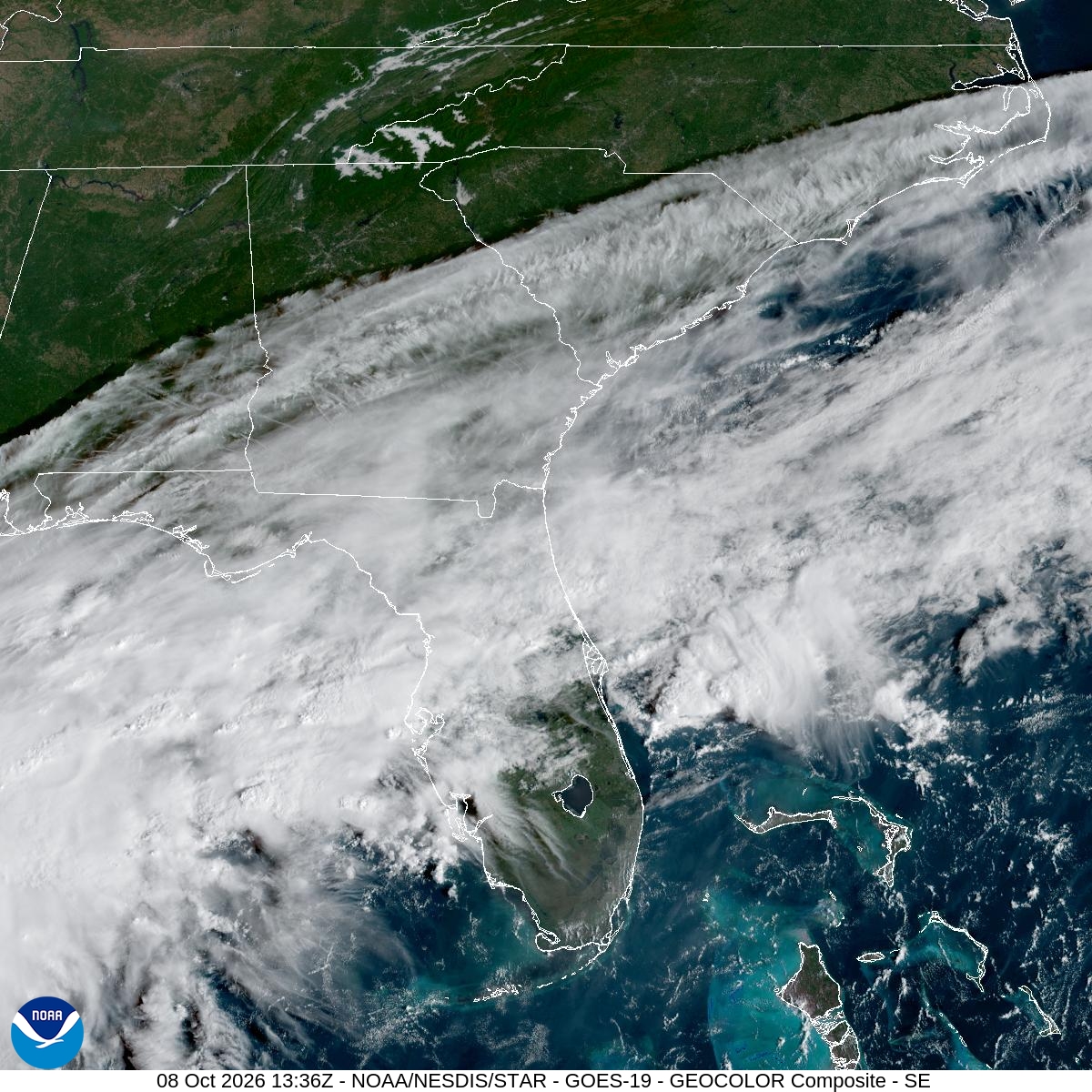
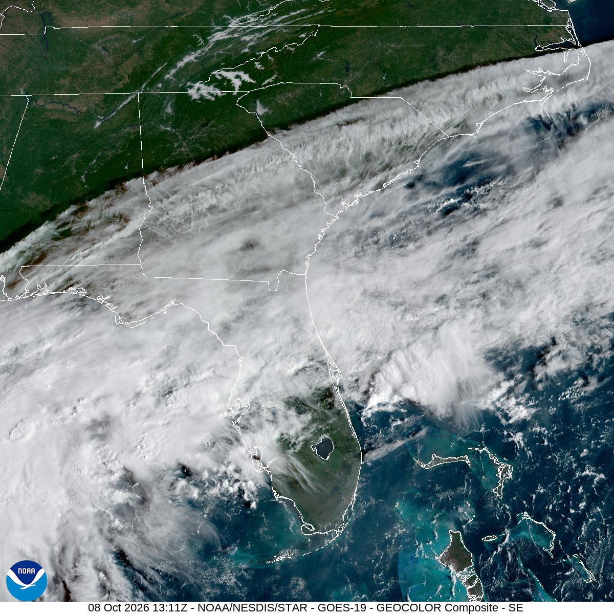
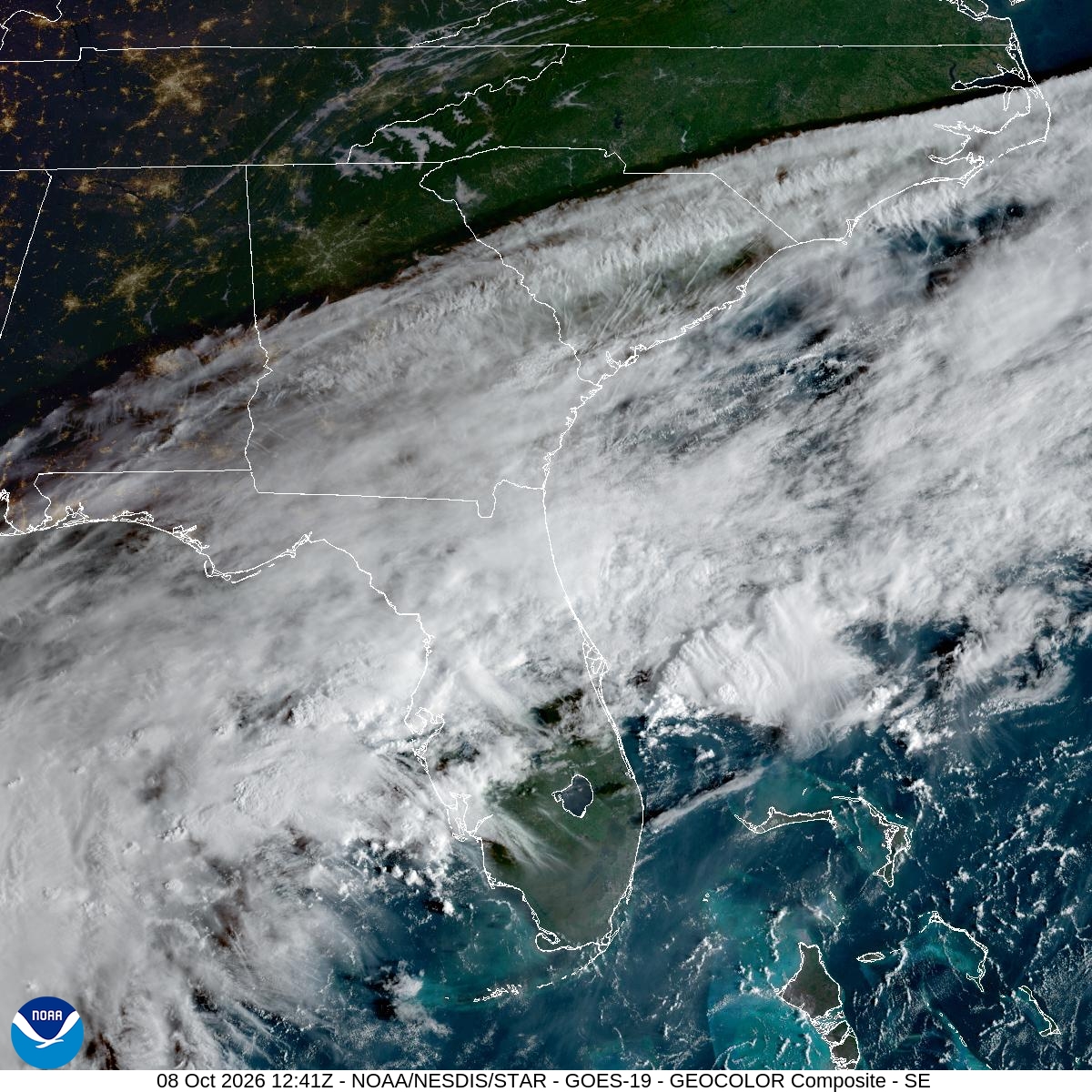
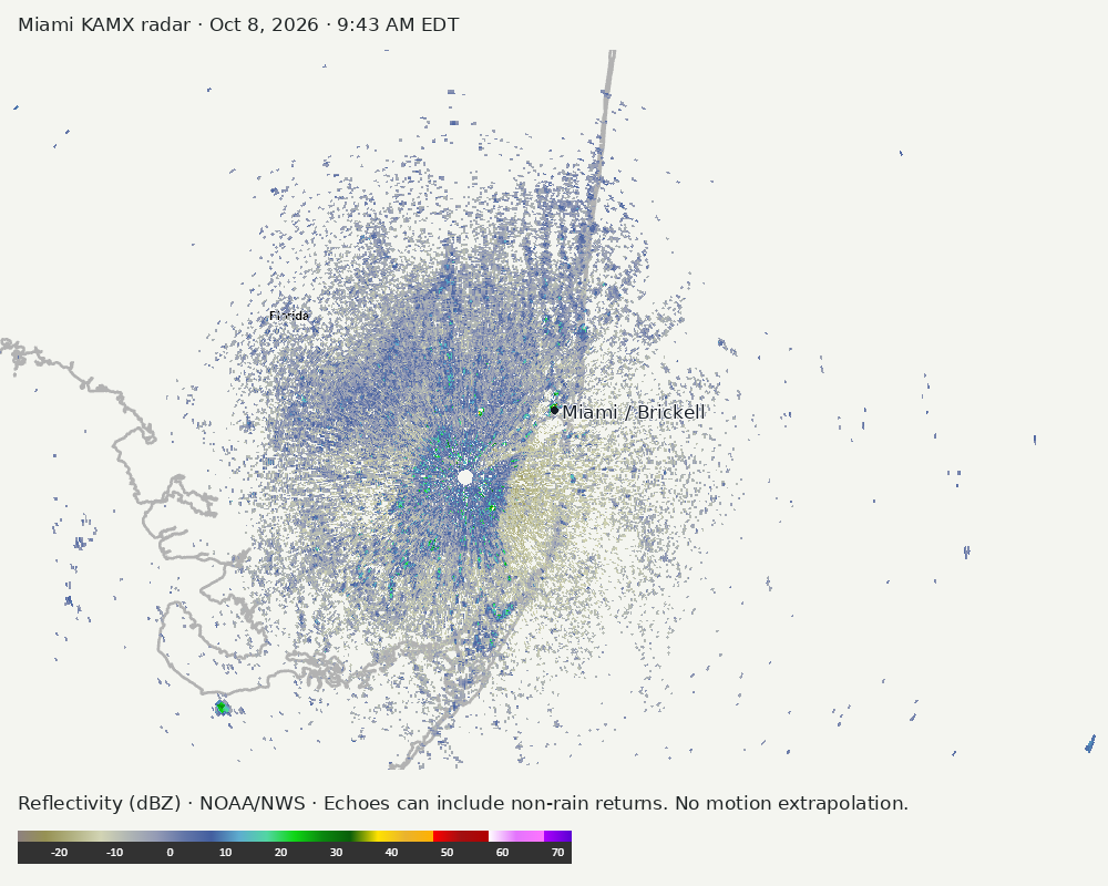
Archived frames show what the instruments captured at their labeled times. Radar echoes can include non-rain returns. No movement or future arrival is inferred automatically from these frames.
Southeast GeoColor satellite
GeoColor shows the Southeast, including Florida. The timestamped sequence below preserves cloud detail without automatically interpreting cloud cover at street level.

Earlier timestamped frames


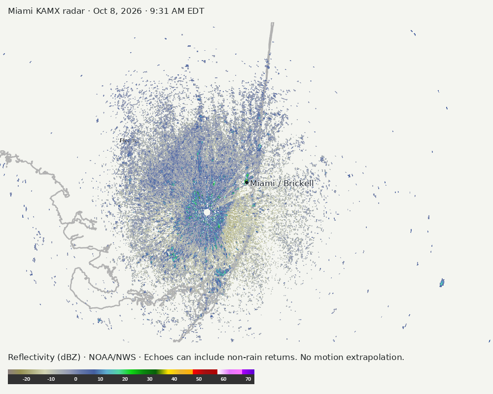
Detailed Miami radar — official KAMX fallback
The automatic echo-location check could not assign a reliable region. Inspect the image; this does not mean conditions are clear.
Earlier timestamped frames
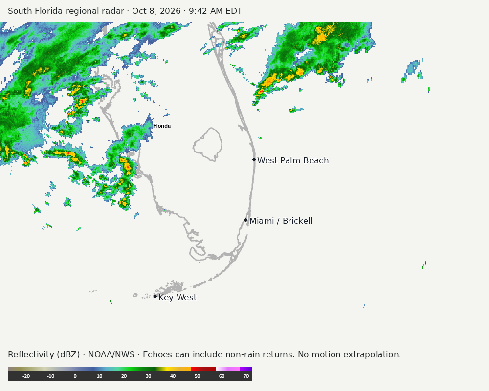
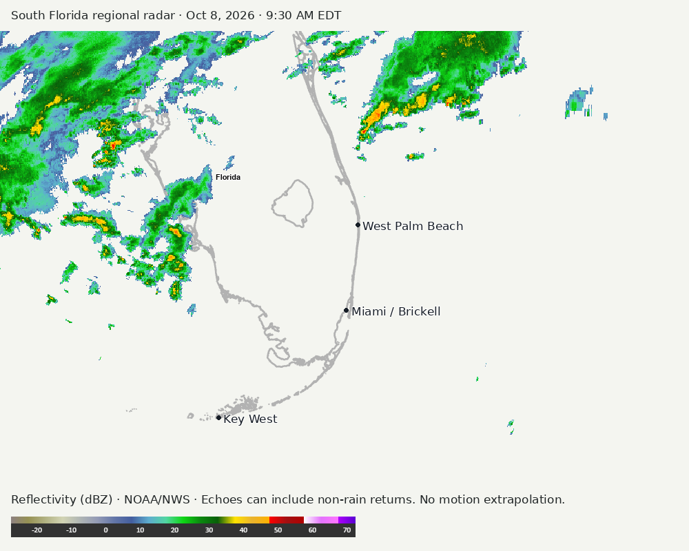
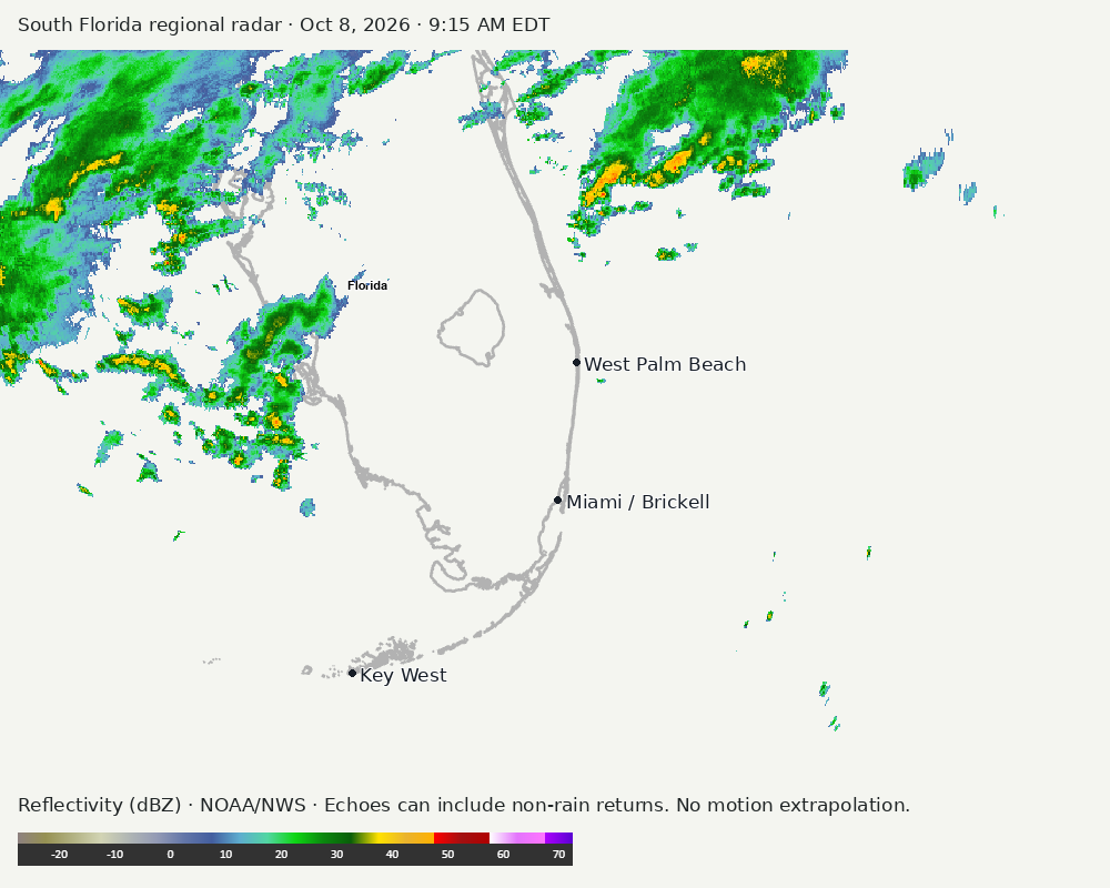
Regional South Florida radar
Colored reflectivity echoes are concentrated northwest of Miami, north of Miami, northeast of Miami relative to Miami in the latest frame. These are echo locations, not confirmation of rain at the surface.
Earlier timestamped frames
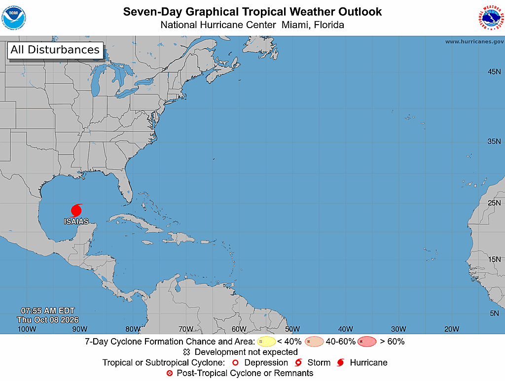
Tropical outlook
The Atlantic outlook describes development potential, not a forecast of impacts in Miami. No local hurricane impact is inferred here.
Read official source text
051
ABNT20 KNHC 081138
TWOAT

Tropical Weather Outlook
NWS National Hurricane Center Miami FL
800 AM EDT Thu Oct 8 2026

For the North Atlantic...Caribbean Sea and the Gulf of America:

Active Systems:
The National Hurricane Center is issuing advisories on Hurricane
Isaias, located over the southwestern Gulf of America.

Tropical cyclone formation is not expected during the next 7 days.

$$
Forecaster Cangialosi
Miami forecast discussion
Read official source text
000
FXUS62 KMFL 081041
AFDMFL

Area Forecast Discussion
National Weather Service Miami FL
641 AM EDT Thu Oct 8 2026

...New AVIATION...

.KEY MESSAGES...
Updated at 640 AM EDT Thu Oct 8 2026

 - Scattered to numerous showers and thunderstorms will develop
   across the region today as a frontal boundary remains stalled
   out just to the north.

 - High rainfall rates combined with the possibility of multiple
   rounds of heavy downpours could continue to create the
   potential of localized flooding across the region today.

 - Minor coastal flooding will be possible across the coastal
   areas during each high tide cycle through the rest of the week
   and into the upcoming weekend due to King Tides associated with
   the upcoming new moon.

&&

.SHORT TERM...
(Today through Friday)
Issued at 220 AM EDT Thu Oct 8 2026

Mid level troughing will continue to pull northeastward away from
the region into the Atlantic today as a strengthening mid level
ridge centered to the northeast of the Bahamas begins to shift
westward towards South Florida. As this ridge continues to try to
build westward over the Florida Peninsula, it will act as a key
feature in steering Hurricane Isaias more northward tonight into
Friday towards the northern Gulf Coast. At the surface, a weak
frontal boundary remains stalled out over Central Florida today,
however, as Hurricane Isaias begins to turn northward tonight, it
will also play a role in lifting the frontal boundary back up to
the north further away from the region.

A light south to southwesterly wind flow will remain in place across
South Florida today, however, as the front begins to move northward,
winds will gradually become southeast tonight and then increase in
speed on Friday as the pressure gradient tightens over the area.
Deep tropical moisture will remain in place across most of the
region for a good portion of the day which will allow for scattered
to numerous showers and thunderstorms to develop once again across
most of the region today. With the front once again acting as an
extra source of lift in combination with sea breeze development, the
highest chances of showers and thunderstorms will remain over the
east coast metro areas as well as locations along and north of
Alligator Alley this afternoon into this evening. Storm motion
will continue to remain slow today and rainfall rates will remain
high due to the abundance of moisture in place. With the stronger
storms having the potential for higher rainfall rates, it would
remain possible that a quick and localized 2 to 4 inches of rain
could fall over a short period of time this afternoon into this
evening. This will allow for the potential of localized flooding
to continue with the highest chances occurring over the urban and
poor drainage areas as well as locations already saturated from
recent heavy rainfall.

As ridging continues to build into the region on Friday, while the
surface level wind flow will increase out of the southeast, mid
level winds will remain southerly which will continue to draw in
moisture as PWAT values remain between 2.0 and 2.2 inches area wide.
With the frontal boundary having less of an influence on lift and
instability since it will be pushing north of the region, convective
development will be more sea breeze driven. As southeasterly
winds increase, this will keep the higher chances of showers and
thunderstorms focused over the interior and Southwest Florida
during Friday afternoon into Friday evening.

High temperatures today will generally rise into the upper 80s to
around 90 across most of the region. High temperatures on Friday
will rise to around 90 along the east coast, and into the lower
90s across Southwest Florida.

&&

.LONG TERM...
(Friday night through Wednesday)
Issued at 220 AM EDT Thu Oct 8 2026

Moving into the upcoming weekend, Isaias will make landfall along
the northern Gulf Coast on Friday night and then move into the Deep
South heading into Saturday. At the same time, mid level ridging in
the western Atlantic will strengthen as it gradually pushes over the
Florida Peninsula and ultimately into the eastern Gulf as the
weekend progresses. The pressure gradient over the region will
still remain tight at the surface during the first part of the
weekend due to Isaias to the northwest, and a strengthening large
area of high pressure in the Atlantic. This will keep a breezy and
gusty southeasterly wind flow in place at the surface and a more
southerly wind flow aloft. This type of set up will continue to
advect deep tropical moisture into the region from the Carribean
as the latest global and ensemble guidance shows PWAT values
rising and ranging between 2.2 and 2.4 inches across the area on
Saturday. This will keep the wet and unsettled pattern in place
during this time frame with higher chances of showers and
thunderstorms across most of the region. While storm motion will
be much faster than it has been over the past several days, the
deep tropical moisture will continue to allow for the possibility
of very efficient rainfall rates with the stronger storms. This
will keep the possibility of localized flooding in place across
the urban and poor drainage areas as well as locations that are
already saturated from recent heavy rainfall.

During the second half of the weekend the latest global and ensemble
guidance suite continues to suggest that mid level ridging will
center over the Florida Peninsula on Sunday before shifting westward
into the Gulf on Monday while quickly flattening over South
Florida. This flattening and westward shift will be caused by the
remnants of Isaias pushing across the Mid-Atlantic States and
into the western Atlantic well off to the north on Monday. At the
surface, high pressure will build over the region on Sunday before
starting to shift into the Gulf on Monday. This will allow for
the pressure gradient to decrease across the area and
southeasterly winds will gradually decrease during this time
frame. At the same time, deeper layer subsidence will bring some
drier air back into the region which will bring a typical late wet
season type pattern back into the region for Sunday and maybe
even lower chances of showers and storms heading into Monday. High
temperatures on Sunday and Monday will generally range from
around 90 along the east coast to the lower 90s across interior
portions of Southwest Florida.

Heading into Tuesday and Wednesday, the forecast uncertainty does
increase a little bit as it is towards the end of the forecast
period, but the latest global and ensemble guidance is hinting at
the potential for a weakening front to approach and push through
the area sometime towards the middle of the week. This would
significantly decrease rain chances behind the front as the
beginning of the dry season approaches. This will continue to be
monitored as the week progresses.

&&

.AVIATION...
(12Z TAFS)
Issued at 640 AM EDT Thu Oct 8 2026

Light and variable winds this morning becoming SSE around 10 kts
this afternoon with a SW wind at APF. Scattered thunderstorms
this afternoon into early evening may result in brief flight
restrictions and erratic winds.

&&

.MARINE...
Issued at 220 AM EDT Thu Oct 8 2026

Gentle to moderate south southwesterly winds will continue across
most of the local waters today. Winds will then shift and become
southeasterly for tonight through the upcoming weekend. Hazardous
marine conditions may develop over the Gulf waters as early as
Friday while they may become hazardous over the Atlantic waters on
Friday night into Saturday as southeasterly winds rapidly increase.
Seas across the Gulf waters will remain at 2 feet or less today,
however, they will start to gradually increase tonight into Friday
as Hurricane Isaias moves northward in the central Gulf. Seas across
the Atlantic waters will generally range between 3 to 5 feet today
and then 2 to 4 feet on Friday. Scattered to numerous showers and
thunderstorms will develop each day across the local waters through
the end of the week and into the first part of the weekend.

&&

.BEACHES...
Issued at 220 AM EDT Thu Oct 8 2026

A moderate risk of rip currents will continue across the Palm
Beaches through the rest of the week. The rip current risk will
then increase across all Atlantic Coast beaches later on Friday
and into the upcoming weekend as onshore flow rapidly increases.
The rip current risk across the Gulf coast could also become
elevated later on Friday and into Saturday as swells from
Hurricane Isaias build across the Gulf waters. Minor coastal
flooding will be possible across the coastal areas during each
high tide cycle through the rest of the week and into the upcoming
weekend due to King Tides associated with the upcoming new moon.

&&

.PRELIMINARY POINT TEMPS/POPS...
Miami            89  78  90  79 /  60  30  30  50
West Kendall     89  77  90  78 /  60  20  30  50
Opa-Locka        90  77  90  79 /  70  30  30  50
Homestead        90  78  90  79 /  40  10  30  60
Fort Lauderdale  89  77  89  79 /  70  30  30  60
N Ft Lauderdale  89  77  89  79 /  70  40  30  60
Pembroke Pines   89  77  89  78 /  70  30  30  50
West Palm Beach  89  75  89  78 /  80  50  30  60
Boca Raton       89  77  89  79 /  70  40  30  70
Naples           87  75  90  77 /  70  50  50  40

&&

.MFL WATCHES/WARNINGS/ADVISORIES...
FL...None.
AM...None.
GM...None.
&&

$$

SHORT TERM...CWC
LONG TERM....CWC
AVIATION...CMF
Sources and freshness
Supplementary failures do not replace missing data with reassuring conclusions. All source times below are Eastern; source metadata and original downloads are archived with this report.
Alerts · available
Source. Retrieved Oct 8, 2026 · 9:44 AM EDT.
Beach · available
Source. Retrieved Oct 8, 2026 · 9:44 AM EDT. Issued Oct 8, 2026 · 4:16 AM EDT.
Coastal Alerts · available
Source. Retrieved Oct 8, 2026 · 9:44 AM EDT.
Discussion · available
Source. Retrieved Oct 8, 2026 · 9:44 AM EDT. Issued Oct 8, 2026 · 6:41 AM EDT.
Forecast · available
Source. Retrieved Oct 8, 2026 · 9:44 AM EDT. Issued Oct 8, 2026 · 4:17 AM EDT.
Hourly · available
Source. Retrieved Oct 8, 2026 · 9:44 AM EDT. Issued Oct 8, 2026 · 4:17 AM EDT.
Local Radar · available
Source. Retrieved Oct 8, 2026 · 9:44 AM EDT. Issued Oct 8, 2026 · 9:43 AM EDT.
Marine · available
Source. Retrieved Oct 8, 2026 · 9:44 AM EDT. Issued Oct 8, 2026 · 4:06 AM EDT.
Mcnoldy · unavailable
Source. Retrieved Oct 8, 2026 · 9:44 AM EDT. URLError: transport or certificate failure
Nhc · available
Source. Retrieved Oct 8, 2026 · 9:44 AM EDT. Issued Oct 8, 2026 · 7:38 AM EDT.
Observation · available
Source. Retrieved Oct 8, 2026 · 9:44 AM EDT. Issued Oct 8, 2026 · 9:30 AM EDT.
Regional Radar · available
Source. Retrieved Oct 8, 2026 · 9:44 AM EDT. Issued Oct 8, 2026 · 9:42 AM EDT.
Satellite · available
Source. Retrieved Oct 8, 2026 · 9:44 AM EDT. Issued Oct 8, 2026 · 9:36 AM EDT.
Tropical Tidbits · not-used
Source. Retrieved not retrieved. No current tropical context requiring this supplementary source, or the NHC input is unavailable.