Morning Miami Weather Report
Miami, October 17 — Chance Showers And Thunderstorms
Automated weather summary from official sources; factual templates with validated source timestamps. Follow NWS Miami and NHC for current guidance.
Forecast for Miami / Brickell
Today: 87°F. Chance Showers And Thunderstorms. Wind 5 mph S. Rain chance: 88%.
A chance of showers and thunderstorms before 8am, then a chance of showers and thunderstorms between 1pm and 3pm, then showers and thunderstorms. Some of the storms could produce heavy rain. Partly sunny. High near 87, with temperatures falling to around 83 in the afternoon. Heat index values as high as 100. South wind around 5 mph. Chance of precipitation is 90%. New rainfall amounts between three quarters and one inch possible.
Tonight: Showers and thunderstorms before 3am, then a chance of showers and thunderstorms between 3am and 4am, then showers and thunderstorms likely. Some of the storms could produce heavy rain. Mostly cloudy, with a low around 76. North wind 7 to 20 mph. Chance of precipitation is 90%. New rainfall amounts between 1 and 2 inches possible.
Hourly forecast — rain chances and timing
| Eastern time | Temperature | Rain chance | Wind | Forecast |
|---|---|---|---|---|
| Oct 17, 2026 · 7:00 AM EDT | 81°F | 27% | 3 mph SE | Chance Showers And Thunderstorms |
| Oct 17, 2026 · 8:00 AM EDT | 80°F | 12% | 3 mph SE | Mostly Sunny |
| Oct 17, 2026 · 9:00 AM EDT | 82°F | 12% | 3 mph SE | Mostly Sunny |
| Oct 17, 2026 · 10:00 AM EDT | 84°F | 13% | 3 mph S | Mostly Sunny |
| Oct 17, 2026 · 11:00 AM EDT | 84°F | 12% | 3 mph S | Partly Sunny |
| Oct 17, 2026 · 12:00 PM EDT | 84°F | 12% | 5 mph S | Partly Sunny |
| Oct 17, 2026 · 1:00 PM EDT | 85°F | 22% | 5 mph S | Slight Chance Showers And Thunderstorms |
| Oct 17, 2026 · 2:00 PM EDT | 86°F | 45% | 5 mph SE | Chance Showers And Thunderstorms |
| Oct 17, 2026 · 3:00 PM EDT | 84°F | 72% | 5 mph S | Showers And Thunderstorms Likely |
| Oct 17, 2026 · 4:00 PM EDT | 83°F | 78% | 5 mph SW | Showers And Thunderstorms |
| Oct 17, 2026 · 5:00 PM EDT | 83°F | 88% | 5 mph NW | Showers And Thunderstorms |
| Oct 17, 2026 · 6:00 PM EDT | 81°F | 86% | 7 mph NW | Showers And Thunderstorms |
| Oct 17, 2026 · 7:00 PM EDT | 80°F | 71% | 7 mph N | Showers And Thunderstorms Likely |
| Oct 17, 2026 · 8:00 PM EDT | 79°F | 79% | 9 mph N | Showers And Thunderstorms |
| Oct 17, 2026 · 9:00 PM EDT | 79°F | 69% | 10 mph N | Showers And Thunderstorms Likely |
| Oct 17, 2026 · 10:00 PM EDT | 79°F | 71% | 12 mph N | Showers And Thunderstorms Likely |
| Oct 17, 2026 · 11:00 PM EDT | 79°F | 58% | 13 mph N | Showers And Thunderstorms Likely |
Observed nearby
Miami International Airport (KMIA), Oct 17, 2026 · 6:50 AM EDT: Clear. Temperature 79°F; wind 0 mph. This airport observation does not measure conditions at your exact location in Brickell.
Alerts and outdoor plans
Swim near a lifeguard. If caught in a rip current, relax and float. Don't swim against the current. If able, swim in a direction following the shoreline. If unable to escape, face the shore and call or wave for help.
Inexperienced mariners, especially those operating smaller vessels, should avoid navigating in hazardous conditions.
Swim near a lifeguard. If caught in a rip current, relax and float. Don't swim against the current. If able, swim in a direction following the shoreline. If unable to escape, face the shore and call or wave for help.
Running: Use the temperature, rain and wind forecast above to plan your window. If thunderstorms are forecast or you hear thunder, postpone outdoor activity and seek a substantial building. This briefing does not certify a safe running window.
Paddleboarding — official Biscayne Bay forecast
Today: SE winds around 5 kt (6 mph). Smooth. A slight chance of showers and tstms this morning, then showers with a chance of tstms this afternoon.
Tonight: N winds 10 to 15 kt (17 mph), increasing to 15 to 20 kt (23 mph) after midnight. Choppy. A chance of tstms. Showers.
Sun: N winds 15 to 20 kt (23 mph), becoming NE 20 to 25 kt (29 mph) in the afternoon. Rough. A chance of tstms.
Wind speeds in the source use knots (1 knot = 1.151 mph). Check current marine alerts and local conditions before launching; no safe launch window is inferred.
Official coastal Miami-Dade beach and rip-current guidance
FLZ173-172100-
Coastal Miami-Dade-
Including the beaches of Miami
352 AM EDT Sat Oct 17 2026

...HIGH RIP CURRENT RISK IN EFFECT FROM LATE TONIGHT THROUGH LATE
MONDAY NIGHT...

.TODAY...
Rip Current Risk*...........High.
Surf Height.................1 foot or less.
Thunderstorm Potential**....Moderate.
UV Index**..................High.
Water Temperature...........In the mid 80s.
Weather.....................Partly sunny. Showers and a chance of
                            thunderstorms.
High Temperature............In the upper 80s.
Max Heat Index..............Up to 100.
Winds.......................Light and variable winds, becoming
                            southeast around 5 mph in the
                            afternoon.
Tides...
   Miami Harbor Entrance....Low at 07:18 AM EDT.
                            High at 02:00 PM EDT.
Sunrise.....................7:20 AM.
Sunset......................6:52 PM.

.SUNDAY...
Rip Current Risk*...........High.
Surf Height.................2 to 3 feet.
Thunderstorm Potential**....Moderate.
Weather.....................Partly sunny. Showers and a chance of
                            thunderstorms.
High Temperature............In the lower 80s.
Winds.......................Breezy. Northeast winds 20 to 25 mph.
Tides...
   Miami Harbor Entrance....Low at 08:17 AM EDT.
                            High at 02:56 PM EDT.
Sunrise.....................7:21 AM.
Sunset......................6:51 PM.

&&

Rip Current Risk Category
* Low Risk - The risk for rip currents is low, however,
life-threatening rip currents often occur in the vicinity of groins,
jetties, reefs, and piers.
* Moderate Risk - Life-threatening rip currents are possible in the
surf zone.
* High Risk - Life-threatening rip currents are likely in the surf
zone.

** For thunderstorm, waterspout, and UV definitions see:
https://www.weather.gov/beach/mfl
Satellite and radar
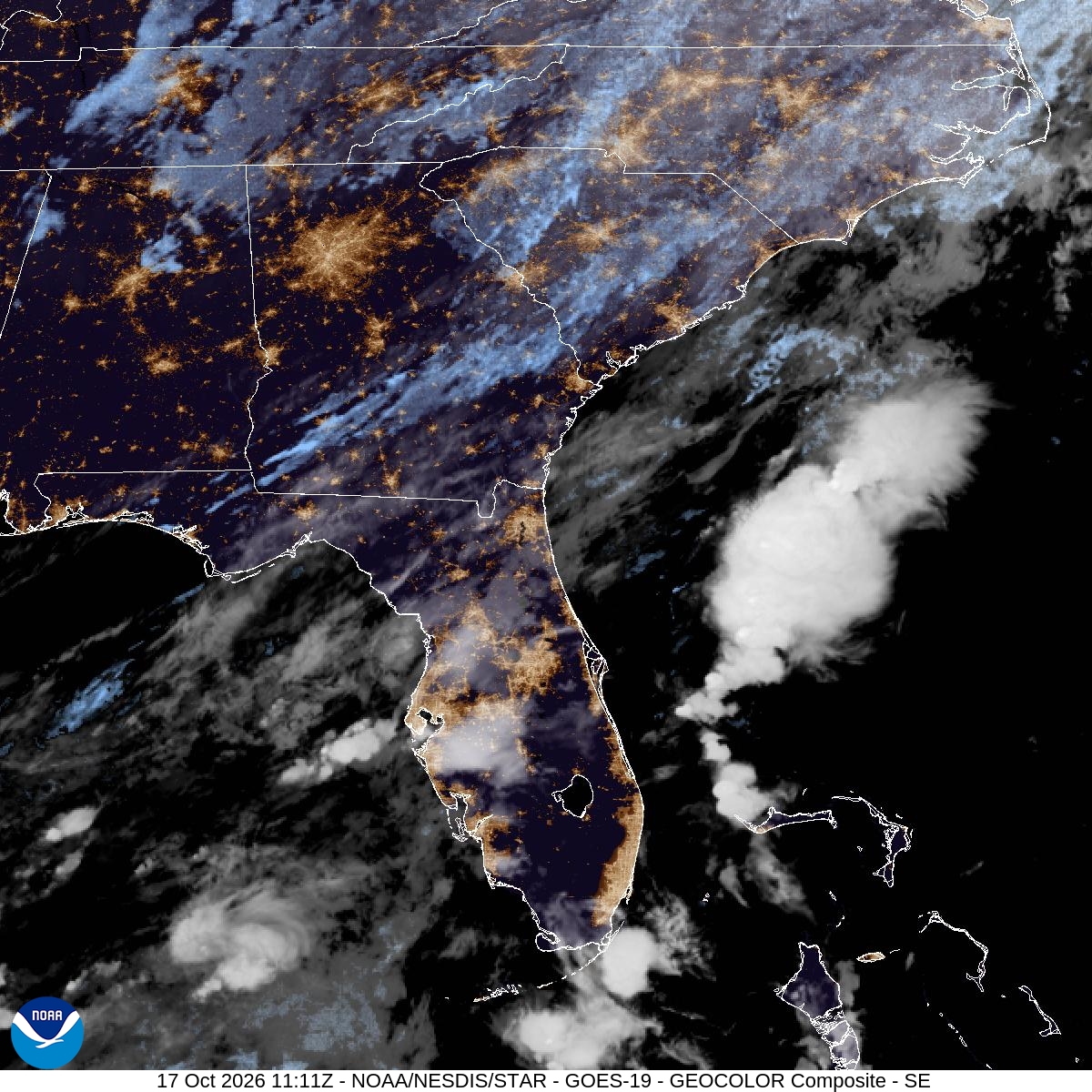
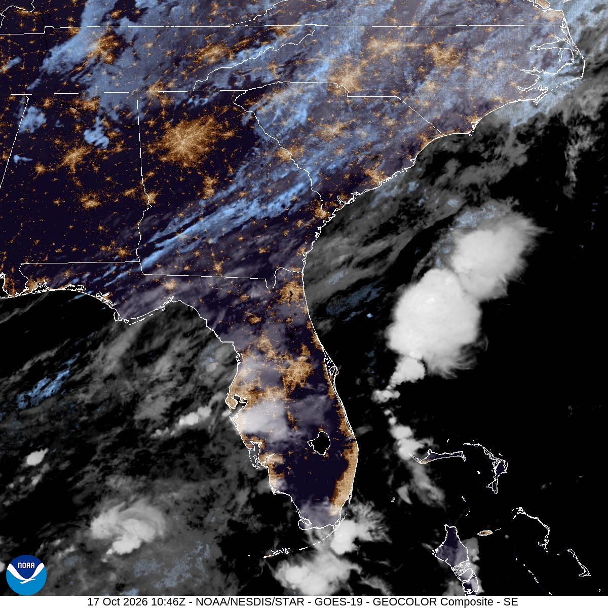
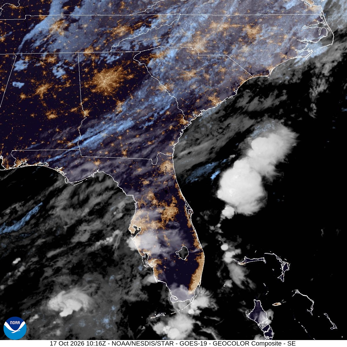
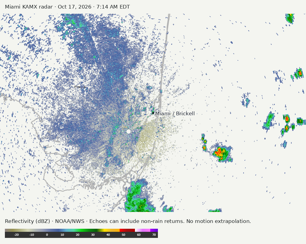
Archived frames show what the instruments captured at their labeled times. Radar echoes can include non-rain returns. No movement or future arrival is inferred automatically from these frames.
Southeast GeoColor satellite
GeoColor shows the Southeast, including Florida. The timestamped sequence below preserves cloud detail without automatically interpreting cloud cover at street level.

Earlier timestamped frames


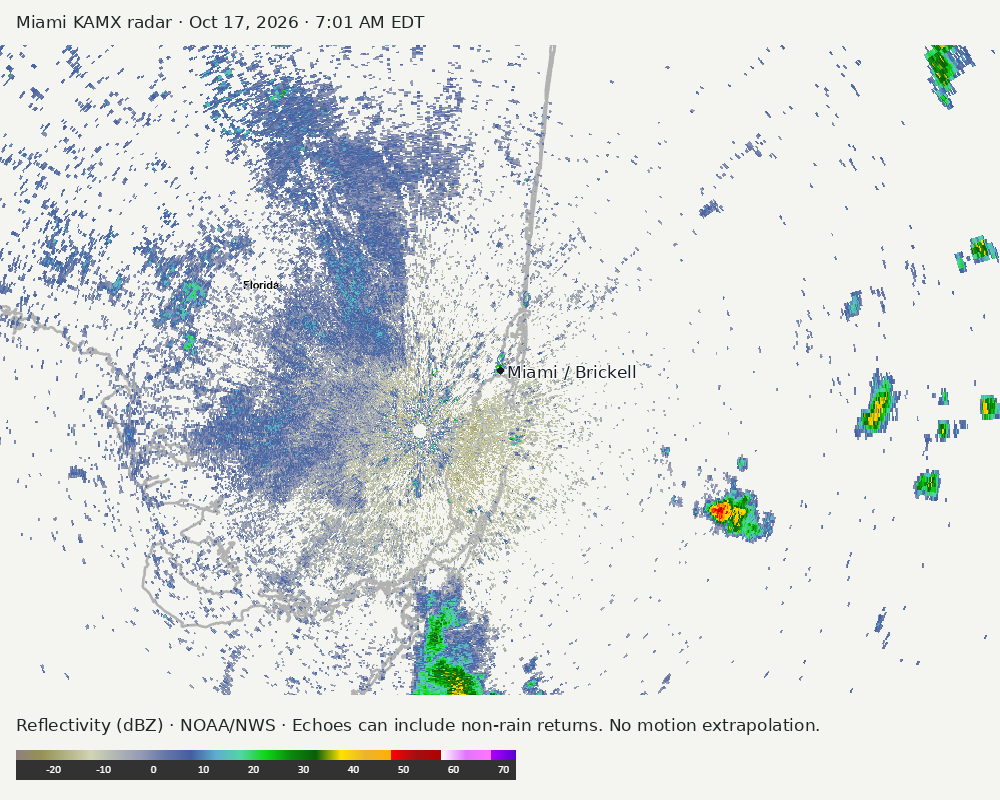
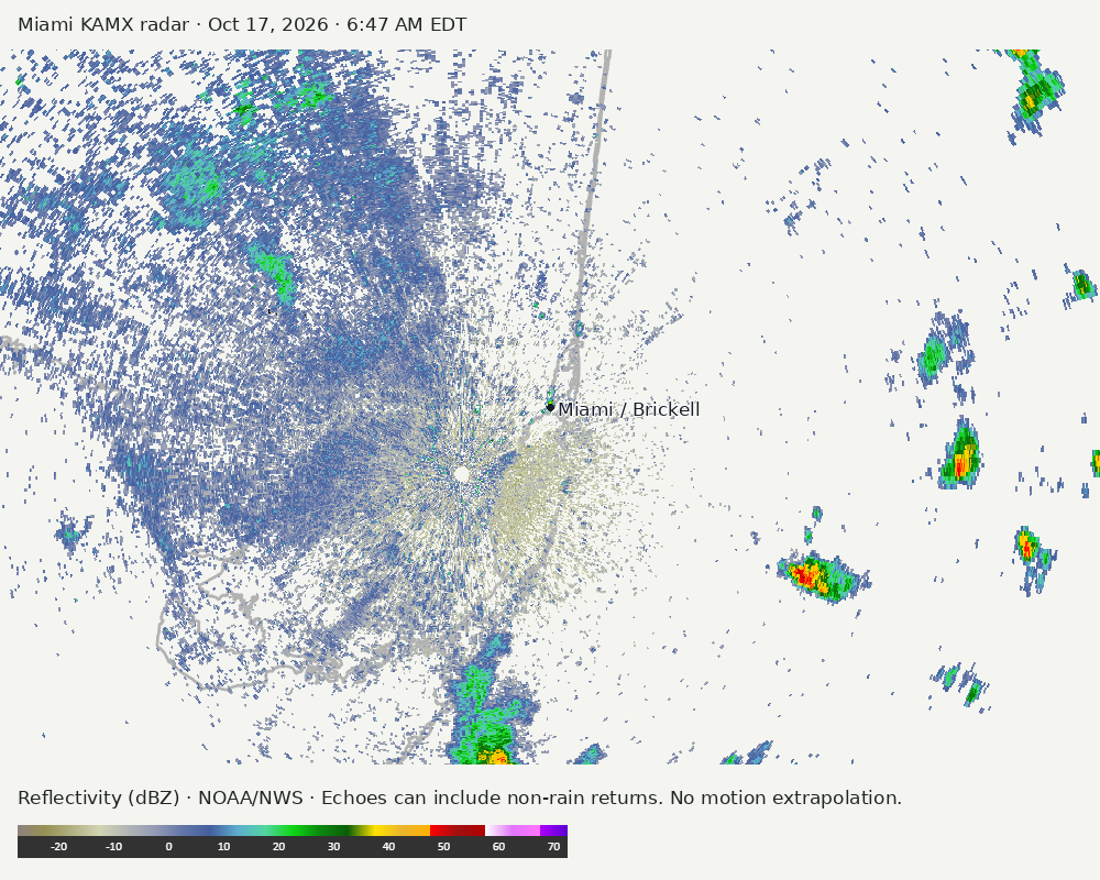
Detailed Miami radar — official KAMX fallback
Colored reflectivity echoes are concentrated south of Miami, east of Miami, southeast of Miami relative to Miami in the latest frame. These are echo locations, not confirmation of rain at the surface.
Earlier timestamped frames
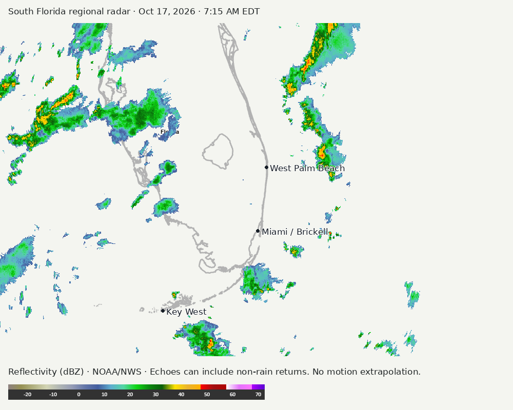
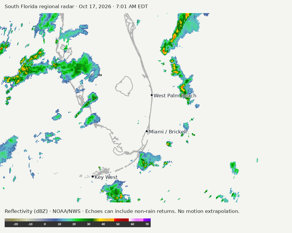
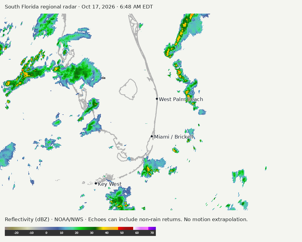
Regional South Florida radar
Colored reflectivity echoes are concentrated northwest of Miami, north of Miami, northeast of Miami relative to Miami in the latest frame. These are echo locations, not confirmation of rain at the surface.
Earlier timestamped frames
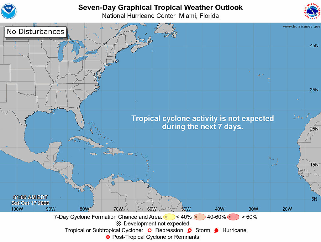
Tropical outlook
The Atlantic outlook describes development potential, not a forecast of impacts in Miami. No local hurricane impact is inferred here.
Read official source text
000
ABNT20 KNHC 170505
TWOAT

Tropical Weather Outlook
NWS National Hurricane Center Miami FL
200 AM EDT Sat Oct 17 2026

For the North Atlantic...Caribbean Sea and the Gulf of America:

Tropical cyclone formation is not expected during the next 7 days.

$$
Forecaster Hagen
Miami forecast discussion
Read official source text
000
FXUS62 KMFL 171051
AFDMFL

Area Forecast Discussion
National Weather Service Miami FL
651 AM EDT Sat Oct 17 2026

...New AVIATION...

.KEY MESSAGES...
Updated at 650 AM EDT Sat Oct 17 2026

 - Scattered to numerous showers and storms today will focus
   mainly across Southeast Florida.

 - Heavy rainfall today in Southeast Florida could lead to
   pockets of localized flooding across urban and poor drainage
   areas along the east coast.

 - Strong winds with the incoming frontal boundary is expected to
   lead to increasingly hazardous marine and beach conditions,
   with elevated seas and near Gale force wind gusts beginning
   tonight and into early this coming week.

&&

.SHORT TERM...
(Today through Sunday)
Issued at 434 AM EDT Sat Oct 17 2026

A deep upper-level trough progressing eastward across the Eastern US
will drive a surface frontal boundary toward South Florida today,
establishing an increasingly unsettled weather pattern across the
region. The combination of abundant moisture, enhanced ascent, and
southwesterly steering flow will support the development of numerous
to showers and thunderstorms across the East Coast. Furthermore,
vorticity impulses rounding the base of the trough will provide
additional ascent.

Widespread rainfall totals of 1-3 inches are forecast along
the East Coast, with 0.5-1 inch expected elsewhere across South
Florida. HREF LPMM guidance indicates the potential of locally
higher amounts of up to 6-8 inches along the East Coast, supported
by several individual ensemble members. Given the potential for slow-
moving or repeated rounds of convection, pockets of localized
flooding will be possible, particularly across urban and poor-
drainage areas. The Weather Prediction Center has included most
of the east coast metro areas in a Slight Risk for Excessive
Rainfall, highlighting the potential for rainfall rates and
accumulations to exceed local flash flood guidance, which ranges
anywhere from 4-6 inches in a 3 to 6 hour period.

The frontal boundary is expected to stall across the Florida Straits
through at least Sunday. While PWATs are forecast to decrease on
Sunday, lingering moisture and the proximity of the boundary will
maintain elevated rain chances across the Atlantic waters and
southernmost portions of the peninsula. A tightening pressure
gradient behind the front will support increasing northeasterly flow
across the region, which may lead to some frictional convergence
showers beginning Sunday despite deep moisture beginning to
decrease.

High temperatures today will range from the lower to mid 80s near
Lake Okeechobee to the upper 80s across southern portions of the
peninsula. Overnight lows will fall into the mid to upper 60s across
SW Florida and the lower to mid 70s across the East Coast. Cooler
temperatures are expected Sunday, with highs generally in the lower
to mid 80s across South Florida.

&&

.LONG TERM...
(Sunday night through Friday)
Issued at 434 AM EDT Sat Oct 17 2026

The frontal boundary remains projected to pass through the area by
Sunday night while also degrading in the process. This boundary will
eventually stall over the Florida Straits while diffusing completely
early this coming week. With moisture levels dropping closer to
average to below average in some areas, rain chances will lower
significantly to below 20% for most of interior and SW Florida as
drier air arrives in the wake of the front. Strong surface high
pressure will re-develop as the low off the coast of the Carolinas
begins to advect offshore and shift more towards the Mid-Atlantic
on, which will create a stout pressure gradient that could last into
the mid-week time frame. Breezy winds are expected out of the NE
with wind gusts in the 20-30 mph range possible through Tuesday
night and potentially a portion of Wednesday. By Wednesday
afternoon, the pressure gradient should be weakened enough for much
less breezy conditions. Even with the breezy and gusty winds early
this week, they should stay below Wind Advisory levels.

The other important aspect of the long term forecast period relates
to any rain potential through the end of the week. While drier air
filters in with the passing of the frontal boundary, strong
northeasterly winds over the local waters will be present in
combination with slower wind speeds over land, which can result in
isolated to scattered frictional convergence showers forming along
the coast. This process is likely to be the main driver in any rain
shower or storm development through the end of the week, but is not
expected to produce impactful rainfall or thunderstorms. Instead,
most of the activity should be of the meager variety. We will
continue to monitor trends in case a more impactful develops for
heavy rainfall. High temperatures will fall to the low to mid 80s
each day in the wake of the front. Overnight lows will range from
the mid to upper 60s near the lake region to the low to mid 70s
elsewhere on Monday night, then fall into the 60s across the entire
region Tuesday night through the end of the week.

&&

.AVIATION...
(12Z TAFS)
Issued at 650 AM EDT Sat Oct 17 2026

L/V winds expected to increase to 6-8 kts out of the NNW today
across all terminals, veering to the NNE by early evening. Scattered
to numerous showers and thunderstorms are possible this afternoon,
with the greatest coverage expected near the east coast sites
between 22Z-01Z. Sub-VFR ceilings are possible this evening in
association with the frontal passage, however, confidence remains
too low to include these conditions in the current TAF cycle.
Winds are expected to increase above 10 kts toward the end of the
TAF period as the pressure gradient strengthens behind the front.

&&

.MARINE...
Issued at 434 AM EDT Sat Oct 17 2026

Light southwesterly winds will gradually shift to moderate north-
northeasterly winds this evening as a frontal boundary approaches
the region, with scattered to numerous showers and storms expected
across all local waters. Marine conditions will deteriorate further
overnight as winds strengthen behind the front, with Small Craft
Advisory conditions expected to develop this evening and persist
through the weekend. Strong winds, with gusts just below gale force,
are expected on Sunday, accompanied by building seas of 8-12 ft
across the Atlantic waters. Scattered showers and isolated storms
will also remain possible over the Atlantic waters on Sunday.

&&

.BEACHES...
Issued at 434 AM EDT Sat Oct 17 2026

A high risk for rip currents will develop overnight tonight and
last into early this coming week as strong winds and elevated seas
develop with a frontal boundary passing through the area. In
addition, high surf conditions are expected to develop by late
Sunday night and into the new week.

&&

.PRELIMINARY POINT TEMPS/POPS...
Miami            88  75  83  75 /  90  70  80  40
West Kendall     88  74  83  74 /  90  60  70  30
Opa-Locka        88  74  83  74 /  90  70  70  40
Homestead        88  75  84  75 /  90  70  80  50
Fort Lauderdale  87  74  82  75 /  90  80  80  40
N Ft Lauderdale  87  74  83  75 /  90  80  70  40
Pembroke Pines   88  73  83  74 /  90  70  70  40
West Palm Beach  86  73  82  74 /  80  90  60  30
Boca Raton       87  73  83  74 /  90  80  80  40
Naples           84  69  83  70 /  80  40  10   0

&&

.MFL WATCHES/WARNINGS/ADVISORIES...
FL...High Rip Current Risk from late tonight through late Monday
     night for FLZ168-172-173.

AM...Small Craft Advisory from 8 PM this evening to 2 AM EDT Monday
     for AMZ610-650-670.

     Small Craft Advisory from 2 AM Sunday to 2 AM EDT Monday for
     AMZ630-651-671.

GM...Small Craft Advisory from 8 PM this evening to 2 AM EDT Monday
     for GMZ656-657-676.

&&

$$

SHORT TERM...DPB
LONG TERM....Redman
AVIATION...Rizzuto
Sources and freshness
Supplementary failures do not replace missing data with reassuring conclusions. All source times below are Eastern; source metadata and original downloads are archived with this report.
Alerts · available
Source. Retrieved Oct 17, 2026 · 7:17 AM EDT.
Beach · available
Source. Retrieved Oct 17, 2026 · 7:17 AM EDT. Issued Oct 17, 2026 · 3:52 AM EDT.
Coastal Alerts · available
Source. Retrieved Oct 17, 2026 · 7:17 AM EDT.
Discussion · available
Source. Retrieved Oct 17, 2026 · 7:17 AM EDT. Issued Oct 17, 2026 · 6:51 AM EDT.
Forecast · available
Source. Retrieved Oct 17, 2026 · 7:17 AM EDT. Issued Oct 17, 2026 · 4:02 AM EDT.
Hourly · available
Source. Retrieved Oct 17, 2026 · 7:17 AM EDT. Issued Oct 17, 2026 · 4:02 AM EDT.
Local Radar · available
Source. Retrieved Oct 17, 2026 · 7:17 AM EDT. Issued Oct 17, 2026 · 7:14 AM EDT.
Marine · available
Source. Retrieved Oct 17, 2026 · 7:17 AM EDT. Issued Oct 17, 2026 · 3:51 AM EDT.
Mcnoldy · unavailable
Source. Retrieved Oct 17, 2026 · 7:17 AM EDT. URLError: transport or certificate failure
Nhc · available
Source. Retrieved Oct 17, 2026 · 7:17 AM EDT. Issued Oct 17, 2026 · 1:06 AM EDT.
Observation · available
Source. Retrieved Oct 17, 2026 · 7:17 AM EDT. Issued Oct 17, 2026 · 6:50 AM EDT.
Regional Radar · available
Source. Retrieved Oct 17, 2026 · 7:17 AM EDT. Issued Oct 17, 2026 · 7:15 AM EDT.
Satellite · available
Source. Retrieved Oct 17, 2026 · 7:17 AM EDT. Issued Oct 17, 2026 · 7:11 AM EDT.
Tropical Tidbits · not-used
Source. Retrieved not retrieved. No current tropical context requiring this supplementary source, or the NHC input is unavailable.