Morning Miami Weather Report
Miami, October 19 — Mostly Sunny then Slight Chance Rain Showers
Automated weather summary from official sources; factual templates with validated source timestamps. Follow NWS Miami and NHC for current guidance.
Late report: current weather data were collected at the publication time below, rather than early this morning.
Forecast for Miami / Brickell
Today: 84°F. Mostly Sunny then Slight Chance Rain Showers. Wind 23 mph NE. Rain chance: 15%.
A slight chance of rain showers between 3pm and 4pm. Mostly sunny, with a high near 84. Northeast wind around 23 mph, with gusts as high as 30 mph. Chance of precipitation is 20%. New rainfall amounts less than a tenth of an inch possible.
Tonight: A chance of rain showers before 5am. Mostly clear, with a low around 77. Northeast wind around 22 mph, with gusts as high as 28 mph. Chance of precipitation is 30%. New rainfall amounts less than a tenth of an inch possible.
Hourly forecast — rain chances and timing
| Eastern time | Temperature | Rain chance | Wind | Forecast |
|---|---|---|---|---|
| Oct 19, 2026 · 1:00 PM EDT | 82°F | 1% | 22 mph NE | Sunny |
| Oct 19, 2026 · 2:00 PM EDT | 82°F | 4% | 21 mph NE | Mostly Sunny |
| Oct 19, 2026 · 3:00 PM EDT | 82°F | 15% | 22 mph NE | Slight Chance Rain Showers |
| Oct 19, 2026 · 4:00 PM EDT | 83°F | 8% | 22 mph NE | Mostly Sunny |
| Oct 19, 2026 · 5:00 PM EDT | 82°F | 12% | 22 mph NE | Mostly Sunny |
| Oct 19, 2026 · 6:00 PM EDT | 82°F | 19% | 22 mph NE | Slight Chance Rain Showers |
| Oct 19, 2026 · 7:00 PM EDT | 82°F | 8% | 22 mph NE | Mostly Clear |
| Oct 19, 2026 · 8:00 PM EDT | 80°F | 2% | 20 mph NE | Mostly Clear |
| Oct 19, 2026 · 9:00 PM EDT | 80°F | 4% | 21 mph NE | Partly Cloudy |
| Oct 19, 2026 · 10:00 PM EDT | 80°F | 8% | 21 mph NE | Mostly Clear |
| Oct 19, 2026 · 11:00 PM EDT | 80°F | 11% | 21 mph NE | Mostly Clear |
Observed nearby
Miami International Airport (KMIA), Oct 19, 2026 · 1:05 PM EDT: Partly Cloudy. Temperature 84°F; wind 16 mph. This airport observation does not measure conditions at your exact location in Brickell.
Alerts and outdoor plans
Swim near a lifeguard. If caught in a rip current, relax and float. Don't swim against the current. If able, swim in a direction following the shoreline. If unable to escape, face the shore and call or wave for help.
Inexperienced mariners, especially those operating smaller vessels, should avoid navigating in hazardous conditions.
Swim near a lifeguard. If caught in a rip current, relax and float. Don't swim against the current. If able, swim in a direction following the shoreline. If unable to escape, face the shore and call or wave for help.
Running: Use the temperature, rain and wind forecast above to plan your window. If thunderstorms are forecast or you hear thunder, postpone outdoor activity and seek a substantial building. This briefing does not certify a safe running window.
Paddleboarding — official Biscayne Bay forecast
Today: NE winds 20 to 25 kt (29 mph). Rough.
Tonight: NE winds 20 to 25 kt (29 mph). Rough. A chance of showers late.
Tue: NE winds 20 to 25 kt (29 mph), diminishing to 15 to 20 kt (23 mph) in the afternoon. Rough.
Wind speeds in the source use knots (1 knot = 1.151 mph). Check current marine alerts and local conditions before launching; no safe launch window is inferred.
Official coastal Miami-Dade beach and rip-current guidance
FLZ173-192100-
Coastal Miami-Dade-
Including the beaches of Miami
331 AM EDT Mon Oct 19 2026

...HIGH RIP CURRENT RISK IN EFFECT THROUGH THURSDAY EVENING...

.TODAY...
Rip Current Risk*...........High.
Surf Height.................2 to 3 feet.
Thunderstorm Potential**....None.
UV Index**..................High.
Water Temperature...........In the lower 80s.
Weather.....................Mostly sunny.
High Temperature............In the mid 80s.
Winds.......................Northeast winds around 20 mph.
Tides...
   Miami Harbor Entrance....Low at 09:21 AM EDT.
                            High at 03:54 PM EDT.
Sunrise.....................7:21 AM.
Sunset......................6:50 PM.

.TUESDAY...
Rip Current Risk*...........High.
Surf Height.................2 to 3 feet.
Thunderstorm Potential**....None.
Weather.....................Sunny.
High Temperature............In the lower 80s.
Winds.......................Northeast winds 15 to 20 mph.
Tides...
   Miami Harbor Entrance....Low at 10:21 AM EDT.
                            High at 04:50 PM EDT.
Sunrise.....................7:22 AM.
Sunset......................6:49 PM.

&&

Rip Current Risk Category
* Low Risk - The risk for rip currents is low, however,
life-threatening rip currents often occur in the vicinity of groins,
jetties, reefs, and piers.
* Moderate Risk - Life-threatening rip currents are possible in the
surf zone.
* High Risk - Life-threatening rip currents are likely in the surf
zone.

** For thunderstorm, waterspout, and UV definitions see:
https://www.weather.gov/beach/mfl
Satellite and radar
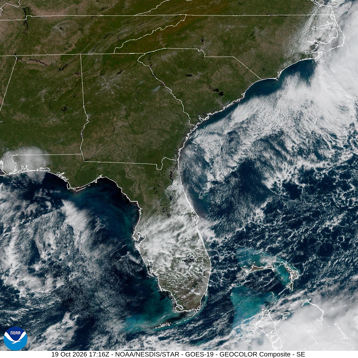
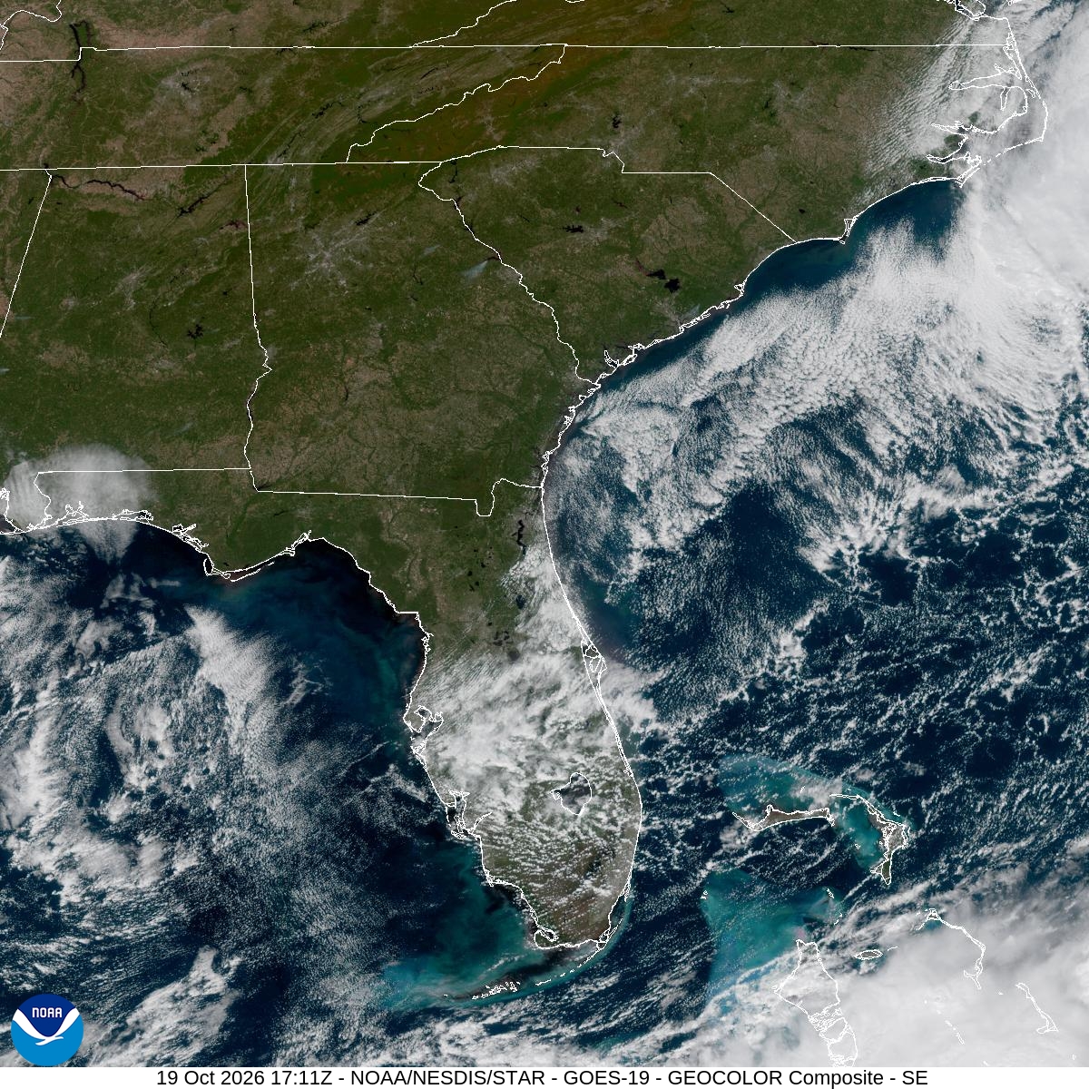
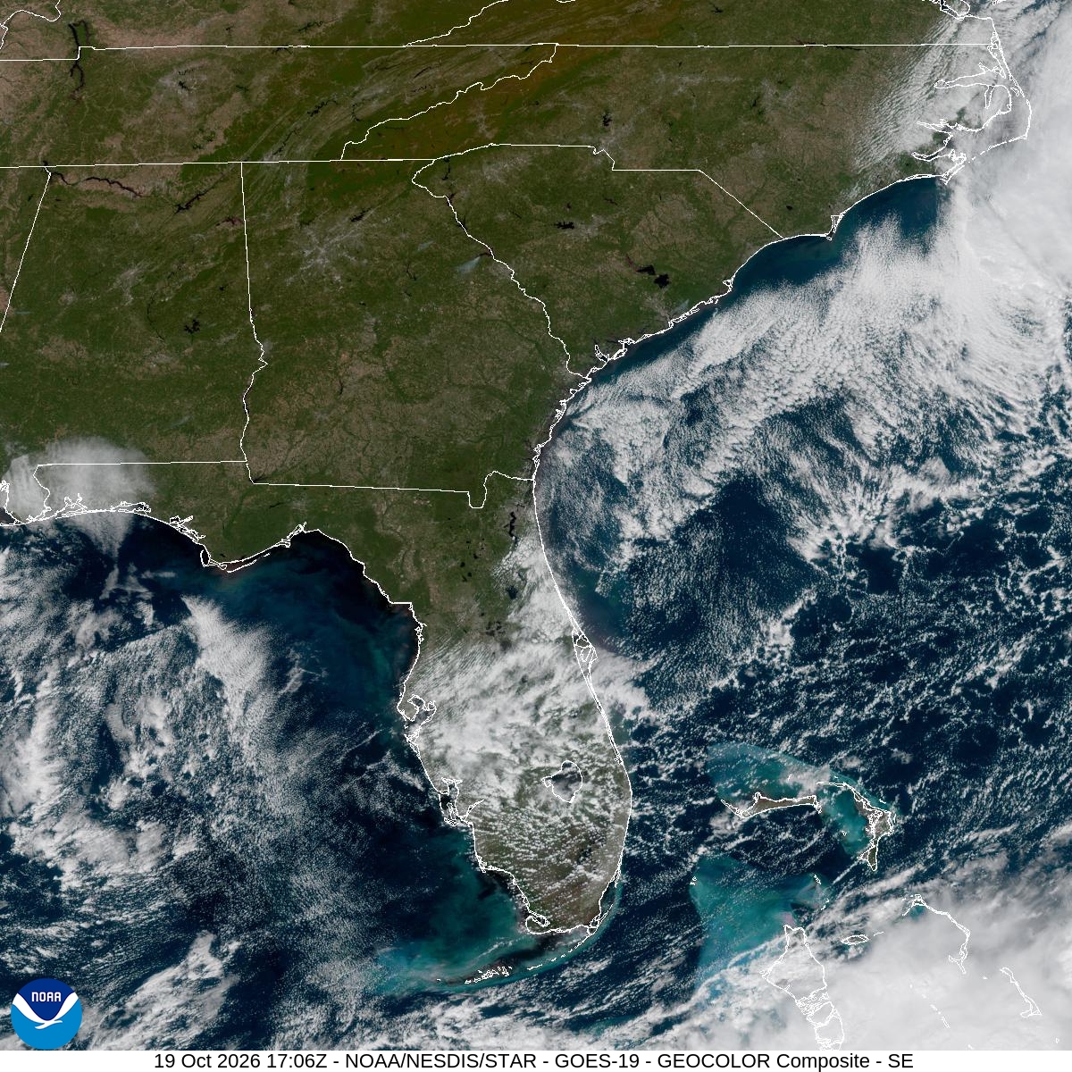
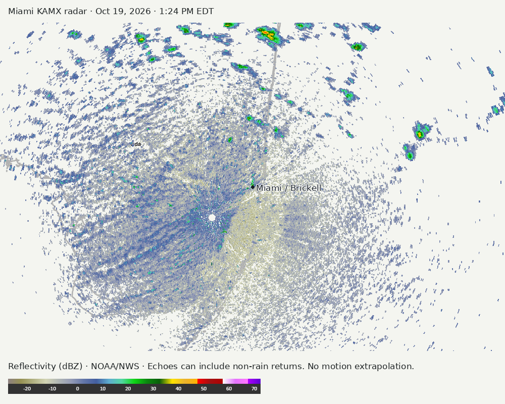
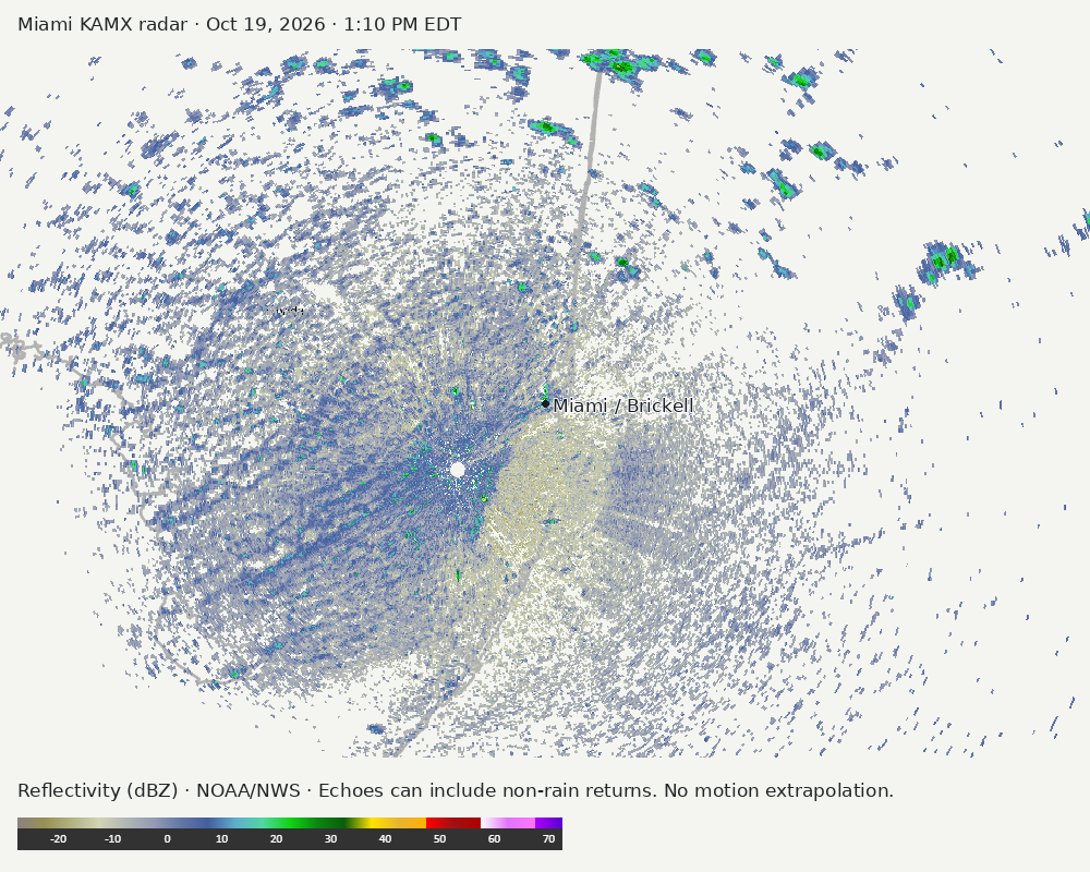
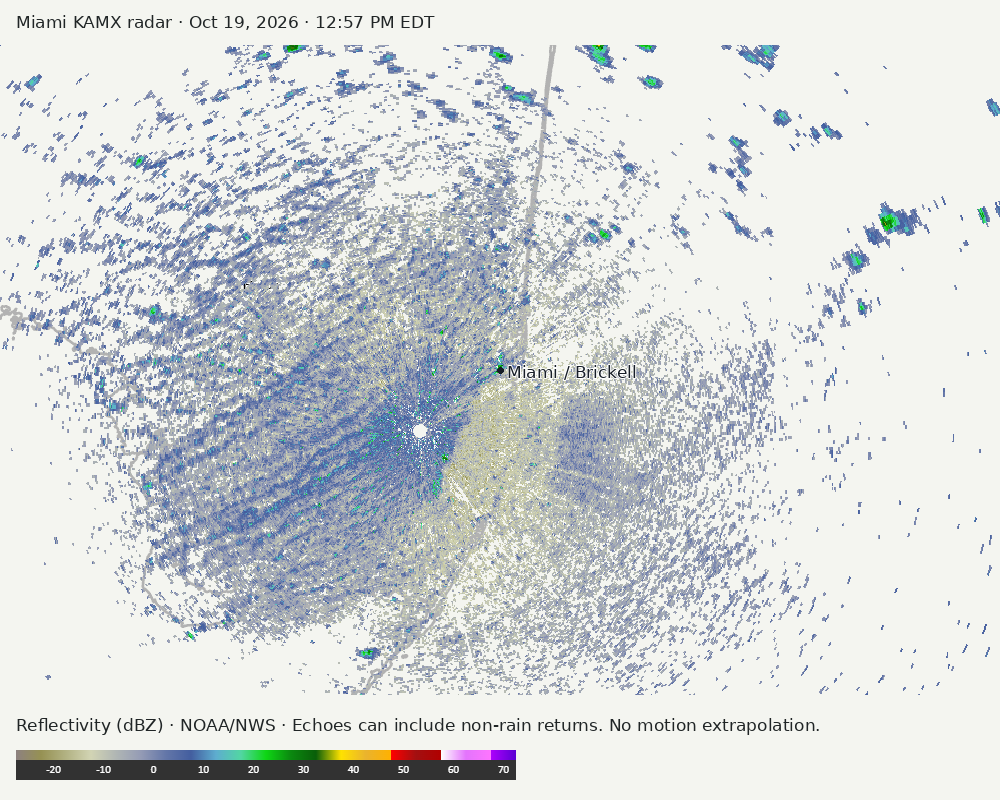
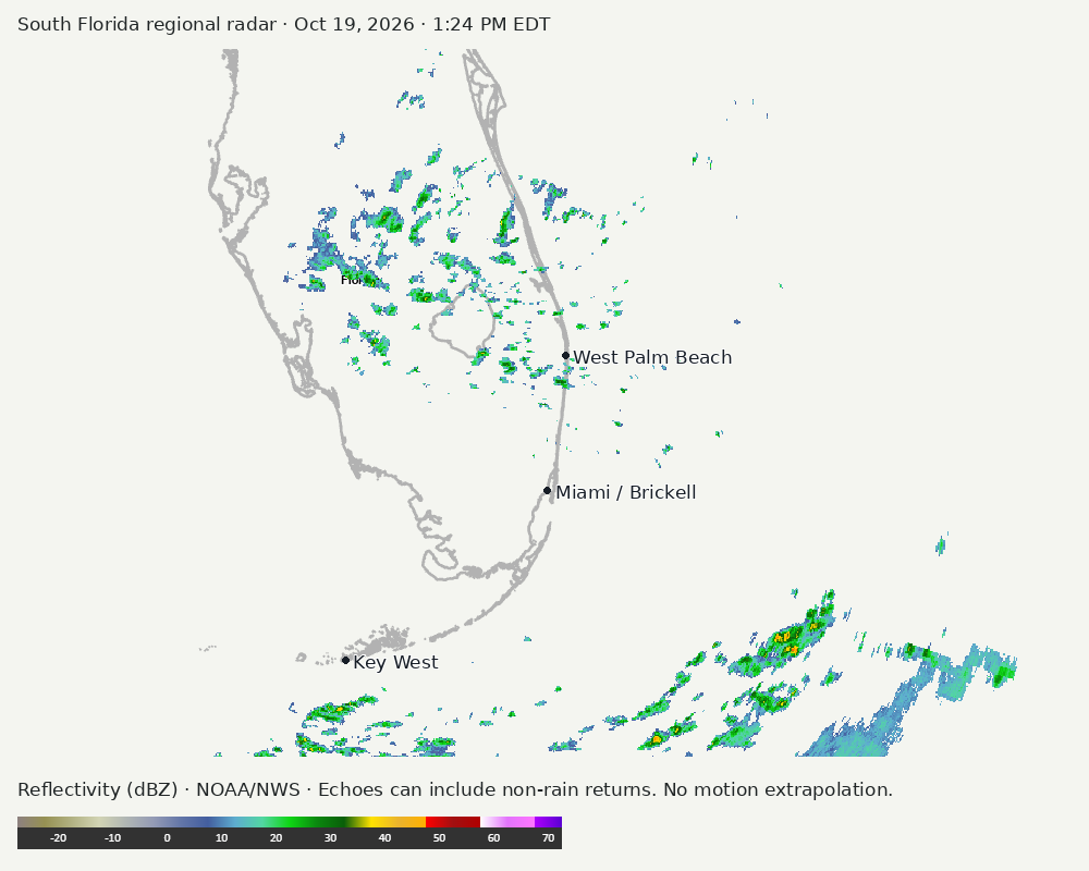
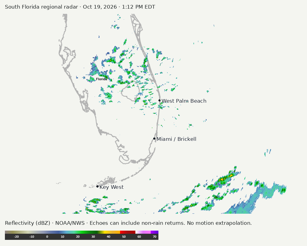
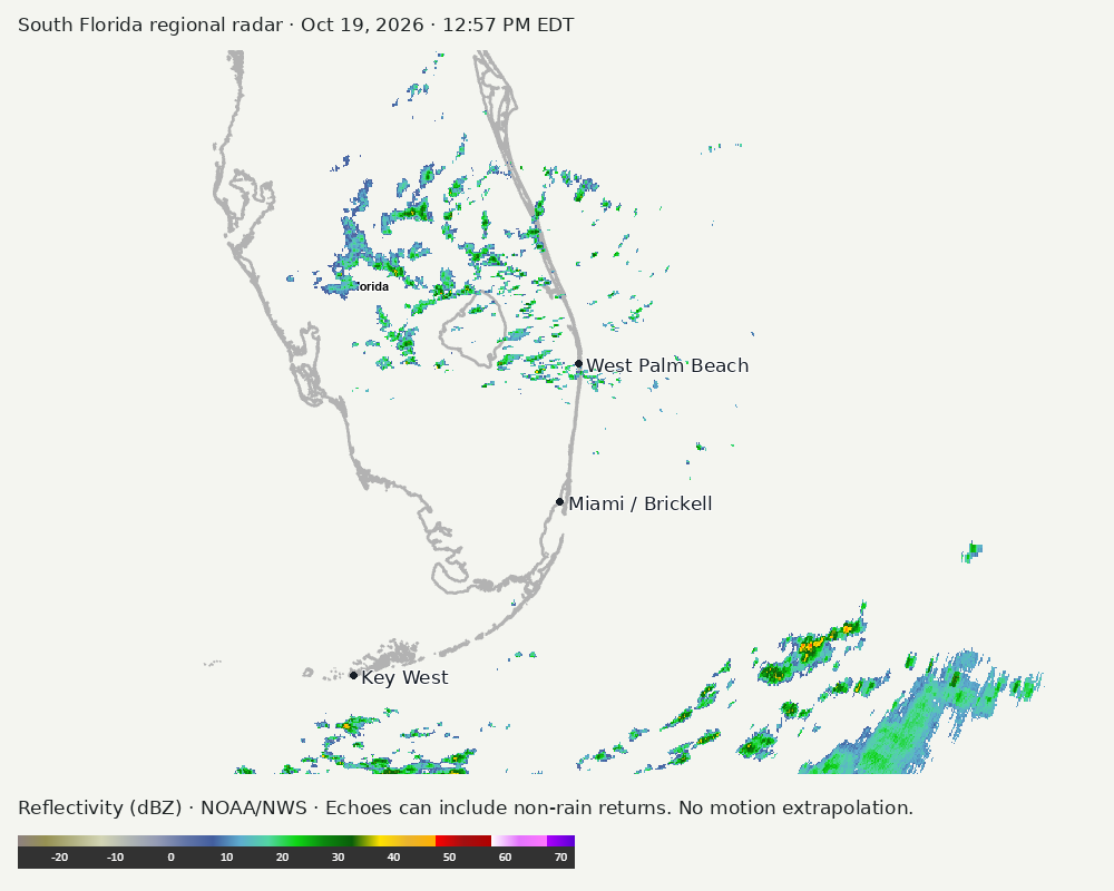
Archived frames show what the instruments captured at their labeled times. Radar echoes can include non-rain returns. No movement or future arrival is inferred automatically from these frames.
Southeast GeoColor satellite
GeoColor shows the Southeast, including Florida. The timestamped sequence below preserves cloud detail without automatically interpreting cloud cover at street level.

Earlier timestamped frames


Detailed Miami radar — official KAMX fallback
The automatic echo-location check could not assign a reliable region. Inspect the image; this does not mean conditions are clear.
Earlier timestamped frames
Regional South Florida radar
Colored reflectivity echoes are concentrated southeast of Miami, north of Miami, northwest of Miami relative to Miami in the latest frame. These are echo locations, not confirmation of rain at the surface.
Earlier timestamped frames
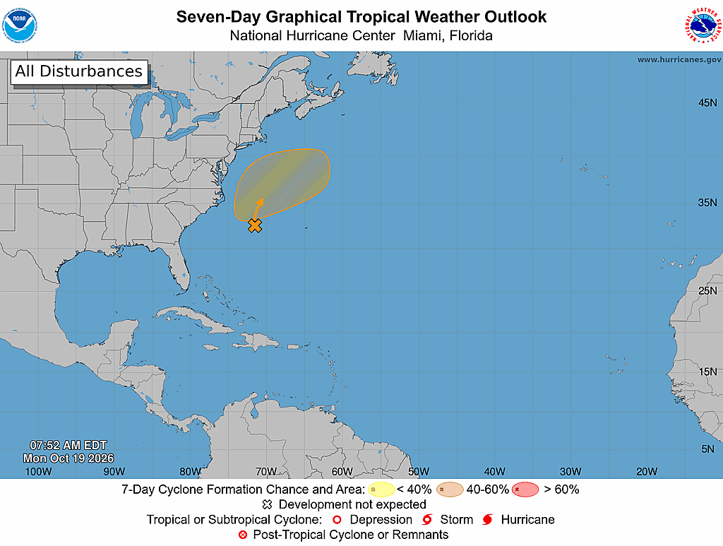
Tropical outlook
The Atlantic outlook describes development potential, not a forecast of impacts in Miami. No local hurricane impact is inferred here.
Read official source text
000
ABNT20 KNHC 191152
TWOAT

Tropical Weather Outlook
NWS National Hurricane Center Miami FL
800 AM EDT Mon Oct 19 2026

For the North Atlantic...Caribbean Sea and the Gulf of America:

Off the East Coast of the United States:
A storm-force non-tropical low pressure area is located along a
frontal boundary a few hundred miles off the southeast coast of the
United States. This low is likely to move slowly and erratically
over the next couple of days. If the low remains over the Gulf
Stream and becomes detached from the front, it could briefly acquire
some subtropical cyclone characteristics during the middle to latter
portions of the week. The system is expected to begin to move
northeastward away from the the eastern United States later this
week, and environmental conditions are expected to become
unfavorable for development by the weekend.  Regardless of the
status of the system, high winds, coastal flooding, and dangerous
surf are expected along portions of the U.S. East Coast during the
next few days. Please consult statements and warnings from local
National Weather Service offices and the Weather Prediction Center
for more information, along with High Seas Forecasts and Storm
Warnings issued by the National Weather Service.
* Formation chance through 48 hours...low...near 0 percent.
* Formation chance through 7 days...medium...40 percent.

&&
High Seas Forecasts issued by the National Weather Service can be
found under AWIPS header NFDHSFAT1, WMO header FZNT01 KWBC, and
online at ocean.weather.gov/shtml/NFDHSFAT1.php

$$
Forecaster Pasch
Miami forecast discussion
Read official source text
000
FXUS62 KMFL 191715
AFDMFL

Area Forecast Discussion
National Weather Service Miami FL
115 PM EDT Mon Oct 19 2026

...New SHORT TERM, AVIATION...

.KEY MESSAGES...
Updated at 107 PM EDT Mon Oct 19 2026

 - Stronger wind gusts continue early this week along with
   hazardous marine and beach conditions for the next few days.
   Elevated seas and near Gale force winds will be observed.

 - Drier conditions early this week with only some isolated weak
   shower activity possible across SE Florida.

&&

.SHORT TERM...
(Rest of today through Tuesday)
Issued at 107 PM EDT Mon Oct 19 2026

It is exceptionally dry out there today with respect to atmospheric
moisture content across South Florida. Current mesoanalysis shows
PWATs ranging between 1.1 and 1.3", which are within the 20th and
30th percentiles for the date according to HREF guidance. Both the
12Z MFL and regional ACARS soundings show an immense dry layer in
the mid to upper levels in tandem with a distinguishable moist layer
in the lower levels roughly between the first 1-3 km of the
atmosphere. Looking at the bigger picture as to why this abundance
of dry air is in place, a sharp longwave upper trough has continued
to dig further south into South Florida, allowing dry air advection
to occur on the upstream side of it. Latest surface analysis map
from the Weather Prediction Center (WPC) shows an anomalously strong
ridge of high pressure reading 1035 mb (which remains near the upper
echelon of climatology for this time of year) still centered well to
our north around the vicinity of the Allegheny Mountains in
Pennsylvania. To our south, we continue to have a stalled frontal
boundary over the Florida Straits and near the proximity of northern
Cuba, which is where we precisely find the highest moisture content
(generalized PWATs of 1.5-2.0") with widely scattered showers and
isolated thunderstorms inhabiting this maritime region.

Despite our atmospheric column being so dry, we are still expected
to have isolated showers (coverage of 10-20% as per our PoPs)
develop across South Florida today as they move briskly to the
southwest along our prevailing northeasterly surface flow (which
continues to be caused by the tight pressure gradient between the
record-strong high to our north and the stalled frontal boundary to
our south). Given the overall layout of the atmospheric profile
today, these showers should be fairly short-lived and shallow-
layered as they swipe across our peninsula. This light to perhaps
occasionally moderate precipitation should be able to penetrate far
enough inland this afternoon to possibly bring some flimsy rainfall
to the interior around the Lake Okeechobee region and portions of
the western half of South Florida. Once we lose the component of
diurnal heating tonight, isolated showers should stay relatively
confined to the east coast as they push onshore from the Atlantic.
Shouldn't be more than just some nuisance rain to mist at times with
no flood threat to be concerned about. Similar to yesterday, it will
stay breezy across South Florida with winds gusting out of the
northeast to around 25-35 mph.

Should be a copy and paste forecast for tomorrow, with a plethora of
dry air staying in place across South Florida but enough low-level
moisture to support the development of isolated showers, mainly
across the east coast with PoPs below 20%. Model guidance shows the
ridge axis over the Allegheny Mountains shifting a bit to the north
toward the Canadian border tomorrow, which should allow our winds to
come down just by a sliver, but to no avail with respect to our
local impacts. With MSLPs (mean sea-level pressure) expected to
remain well above average for this time of year around the vicinity
of the Great Lakes and a regional pressure gradient still existing
across our region, it is forecast to be another breezy day with NBM
guidance suggesting northeasterly wind gusts of 20-30 mph across
much of South Florida.

High temperatures will stay nice and comfortable in the low to mid
80s across South Florida today (which is right around where we
should be this time of year) and Tuesday due to the breezier-than-
normal conditions and a drier and less humid air mass having
filtered down the peninsula behind our stalled front to the south.
It will take another day or two for those across Southeast Florida
to feel the modest but pleasant drop in low temperatures; but those
around the Lake, over the interior, and along the Gulf coast will
already be waking up to temperatures in the mid to upper 60s Tuesday
morning while the east coast metros will settle for the mid 70s.
Hang in there, the slight cooldown is coming!

&&

.LONG TERM...
(Tuesday night through Sunday)
Issued at 122 AM EDT Mon Oct 19 2026

For the middle of end of this week, enhanced jet stream dynamics
in the western US will enhance the development of a deep trough
out west, which in return will strengthen the ridge over the
central US and an upper level trough across the Eastern Seaboard.
At the same time, guidance is hinting at a return in deeper
moisture to average or slightly above average levels. With upper-
level high pressure providing some forcing for ascent along with
diurnal processes, rain chances will begin to increase again for
the end of this week and upcoming weekend. Mid-level and upper-
level flow for this time period will shift to the SW as the region
will sit on the downstream side of the trough pattern, which will
favor the highest rain chances across SE Florida between 30-50%.
Uncertainty remains in how much rain could be seen, but currently
this setup is not anticipated to result in the type of rainfall
we saw this past weekend.

High temperatures for the middle to end of this week and into next
weekend are expected in the low to mid 80s each day, with overnight
lows ranging from the low to mid 60s for SW Florida to the upper 60s
and low 70s for SE Florida.

&&

.AVIATION...
(18Z TAFS)
Issued at 107 PM EDT Mon Oct 19 2026

Generally VFR through the period save for brief bouts of sub-VFR
at terminals directly impacted by fast-moving SHRA. Gusty NE winds
will become more NNE through the period as shower chances diminish
tonight.


&&

.MARINE...
Issued at 122 AM EDT Mon Oct 19 2026

Hazardous conditions will continue early this week as a strong
pressure gradient is present and a system near the Mid-Atlantic
continues to produce a large NE swell. Strong winds at 20-30 kts
with gusts occasionally reaching near Gale force are expected today
before starting to decrease mid-week. In addition, seas will remain
10-14 feet in the Atlantic today and 6-8 feet in the Gulf before
slowly decreasing in the mid-week period. Seas are expected to
remain at 8-10 feet in the Atlantic through at least Wednesday.
Small Craft Advisories remain in effect through Wednesday across all
local waters, including Biscayne Bay and Lake Okeechobee.

&&

.BEACHES...
Issued at 122 AM EDT Mon Oct 19 2026

A high risk for rip currents continues for all Atlantic coast
beaches early this week as strong northeasterly winds and swell
continue. In addition, large breaking waves of 7-9 feet in the Palm
Beaches surf zone keeps a High Surf Advisory in effect through
Tuesday, with the Broward beaches added to the advisory on Tuesday.

&&

.PRELIMINARY POINT TEMPS/POPS...
Miami            75  84  71  84 /  20  10   0  10
West Kendall     73  84  70  85 /  20  10   0  10
Opa-Locka        74  85  71  85 /  20  10   0  10
Homestead        74  85  71  85 /  20  20   0  10
Fort Lauderdale  74  83  72  83 /  20  10   0  10
N Ft Lauderdale  74  84  72  84 /  20  10   0  10
Pembroke Pines   73  84  70  84 /  20  10   0  10
West Palm Beach  73  83  71  84 /  20   0   0  10
Boca Raton       74  83  72  84 /  30   0   0  10
Naples           68  84  65  84 /   0   0   0   0

&&

.MFL WATCHES/WARNINGS/ADVISORIES...
FL...High Rip Current Risk through Thursday evening for FLZ168-172-
     173.

     High Surf Advisory until 8 AM EDT Wednesday for FLZ168.

     High Surf Advisory until 8 PM EDT Tuesday for FLZ172.

AM...Small Craft Advisory until 8 PM EDT Wednesday for AMZ610-630-650-
     651-670-671.

GM...Small Craft Advisory until 8 PM EDT Wednesday for GMZ656-657-676.

&&

$$

SHORT TERM...AD
LONG TERM....Redman
AVIATION...Rizzuto
Sources and freshness
Supplementary failures do not replace missing data with reassuring conclusions. All source times below are Eastern; source metadata and original downloads are archived with this report.
Alerts · available
Source. Retrieved Oct 19, 2026 · 1:26 PM EDT.
Beach · available
Source. Retrieved Oct 19, 2026 · 1:26 PM EDT. Issued Oct 19, 2026 · 3:31 AM EDT.
Coastal Alerts · available
Source. Retrieved Oct 19, 2026 · 1:26 PM EDT.
Discussion · available
Source. Retrieved Oct 19, 2026 · 1:26 PM EDT. Issued Oct 19, 2026 · 1:15 PM EDT.
Forecast · available
Source. Retrieved Oct 19, 2026 · 1:26 PM EDT. Issued Oct 19, 2026 · 3:41 AM EDT.
Hourly · available
Source. Retrieved Oct 19, 2026 · 1:26 PM EDT. Issued Oct 19, 2026 · 3:41 AM EDT.
Local Radar · available
Source. Retrieved Oct 19, 2026 · 1:26 PM EDT. Issued Oct 19, 2026 · 1:24 PM EDT.
Marine · available
Source. Retrieved Oct 19, 2026 · 1:26 PM EDT. Issued Oct 19, 2026 · 3:46 AM EDT.
Mcnoldy · unavailable
Source. Retrieved Oct 19, 2026 · 1:26 PM EDT. URLError: transport or certificate failure
Nhc · available
Source. Retrieved Oct 19, 2026 · 1:26 PM EDT. Issued Oct 19, 2026 · 7:52 AM EDT.
Observation · available
Source. Retrieved Oct 19, 2026 · 1:26 PM EDT. Issued Oct 19, 2026 · 1:05 PM EDT.
Regional Radar · available
Source. Retrieved Oct 19, 2026 · 1:26 PM EDT. Issued Oct 19, 2026 · 1:24 PM EDT.
Satellite · available
Source. Retrieved Oct 19, 2026 · 1:26 PM EDT. Issued Oct 19, 2026 · 1:16 PM EDT.
Tropical Tidbits · link-only
Source. Retrieved Oct 19, 2026 · 1:26 PM EDT. Optional context only. Imagery is not copied: Tropical Tidbits reserves reuse rights.