Morning Miami Weather Report
Miami, October 22 — Slight Chance Showers And Thunderstorms then Chance Showers And Thunderstorms
Automated weather summary from official sources; factual templates with validated source timestamps. Follow NWS Miami and NHC for current guidance.
Forecast for Miami / Brickell
Today: 82°F. Slight Chance Showers And Thunderstorms then Chance Showers And Thunderstorms. Wind 13 to 16 mph N. Rain chance: 41%.
A slight chance of showers and thunderstorms between 11am and noon, then a chance of showers and thunderstorms between noon and 2pm, then a chance of showers and thunderstorms. Partly sunny, with a high near 82. North wind 13 to 16 mph, with gusts as high as 21 mph. Chance of precipitation is 40%. New rainfall amounts less than a tenth of an inch possible.
Tonight: A chance of showers and thunderstorms before 2am, then a chance of showers and thunderstorms between 2am and 4am, then a slight chance of showers and thunderstorms. Mostly cloudy, with a low around 73. North wind around 15 mph, with gusts as high as 20 mph. Chance of precipitation is 40%. New rainfall amounts between a tenth and quarter of an inch possible.
Hourly forecast — rain chances and timing
| Eastern time | Temperature | Rain chance | Wind | Forecast |
|---|---|---|---|---|
| Oct 22, 2026 · 8:00 AM EDT | 74°F | 13% | 14 mph N | Mostly Sunny |
| Oct 22, 2026 · 9:00 AM EDT | 76°F | 12% | 13 mph N | Partly Sunny |
| Oct 22, 2026 · 10:00 AM EDT | 77°F | 14% | 13 mph N | Mostly Sunny |
| Oct 22, 2026 · 11:00 AM EDT | 79°F | 20% | 13 mph N | Slight Chance Showers And Thunderstorms |
| Oct 22, 2026 · 12:00 PM EDT | 80°F | 32% | 13 mph N | Chance Showers And Thunderstorms |
| Oct 22, 2026 · 1:00 PM EDT | 80°F | 39% | 14 mph N | Chance Showers And Thunderstorms |
| Oct 22, 2026 · 2:00 PM EDT | 80°F | 41% | 15 mph N | Chance Showers And Thunderstorms |
| Oct 22, 2026 · 3:00 PM EDT | 80°F | 38% | 16 mph NE | Chance Showers And Thunderstorms |
| Oct 22, 2026 · 4:00 PM EDT | 81°F | 34% | 16 mph NE | Chance Showers And Thunderstorms |
| Oct 22, 2026 · 5:00 PM EDT | 80°F | 34% | 16 mph NE | Chance Showers And Thunderstorms |
| Oct 22, 2026 · 6:00 PM EDT | 80°F | 35% | 15 mph NE | Chance Showers And Thunderstorms |
| Oct 22, 2026 · 7:00 PM EDT | 80°F | 33% | 15 mph N | Chance Showers And Thunderstorms |
| Oct 22, 2026 · 8:00 PM EDT | 78°F | 26% | 14 mph N | Chance Showers And Thunderstorms |
| Oct 22, 2026 · 9:00 PM EDT | 77°F | 31% | 14 mph N | Chance Showers And Thunderstorms |
| Oct 22, 2026 · 10:00 PM EDT | 77°F | 38% | 14 mph N | Chance Showers And Thunderstorms |
| Oct 22, 2026 · 11:00 PM EDT | 77°F | 36% | 14 mph N | Chance Showers And Thunderstorms |
Observed nearby
Miami International Airport (KMIA), Oct 22, 2026 · 8:00 AM EDT: Condition not supplied. Temperature 73°F; wind 6 mph. This airport observation does not measure conditions at your exact location in Brickell.
Alerts and outdoor plans
If travel is required, allow extra time as some roads may be closed. Do not drive around barricades or through water of unknown depth. Take the necessary actions to protect flood-prone property. Swim near a lifeguard. If caught in a rip current, relax and float. Don't swim against the current. If able, swim in a direction following the shoreline. If unable to escape, face the shore and call or wave for help.
If travel is required, allow extra time as some roads may be closed. Do not drive around barricades or through water of unknown depth. Take the necessary actions to protect flood-prone property. Swim near a lifeguard. If caught in a rip current, relax and float. Don't swim against the current. If able, swim in a direction following the shoreline. If unable to escape, face the shore and call or wave for help.
Inexperienced mariners, especially those operating smaller vessels, should avoid navigating in hazardous conditions.
If travel is required, allow extra time as some roads may be closed. Do not drive around barricades or through water of unknown depth. Take the necessary actions to protect flood-prone property. Swim near a lifeguard. If caught in a rip current, relax and float. Don't swim against the current. If able, swim in a direction following the shoreline. If unable to escape, face the shore and call or wave for help.
If travel is required, allow extra time as some roads may be closed. Do not drive around barricades or through water of unknown depth. Take the necessary actions to protect flood-prone property. Swim near a lifeguard. If caught in a rip current, relax and float. Don't swim against the current. If able, swim in a direction following the shoreline. If unable to escape, face the shore and call or wave for help.
Running: Use the temperature, rain and wind forecast above to plan your window. If thunderstorms are forecast or you hear thunder, postpone outdoor activity and seek a substantial building. This briefing does not certify a safe running window.
Paddleboarding — official Biscayne Bay forecast
Today: N winds 10 to 15 kt (17 mph). A moderate chop. A chance of showers with a slight chance of tstms early this afternoon. A chance of showers and tstms late.
Tonight: N winds 10 to 15 kt (17 mph). A moderate chop. A chance of tstms in the evening. A chance of showers until early morning.
Fri: N winds 10 to 15 kt (17 mph), becoming NE 15 to 20 kt (23 mph) in the afternoon. Choppy. A chance of showers early in the afternoon. A chance of tstms in the afternoon. Showers likely late.
Wind speeds in the source use knots (1 knot = 1.151 mph). Check current marine alerts and local conditions before launching; no safe launch window is inferred.
Official coastal Miami-Dade beach and rip-current guidance
FLZ173-222200-
Coastal Miami-Dade-
Including the beaches of Miami
401 AM EDT Thu Oct 22 2026

...HIGH RIP CURRENT RISK IN EFFECT THROUGH SATURDAY EVENING...

.TODAY...
Rip Current Risk*...........High.
Surf Height.................2 to 3 feet.
Thunderstorm Potential**....Moderate.
Waterspout Risk**...........None.
UV Index**..................High.
Water Temperature...........In the lower 80s.
Weather.....................Mostly sunny. A chance of showers and
                            thunderstorms.
High Temperature............In the lower 80s.
Winds.......................North winds 10 to 15 mph.
Tides...
   Miami Harbor Entrance....High at 06:09 AM EDT.
                            Low at 12:03 PM EDT.
Sunrise.....................7:23 AM.
Sunset......................6:47 PM.

.FRIDAY...
Rip Current Risk*...........High.
Surf Height.................2 to 3 feet.
Thunderstorm Potential**....Moderate.
Waterspout Risk**...........None.
Weather.....................Mostly sunny. A chance of showers and
                            thunderstorms.
High Temperature............In the lower 80s.
Winds.......................Northeast winds 15 to 20 mph.
Tides...
   Miami Harbor Entrance....High at 07:00 AM EDT.
                            Low at 12:48 PM EDT.
Sunrise.....................7:23 AM.
Sunset......................6:47 PM.

&&

Rip Current Risk Category
* Low Risk - The risk for rip currents is low, however,
life-threatening rip currents often occur in the vicinity of groins,
jetties, reefs, and piers.
* Moderate Risk - Life-threatening rip currents are possible in the
surf zone.
* High Risk - Life-threatening rip currents are likely in the surf
zone.

** For thunderstorm, waterspout, and UV definitions see:
https://www.weather.gov/beach/mfl
Satellite and radar
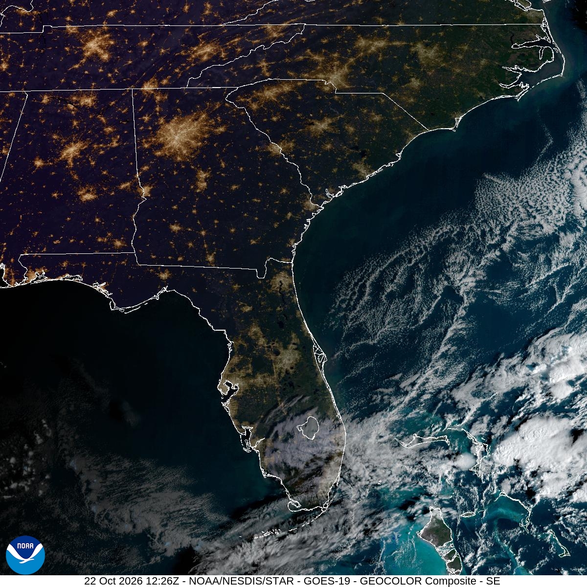
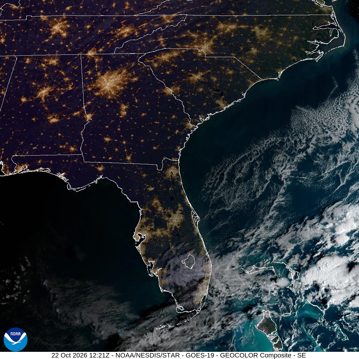
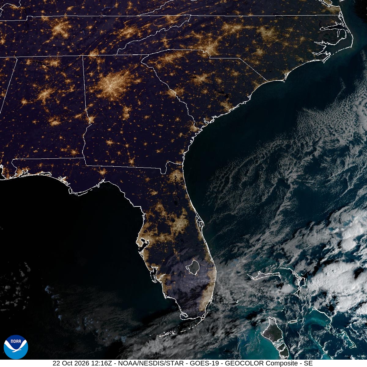
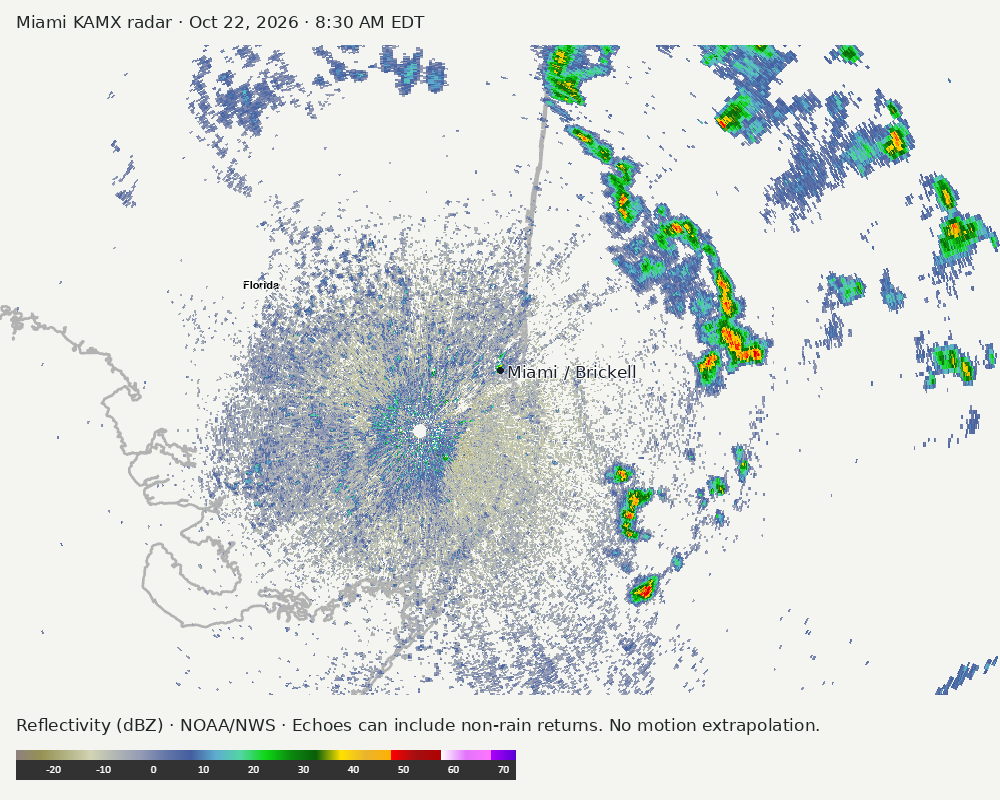
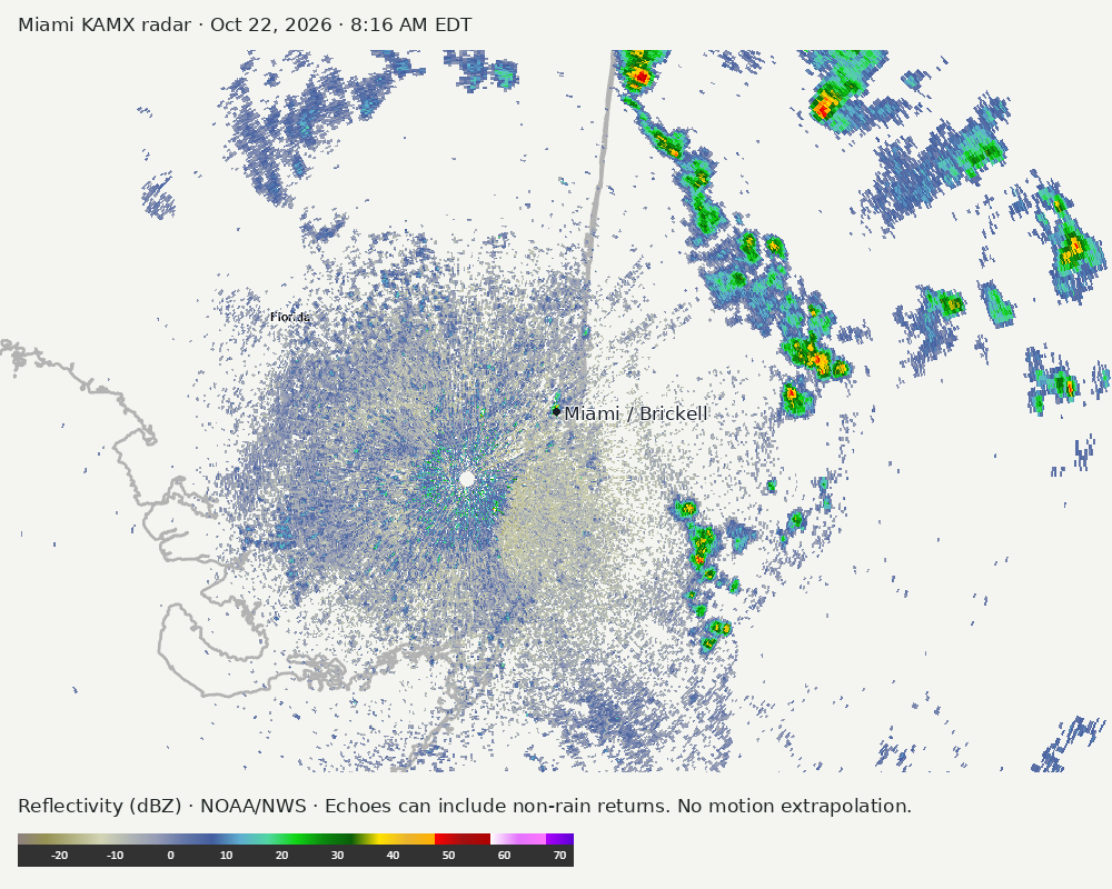
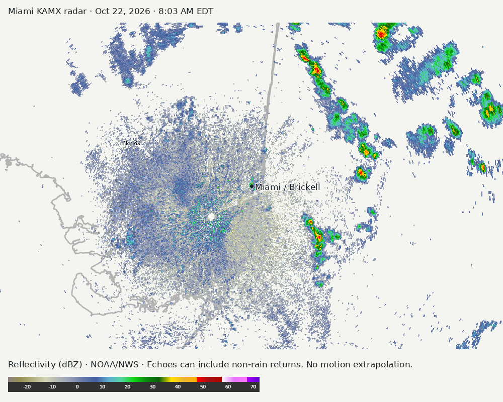
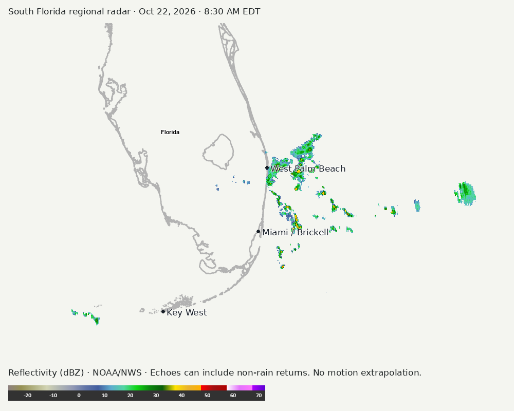
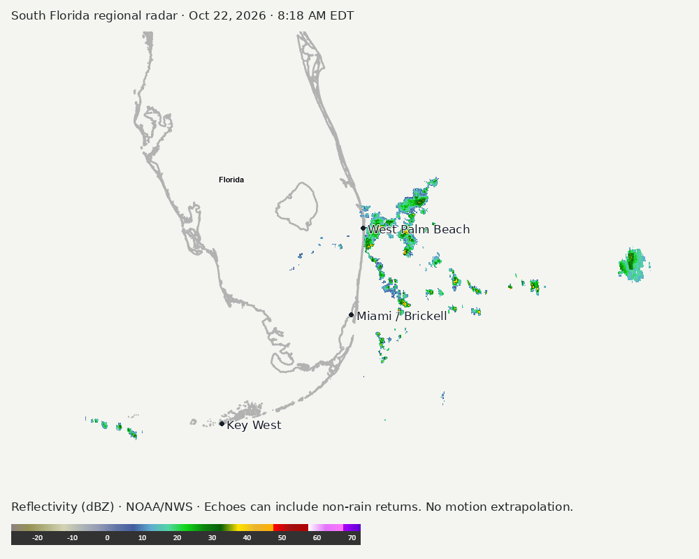
Archived frames show what the instruments captured at their labeled times. Radar echoes can include non-rain returns. No movement or future arrival is inferred automatically from these frames.
Southeast GeoColor satellite
GeoColor shows the Southeast, including Florida. The timestamped sequence below preserves cloud detail without automatically interpreting cloud cover at street level.

Earlier timestamped frames


Detailed Miami radar — official KAMX fallback
Colored reflectivity echoes are concentrated northeast of Miami, east of Miami, southeast of Miami relative to Miami in the latest frame. These are echo locations, not confirmation of rain at the surface.
Earlier timestamped frames
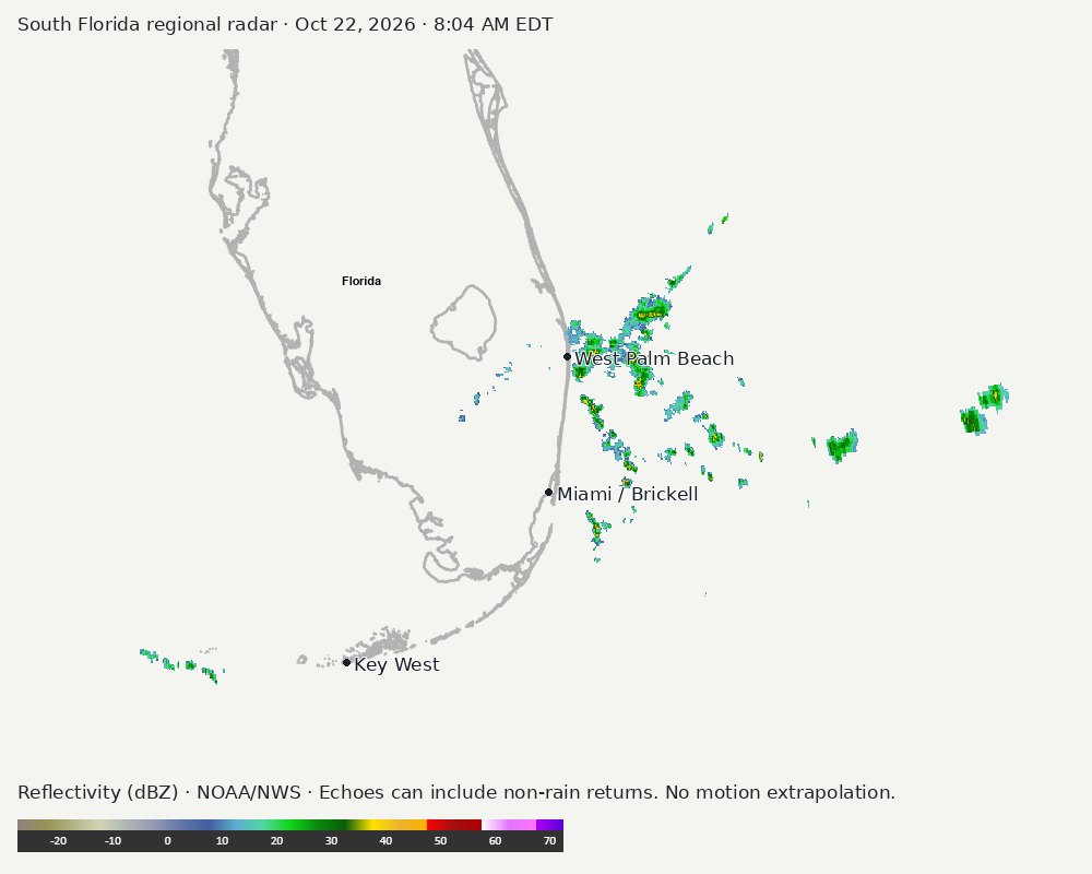
Regional South Florida radar
Colored reflectivity echoes are concentrated east of Miami, northeast of Miami relative to Miami in the latest frame. These are echo locations, not confirmation of rain at the surface.
Earlier timestamped frames
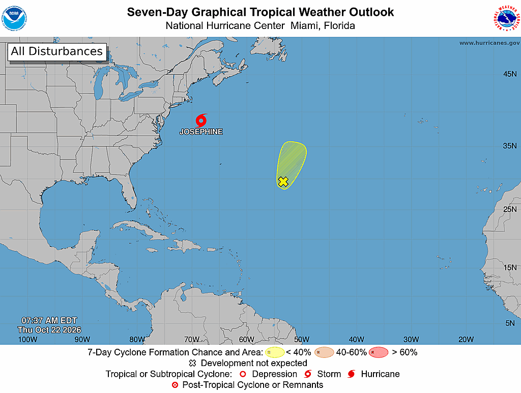
Tropical outlook
The Atlantic outlook describes development potential, not a forecast of impacts in Miami. No local hurricane impact is inferred here.
Read official source text
000
ABNT20 KNHC 221136
TWOAT

Tropical Weather Outlook
NWS National Hurricane Center Miami FL
800 AM EDT Thu Oct 22 2026

For the North Atlantic...Caribbean Sea and the Gulf of America:

Active Systems:
The National Hurricane Center is issuing advisories on Subtropical
Storm Josephine, located a few hundred miles offshore of the
Mid-Atlantic coast of the United States.

Subtropical Central Atlantic:
A trough of low pressure located several hundred miles to the
east-southeast of Bermuda is producing a large area of disorganized
showers and thunderstorms. Some development of this system is
possible during the next day or two while it moves slowly
north-northeastward. Upper-level winds are forecast to become too
strong for further development by the weekend.
* Formation chance through 48 hours...low...10 percent.
* Formation chance through 7 days...low...10 percent.

&&
Public Advisories on Josephine are issued under WMO header WTNT35
KNHC and under AWIPS header MIATCPAT5.
Forecast/Advisories on Josephine are issued under WMO header WTNT25
KNHC and under AWIPS header MIATCMAT5.

$$
Forecaster Beven
Miami forecast discussion
Read official source text
000
FXUS62 KMFL 221130
AFDMFL

Area Forecast Discussion
National Weather Service Miami FL
730 AM EDT Thu Oct 22 2026

...New UPDATE, AVIATION, BEACHES...

.KEY MESSAGES...
Updated at 730 AM EDT Thu Oct 22 2026

 - Hazardous marine conditions continue through the end of the
   work week for the Atlantic waters. Hazardous winds and seas for
   all local waters return this weekend.

 - High risk of rip currents continues for the Atlantic beaches,
   and will likely last at least into early next week. In
   addition, high surf conditions continue for the Palm Beaches.

 - Moderate coastal flooding is expected to continue around high
   tide along the east coast. A low, 10-30% chance of major
   coastal flooding is possible beginning during the second half
   of the upcoming weekend.

 - Heavy rain, isolated flash flooding, and windy conditions are
   forecast for this weekend into early next week.

&&

.UPDATE...
Issued at 730 AM EDT Thu Oct 22 2026

Low-level trough just north of the Bahamas, embedded in the
general N-NE wind flow, is skirting the Florida east coast this
morning and helping to trigger scattered showers along and
offshore the Palm Beach County coast. Hi-res/short range models
are handling this scenario fairly well, and depict a southward
spread of the showers mainly over the nearshore Atlantic waters
but skirting the east coast metro from time to time through much
of the day. Current forecast PoPs are handling this well so no
changes needed to the forecast at this time except to increase
cloud cover southward along the east coast this morning.

NOS tide gauges are peaking in the minor flood stage at the
current high tide, except bordering on moderate at Lake Worth
Pier. These levels continue slightly above guidance, so current
expectation of moderate flood levels with upcoming high tides over
the next several days is on track.

&&

.SHORT TERM...
(Today through Friday)
Issued at 106 AM EDT Thu Oct 22 2026

Latest surface analysis shows high pressure over the TN Valley, and
Subtropical Storm Josephine off the New England coast. At the upper
levels, the ridge over the center of the country continues to nose
eastward and a trough is slowly deepening over the eastern third of
the country. Latest 00Z sounding shows plenty of dry air at the mid
and upper levels, with some low level moisture to support widely
scattered coastal showers today. Winds will continue to be out of
the NNE and gusting to around 20-25 mph this afternoon. High temps
will be in the low to middle 80s. Scattered coastal showers will
continue overnight with mainly dry conditions over the interior and
SW FL. Overnight lows will be comfortable ranging from the low to
mid 60s around the lake region, the lower 70s closer to the coast.

As the trough continues to deepen on Friday and an upper low starts
to develop off the SE US coast late in the day, low level moisture
will start to increase with PWAT values nosing up to around 1.5
inches. Forecast soundings still show plenty of dry air aloft, but
the shower activity should be more increased across the east coast
metro compared to the past several days. Could even see some
isolated thunderstorms near the coast. NE winds will be pick up a
bit on Friday, with wind gusts of 20-30 mph possible, especially
along the coast. Afternoon high temps will again be in the low to
middle 80s.

&&

.LONG TERM...
(Friday night through Wednesday)
Issued at 106 AM EDT Thu Oct 22 2026

As we head into the weekend and into early next week, a multi hazard
event will be taking shape as an upper level low lingers in the
region and strong surface high pressure builds into the eastern US.
Enhanced moisture around the upper low will bring rounds of showers,
heavy at times, to SE FL from Saturday through Monday. While mean
QPF values have trended downward the past several days, 1-3 inches
is still expected across the east coast metro, with localized higher
end amounts of 4-6 inches possible. This rain combined with the
higher king tides this weekend may present some flooding issues. WPC
has a Slight risk of excessive rain across the metro both days this
weekend. The other main story will be the gusty winds this weekend
as the pressure gradient tightens. NE winds will gust 25-35 mph on
Saturday and 30-40 mph on Sunday.

Conditions begin to improve Tuesday into mid week as the upper low
pulls away from the region to the northeast and with it the deeper
moisture will exit the area. There will still be scattered coastal
showers around both days, but the rainfall flooding threat will
decrease.

Fairly comfortable temperatures are expected this weekend into next
week with high temps generally in the low to middle 80s, and low
temps each day in the 60s/70s.

&&

.AVIATION...
(12Z TAFS)
Issued at 730 AM EDT Thu Oct 22 2026

VFR conditions expected through the forecast period with a
predominant BKN occasionally OVC layer 050-060. SHRA over the
nearshore Atlantic waters will skirt the east coast and could
briefly affect some of the terminals for much of the period. Main
impact will be brief MVFR ceiling/visibility, primarily at KDJT
through about 14z, with lower confidence at the remainder of the
terminals where VCSH is indicated. Wind 330-350 degrees near 10
knots through 15z-17z, becoming 020-030 degrees after 17z.

&&

.MARINE...
Issued at 106 AM EDT Thu Oct 22 2026

Hazardous seas will continue in the Atlantic waters the rest of the
week with seas of 5-8 ft. NE winds 15-20 kts through Friday for all
local waters.

Hazardous winds and seas return for all local waters this weekend
into early next week as the pressure gradient tightens across the
area. Gale force winds are possible in both the Atlantic and Gulf
waters this weekend.

&&

.HYDROLOGY...
Issued at 106 AM EDT Thu Oct 22 2026

We're beginning to come out of an ebb in the astronomical tides
as we head towards the full moon and peak of the tide forecasts
late this weekend and into early next week. Observed water-levels
are already over-performing predictions and we'll likely begin
reaching Moderate flooding thresholds this evening at all of our
east coast tidal stations. It's also not out of the question that
Palm Beach county may even reach Major flooding levels at the
peak of the King Tide.

The normal King Tides are complicated by the fact that we'll be
dealing with a complex upper/surface low pressure pattern that
will feature an approaching front from the north and convection
rising out of the Caribbean from the south. This will likely
increase the onshore wind component and magnify the already high
tides. This is somewhat accounted for in the predictions mentioned
above, but only crudely. Furthermore, the potential for heavy
rainfall during periods of high tide is also something to be aware
of that could further aggravate coastal flooding. In short, we're
heading into what could be a rather impactful period for coastal
flooding and sensitive locations should consider preparations.

&&

.PRELIMINARY POINT TEMPS/POPS...
Miami            83  71  83  72 /  40  30  50  40
West Kendall     84  70  84  70 /  30  20  50  30
Opa-Locka        83  70  83  71 /  40  30  50  40
Homestead        84  70  84  71 /  30  30  50  40
Fort Lauderdale  82  71  82  72 /  50  40  50  50
N Ft Lauderdale  82  71  82  72 /  50  30  50  50
Pembroke Pines   83  70  83  71 /  40  30  50  40
West Palm Beach  82  70  82  72 /  40  40  50  40
Boca Raton       82  71  82  72 /  50  40  50  50
Naples           84  66  84  67 /   0   0  20   0

&&

.MFL WATCHES/WARNINGS/ADVISORIES...
FL...Coastal Flood Advisory until 8 PM EDT Saturday for FLZ168-172-
     173.

     High Rip Current Risk through Saturday evening for FLZ168-172-
     173.

     High Surf Advisory until 2 AM EDT Saturday for FLZ168.

AM...Small Craft Advisory until 8 PM EDT Friday for AMZ650-651-670-
     671.

GM...None.
&&

$$

SHORT TERM...CMF
LONG TERM....CMF
UPDATE/AVIATION...Molleda
Sources and freshness
Supplementary failures do not replace missing data with reassuring conclusions. All source times below are Eastern; source metadata and original downloads are archived with this report.
Alerts · available
Source. Retrieved Oct 22, 2026 · 8:32 AM EDT.
Beach · available
Source. Retrieved Oct 22, 2026 · 8:32 AM EDT. Issued Oct 22, 2026 · 4:01 AM EDT.
Coastal Alerts · available
Source. Retrieved Oct 22, 2026 · 8:32 AM EDT.
Discussion · available
Source. Retrieved Oct 22, 2026 · 8:32 AM EDT. Issued Oct 22, 2026 · 7:30 AM EDT.
Forecast · available
Source. Retrieved Oct 22, 2026 · 8:32 AM EDT. Issued Oct 22, 2026 · 8:26 AM EDT.
Hourly · available
Source. Retrieved Oct 22, 2026 · 8:32 AM EDT. Issued Oct 22, 2026 · 8:26 AM EDT.
Local Radar · available
Source. Retrieved Oct 22, 2026 · 8:32 AM EDT. Issued Oct 22, 2026 · 8:30 AM EDT.
Marine · available
Source. Retrieved Oct 22, 2026 · 8:32 AM EDT. Issued Oct 22, 2026 · 3:51 AM EDT.
Mcnoldy · unavailable
Source. Retrieved Oct 22, 2026 · 8:32 AM EDT. URLError: transport or certificate failure
Nhc · available
Source. Retrieved Oct 22, 2026 · 8:32 AM EDT. Issued Oct 22, 2026 · 7:36 AM EDT.
Observation · available
Source. Retrieved Oct 22, 2026 · 8:32 AM EDT. Issued Oct 22, 2026 · 8:00 AM EDT.
Regional Radar · available
Source. Retrieved Oct 22, 2026 · 8:32 AM EDT. Issued Oct 22, 2026 · 8:30 AM EDT.
Satellite · available
Source. Retrieved Oct 22, 2026 · 8:32 AM EDT. Issued Oct 22, 2026 · 8:26 AM EDT.
Tropical Tidbits · link-only
Source. Retrieved Oct 22, 2026 · 8:32 AM EDT. Optional context only. Imagery is not copied: Tropical Tidbits reserves reuse rights.