Morning Miami Weather Report
Miami, October 25 — Showers And Thunderstorms
Automated weather summary from official sources; factual templates with validated source timestamps. Follow NWS Miami and NHC for current guidance.
Late report: current weather data were collected at the publication time below, rather than early this morning.
Forecast for Miami / Brickell
Today: 82°F. Showers And Thunderstorms. Wind 15 to 23 mph N. Rain chance: 87%.
Showers and thunderstorms. Partly sunny, with a high near 82. North wind 15 to 23 mph, with gusts as high as 31 mph. Chance of precipitation is 90%. New rainfall amounts between a half and three quarters of an inch possible.
Tonight: Showers and thunderstorms before 10pm, then a chance of showers and thunderstorms between 10pm and 11pm, then showers and thunderstorms. Partly cloudy, with a low around 76. Northeast wind around 24 mph, with gusts as high as 31 mph. Chance of precipitation is 80%. New rainfall amounts between a half and three quarters of an inch possible.
Hourly forecast — rain chances and timing
| Eastern time | Temperature | Rain chance | Wind | Forecast |
|---|---|---|---|---|
| Oct 25, 2026 · 12:00 PM EDT | 79°F | 79% | 20 mph NE | Showers And Thunderstorms |
| Oct 25, 2026 · 1:00 PM EDT | 78°F | 69% | 21 mph NE | Showers And Thunderstorms Likely |
| Oct 25, 2026 · 2:00 PM EDT | 79°F | 87% | 22 mph NE | Showers And Thunderstorms |
| Oct 25, 2026 · 3:00 PM EDT | 79°F | 77% | 23 mph NE | Showers And Thunderstorms |
| Oct 25, 2026 · 4:00 PM EDT | 79°F | 78% | 23 mph NE | Showers And Thunderstorms |
| Oct 25, 2026 · 5:00 PM EDT | 81°F | 66% | 23 mph NE | Showers And Thunderstorms Likely |
| Oct 25, 2026 · 6:00 PM EDT | 80°F | 71% | 23 mph NE | Showers And Thunderstorms Likely |
| Oct 25, 2026 · 7:00 PM EDT | 80°F | 64% | 23 mph NE | Showers And Thunderstorms Likely |
| Oct 25, 2026 · 8:00 PM EDT | 80°F | 79% | 22 mph NE | Showers And Thunderstorms |
| Oct 25, 2026 · 9:00 PM EDT | 79°F | 73% | 23 mph NE | Showers And Thunderstorms Likely |
| Oct 25, 2026 · 10:00 PM EDT | 79°F | 53% | 23 mph NE | Chance Showers And Thunderstorms |
| Oct 25, 2026 · 11:00 PM EDT | 79°F | 61% | 22 mph NE | Showers And Thunderstorms Likely |
Observed nearby
Miami International Airport (KMIA), Oct 25, 2026 · 11:40 AM EDT: Light Rain. Temperature 79°F; wind 10 mph. This airport observation does not measure conditions at your exact location in Brickell.
Alerts and outdoor plans
Take the necessary actions to protect flood-prone property. If travel is required, do not drive around barricades or through water of unknown depth. Swim near a lifeguard. If caught in a rip current, relax and float. Don't swim against the current. If able, swim in a direction following the shoreline. If unable to escape, face the shore and call or wave for help.
Take the necessary actions to protect flood-prone property. If travel is required, do not drive around barricades or through water of unknown depth. Swim near a lifeguard. If caught in a rip current, relax and float. Don't swim against the current. If able, swim in a direction following the shoreline. If unable to escape, face the shore and call or wave for help.
Take the necessary actions to protect flood-prone property. If travel is required, do not drive around barricades or through water of unknown depth. Swim near a lifeguard. If caught in a rip current, relax and float. Don't swim against the current. If able, swim in a direction following the shoreline. If unable to escape, face the shore and call or wave for help.
Mariners should alter plans to avoid these hazardous conditions. Remain in port, seek safe harbor, alter course, and/or secure the vessel for hazardous conditions.
Mariners should alter plans to avoid these hazardous conditions. Remain in port, seek safe harbor, alter course, and/or secure the vessel for hazardous conditions.
Mariners should alter plans to avoid these hazardous conditions. Remain in port, seek safe harbor, alter course, and/or secure the vessel for hazardous conditions.
Mariners should alter plans to avoid these hazardous conditions. Remain in port, seek safe harbor, alter course, and/or secure the vessel for hazardous conditions.
Mariners should alter plans to avoid these hazardous conditions. Remain in port, seek safe harbor, alter course, and/or secure the vessel for hazardous conditions.
Mariners should alter plans to avoid these hazardous conditions. Remain in port, seek safe harbor, alter course, and/or secure the vessel for hazardous conditions.
Take the necessary actions to protect flood-prone property. If travel is required, do not drive around barricades or through water of unknown depth. Swim near a lifeguard. If caught in a rip current, relax and float. Don't swim against the current. If able, swim in a direction following the shoreline. If unable to escape, face the shore and call or wave for help.
Take the necessary actions to protect flood-prone property. If travel is required, do not drive around barricades or through water of unknown depth. Swim near a lifeguard. If caught in a rip current, relax and float. Don't swim against the current. If able, swim in a direction following the shoreline. If unable to escape, face the shore and call or wave for help.
Take the necessary actions to protect flood-prone property. If travel is required, do not drive around barricades or through water of unknown depth. Swim near a lifeguard. If caught in a rip current, relax and float. Don't swim against the current. If able, swim in a direction following the shoreline. If unable to escape, face the shore and call or wave for help.
Running: Use the temperature, rain and wind forecast above to plan your window. If thunderstorms are forecast or you hear thunder, postpone outdoor activity and seek a substantial building. This briefing does not certify a safe running window.
Paddleboarding — official Biscayne Bay forecast
Today: N winds 10 to 15 kt (17 mph) with gusts up to 20 kt (23 mph), becoming NE 20 to 25 kt (29 mph) with gusts up to 30 kt (35 mph) this afternoon. Rough. Showers likely with a slight chance of tstms this morning, then showers with a chance of tstms this afternoon.
Tonight: NE winds 20 to 25 kt (29 mph) with gusts up to 30 kt (35 mph). Rough. Showers likely with a chance of tstms until early morning, then a chance of showers late.
Mon: NE winds 25 to 30 kt (35 mph). Very rough. A chance of tstms until late afternoon. Showers likely.
Wind speeds in the source use knots (1 knot = 1.151 mph). Check current marine alerts and local conditions before launching; no safe launch window is inferred.
Official coastal Miami-Dade beach and rip-current guidance
FLZ173-252100-
Coastal Miami-Dade-
Including the beaches of Miami
321 AM EDT Sun Oct 25 2026

...HIGH RIP CURRENT RISK IN EFFECT THROUGH LATE TUESDAY NIGHT...

.TODAY...
Rip Current Risk*...........High.
Surf Height.................2 to 3 feet.
Thunderstorm Potential**....Moderate.
Waterspout Risk**...........None.
UV Index**..................High.
Water Temperature...........In the upper 70s.
Weather.....................Partly sunny. Showers and a chance of
                            thunderstorms.
High Temperature............In the lower 80s.
Winds.......................Northeast winds 15 to 20 mph.
Tides...
   Miami Harbor Entrance....High at 08:33 AM EDT.
                            Low at 02:15 PM EDT.
Sunrise.....................7:24 AM.
Sunset......................6:45 PM.

.MONDAY...
Rip Current Risk*...........High.
Surf Height.................3 to 4 feet.
Thunderstorm Potential**....Moderate.
Weather.....................Mostly sunny. Showers likely and a
                            chance of thunderstorms.
High Temperature............In the lower 80s.
Winds.......................Breezy. Northeast winds around 25 mph.
Tides...
   Miami Harbor Entrance....High at 09:19 AM EDT.
                            Low at 02:59 PM EDT.
Sunrise.....................7:25 AM.
Sunset......................6:44 PM.

&&

Rip Current Risk Category
* Low Risk - The risk for rip currents is low, however,
life-threatening rip currents often occur in the vicinity of groins,
jetties, reefs, and piers.
* Moderate Risk - Life-threatening rip currents are possible in the
surf zone.
* High Risk - Life-threatening rip currents are likely in the surf
zone.

** For thunderstorm, waterspout, and UV definitions see:
https://www.weather.gov/beach/mfl
Satellite and radar
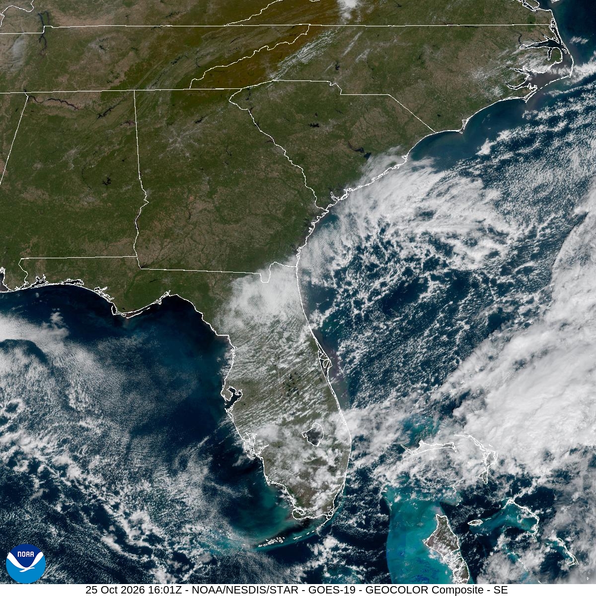
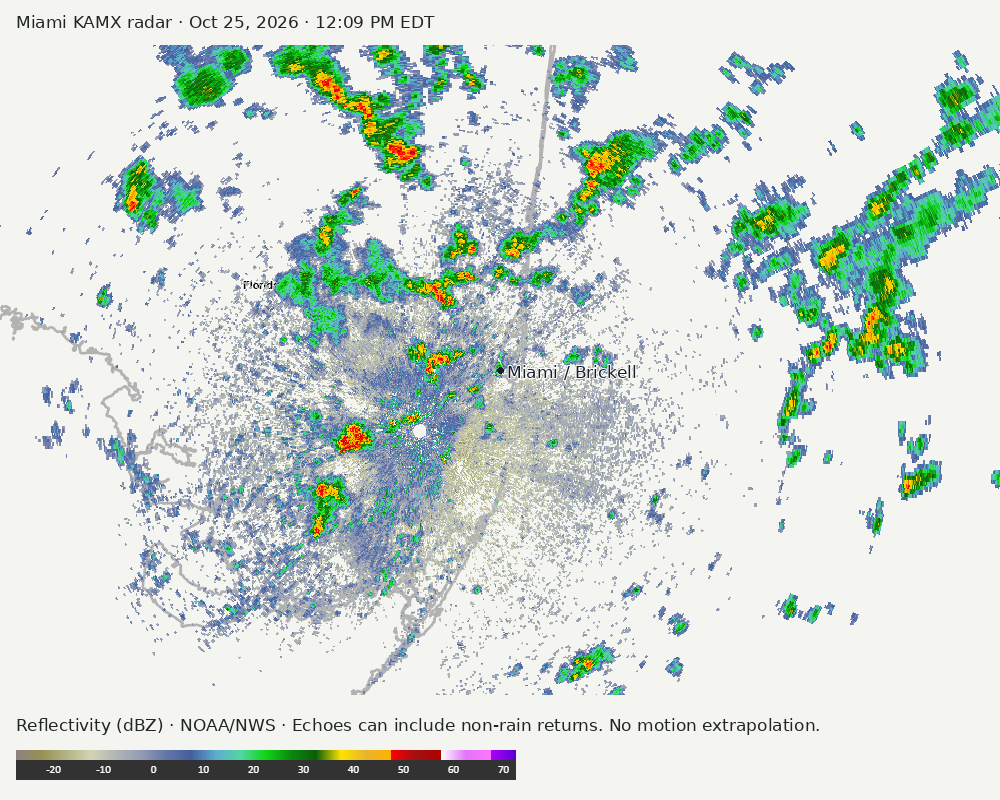
Archived frames show what the instruments captured at their labeled times. Radar echoes can include non-rain returns. No movement or future arrival is inferred automatically from these frames.
Southeast GeoColor satellite
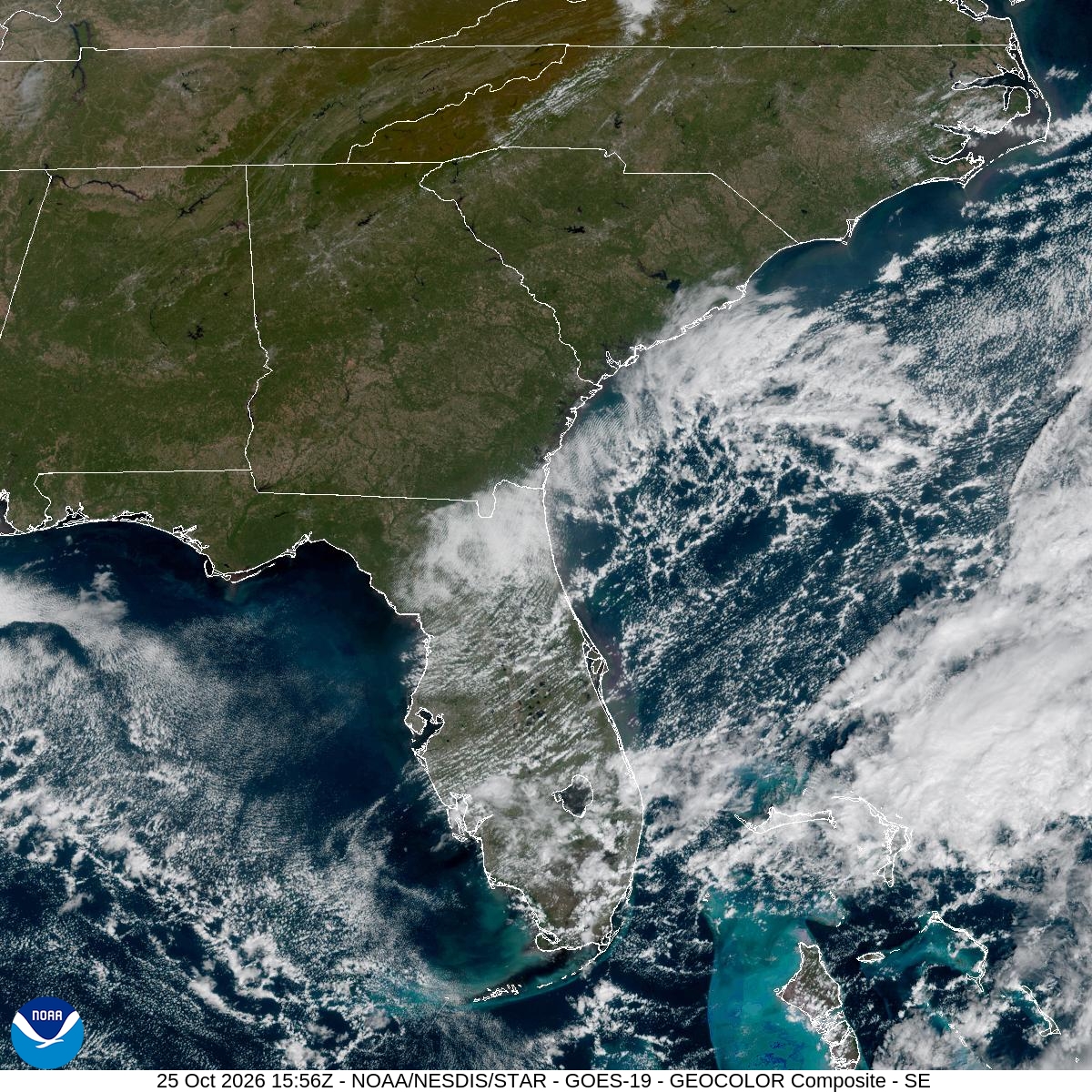
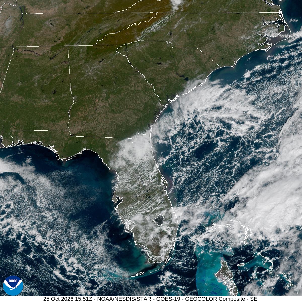
GeoColor shows the Southeast, including Florida. The timestamped sequence below preserves cloud detail without automatically interpreting cloud cover at street level.

Earlier timestamped frames


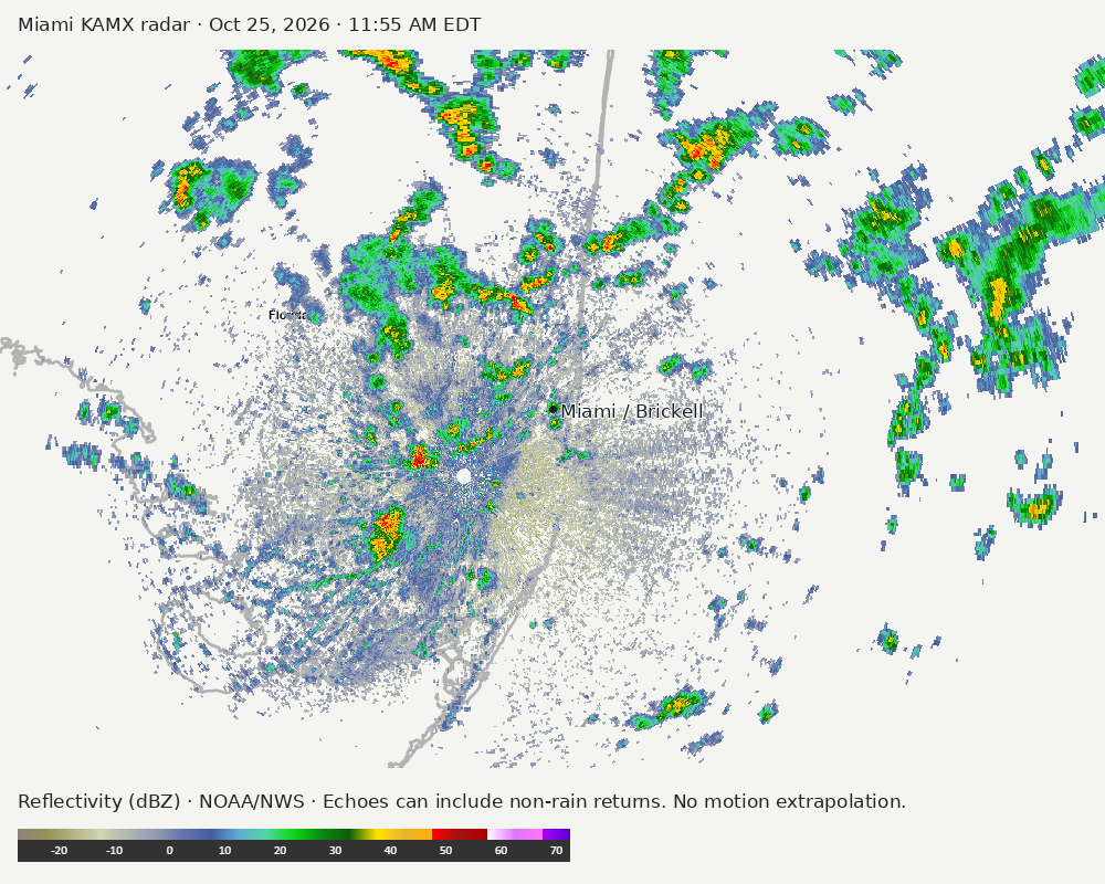
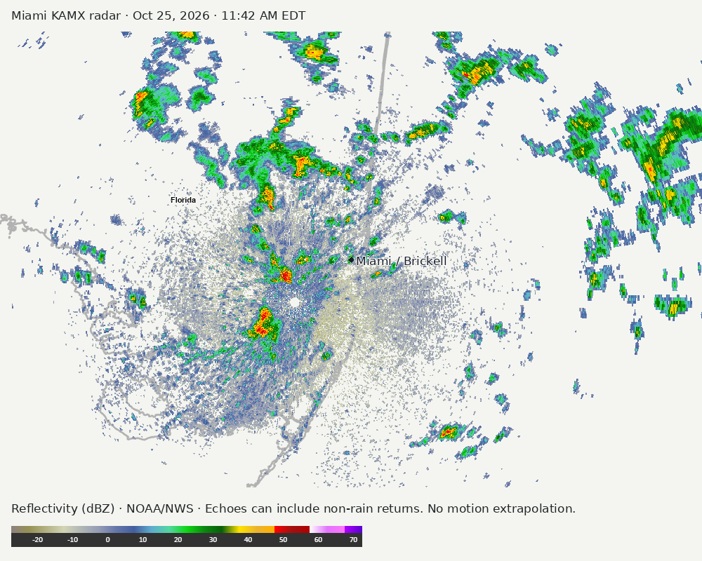
Detailed Miami radar — official KAMX fallback
Colored reflectivity echoes are concentrated northwest of Miami, northeast of Miami, east of Miami relative to Miami in the latest frame. These are echo locations, not confirmation of rain at the surface.
Earlier timestamped frames
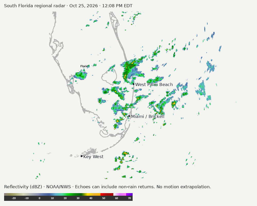
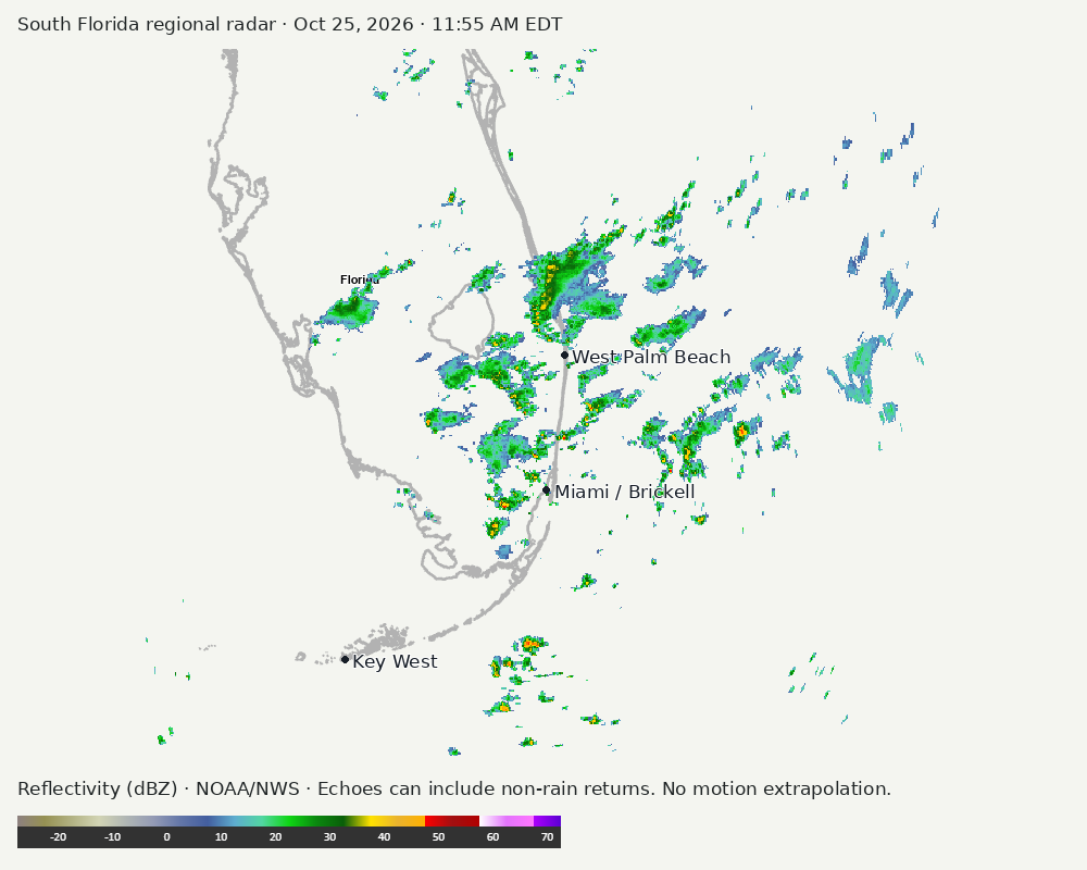
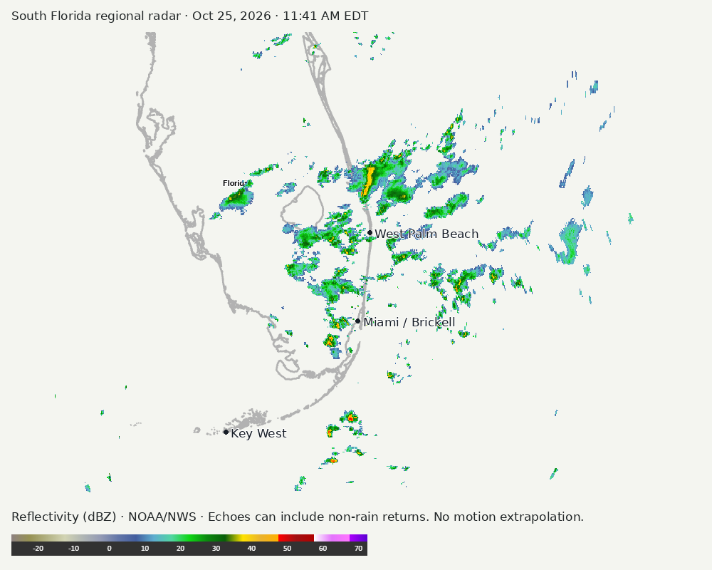
Regional South Florida radar
Colored reflectivity echoes are concentrated north of Miami, northeast of Miami, northwest of Miami relative to Miami in the latest frame. These are echo locations, not confirmation of rain at the surface.
Earlier timestamped frames
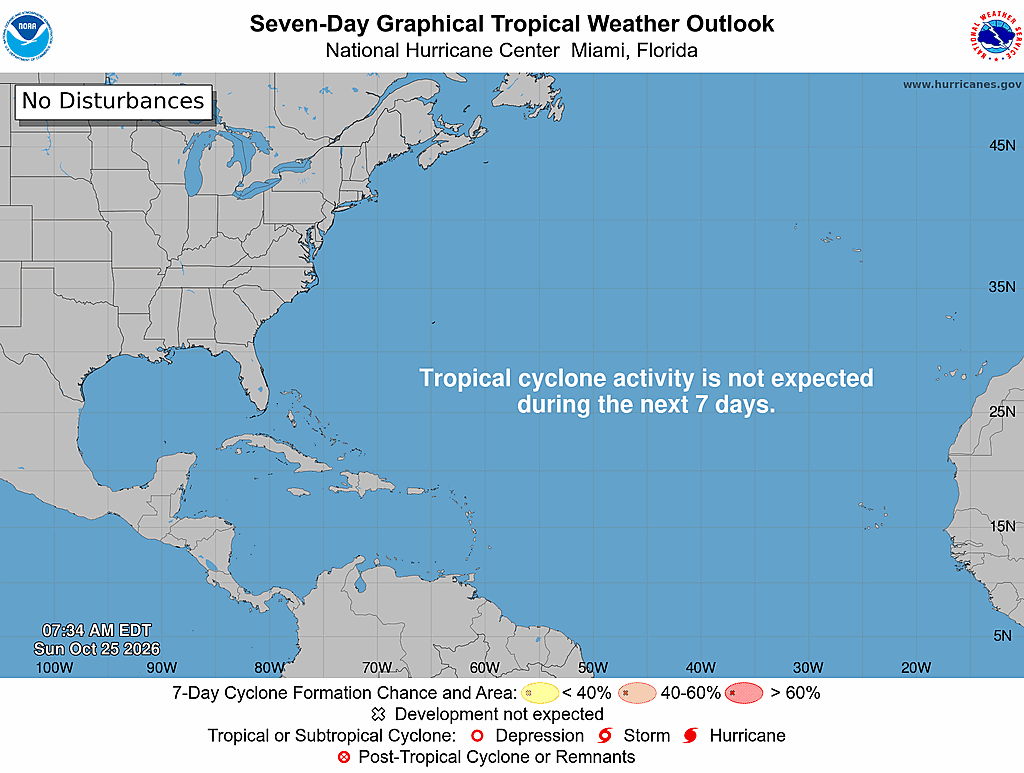
Tropical outlook
The Atlantic outlook describes development potential, not a forecast of impacts in Miami. No local hurricane impact is inferred here.
Read official source text
000
ABNT20 KNHC 251134
TWOAT

Tropical Weather Outlook
NWS National Hurricane Center Miami FL
800 AM EDT Sun Oct 25 2026

For the North Atlantic...Caribbean Sea and the Gulf of America:

Tropical cyclone formation is not expected during the next 7 days.

$$
Forecaster Adams
Miami forecast discussion
Read official source text
000
FXUS62 KMFL 251131
AFDMFL

Area Forecast Discussion
National Weather Service Miami FL
731 AM EDT Sun Oct 25 2026

...New AVIATION...

.KEY MESSAGES...
Updated at 715 AM EDT Sun Oct 25 2026

 - Moderate coastal flooding is expected with each high tide
   cycle. Major coastal flooding is possible late this weekend
   into early next week.

 - Heavy rain and isolated flash flooding is possible across the
   east coast metros today through Monday.

 - Strong winds, with gusts over 35 mph are possible today through
   Monday night.

 - Dangerous marine and beach conditions are expected through the
   middle of the week.

&&

.SHORT TERM...
(Today through Monday)
Issued at 324 AM EDT Sun Oct 25 2026

A complex weather pattern is set up for today and into early this
coming week as an omega block ridge over the central U.S. creates a
primarily meridional flow pattern with steady northerly flow in the
mid-levels and upper-levels of the atmosphere. An elongated north-to-
south trough is set up just east of this ridge block over the
western Atlantic and extending into the Atlantic coastline across
the Eastern Seaboard. Additionally, this results in surface high
pressure underneath this upper-level setup being stout as well, with
a strong pressure gradient setting up that is expected to bring
increasingly gusty winds to South Florida. The surface high will be
centered in the Northeast U.S. with a surface trough off the coast.
This pattern could lead to us approaching Wind Advisory criteria on
Monday, especially along the east coastline, but probabilities are
not high enough currently to result in enough confidence to issue an
advisory yet. Regardless, sustained NE winds of 20-25 mph and gusts
of 30-35 mph are likely and occasional gusts to 40 mph are certainly
possible.

In terms of convective potential today, the main drivers will be
vorticity advection from the nearby elongated trough and
speed/friction convergence created by strong NE flow rushing into
less strong winds over land. This type of convergence can lead to
numerous pop up showers and storms, but typically not as long
lasting or tall as in a typical low level convergence setup.
Nevertheless, expect scattered to numerous showers today primarily
across the east coast metro with some embedded storms. With how
scattered convection is expected to be along with the brisk flow
leading to fast-moving showers and storms, concerns are low for
excessive rainfall across the region. Additionally, deep convection
is typically hard to come by in these types of setups. However, an
isolated occurrence or two for localized flooding still cannot be
ruled out due to training activity, but the risk overall across the
region is not high.

As we move into Monday, most of the ensemble members and short range
model guidance show the deepest moisture advecting offshore and thus
there will be an even lesser risk for convective and hydro hazards
on Monday. Some level of scattered shower activity is still likely,
but less than today and once again any convection will be fast
moving. High temperatures are expected in the low to mid 80s for
most areas with parts of Southwest Florida reaching the upper 80s.

&&

.LONG TERM...
(Monday night through Saturday)
Issued at 324 AM EDT Sun Oct 25 2026

While not much of a legend down here as it is up in the Great Lakes,
it appears that the gales of November may indeed come early for
South Florida. Breezy 25 to 35 mph wind gusts will continue to be
common Monday night through Tuesday morning. Strong surface high
pressure over the mid-Atlantic states will continue to induce a
tight pressure gradient along the Florida Atlantic coast through the
end of the week. As a result, breezy conditions will continue at
least through Wednesday. As discussed in the short term
discussion, whether a wind advisory will also be needed for the
Monday night and Tuesday period is still up for debate. It seems
that the most likely areas to see sustained winds of 30 mph or
greater is along the immediate coasts of Broward, Dade, and Palm
Beach counties. Probabilities for advisory criteria winds are only
at about 40%, so most areas will likely only see sustained winds
of around 20 mph. Pressure gradients begin to relax near the
middle of the week, which will finally lead to some calming of the
winds. However, surface high pressure along the eastern seaboard
will keep the same overall pattern in place, with northeast winds
persisting into next weekend at around 10 to 15 mph.

Ensemble clusters are showing relatively good agreement regarding
the upper level pattern heading into the middle of the week. A
series of shortwave perturbations moving over the intermountain west
will begin to flatten and steer high pressure over the Gulf and
Deep South. Meanwhile, a cut off low over the Bahamas will begin
to eject out into the Atlantic by Wednesday, which should allow
for the weather to become a little less unsettled. As the mid-
level ridge begins to exert greater influence over South Florida,
chances of precipitation will decline and high temperatures look
to climb back up into the upper 80s. The cut off low near the
Bahamas will help transport some increased moisture into the
northern Caribbean, with PWATs looking to climb to near 1.8 inches
over South Florida (if the systems stays close enough to our
area). Overall, this northeasterly flow pattern will favor
scattered showers and storms coming off of the Gulf Stream waters
for most of the week. Lightning and locally heavy rainfall will be
the main threats, but there is currently no risk of excessive
rainfall after Tuesday. A more typical sea breeze induced
convective pattern will likely return once northeast winds weaken
towards the end of the week.

The potential for moderate and major tidal flooding may continue
during the middle portions of the week. This tidal flooding may also
be exacerbated by coastal showers and strong northeast winds, which
could lead to significant water rises along the far eastern metro
areas. While the peak tides will be during the beginning to middle
of the week, moderate coastal flooding may persist through the end
of the week as we come out of this full moon phase.

&&

.AVIATION...
(12Z TAFS)
Issued at 715 AM EDT Sun Oct 25 2026

Mainly VFR conditions expected across all South Florida terminals
today except for brief periods of sub-VFR within showers and
thunderstorms. A land breeze/NNW winds this morning across east
coast terminals will veer to a NNE direction by around 13-14Z and
become quite gusty with peak gusts throughout much of the
forecast period oscillating between 25 and 30 kts across all South
Florida terminals.

&&

.MARINE...
Issued at 324 AM EDT Sun Oct 25 2026

Hazardous marine conditions will continue the rest of this weekend
and into the middle of this coming week. Strong northeasterly winds
will increase up to 25-35 kts by tonight and into early this week,
with the strongest winds expected at Gale Force over the Atlantic
waters. Scattered to numerous showers and storms are also expected
to develop along the Atlantic over the next several days. Heavy
rainfall, lightning, and locally higher seas will be a threat with
any storm. Seas are currently forecast to peak around 6-9 feet in
the Gulf and 10-14 feet across the Atlantic waters Sunday night into
Monday. High seas and breezy conditions will persist through at
least the middle of the week, before conditions finally start to
relax during the end of the week.

&&

.BEACHES...
Issued at 324 AM EDT Sun Oct 25 2026

A high risk of rip currents will persist for all Atlantic beaches
through at least the middle of this week. Dangerous surf heights of
10 to 12 feet may be possible for the Palm Beaches through at least
Tuesday.

Furthermore, strong onshore wind flow and high seas may
combine with King Tides to increase the threat of coastal flooding
along the Atlantic coast. Currently, it is expected that moderate
flooding will occur through today, with potential to reach major
flood stage on Monday and Tuesday. This situation will be assessed
further, but for now a Coastal Flood Watch remains in effect for the
Mon-Tue time frame as we continue to monitor the potential for major
tidal flooding.

&&

.PRELIMINARY POINT TEMPS/POPS...
Miami            83  74  83  74 /  80  70  60  60
West Kendall     84  73  84  74 /  70  60  60  50
Opa-Locka        84  74  84  74 /  90  80  60  60
Homestead        84  73  84  74 /  80  70  70  60
Fort Lauderdale  82  74  82  74 /  90  80  70  70
N Ft Lauderdale  82  74  83  75 /  90  80  70  70
Pembroke Pines   84  73  84  74 /  90  80  60  60
West Palm Beach  82  73  83  74 /  90  70  70  60
Boca Raton       82  74  82  75 /  90  80  80  70
Naples           85  71  86  71 /  30  10   0   0

&&

.MFL WATCHES/WARNINGS/ADVISORIES...
FL...Coastal Flood Advisory until 2 AM EDT Monday for FLZ168-172-173.

     High Rip Current Risk through late Tuesday night for FLZ168-172-
     173.

     High Surf Advisory until 2 AM EDT Wednesday for FLZ168.

     Coastal Flood Watch from late tonight through Tuesday morning
     for FLZ168-172-173.

AM...Small Craft Advisory until 2 AM EDT Wednesday for AMZ610-630.

     Small Craft Advisory until 2 PM EDT this afternoon for AMZ650-
     651-670-671.

     Gale Watch from 2 PM EDT this afternoon through this evening for
     AMZ650-651-670-671.

     Gale Watch from late Monday night through late Tuesday night for
     AMZ650-651-670-671.

     Gale Warning from 8 PM this evening to 2 AM EDT Tuesday for
     AMZ650-651-670-671.

GM...Small Craft Advisory until 2 AM EDT Wednesday for GMZ656-657-676.

&&

$$

SHORT TERM...Redman
LONG TERM....NMP
AVIATION...AD
Sources and freshness
Supplementary failures do not replace missing data with reassuring conclusions. All source times below are Eastern; source metadata and original downloads are archived with this report.
Alerts · available
Source. Retrieved Oct 25, 2026 · 12:11 PM EDT.
Beach · available
Source. Retrieved Oct 25, 2026 · 12:11 PM EDT. Issued Oct 25, 2026 · 3:21 AM EDT.
Coastal Alerts · available
Source. Retrieved Oct 25, 2026 · 12:11 PM EDT.
Discussion · available
Source. Retrieved Oct 25, 2026 · 12:11 PM EDT. Issued Oct 25, 2026 · 7:31 AM EDT.
Forecast · available
Source. Retrieved Oct 25, 2026 · 12:11 PM EDT. Issued Oct 25, 2026 · 7:47 AM EDT.
Hourly · available
Source. Retrieved Oct 25, 2026 · 12:11 PM EDT. Issued Oct 25, 2026 · 7:47 AM EDT.
Local Radar · available
Source. Retrieved Oct 25, 2026 · 12:11 PM EDT. Issued Oct 25, 2026 · 12:09 PM EDT.
Marine · available
Source. Retrieved Oct 25, 2026 · 12:11 PM EDT. Issued Oct 25, 2026 · 3:51 AM EDT.
Mcnoldy · unavailable
Source. Retrieved Oct 25, 2026 · 12:11 PM EDT. URLError: transport or certificate failure
Nhc · available
Source. Retrieved Oct 25, 2026 · 12:11 PM EDT. Issued Oct 25, 2026 · 7:34 AM EDT.
Observation · available
Source. Retrieved Oct 25, 2026 · 12:11 PM EDT. Issued Oct 25, 2026 · 11:40 AM EDT.
Regional Radar · available
Source. Retrieved Oct 25, 2026 · 12:11 PM EDT. Issued Oct 25, 2026 · 12:08 PM EDT.
Satellite · available
Source. Retrieved Oct 25, 2026 · 12:11 PM EDT. Issued Oct 25, 2026 · 12:01 PM EDT.
Tropical Tidbits · not-used
Source. Retrieved not retrieved. No current tropical context requiring this supplementary source, or the NHC input is unavailable.