Morning Miami Weather Report
Miami, October 30 — Slight Chance Showers And Thunderstorms
Automated weather summary from official sources; factual templates with validated source timestamps. Follow NWS Miami and NHC for current guidance.
Late report: current weather data were collected at the publication time below, rather than early this morning.
Forecast for Miami / Brickell
This Afternoon: 85°F. Slight Chance Showers And Thunderstorms. Wind 13 mph E. Rain chance: 27%.
A slight chance of showers and thunderstorms before 5pm, then a chance of showers and thunderstorms. Mostly sunny, with a high near 85. East wind around 13 mph. Chance of precipitation is 30%. New rainfall amounts less than a tenth of an inch possible.
Tonight: A chance of showers and thunderstorms before 8pm, then a chance of showers and thunderstorms between 8pm and 11pm, then showers and thunderstorms likely between 11pm and 2am, then a chance of showers and thunderstorms between 2am and 3am, then showers and thunderstorms likely between 3am and 4am, then a chance of showers and thunderstorms. Mostly cloudy, with a low around 78. East wind 12 to 15 mph, with gusts as high as 18 mph. Chance of precipitation is 60%. New rainfall amounts between a tenth and quarter of an inch possible.
Hourly forecast — rain chances and timing
| Eastern time | Temperature | Rain chance | Wind | Forecast |
|---|---|---|---|---|
| Oct 30, 2026 · 3:00 PM EDT | 83°F | 23% | 12 mph E | Slight Chance Showers And Thunderstorms |
| Oct 30, 2026 · 4:00 PM EDT | 84°F | 24% | 13 mph E | Slight Chance Showers And Thunderstorms |
| Oct 30, 2026 · 5:00 PM EDT | 83°F | 27% | 12 mph E | Chance Showers And Thunderstorms |
| Oct 30, 2026 · 6:00 PM EDT | 83°F | 32% | 12 mph E | Chance Showers And Thunderstorms |
| Oct 30, 2026 · 7:00 PM EDT | 82°F | 30% | 12 mph E | Chance Showers And Thunderstorms |
| Oct 30, 2026 · 8:00 PM EDT | 81°F | 19% | 12 mph E | Slight Chance Showers And Thunderstorms |
| Oct 30, 2026 · 9:00 PM EDT | 81°F | 28% | 12 mph E | Chance Showers And Thunderstorms |
| Oct 30, 2026 · 10:00 PM EDT | 81°F | 41% | 13 mph E | Chance Showers And Thunderstorms |
| Oct 30, 2026 · 11:00 PM EDT | 81°F | 43% | 14 mph E | Chance Showers And Thunderstorms |
Observed nearby
Miami International Airport (KMIA), Oct 30, 2026 · 3:10 PM EDT: Partly Cloudy. Temperature 88°F; wind 11 mph. This airport observation does not measure conditions at your exact location in Brickell.
Alerts and outdoor plans
If travel is required, allow extra time as some roads may be closed. Do not drive around barricades or through water of unknown depth. Take the necessary actions to protect flood-prone property. Swim near a lifeguard. If caught in a rip current, relax and float. Don't swim against the current. If able, swim in a direction following the shoreline. If unable to escape, face the shore and call or wave for help.
If travel is required, allow extra time as some roads may be closed. Do not drive around barricades or through water of unknown depth. Take the necessary actions to protect flood-prone property. Swim near a lifeguard. If caught in a rip current, relax and float. Don't swim against the current. If able, swim in a direction following the shoreline. If unable to escape, face the shore and call or wave for help.
If travel is required, allow extra time as some roads may be closed. Do not drive around barricades or through water of unknown depth. Take the necessary actions to protect flood-prone property. Swim near a lifeguard. If caught in a rip current, relax and float. Don't swim against the current. If able, swim in a direction following the shoreline. If unable to escape, face the shore and call or wave for help.
If travel is required, allow extra time as some roads may be closed. Do not drive around barricades or through water of unknown depth. Take the necessary actions to protect flood-prone property. Swim near a lifeguard. If caught in a rip current, relax and float. Don't swim against the current. If able, swim in a direction following the shoreline. If unable to escape, face the shore and call or wave for help.
Inexperienced mariners, especially those operating smaller vessels, should avoid navigating in hazardous conditions.
Running: Use the temperature, rain and wind forecast above to plan your window. If thunderstorms are forecast or you hear thunder, postpone outdoor activity and seek a substantial building. This briefing does not certify a safe running window.
Paddleboarding — official Biscayne Bay forecast
Today: NE winds 5 to 10 kt (12 mph). Light chop. A slight chance of showers and tstms this afternoon.
Tonight: E winds 10 to 15 kt (17 mph). A moderate chop. A chance of showers in the late evening and overnight.
Sat: E winds 10 to 15 kt (17 mph), increasing to 15 to 20 kt (23 mph) in the afternoon. Choppy. A chance of showers. A chance of tstms in the late morning and afternoon.
Wind speeds in the source use knots (1 knot = 1.151 mph). Check current marine alerts and local conditions before launching; no safe launch window is inferred.
Official coastal Miami-Dade beach and rip-current guidance
FLZ173-302200-
Coastal Miami-Dade-
Including the beaches of Miami
406 AM EDT Fri Oct 30 2026

...HIGH RIP CURRENT RISK IN EFFECT FROM THIS EVENING THROUGH SUNDAY
EVENING...

.TODAY...
Rip Current Risk*...........High.
Surf Height.................1 to 2 feet.
Thunderstorm Potential**....Low.
UV Index**..................High.
Water Temperature...........In the lower 80s.
Weather.....................Mostly sunny. A chance of showers and a
                            slight chance of thunderstorms.
High Temperature............In the mid 80s.
Winds.......................Northeast winds 5 to 10 mph.
Tides...
   Miami Harbor Entrance....High at 12:44 PM EDT.
Sunrise.....................7:27 AM.
Sunset......................6:41 PM.

.SATURDAY...
Rip Current Risk*...........High.
Surf Height.................3 to 5 feet.
Thunderstorm Potential**....Moderate.
Weather.....................Partly sunny. A chance of showers and
                            thunderstorms.
High Temperature............In the mid 80s.
Winds.......................East winds around 15 mph.
Tides...
   Miami Harbor Entrance....Low at 06:50 AM EDT.
                            High at 01:43 PM EDT.
Sunrise.....................7:28 AM.
Sunset......................6:40 PM.

&&

Rip Current Risk Category
* Low Risk - The risk for rip currents is low, however,
life-threatening rip currents often occur in the vicinity of groins,
jetties, reefs, and piers.
* Moderate Risk - Life-threatening rip currents are possible in the
surf zone.
* High Risk - Life-threatening rip currents are likely in the surf
zone.

** For thunderstorm, waterspout, and UV definitions see:
https://www.weather.gov/beach/mfl
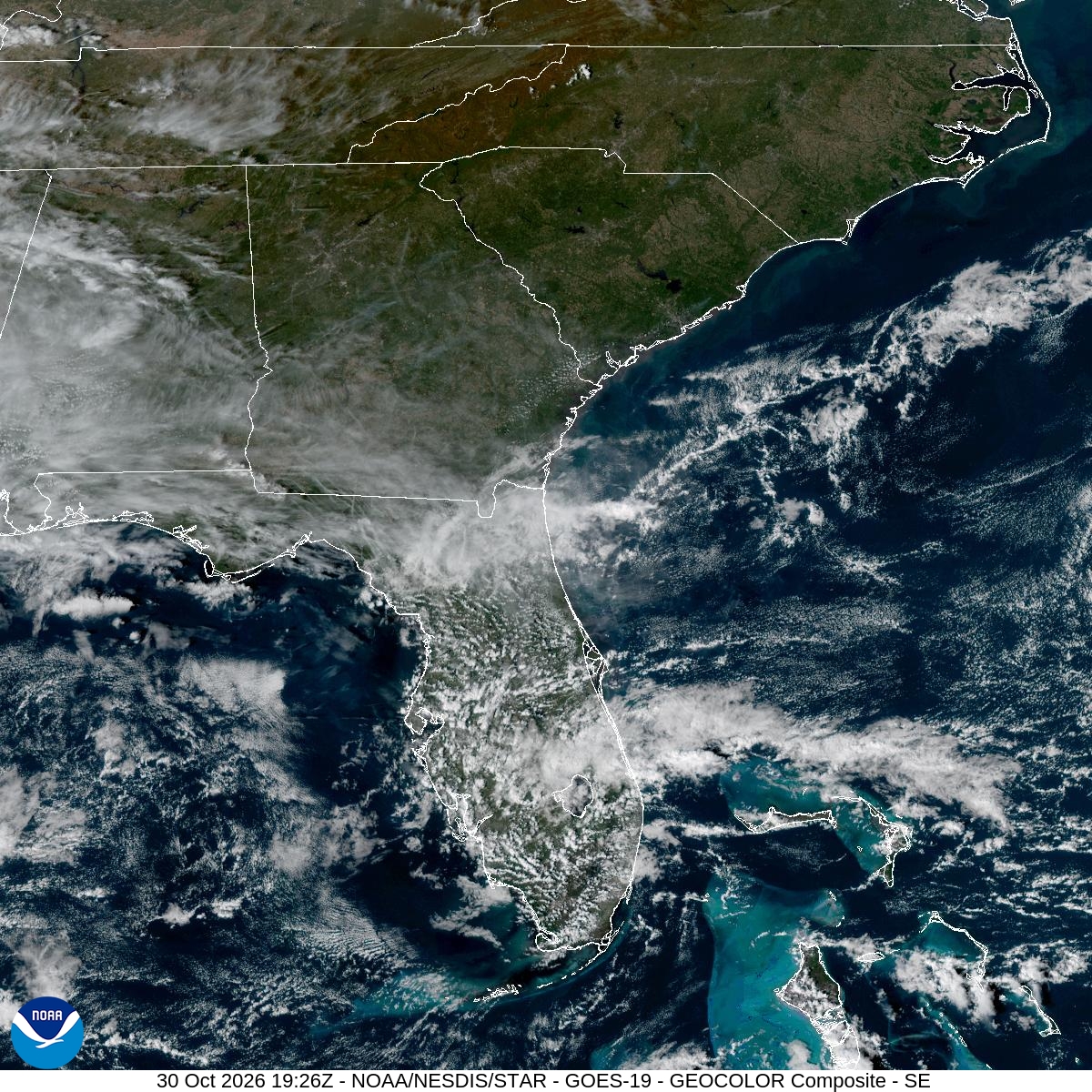
Satellite and radar
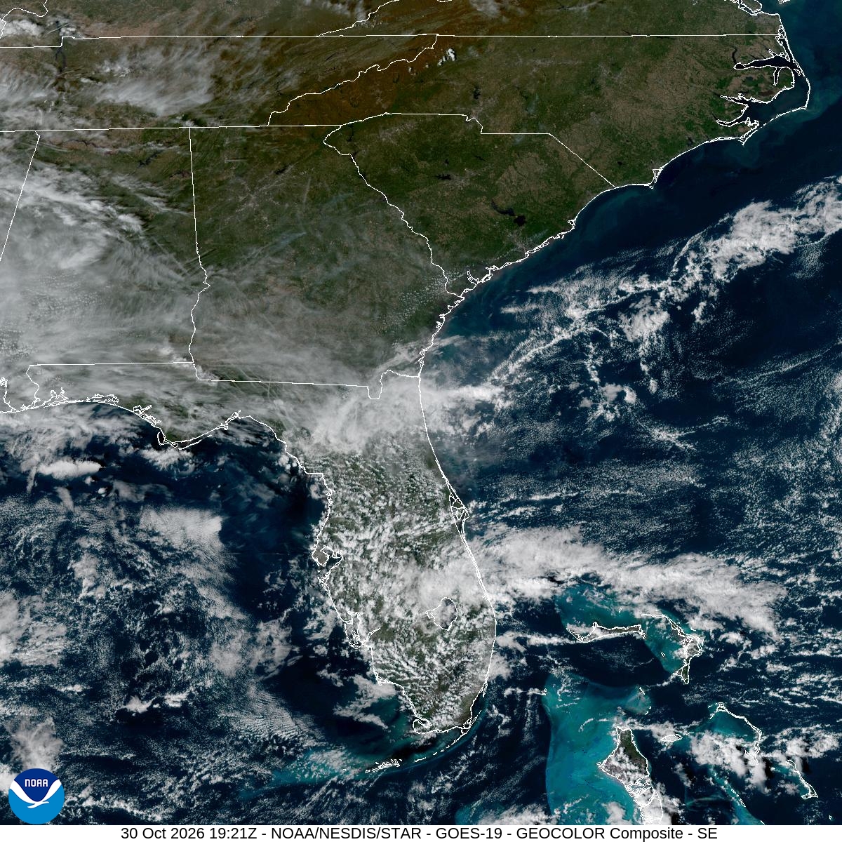
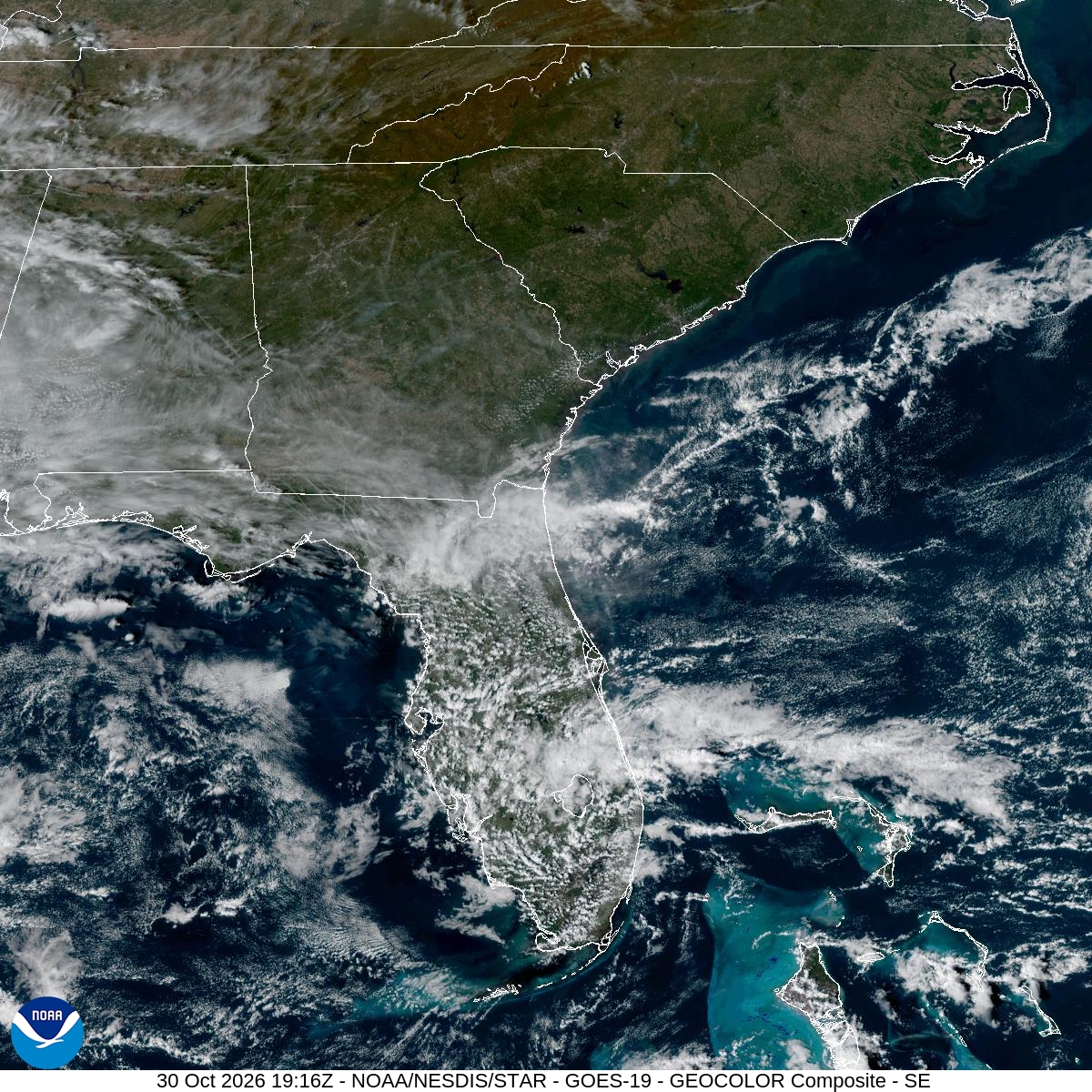
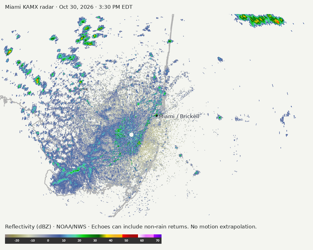
Archived frames show what the instruments captured at their labeled times. Radar echoes can include non-rain returns. No movement or future arrival is inferred automatically from these frames.
Southeast GeoColor satellite
GeoColor shows the Southeast, including Florida. The timestamped sequence below preserves cloud detail without automatically interpreting cloud cover at street level.

Earlier timestamped frames


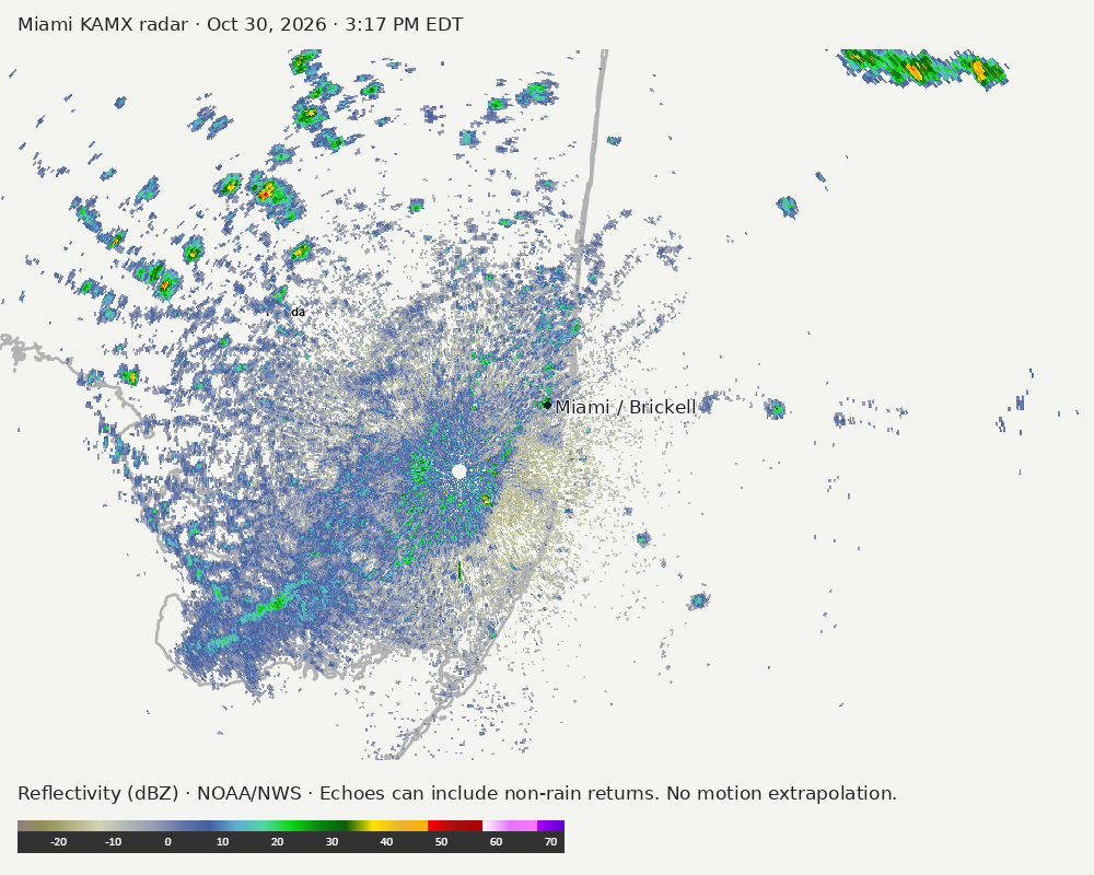
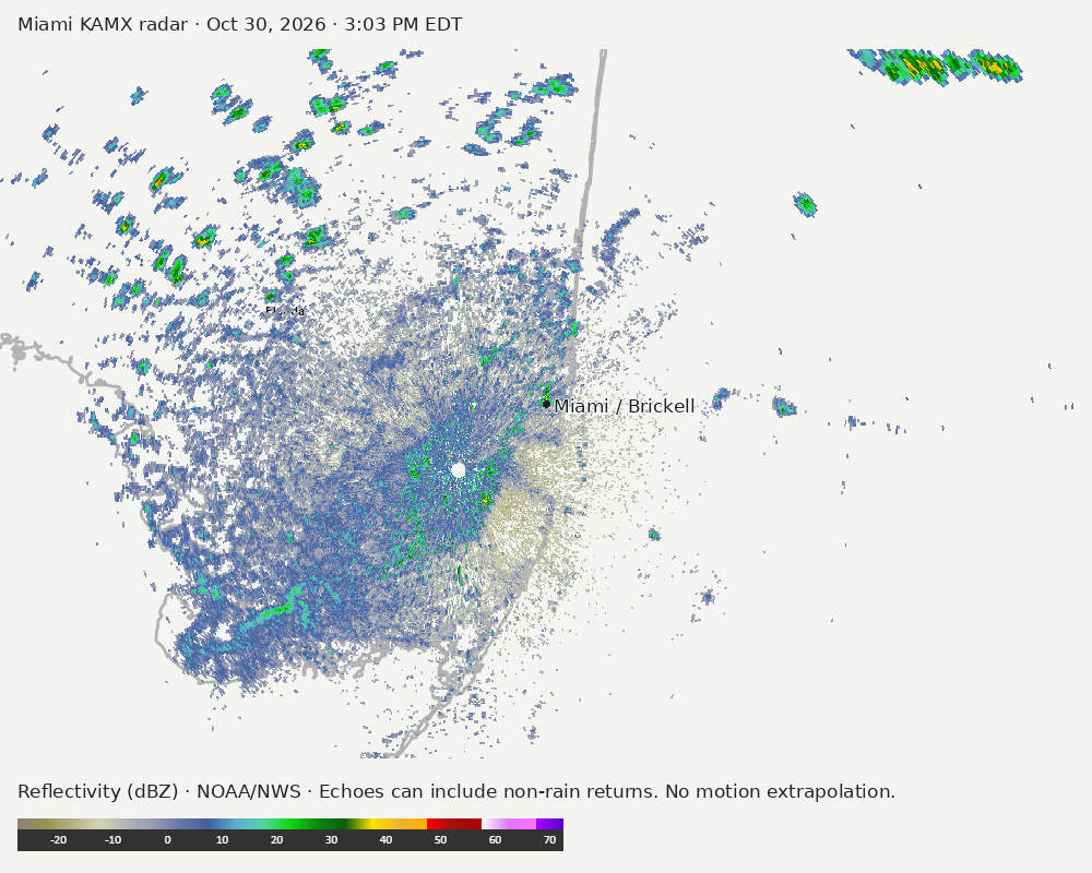
Detailed Miami radar — official KAMX fallback
Colored reflectivity echoes are concentrated northeast of Miami, northwest of Miami, southwest of Miami relative to Miami in the latest frame. These are echo locations, not confirmation of rain at the surface.
Earlier timestamped frames
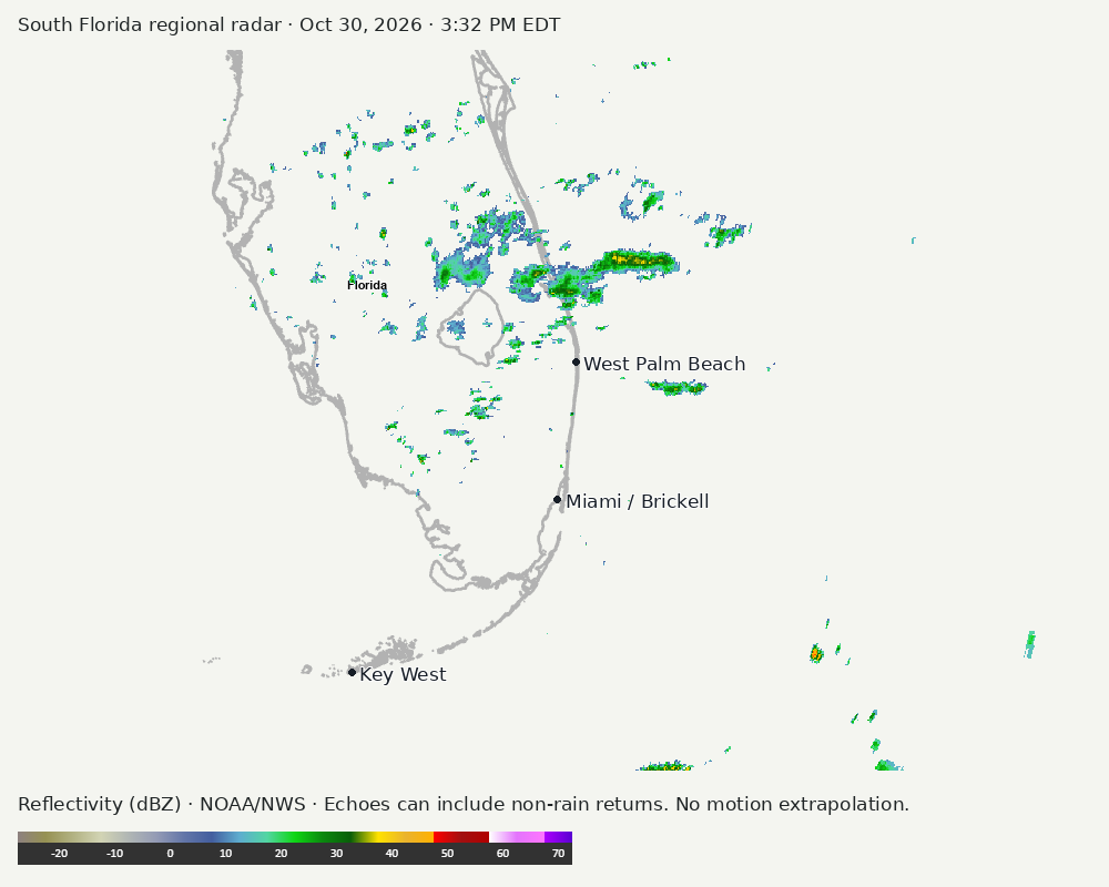
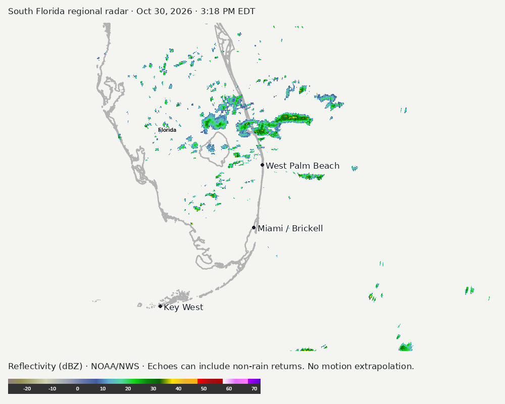
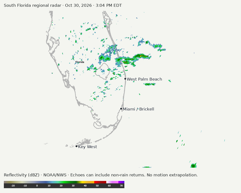
Regional South Florida radar
Colored reflectivity echoes are concentrated north of Miami relative to Miami in the latest frame. These are echo locations, not confirmation of rain at the surface.
Earlier timestamped frames
Tropical outlook
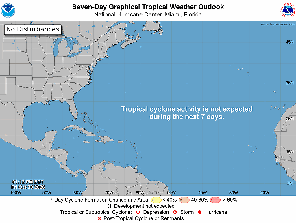
The Atlantic outlook describes development potential, not a forecast of impacts in Miami. No local hurricane impact is inferred here.
Read official source text
000
ABNT20 KNHC 301711
TWOAT

Tropical Weather Outlook
NWS National Hurricane Center Miami FL
200 PM EDT Fri Oct 30 2026

For the North Atlantic...Caribbean Sea and the Gulf of America:

Tropical cyclone formation is not expected during the next 7 days.

$$
Forecaster Reinhart
Miami forecast discussion
Read official source text
000
FXUS62 KMFL 301744
AFDMFL

Area Forecast Discussion
National Weather Service Miami FL
144 PM EDT Fri Oct 30 2026

...New AVIATION...

.KEY MESSAGES...
Updated at 140 PM EDT Fri Oct 30 2026

  - Minor to moderate coastal flooding remains possible for the
    remainder of the week into the weekend. Inundated roadways
    along coastal areas will be likely.

  - Chances for heavy rainfall return starting Saturday and being
    maximized Sunday- Monday as a disturbance moves across the
    area. Generalized 1-3 inches of rain with locally higher
    amounts could lead to flooding.

  - Increasing winds and seas across the local Atlantic waters
    tonight will result in hazardous boating conditions through
    the weekend.

&&

.SHORT TERM...
(Today through Saturday)
Issued at 321 AM EDT Fri Oct 30 2026

The synoptic pattern should remain generally unchanged today, with
mid-level ridging in place over the Gulf and an area of high
pressure overspreading the southeastern US. This setup will continue
to promote light easterly-notheasterly winds across the area. Low-
level moisture should remain plentiful (with PWATs in the 1.5-1.8
inch range), but the 00Z MFL sounding, along with ACARS data from
KMIA, KFLL and KDJT, and forecast soundings, all show a
pronounced dry layer between 700-500mb that looks to remain in
place today. This, combined with subsidence beneath the ridge,
should help continue to limit convective activity across South
Florida throughout the day. A few isolated showers will remain
possible, mainly as a result of diurnal heating in the afternoon,
with PoPs in the 20-40% range. Chances for thunderstorms also
remain very low, but cannot be ruled out entirely. Highs today
will remain in the mid to upper 80s.

The pattern begins to transition on Saturday as an upper-level
disturbance develops over the Gulf and gradually shifts eastward. At
the same time, the axis of thr surface high over the SE CONUS
will shift southeastward, helping to strengthen the pressure
gradient across the western Atlantic waters and the FL peninsula.
This will lead to increasing northeasterly to easterly winds
across the area through the day, especially along the immediate
East Coast. Concurrently, moisture advection aloft will help erode
the dry air pocket and moisten the atmospheric column, while also
helping enhance instability across the area. This setup, along
with increasing convergence due to the enhanced pressure gradient, will
help drive up the chances for more widespread rainfall activity
on Saturday. In fact, some of the high-res guidance shows the
possibility of repeated rounds of rainfall moving in from the
Atlantic Ocean throughout the day. This could result in locally
heavy rainfall and some localized flooding in spots. HREF rainfall
accumulations show some 24-hour-accumulation bullseyes in the 1-3
inch range along the East coast metro, with a 1 in 10 chance of
some locations seeing 2-4 inches. This, combined with lingering
minor coastal flooding concerns, could exacerbate generalized
flooding concerns across vulnerable areas. Highs on Saturday will
remain in the mid 80s, with the warmest temperatures over interior
and southwest FL.

&&

.LONG TERM...
(Saturday night through Thursday)
Issued at 321 AM EDT Fri Oct 30 2026

The aforementioned upper-level disturbance should move across the
Florida peninsula on Sunday, bringing the wettest period of the
forecast. Increasing large-scale ascent, cooler mid-level
temperatures and a deep moisture profile should support
widespread shower and thunderstorm development through much of the
day, with PoPs in the 80-90% range. Heavy rainfall and potential
flooding will be the main concerns, with WPC already placing the
East Coast metro areas under a Marginal Risk (Level 1 of 4) of
Flash flooding on Sunday and Monday. In fact, guidance shows the
highest convective coverage could be most likely along the East
Coast. However, this will ultimately be very dependent on the
timing, track and strength of the feature as it moves across the
area.

DESI 500mb heights ensemble cluster analysis still shows a primary
cluster with a weaker system that takes a more northerly track,
while the other three clusters favor some flavor of a deeper system
taking a more southerly track. The more northerly track would take
the higher rainfall totals north across northern-central FL, while
the more southerly tracks would keep the heavy rainfall
concentrated across central and south FL. Among the global
ensembles, the GEFS moves the system eastward faster, while the
ENS shows the disturbance, and thus its impacts, lingering into
Monday. As such, the ENS solution is also the wetter of the
possible options. As a result of these slight guidance
discrepancies, there is still somewhat low-to-medium confidence
regarding the forecast for Sunday and Monday, but we erred on the
side of the more southerly solutions and kept high PoPs gradually
tapering off from west to east on Monday night.

Confidence in the forecast declines further as we head into the
middle of next week. Mid-level ridging will look to build briefly
across the area, favoring a brief dry out across the region
Tuesday and Wednesday. However, later in the week the global
models try to develop the next upper level trough and surface low
over the Rockies. This complex would gradually move eastward and
potentially bring a cold front across the FL peninsula late in the
week. Considerable spread remains in the timing and strength of
this solution, and we will continue to monitor the evolution of
the forecast as we approach next week.

Temperatures will cool down a bit Sunday-Monday with the increased
storminess and cloud cover, with highs in the mid 80s. Lows will
slide into the mid 60s across the interior, and the low 70s along
the coasts.

&&

.AVIATION...
(18Z TAFS)
Issued at 140 PM EDT Fri Oct 30 2026

Brief periods of MVFR conditions are possible with lowering
vis/cigs accompanying passing showers. A lower deck of clouds may
linger across the area tonight and into Saturday. E/NE winds will
continue tonight, and becoming gusty around 25kt after 15Z. VCTS
has been introduced for Saturday late morning and afternoon.

&&

.MARINE...
Issued at 321 AM EDT Fri Oct 30 2026

Conditions will start to gradually deteriorate today as the pressure
gradient over Florida strengthens. As a result, winds across the
local Atlantic waters will increase up to 20-25 kts starting
tonight, while seas will build up to 7-10 ft along the Gulf Stream.
Small Craft Advisories will be in effect starting tonight and
through the weekend.  Conditions across the Gulf will remain below
hazardous criteria, but will need to be monitored closely. These
impacts could last through the weekend as the stout pressure
gradient and breezy easterly northeasterly winds prevail. Isolated
showers and a rogue thunderstorm or two remain possible today.
Chances for more widespread rain and storms increase during the
weekend.

&&

.BEACHES...
Issued at 321 AM EDT Fri Oct 30 2026

Coastal flooding remains likely along the southeastern and southern
coastlines during the high tide cycles today. Observations continue
to out-perform guidance by a decent margin, leading us to anticipate
tidal gauges to continue reaching Moderate flooding levels once
again today. As such, a Coastal Flood Advisory remains in effect for
the Atlantic coastline, while a Coastal Flood STatement remains in
effect for mainland Monroe through this morning, where Minor stage
coastal flooding could be possible.

A high risk of rip currents will also persist along the Atlantic
coastline Sunday evening.

&&

.PRELIMINARY POINT TEMPS/POPS...
Miami            76  84  76  82 /  60  70  70  90
West Kendall     76  85  76  84 /  40  70  70  90
Opa-Locka        76  85  76  84 /  60  60  70  80
Homestead        76  86  76  84 /  40  60  70  90
Fort Lauderdale  76  83  75  82 /  60  60  80  90
N Ft Lauderdale  76  84  75  82 /  60  50  70  90
Pembroke Pines   75  85  75  84 /  60  60  70  90
West Palm Beach  75  84  75  82 /  40  30  60  80
Boca Raton       76  83  75  82 /  40  50  70  90
Naples           73  86  73  84 /  20  50  40  80

&&

.MFL WATCHES/WARNINGS/ADVISORIES...
FL...Coastal Flood Advisory until 8 PM EDT Saturday for FLZ168-172-
     173.

     High Rip Current Risk through Sunday evening for FLZ168.

     High Surf Advisory from 2 PM Saturday to 7 PM EDT Sunday for
     FLZ168-172.

     High Rip Current Risk from 8 PM EDT this evening through Sunday
     evening for FLZ172-173.

AM...Small Craft Advisory from 8 PM this evening to 7 PM EDT Sunday
     for AMZ650-651-670-671.

GM...None.
&&

$$

SHORT TERM...ATV
LONG TERM....ATV
AVIATION...17
Sources and freshness
Supplementary failures do not replace missing data with reassuring conclusions. All source times below are Eastern; source metadata and original downloads are archived with this report.
Alerts · available
Source. Retrieved Oct 30, 2026 · 3:33 PM EDT.
Beach · available
Source. Retrieved Oct 30, 2026 · 3:33 PM EDT. Issued Oct 30, 2026 · 4:06 AM EDT.
Coastal Alerts · available
Source. Retrieved Oct 30, 2026 · 3:33 PM EDT.
Discussion · available
Source. Retrieved Oct 30, 2026 · 3:33 PM EDT. Issued Oct 30, 2026 · 1:44 PM EDT.
Forecast · available
Source. Retrieved Oct 30, 2026 · 3:33 PM EDT. Issued Oct 30, 2026 · 2:31 PM EDT.
Hourly · available
Source. Retrieved Oct 30, 2026 · 3:33 PM EDT. Issued Oct 30, 2026 · 2:31 PM EDT.
Local Radar · available
Source. Retrieved Oct 30, 2026 · 3:33 PM EDT. Issued Oct 30, 2026 · 3:30 PM EDT.
Marine · available
Source. Retrieved Oct 30, 2026 · 3:33 PM EDT. Issued Oct 30, 2026 · 3:51 AM EDT.
Mcnoldy · unavailable
Source. Retrieved Oct 30, 2026 · 3:33 PM EDT. URLError: transport or certificate failure
Nhc · available
Source. Retrieved Oct 30, 2026 · 3:33 PM EDT. Issued Oct 30, 2026 · 1:12 PM EDT.
Observation · available
Source. Retrieved Oct 30, 2026 · 3:33 PM EDT. Issued Oct 30, 2026 · 3:10 PM EDT.
Regional Radar · available
Source. Retrieved Oct 30, 2026 · 3:33 PM EDT. Issued Oct 30, 2026 · 3:32 PM EDT.
Satellite · available
Source. Retrieved Oct 30, 2026 · 3:33 PM EDT. Issued Oct 30, 2026 · 3:26 PM EDT.
Tropical Tidbits · not-used
Source. Retrieved not retrieved. No current tropical context requiring this supplementary source, or the NHC input is unavailable.