Morning Miami Weather Report
Miami, November 1 — Showers And Thunderstorms Likely
Automated weather summary from official sources; factual templates with validated source timestamps. Follow NWS Miami and NHC for current guidance.
Forecast for Miami / Brickell
Today: 82°F. Showers And Thunderstorms Likely. Wind 17 mph E. Rain chance: 86%.
Showers and thunderstorms likely before 1pm, then a chance of showers and thunderstorms between 1pm and 2pm, then showers and thunderstorms. Partly sunny, with a high near 82. East wind around 17 mph, with gusts as high as 25 mph. Chance of precipitation is 90%. New rainfall amounts between a half and three quarters of an inch possible.
Tonight: Showers and thunderstorms before 7pm, then showers and thunderstorms likely between 7pm and 10pm, then showers and thunderstorms likely between 10pm and 1am, then a chance of showers and thunderstorms between 1am and 4am, then showers and thunderstorms likely. Mostly cloudy, with a low around 75. East wind 15 to 18 mph, with gusts as high as 22 mph. Chance of precipitation is 80%. New rainfall amounts between three quarters and one inch possible.
Hourly forecast — rain chances and timing
| Eastern time | Temperature | Rain chance | Wind | Forecast |
|---|---|---|---|---|
| Nov 1, 2026 · 10:00 AM EST | 81°F | 69% | 17 mph E | Showers And Thunderstorms Likely |
| Nov 1, 2026 · 11:00 AM EST | 80°F | 64% | 17 mph E | Showers And Thunderstorms Likely |
| Nov 1, 2026 · 12:00 PM EST | 80°F | 67% | 17 mph E | Showers And Thunderstorms Likely |
| Nov 1, 2026 · 1:00 PM EST | 80°F | 48% | 17 mph E | Chance Showers And Thunderstorms |
| Nov 1, 2026 · 2:00 PM EST | 81°F | 56% | 17 mph E | Showers And Thunderstorms Likely |
| Nov 1, 2026 · 3:00 PM EST | 80°F | 74% | 17 mph E | Showers And Thunderstorms Likely |
| Nov 1, 2026 · 4:00 PM EST | 80°F | 78% | 16 mph E | Showers And Thunderstorms |
| Nov 1, 2026 · 5:00 PM EST | 80°F | 86% | 16 mph E | Showers And Thunderstorms |
| Nov 1, 2026 · 6:00 PM EST | 78°F | 76% | 16 mph E | Showers And Thunderstorms |
| Nov 1, 2026 · 7:00 PM EST | 78°F | 70% | 15 mph E | Showers And Thunderstorms Likely |
| Nov 1, 2026 · 8:00 PM EST | 78°F | 71% | 16 mph E | Showers And Thunderstorms Likely |
| Nov 1, 2026 · 9:00 PM EST | 79°F | 67% | 17 mph E | Showers And Thunderstorms Likely |
| Nov 1, 2026 · 10:00 PM EST | 79°F | 68% | 17 mph E | Showers And Thunderstorms Likely |
| Nov 1, 2026 · 11:00 PM EST | 79°F | 66% | 18 mph E | Showers And Thunderstorms Likely |
Observed nearby
Miami International Airport (KMIA), Nov 1, 2026 · 9:23 AM EST: Thunderstorms and Rain. Temperature 78°F; wind not supplied. This airport observation does not measure conditions at your exact location in Brickell.
Alerts and outdoor plans
If travel is required, allow extra time as some roads may be closed. Do not drive around barricades or through water of unknown depth. Take the necessary actions to protect flood-prone property. Swim near a lifeguard. If caught in a rip current, relax and float. Don't swim against the current. If able, swim in a direction following the shoreline. If unable to escape, face the shore and call or wave for help.
If travel is required, allow extra time as some roads may be closed. Do not drive around barricades or through water of unknown depth. Take the necessary actions to protect flood-prone property. Swim near a lifeguard. If caught in a rip current, relax and float. Don't swim against the current. If able, swim in a direction following the shoreline. If unable to escape, face the shore and call or wave for help.
You should monitor later forecasts and be alert for possible Flood Warnings. Those living in areas prone to flooding should be prepared to take action should flooding develop.
Inexperienced mariners, especially those operating smaller vessels, should avoid navigating in hazardous conditions.
If travel is required, allow extra time as some roads may be closed. Do not drive around barricades or through water of unknown depth. Take the necessary actions to protect flood-prone property. Swim near a lifeguard. If caught in a rip current, relax and float. Don't swim against the current. If able, swim in a direction following the shoreline. If unable to escape, face the shore and call or wave for help.
If travel is required, allow extra time as some roads may be closed. Do not drive around barricades or through water of unknown depth. Take the necessary actions to protect flood-prone property. Swim near a lifeguard. If caught in a rip current, relax and float. Don't swim against the current. If able, swim in a direction following the shoreline. If unable to escape, face the shore and call or wave for help.
You should monitor later forecasts and be alert for possible Flood Warnings. Those living in areas prone to flooding should be prepared to take action should flooding develop.
Running: Use the temperature, rain and wind forecast above to plan your window. If thunderstorms are forecast or you hear thunder, postpone outdoor activity and seek a substantial building. This briefing does not certify a safe running window.
Paddleboarding — official Biscayne Bay forecast
Today: E winds 10 to 15 kt (17 mph) with gusts up to 20 kt (23 mph). A moderate chop. A chance of tstms. Showers.
Tonight: E winds 15 to 20 kt (23 mph). Choppy. Showers and tstms likely in the evening, then showers with a chance of tstms after midnight.
Mon: E winds 10 to 15 kt (17 mph) with gusts up to 20 kt (23 mph). A moderate chop. A chance of tstms. Showers until late afternoon, then a chance of showers late.
Wind speeds in the source use knots (1 knot = 1.151 mph). Check current marine alerts and local conditions before launching; no safe launch window is inferred.
Official coastal Miami-Dade beach and rip-current guidance
FLZ173-012200-
Coastal Miami-Dade-
Including the beaches of Miami
346 AM EST Sun Nov 1 2026

...HIGH RIP CURRENT RISK IN EFFECT THROUGH MONDAY EVENING...

.TODAY...
Rip Current Risk*...........High.
Surf Height.................3 to 5 feet.
Thunderstorm Potential**....High.
Waterspout Risk**...........None.
UV Index**..................Moderate.
Water Temperature...........In the lower 80s.
Weather.....................Mostly cloudy. Showers with
                            thunderstorms likely.
High Temperature............In the lower 80s.
Winds.......................East winds around 15 mph.
Tides...
   Miami Harbor Entrance....Low at 06:59 AM EST.
                            High at 01:46 PM EST.
Sunrise.....................6:28 AM.
Sunset......................5:40 PM.

.MONDAY...
Rip Current Risk*...........High.
Surf Height.................3 to 5 feet.
Thunderstorm Potential**....Moderate.
Waterspout Risk**...........None.
Weather.....................Mostly cloudy. Showers and a chance of
                            thunderstorms.
High Temperature............In the lower 80s.
Winds.......................East winds around 15 mph.
Tides...
   Miami Harbor Entrance....Low at 08:10 AM EST.
                            High at 02:50 PM EST.
Sunrise.....................6:29 AM.
Sunset......................5:39 PM.

&&

Rip Current Risk Category
* Low Risk - The risk for rip currents is low, however,
life-threatening rip currents often occur in the vicinity of groins,
jetties, reefs, and piers.
* Moderate Risk - Life-threatening rip currents are possible in the
surf zone.
* High Risk - Life-threatening rip currents are likely in the surf
zone.

** For thunderstorm, waterspout, and UV definitions see:
https://www.weather.gov/beach/mfl
Satellite and radar
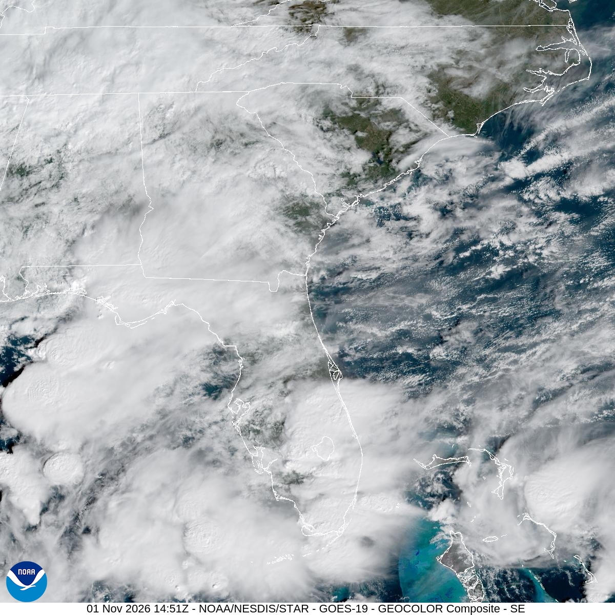
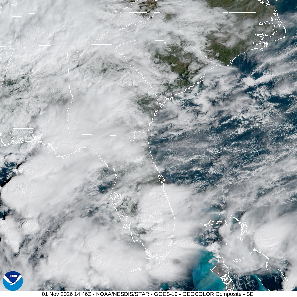
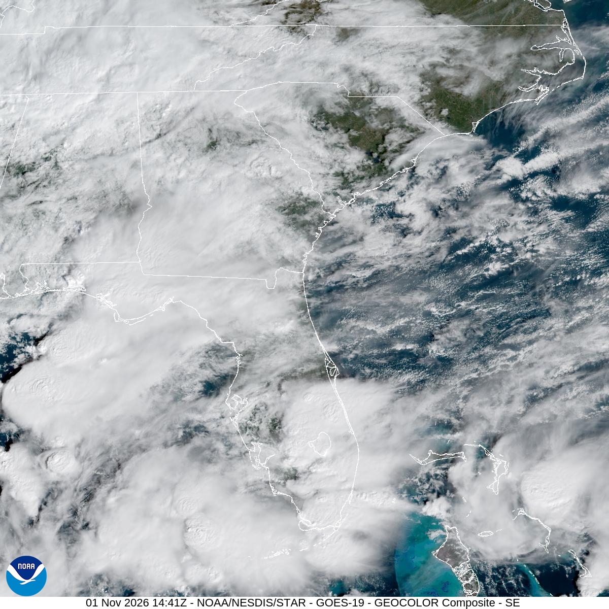
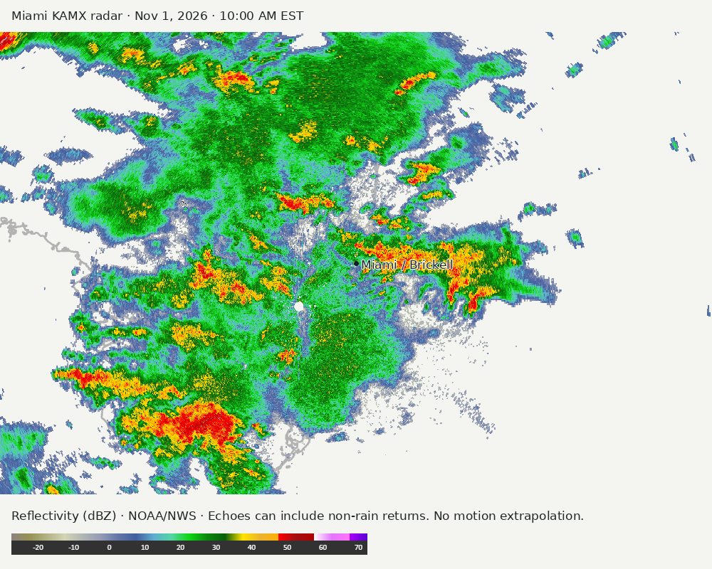
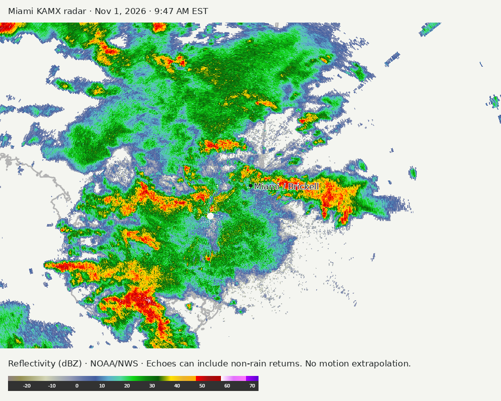
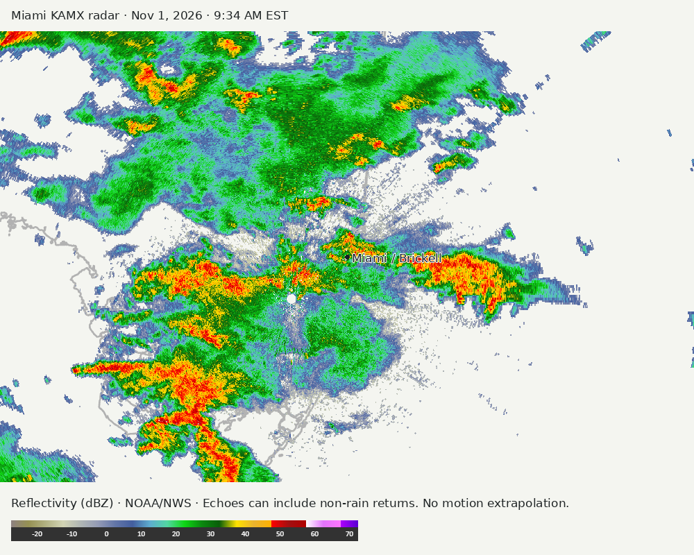
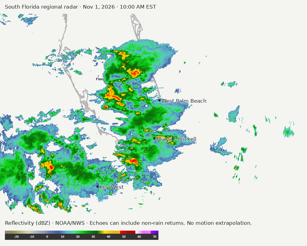
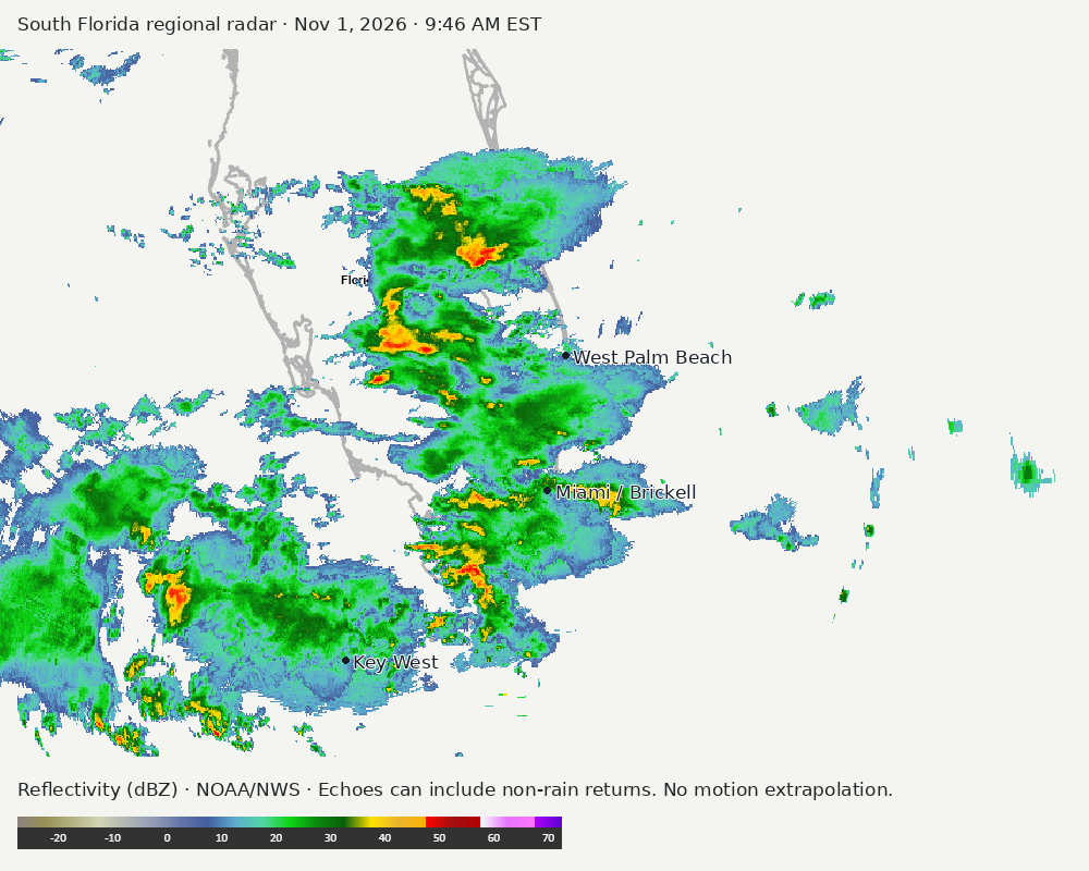
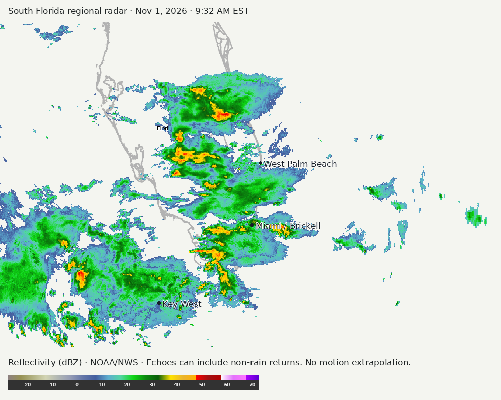
Archived frames show what the instruments captured at their labeled times. Radar echoes can include non-rain returns. No movement or future arrival is inferred automatically from these frames.
Southeast GeoColor satellite
GeoColor shows the Southeast, including Florida. The timestamped sequence below preserves cloud detail without automatically interpreting cloud cover at street level.

Earlier timestamped frames


Detailed Miami radar — official KAMX fallback
Colored reflectivity echoes are concentrated northwest of Miami, north of Miami, southwest of Miami relative to Miami in the latest frame. These are echo locations, not confirmation of rain at the surface.
Earlier timestamped frames
Regional South Florida radar
Colored reflectivity echoes are concentrated west of Miami, southwest of Miami, northwest of Miami relative to Miami in the latest frame. These are echo locations, not confirmation of rain at the surface.
Earlier timestamped frames
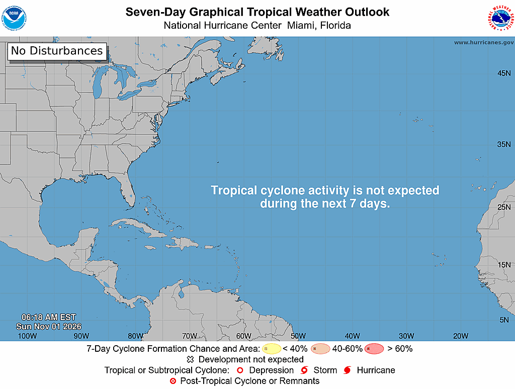
Tropical outlook
The Atlantic outlook describes development potential, not a forecast of impacts in Miami. No local hurricane impact is inferred here.
Read official source text
000
ABNT20 KNHC 011118
TWOAT

Tropical Weather Outlook
NWS National Hurricane Center Miami FL
700 AM EST Sun Nov 1 2026

For the North Atlantic...Caribbean Sea and the Gulf of America:

Tropical cyclone formation is not expected during the next 7 days.

$$
Forecaster Kelly
Miami forecast discussion
Read official source text
000
FXUS62 KMFL 011038
AFDMFL

Area Forecast Discussion
National Weather Service Miami FL
538 AM EST Sun Nov 1 2026

...New AVIATION...

.KEY MESSAGES...
Updated at 536 AM EST Sun Nov 1 2026

  - Flood watch in effect for the eastern half of South Florida
    through Monday as the potential for isolated flash flooding
    increases.

  - Minor to Moderate coastal flooding expected during times of
    high tide.

  - Dangerous marine and beach conditions are expected across the
    Atlantic coast.

&&

.SYNOPSIS...
Issued at 226 AM EST Sun Nov 1 2026

Satellite imagery and model analysis data show a shortwave moving
into the eastern Gulf and assisting with the development of deep
convection. Another shortwave can be found in WV imagery over
central AR. Together, these waves are responsible for the dip in
the longwave upper-level trough over the Southeast. A CONUS-scale
surface analysis by the WPC depicts a large ridge centered over
the Mid-Atlantic/Northeast, that sits under a mid/upper ridge axis
that stretches from the Northern Plains, through the Midwest, and
off the Mid-Atlantic coast. A hand analysis of the surface pattern
across the local area reveals a persistent trough along the
eastern FL coastline (along the Gulf Stream). The strong easterly
flow across this trough is resulting in bands of shower activity
developing near, and moving over SE FL.

&&

.SHORT TERM...
(Today through Monday)
Issued at 226 AM EST Sun Nov 1 2026

Through today, the leading shortwave will cross the Peninsula as
the trailing shortwave elongates and moves into the eastern Gulf.
Stable layers in the mid-levels are preventing a robust surface
response to these upper-level shortwaves. However, the affect of
the shortwaves will be in the addition of moisture to the column
and the contribution to ascent in areas where convection is
ongoing. Thus, for the surface forcing today we'll rely on low-
level isentropic ascent and mesoscale boundaries. Where these
features develop is uncertain; but while the development pattern
is similar to recent days, the coverage may be a bit higher, the
thunderstorm threat will be higher, and the potential for heavy
rainfall will be higher. Global ensembles, even in the day 1-2
period, have a rather large spread on QPF amounts. This is likely
due to the lack of a clear, synoptic-scale surface forcing
mechanism. However, the majority of the ensemble members would
suggest that 1-2" of rain will be a common amount for locations
across south Florida over the next 48 hours. Common high-end
amounts for localized areas could be on the order of 2-4", with
reasonable worst case scenario that a location or two could get
5-7" of rain over 48 hours. How it's determined how much you get
will be based on whether you're impacted by a stray shower now and
then, a couple back to back heavy showers, or a banding feature
setting up across your specific location. All of these scenarios
are probably, but pinning down the location for each is quite
difficult. The current suite of hi-res data, and trends over the
last several hours, would indicate that Broward county probably
has the greater chance for those high-end amounts today. Hi-res
guidance would also indicate this axis of heavy rain may shift
north overnight tonight, with Palm Beach county having the
greatest chance for heavy rain overnight. How wet Monday will be
is also a source of spread in the ensembles in the near term. Some
of this uncertainty is whether or not a part of the second
shortwave cuts off and meanders over the SE Gulf/Straits, or stays
connected to the mean trough and moves a bit further eastward.
Either way, showers are still expected as we remain in the
persistent low-level easterly flow regime. The question is just
how widespread and how heavy they may be.

Bottom line (at the end), is that the next couple days will be
characterized by showers and isolated storms across South Florida,
with the main threat being periods of heavy rainfall.

&&

.LONG TERM...
(Monday night through Saturday)
Issued at 226 AM EST Sun Nov 1 2026

A brief period of mid/upper level ridging is expected early to
mid-week, with low-level easterly flow continuing around the
surface ridge. This will likely keep us from completely drying out
through early next week. However, by mid-week, a frontal system
moving through the central CONUS is forecast to start pushing the
low-level ridge northeastward. This will give us a more southerly
component to the low-level winds and end the persistent shower
activity. It'll still be humid, just not as wet. There is a ton of
model divergence on how that central CONUS system evolves, but it
seems like the majority of the solutions bring a pretty weak
frontal boundary through Florida by the end of the week.

&&

.AVIATION...
(12Z TAFS)
Issued at 536 AM EST Sun Nov 1 2026

SCT to BKN MVFR ceilings today with NE winds 10-15 kts and gusting
to around 25 kts. Scattered thunderstorms today may result in
brief flight restrictions and erratic winds.

&&

.MARINE...
Issued at 226 AM EST Sun Nov 1 2026

Strong easterly flow over the Atlantic will keep seas elevated
through early this week. Advisory conditions are expected to
continue, with hazardous conditions for small craft. Showers and
storms are expected to be widespread today and tomorrow. Calming
winds and lowering seas are expected starting around mid-week.

&&

.BEACHES...
Issued at 226 AM EST Sun Nov 1 2026

The onshore flow and elevated winds and seas will keep a High Risk
for rip currents across Atlantic beaches well into this week.
Large breakers are expected through at least today across Broward
and Palm beaches, with a high surf advisory in effect for these
locations. Higher than usual tides will also create elevated water
levels near the coast. Dangerous beach and swim conditions are
expected through mid-week.

&&

.HYDROLOGY...
Issued at 226 AM EST Sun Nov 1 2026

Believe it or not we're nearing the ebb of the astronomical tides
between the full and new moons. While we may briefly (and barely)
drop below moderate flood levels on Monday, probabilities of at
least reaching low-end moderate flood levels appear too high to
let the Coastal Flood Advisory drop. Water levels are forecast to
gradually start climbing again by mid-week as we draw closer and
closer to the New Moon on Nov 9. Hopefully we'll be able to remove
the strong onshore wind component and pull back some of the heavy
rain potential as astronomical tide levels start to rise again.

&&

.PRELIMINARY POINT TEMPS/POPS...
Miami            82  74  81  74 /  80  70  90  70
West Kendall     84  74  82  74 /  80  70  90  50
Opa-Locka        83  74  82  74 /  80  70  90  70
Homestead        84  74  83  75 /  70  80  80  60
Fort Lauderdale  81  73  80  74 /  80  80  90  80
N Ft Lauderdale  82  73  81  74 /  80  80  90  80
Pembroke Pines   84  73  82  73 /  80  70  90  70
West Palm Beach  82  73  81  73 /  60  70  80  80
Boca Raton       82  74  81  74 /  70  80  90  80
Naples           84  71  82  71 /  70  60  70  30

&&

.MFL WATCHES/WARNINGS/ADVISORIES...
FL...Flood Watch from 10 AM EST this morning through Monday afternoon
     for FLZ067-068-071>074-168-172>174.

     Coastal Flood Advisory until 7 PM EST Monday for FLZ168-172-173.

     High Rip Current Risk through Monday evening for FLZ168-172-173.

     High Surf Advisory until 7 PM EST this evening for FLZ168-172.

AM...Small Craft Advisory until 7 PM EST Monday for AMZ650-651-670-
     671.

GM...None.
&&

$$

SHORT TERM...Harrigan
LONG TERM....Harrigan
AVIATION...CMF
Sources and freshness
Supplementary failures do not replace missing data with reassuring conclusions. All source times below are Eastern; source metadata and original downloads are archived with this report.
Alerts · available
Source. Retrieved Nov 1, 2026 · 10:02 AM EST.
Beach · available
Source. Retrieved Nov 1, 2026 · 10:02 AM EST. Issued Nov 1, 2026 · 3:46 AM EST.
Coastal Alerts · available
Source. Retrieved Nov 1, 2026 · 10:02 AM EST.
Discussion · available
Source. Retrieved Nov 1, 2026 · 10:02 AM EST. Issued Nov 1, 2026 · 5:38 AM EST.
Forecast · available
Source. Retrieved Nov 1, 2026 · 10:02 AM EST. Issued Nov 1, 2026 · 3:47 AM EST.
Hourly · available
Source. Retrieved Nov 1, 2026 · 10:02 AM EST. Issued Nov 1, 2026 · 3:47 AM EST.
Local Radar · available
Source. Retrieved Nov 1, 2026 · 10:02 AM EST. Issued Nov 1, 2026 · 10:00 AM EST.
Marine · available
Source. Retrieved Nov 1, 2026 · 10:02 AM EST. Issued Nov 1, 2026 · 2:56 AM EST.
Mcnoldy · unavailable
Source. Retrieved Nov 1, 2026 · 10:02 AM EST. URLError: transport or certificate failure
Nhc · available
Source. Retrieved Nov 1, 2026 · 10:02 AM EST. Issued Nov 1, 2026 · 6:18 AM EST.
Observation · available
Source. Retrieved Nov 1, 2026 · 10:02 AM EST. Issued Nov 1, 2026 · 9:23 AM EST.
Regional Radar · available
Source. Retrieved Nov 1, 2026 · 10:02 AM EST. Issued Nov 1, 2026 · 10:00 AM EST.
Satellite · available
Source. Retrieved Nov 1, 2026 · 10:02 AM EST. Issued Nov 1, 2026 · 9:51 AM EST.
Tropical Tidbits · not-used
Source. Retrieved not retrieved. No current tropical context requiring this supplementary source, or the NHC input is unavailable.