Morning Miami Weather Report
Miami, November 11 — Mostly Sunny then Slight Chance Showers And Thunderstorms
Automated weather summary from official sources; factual templates with validated source timestamps. Follow NWS Miami and NHC for current guidance.
Late report: current weather data were collected at the publication time below, rather than early this morning.
Forecast for Miami / Brickell
Veterans Day: 84°F. Mostly Sunny then Slight Chance Showers And Thunderstorms. Wind 5 to 8 mph SE. Rain chance: 28%.
A slight chance of rain showers between 3pm and 4pm, then a slight chance of showers and thunderstorms between 4pm and 5pm, then a chance of showers and thunderstorms. Mostly sunny, with a high near 84. Southeast wind 5 to 8 mph. Chance of precipitation is 30%. New rainfall amounts less than a tenth of an inch possible.
Tonight: A slight chance of showers and thunderstorms before 8pm. Mostly cloudy, with a low around 74. Southwest wind around 6 mph. Chance of precipitation is 20%. New rainfall amounts less than a tenth of an inch possible.
Hourly forecast — rain chances and timing
| Eastern time | Temperature | Rain chance | Wind | Forecast |
|---|---|---|---|---|
| Nov 11, 2026 · 1:00 PM EST | 82°F | 8% | 9 mph S | Mostly Sunny |
| Nov 11, 2026 · 2:00 PM EST | 82°F | 13% | 9 mph S | Mostly Sunny |
| Nov 11, 2026 · 3:00 PM EST | 83°F | 21% | 9 mph S | Slight Chance Rain Showers |
| Nov 11, 2026 · 4:00 PM EST | 82°F | 25% | 8 mph S | Chance Showers And Thunderstorms |
| Nov 11, 2026 · 5:00 PM EST | 82°F | 27% | 7 mph S | Chance Showers And Thunderstorms |
| Nov 11, 2026 · 6:00 PM EST | 81°F | 21% | 6 mph S | Slight Chance Showers And Thunderstorms |
| Nov 11, 2026 · 7:00 PM EST | 79°F | 12% | 6 mph S | Partly Cloudy |
| Nov 11, 2026 · 8:00 PM EST | 79°F | 8% | 5 mph SW | Mostly Clear |
| Nov 11, 2026 · 9:00 PM EST | 79°F | 4% | 5 mph S | Partly Cloudy |
| Nov 11, 2026 · 10:00 PM EST | 78°F | 4% | 5 mph SW | Mostly Clear |
| Nov 11, 2026 · 11:00 PM EST | 78°F | 3% | 3 mph SW | Mostly Clear |
Observed nearby
Miami International Airport (KMIA), Nov 11, 2026 · 1:20 PM EST: Partly Cloudy. Temperature 84°F; wind 11 mph. This airport observation does not measure conditions at your exact location in Brickell.
Alerts and outdoor plans
Miami / Brickell: no active alerts returned by the official query at collection time. This is not a statement that conditions are safe.
Biscayne Bay and the Miami-Dade coast: no active alerts returned by the official query at collection time. This is not a statement that conditions are safe.
Running: Use the temperature, rain and wind forecast above to plan your window. If thunderstorms are forecast or you hear thunder, postpone outdoor activity and seek a substantial building. This briefing does not certify a safe running window.
Paddleboarding — official Biscayne Bay forecast
Today: SE winds 5 to 10 kt (12 mph). Light chop. A slight chance of showers and tstms late.
Tonight: W winds around 5 kt (6 mph). Smooth.
Thu: W winds around 5 kt (6 mph). Smooth. A chance of showers late.
Wind speeds in the source use knots (1 knot = 1.151 mph). Check current marine alerts and local conditions before launching; no safe launch window is inferred.
Official coastal Miami-Dade beach and rip-current guidance
FLZ173-112200-
Coastal Miami-Dade-
Including the beaches of Miami
331 AM EST Wed Nov 11 2026

.TODAY...
Rip Current Risk*...........Low.
Surf Height.................1 foot or less.
Thunderstorm Potential**....Low.
Waterspout Risk**...........None.
UV Index**..................Moderate.
Water Temperature...........In the lower 80s.
Weather.....................Mostly cloudy until 9 AM, then mostly
                            sunny. A chance of showers and a slight
                            chance of thunderstorms.
High Temperature............In the mid 80s.
Winds.......................South winds around 5 mph.
Tides...
   Miami Harbor Entrance....High at 09:37 AM EST.
                            Low at 03:21 PM EST.
Sunrise.....................6:35 AM.
Sunset......................5:34 PM.

.THURSDAY...
Rip Current Risk*...........Low.
Surf Height.................1 foot or less.
Thunderstorm Potential**....Low.
Waterspout Risk**...........None.
Weather.....................Mostly cloudy. A chance of showers and
                            a slight chance of thunderstorms.
High Temperature............In the lower 80s.
Winds.......................West winds around 5 mph.
Tides...
   Miami Harbor Entrance....High at 10:16 AM EST.
                            Low at 04:00 PM EST.
Sunrise.....................6:36 AM.
Sunset......................5:34 PM.

&&

Rip Current Risk Category
* Low Risk - The risk for rip currents is low, however,
life-threatening rip currents often occur in the vicinity of groins,
jetties, reefs, and piers.
* Moderate Risk - Life-threatening rip currents are possible in the
surf zone.
* High Risk - Life-threatening rip currents are likely in the surf
zone.

** For thunderstorm, waterspout, and UV definitions see:
https://www.weather.gov/beach/mfl
Satellite and radar
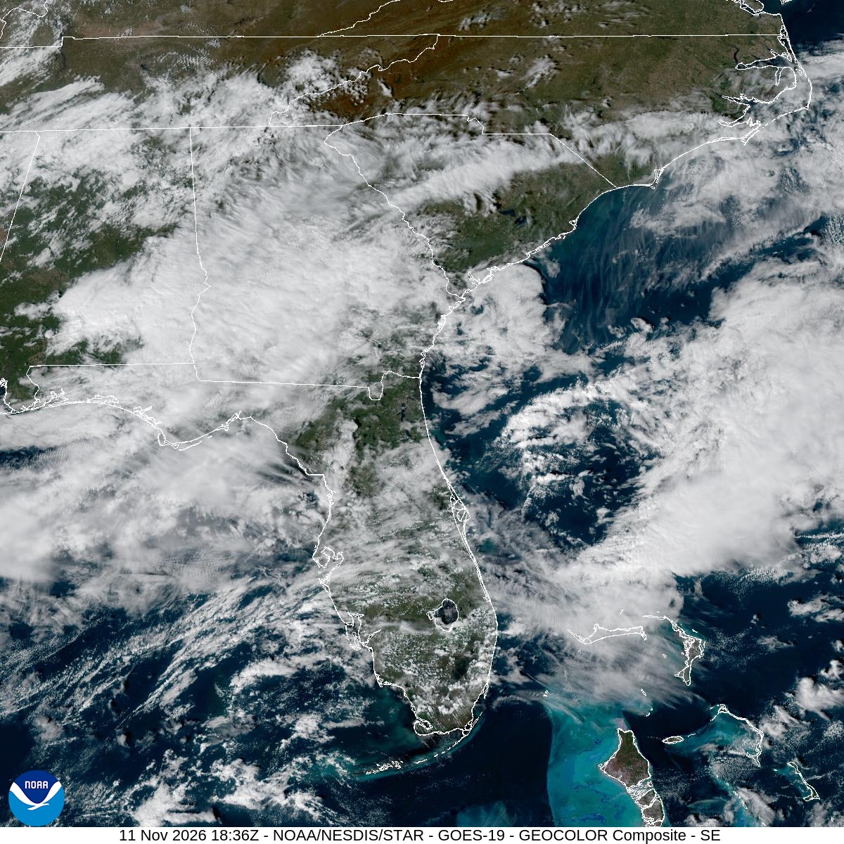
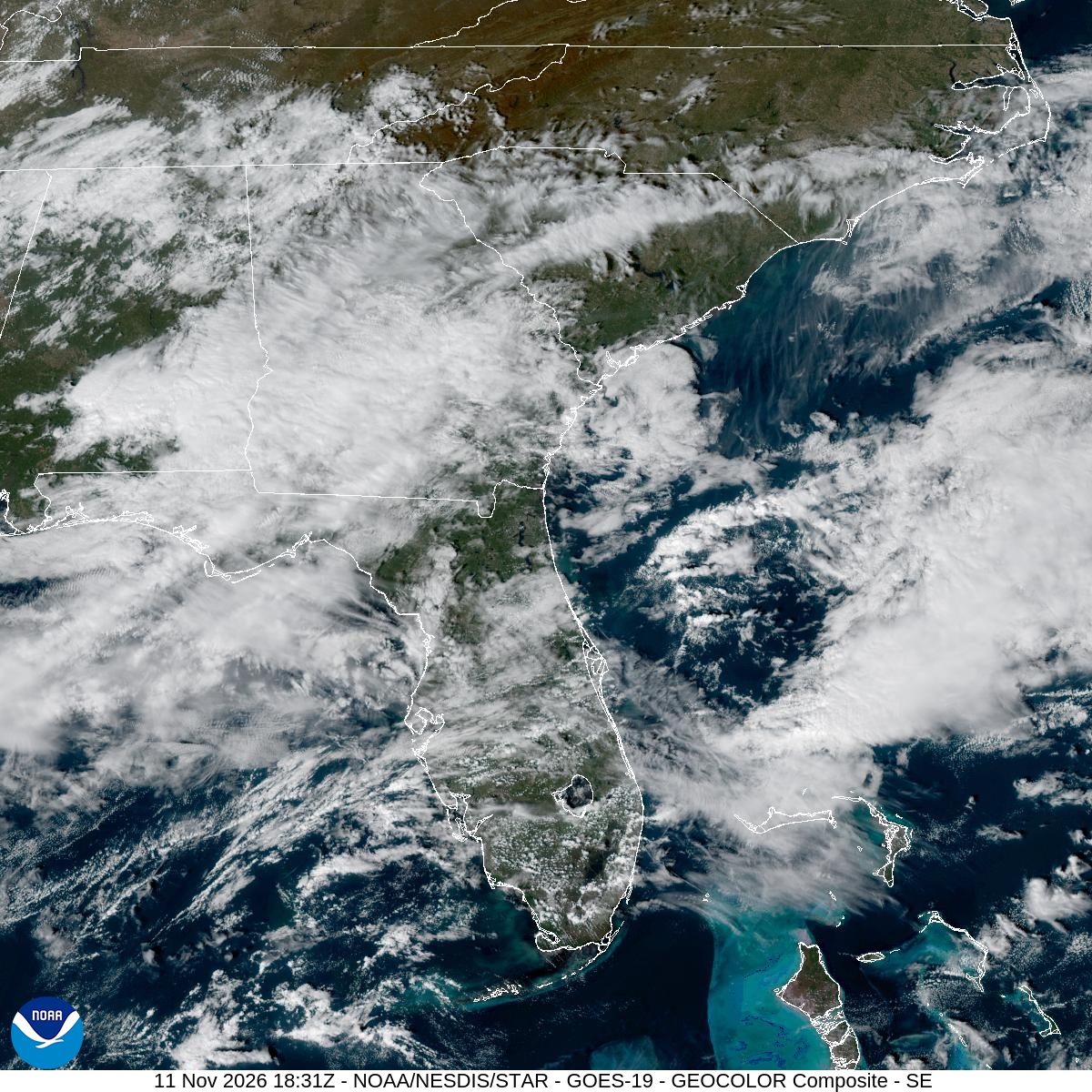
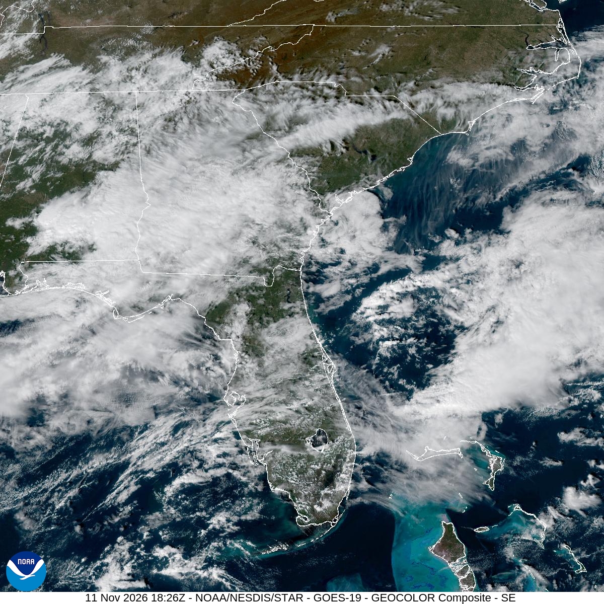
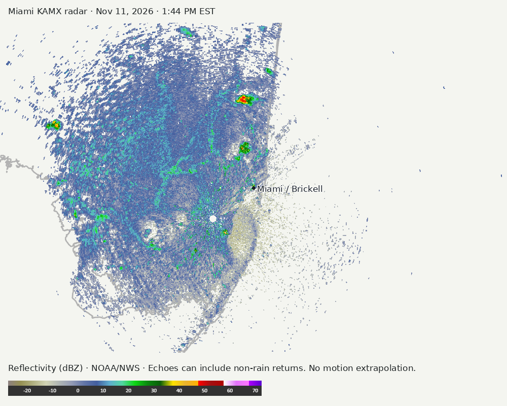
Archived frames show what the instruments captured at their labeled times. Radar echoes can include non-rain returns. No movement or future arrival is inferred automatically from these frames.
Southeast GeoColor satellite
GeoColor shows the Southeast, including Florida. The timestamped sequence below preserves cloud detail without automatically interpreting cloud cover at street level.

Earlier timestamped frames


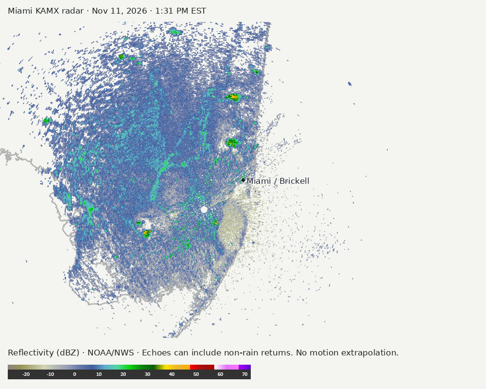
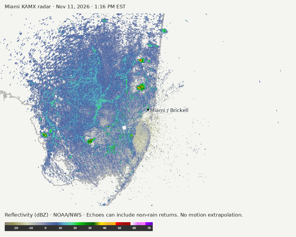
Detailed Miami radar — official KAMX fallback
Colored reflectivity echoes are concentrated west of Miami, north of Miami relative to Miami in the latest frame. These are echo locations, not confirmation of rain at the surface.
Earlier timestamped frames
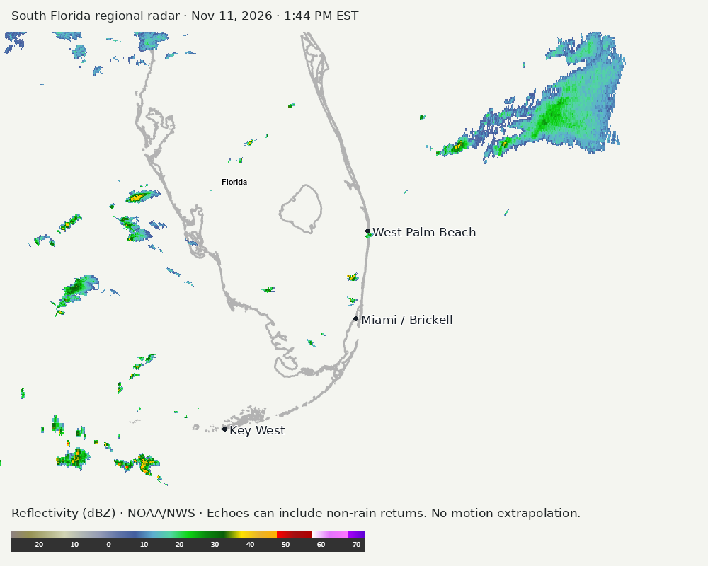
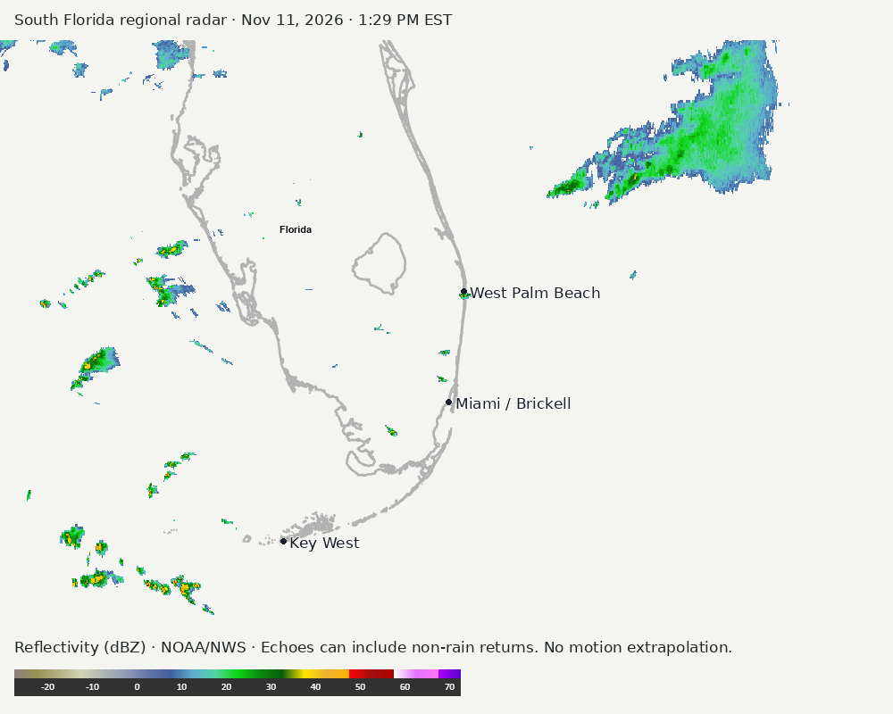
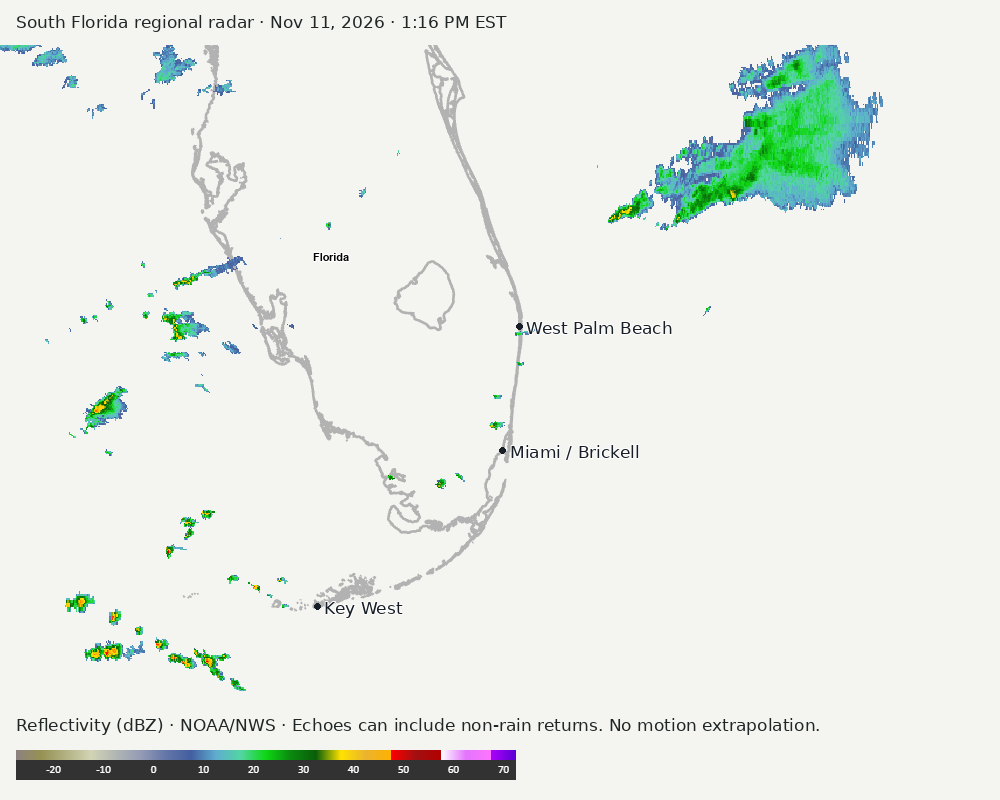
Regional South Florida radar
Colored reflectivity echoes are concentrated northeast of Miami, west of Miami, southwest of Miami relative to Miami in the latest frame. These are echo locations, not confirmation of rain at the surface.
Earlier timestamped frames
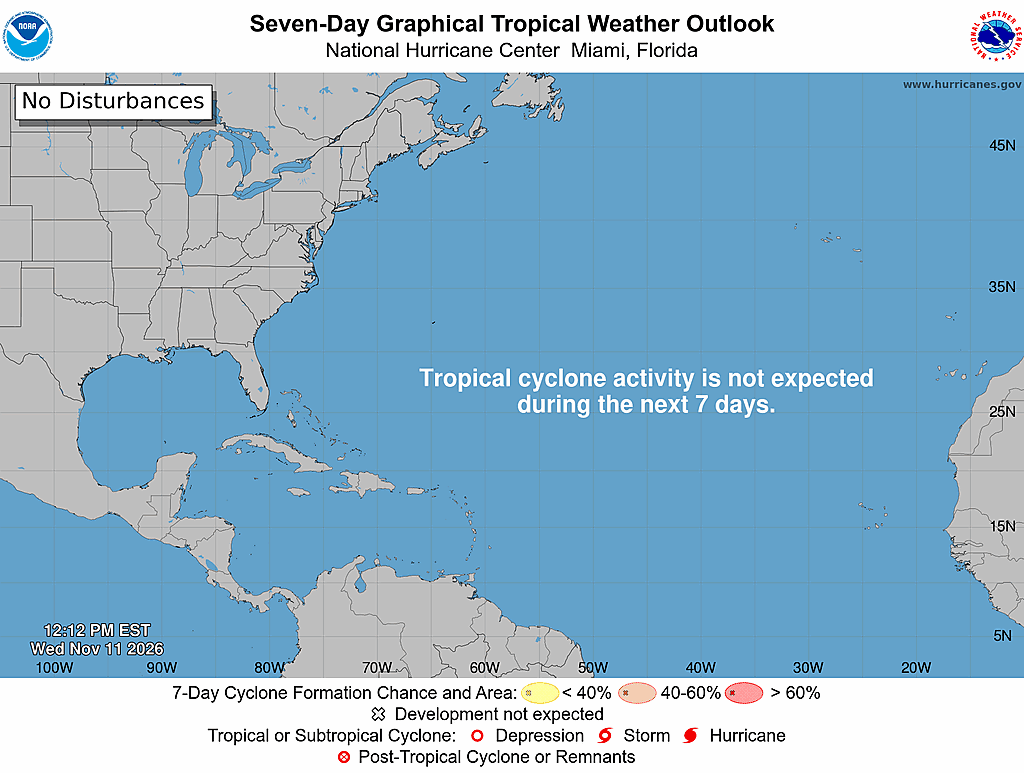
Tropical outlook
The Atlantic outlook describes development potential, not a forecast of impacts in Miami. No local hurricane impact is inferred here.
Read official source text
394
ABNT20 KNHC 111712
TWOAT

Tropical Weather Outlook
NWS National Hurricane Center Miami FL
100 PM EST Wed Nov 11 2026

For the North Atlantic...Caribbean Sea and the Gulf of America:

Tropical cyclone formation is not expected during the next 7 days.

$$
Forecaster Katz/Cangialosi
Miami forecast discussion
Read official source text
000
FXUS62 KMFL 111707
AFDMFL

Area Forecast Discussion
National Weather Service Miami FL
1207 PM EST Wed Nov 11 2026

...New AVIATION...

.KEY MESSAGES...
Updated at 1205 PM EST Wed Nov 11 2026

  - Scattered showers and storms will develop across the interior
    and east coast metro areas this afternoon. Some of these
    storms could become strong across the Lake Okeechobee region
    containing gusty winds, small hail, and heavy downpours.

  - A strong cold front will push through the region late Thursday
    night into Friday morning. Scattered showers and isolated
    thunderstorms will be possible Thursday into Friday morning.

  - Behind the front, much cooler and drier air will push into the
    region for the upcoming weekend along with breezy conditions
    as high pressure builds in from the north.

&&

.SHORT TERM...
(Today through Thursday)
Issued at 201 AM EST Wed Nov 11 2026

A rather fast moving mid level shortwave will push along the
Northern Gulf Coast today before pushing across Northern Florida and
out into the western Atlantic tonight. At the surface, high pressure
will push further to the east in the western Atlantic as a
developing area of low pressure moves across the Midwest today and
tonight. This area of low pressure will then rapidly push across
the Mid-Atlantic states as Thursday progresses before pushing
offshore into the western Atlantic.

As the aforementioned mid level shortwave pushes across the Gulf
coast and towards Northern Florida, it will cause the mid level wind
flow to veer and become southwesterly today. This should help to
bring in some deeper layer moisture over the region as the mid
level drier air that has been in place over the past several days
begins to erode. At the same time, mid level heights will lower
throughout the day and 500mb temperatures will become colder.
These 500mb temperatures will generally range from -8C across the
southern portion of the peninsula to -10C across the Lake
Okeechobee region this afternoon causing lapse rates to steepen as
the day progresses. With the surface high shifting further into
the Atlantic the background surface wind flow will remain light,
however it will become more south southwesterly as the day
progresses. As the sea breezes develop, there will be enough
moisture in place to support scattered shower and thunderstorm
development as the sea breeze boundaries push inland and interact
with each other. While the sea breezes will remain the main
lifting mechanism for convective development this afternoon, the
colder air aloft provided by the shortwave passing off to the
north will aid in the potential for an isolated strong
thunderstorm or two this afternoon. The best chances for stronger
thunderstorms will be located across the Lake Okeechobee region as
well as Palm Beach County where the colder air aloft and higher
instability will be located. The stronger storms will be capable
of producing gusty winds, frequent cloud to ground lightning, and
even some small hail. High temperatures today will generally rise
into the lower to mid 80s across most areas, however, upper 80s
will be possible along and south of Alligator Alley.

Moving into Thursday, mid level troughing will deepen and amplify
over the Eastern Seaboard. At the same time, the surface cold front
associated with the intensifying area of low pressure over the
Mid-Atlantic states will gradually push across the Southeast and
down towards the Northern Gulf Coast and Northern Florida. Out
ahead of this frontal boundary, guidance is hinting at a
prefrontal surface trough setting up and passing through South
Florida as Thursday progresses. This will help to create a wind
shift as winds become more west southwesterly across the region
during this time frame. This prefrontal trough will also help to
spark off some scattered showers and isolated thunderstorms as it
passes through. Since the best dynamics and instability will still
be located well off to the northeast of the region, stronger
thunderstorm development will be very limited as the prefrontal
trough pushes through and most of the activity will be in the form
of lower topped showers. High temperatures on Thursday will
generally range from around 80 across the Lake Okeechobee region
to the lower 80s across most other areas.

&&

.LONG TERM...
(Thursday night through Tuesday)
Issued at 201 AM EST Wed Nov 11 2026

The actual cold front will approach South Florida on Thursday
night before pushing through the region on Friday morning. Chances
for showers out ahead of the actual front will be on the lower
end as the prefrontal trough would have helped to reduce some of
the available moisture over the region. Once the front passes
through, strong high pressure will begin to build into the area
from the northwest. As the pressure gradient tightens, winds will
increase out of the northwest allowing for strong cold air
advection to take place beginning on Friday afternoon and lasting
into the first part of the weekend. This strong cold air advection
will allow for the coolest airmass of the fall season so far to
move into South Florida during this time frame. Low temperatures
on Friday night into Saturday morning have the potential to drop
into the lower 50s across the Lake Okeechobee region and into the
interior portions of Southwest Florida. Most other areas will see
low temperatures drop into the mid to upper 50s, while lower 60s
will remain possible along the immediate east coast. High
temperatures on Saturday will only rise into the upper 60s across
the Lake Okeechobee region and they will rise into the lower 70s
across most other areas. Low temperatures will continue to remain
cool on Saturday night into Sunday morning, however, they may be
very slightly warmer as compared to the previous night due to
winds beginning to veer and become north northeasterly.

As high pressure continues to shift eastward dry conditions will
remain in place for Sunday, however, with winds continuing to veer
and become more northeasterly temperatures will moderate as the
day progresses. High temperatures on Sunday will generally range
from mid 70s west of Lake Okeechobee to the upper 70s to around 80
across the rest of the region.

During the early portion of next week, the latest global and
ensemble guidance is hinting at the potential for another mid level
shortwave to dive down from the Southern Plains into the Lower
Mississippi Valley and along the Northern Gulf Coast heading into
Monday and Tuesday. This mid level shortwave could cause
cyclogenesis to take place at the surface along the Northwestern
Gulf coast early Monday before moving eastward across the Gulf
and towards the Florida Peninsula through the early portion of
next week. Uncertainty in this part of the forecast remains on the
higher end as this is towards the end of the forecast period and
the latest guidance suite still remains in disagreement in regards
to the intensity and timing of the surface low development along
with its eventual movement across the Gulf. However, with a
gradual increase in moisture anticipated out ahead of this system,
chances for showers for thunderstorms could increase across South
Florida during the early week period. The latest forecast takes a
blend of the models and increases the chances of showers and
thunderstorms during this time frame. This will continue to be
monitored as the week progresses.

&&

.AVIATION...
(18Z TAFS)
Issued at 1205 PM EST Wed Nov 11 2026

SE winds around 10 kts across the east coast metro with a
westerly Gulf breeze this afternoon at APF. Scattered SHRA/TS
expected primarily across the east coast metro this afternoon and
evening, which may result in brief flight restrictions and lower
CIGS/VIS. Winds become light again overnight.

&&

.MARINE...
Issued at 201 AM EST Wed Nov 11 2026

A gentle to moderate south southwesterly wind flow will develop
across most of the local waters today. The exception to this will be
over southern portions of the Atlantic waters, where winds may
remain southeasterly. Scattered showers and storms will be possible
mainly over the Atlantic waters and Lake Okeechobee this afternoon.
Seas across the Atlantic and Gulf waters will generally remain at 2
feet or less through Thursday. A strong cold front will approach the
local waters on Thursday before moving across the region on Friday
morning. Winds and seas may increase behind the front across all
local waters on Friday afternoon into the upcoming weekend.

&&

.BEACHES...
Issued at 201 AM EST Wed Nov 11 2026

A moderate risk of rip currents will continue across the Palm
Beaches today.

&&

.PRELIMINARY POINT TEMPS/POPS...
Miami            72  84  71  79 /  20  30  10  10
West Kendall     72  84  71  80 /  10  20  10  10
Opa-Locka        72  84  70  79 /  20  30  10  10
Homestead        72  85  71  81 /  10  20  10  10
Fort Lauderdale  71  82  69  77 /  30  30  10   0
N Ft Lauderdale  71  82  69  77 /  30  40  10   0
Pembroke Pines   70  84  69  80 /  30  30  10  10
West Palm Beach  69  81  68  77 /  40  40  10   0
Boca Raton       70  81  69  77 /  30  40  10   0
Naples           72  81  71  78 /  30  60  10  10

&&

.MFL WATCHES/WARNINGS/ADVISORIES...
FL...None.
AM...None.
GM...None.
&&

$$

SHORT TERM...CWC
LONG TERM....CWC
AVIATION...Redman
Sources and freshness
Supplementary failures do not replace missing data with reassuring conclusions. All source times below are Eastern; source metadata and original downloads are archived with this report.
Alerts · available
Source. Retrieved Nov 11, 2026 · 1:45 PM EST.
Beach · available
Source. Retrieved Nov 11, 2026 · 1:45 PM EST. Issued Nov 11, 2026 · 3:31 AM EST.
Coastal Alerts · available
Source. Retrieved Nov 11, 2026 · 1:45 PM EST.
Discussion · available
Source. Retrieved Nov 11, 2026 · 1:45 PM EST. Issued Nov 11, 2026 · 12:07 PM EST.
Forecast · available
Source. Retrieved Nov 11, 2026 · 1:45 PM EST. Issued Nov 11, 2026 · 3:31 AM EST.
Hourly · available
Source. Retrieved Nov 11, 2026 · 1:45 PM EST. Issued Nov 11, 2026 · 1:21 PM EST.
Local Radar · available
Source. Retrieved Nov 11, 2026 · 1:45 PM EST. Issued Nov 11, 2026 · 1:44 PM EST.
Marine · available
Source. Retrieved Nov 11, 2026 · 1:45 PM EST. Issued Nov 11, 2026 · 2:41 AM EST.
Mcnoldy · link-only
Source. Retrieved Nov 11, 2026 · 1:45 PM EST. Original image reuse has not been authorized; official KAMX imagery is used instead.
Nhc · available
Source. Retrieved Nov 11, 2026 · 1:45 PM EST. Issued Nov 11, 2026 · 12:12 PM EST.
Observation · available
Source. Retrieved Nov 11, 2026 · 1:45 PM EST. Issued Nov 11, 2026 · 1:20 PM EST.
Regional Radar · available
Source. Retrieved Nov 11, 2026 · 1:45 PM EST. Issued Nov 11, 2026 · 1:44 PM EST.
Satellite · available
Source. Retrieved Nov 11, 2026 · 1:45 PM EST. Issued Nov 11, 2026 · 1:36 PM EST.
Tropical Tidbits · not-used
Source. Retrieved not retrieved. No current tropical context requiring this supplementary source, or the NHC input is unavailable.