Morning Miami Weather Report
Miami, November 13 — Mostly Sunny
Automated weather summary from official sources; factual templates with validated source timestamps. Follow NWS Miami and NHC for current guidance.
Late report: current weather data were collected at the publication time below, rather than early this morning.
Forecast for Miami / Brickell
This Afternoon: 81°F. Mostly Sunny. Wind 10 mph NW. Rain chance: 5%.
Mostly sunny, with a high near 81. Northwest wind around 10 mph.
Tonight: Mostly clear, with a low around 64. Northwest wind 10 to 15 mph, with gusts as high as 20 mph.
Hourly forecast — rain chances and timing
| Eastern time | Temperature | Rain chance | Wind | Forecast |
|---|---|---|---|---|
| Nov 13, 2026 · 1:00 PM EST | 79°F | 5% | 9 mph NW | Mostly Sunny |
| Nov 13, 2026 · 2:00 PM EST | 80°F | 4% | 9 mph NW | Mostly Sunny |
| Nov 13, 2026 · 3:00 PM EST | 79°F | 4% | 10 mph NW | Mostly Sunny |
| Nov 13, 2026 · 4:00 PM EST | 79°F | 3% | 10 mph NW | Mostly Sunny |
| Nov 13, 2026 · 5:00 PM EST | 79°F | 3% | 10 mph NW | Mostly Sunny |
| Nov 13, 2026 · 6:00 PM EST | 76°F | 2% | 10 mph NW | Partly Cloudy |
| Nov 13, 2026 · 7:00 PM EST | 75°F | 1% | 10 mph NW | Partly Cloudy |
| Nov 13, 2026 · 8:00 PM EST | 74°F | 0% | 12 mph NW | Mostly Clear |
| Nov 13, 2026 · 9:00 PM EST | 73°F | 0% | 12 mph N | Mostly Clear |
| Nov 13, 2026 · 10:00 PM EST | 72°F | 0% | 12 mph NW | Partly Cloudy |
| Nov 13, 2026 · 11:00 PM EST | 71°F | 0% | 13 mph NW | Mostly Clear |
Observed nearby
Miami International Airport (KMIA), Nov 13, 2026 · 12:45 PM EST: Light Rain. Temperature 81°F; wind 6 mph. This airport observation does not measure conditions at your exact location in Brickell.
Alerts and outdoor plans
Miami / Brickell: no active alerts returned by the official query at collection time. This is not a statement that conditions are safe.
Inexperienced mariners, especially those operating smaller vessels, should avoid navigating in hazardous conditions.
Running: Use the temperature, rain and wind forecast above to plan your window. If thunderstorms are forecast or you hear thunder, postpone outdoor activity and seek a substantial building. This briefing does not certify a safe running window.
Paddleboarding — official Biscayne Bay forecast
Today: NW winds 5 to 10 kt (12 mph). Light chop.
Tonight: NW winds 10 to 15 kt (17 mph). A moderate chop.
Sat: N winds 10 to 15 kt (17 mph). A moderate chop.
Wind speeds in the source use knots (1 knot = 1.151 mph). Check current marine alerts and local conditions before launching; no safe launch window is inferred.
Official coastal Miami-Dade beach and rip-current guidance
FLZ173-132200-
Coastal Miami-Dade-
Including the beaches of Miami
321 AM EST Fri Nov 13 2026

.TODAY...
Rip Current Risk*...........Low.
Surf Height.................1 foot or less.
Thunderstorm Potential**....None.
Waterspout Risk**...........None.
UV Index**..................High.
Water Temperature...........In the lower 80s.
Weather.....................Partly sunny.
High Temperature............Around 80.
Winds.......................Northwest winds 5 to 10 mph.
Tides...
   Miami Harbor Entrance....High at 10:56 AM EST.
                            Low at 04:40 PM EST.
Sunrise.....................6:36 AM.
Sunset......................5:33 PM.

.SATURDAY...
Rip Current Risk*...........Low.
Surf Height.................1 to 2 feet.
Thunderstorm Potential**....None.
Waterspout Risk**...........None.
Weather.....................Sunny.
High Temperature............In the lower 70s.
Winds.......................North winds 10 to 15 mph.
Tides...
   Miami Harbor Entrance....High at 11:39 AM EST.
                            Low at 05:25 PM EST.
Sunrise.....................6:37 AM.
Sunset......................5:33 PM.

&&

Rip Current Risk Category
* Low Risk - The risk for rip currents is low, however,
life-threatening rip currents often occur in the vicinity of groins,
jetties, reefs, and piers.
* Moderate Risk - Life-threatening rip currents are possible in the
surf zone.
* High Risk - Life-threatening rip currents are likely in the surf
zone.

** For thunderstorm, waterspout, and UV definitions see:
https://www.weather.gov/beach/mfl
Satellite and radar
Archived frames show what the instruments captured at their labeled times. Radar echoes can include non-rain returns. No movement or future arrival is inferred automatically from these frames.
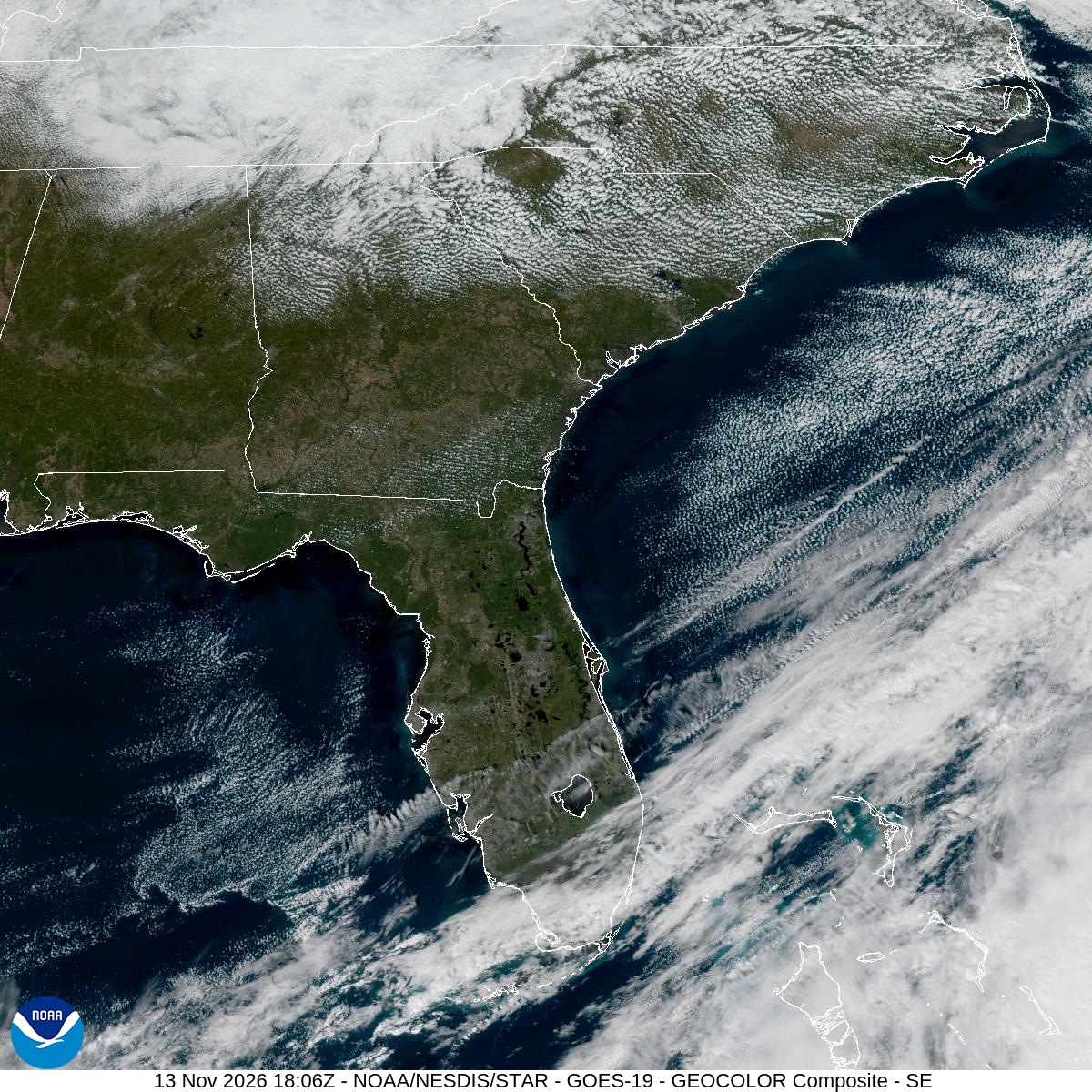
Southeast GeoColor satellite
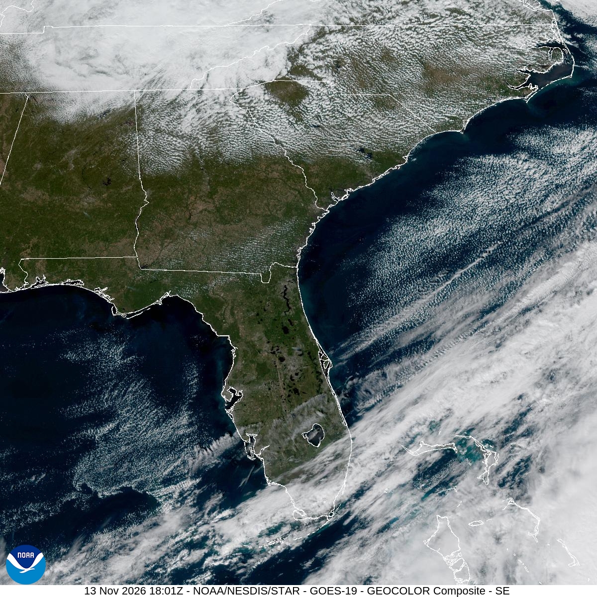
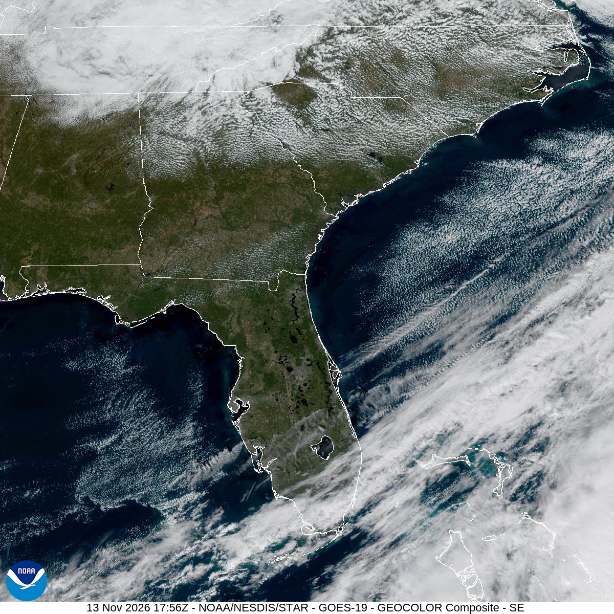
GeoColor shows the Southeast, including Florida. The timestamped sequence below preserves cloud detail without automatically interpreting cloud cover at street level.

Earlier timestamped frames


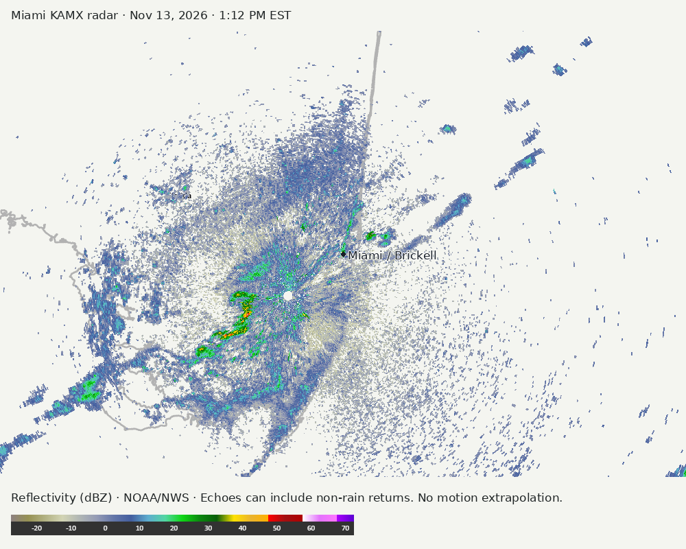
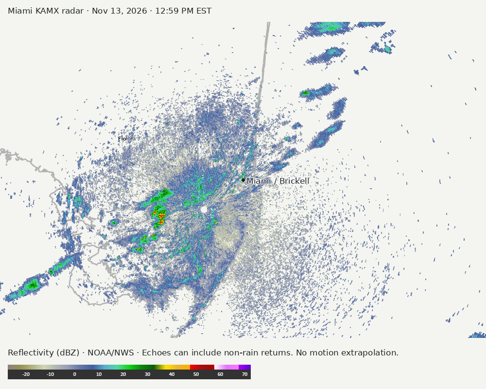
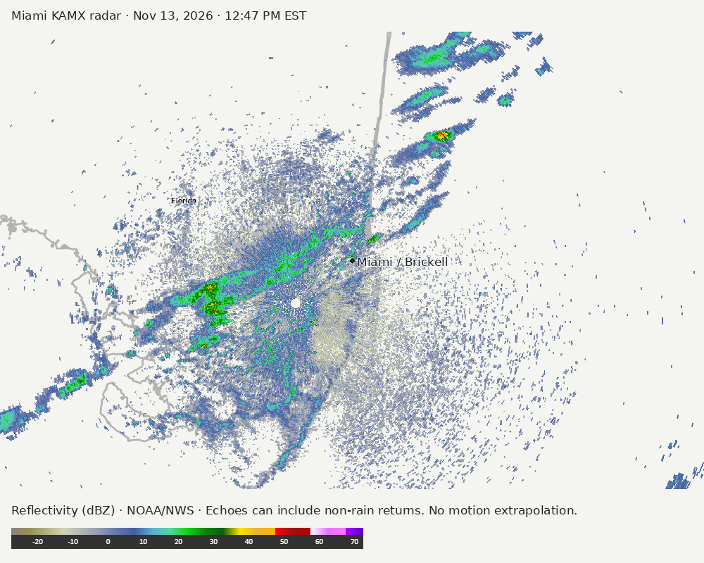
Detailed Miami radar — official KAMX fallback
Colored reflectivity echoes are concentrated southwest of Miami relative to Miami in the latest frame. These are echo locations, not confirmation of rain at the surface.
Earlier timestamped frames
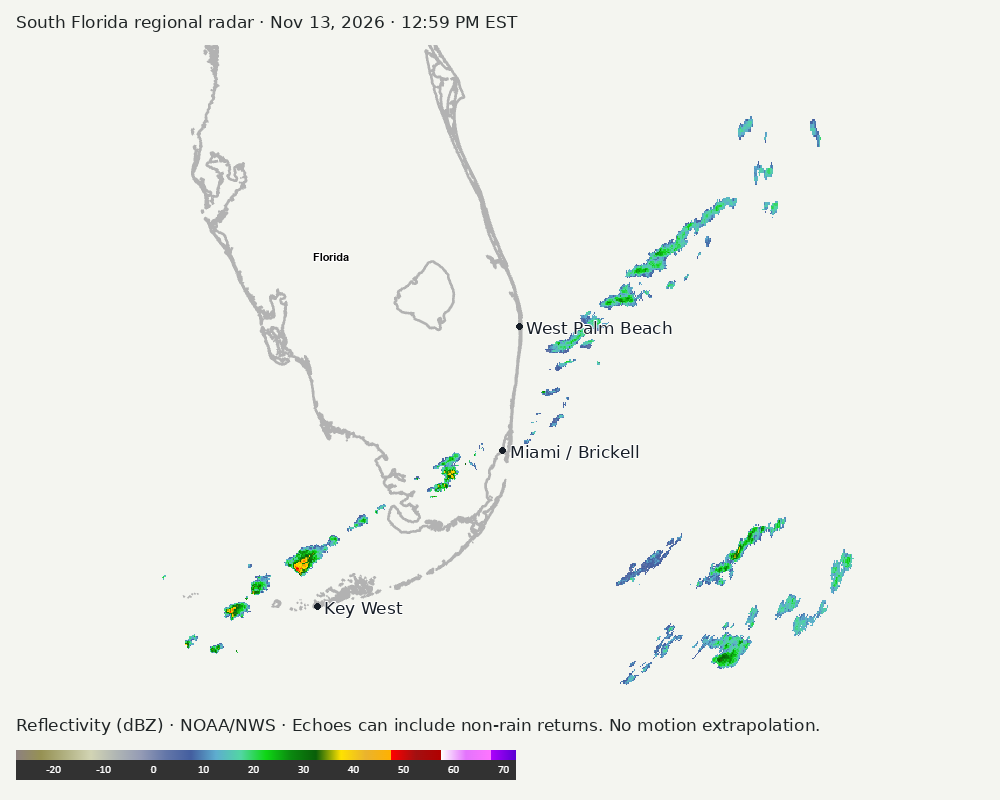
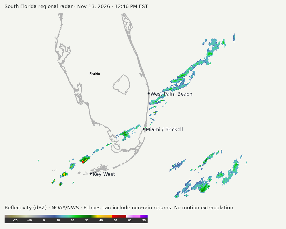
Regional South Florida radar
Colored reflectivity echoes are concentrated southwest of Miami relative to Miami in the latest frame. These are echo locations, not confirmation of rain at the surface.
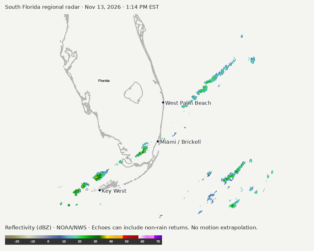
Earlier timestamped frames
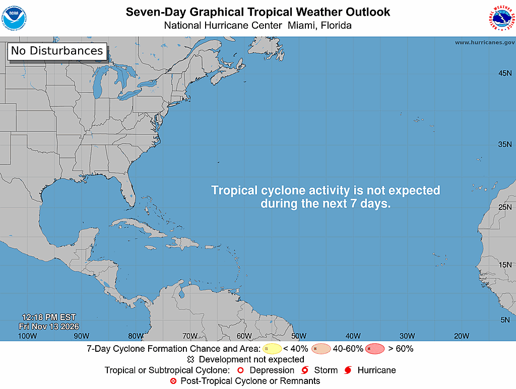
Tropical outlook
The Atlantic outlook describes development potential, not a forecast of impacts in Miami. No local hurricane impact is inferred here.
Read official source text
000
ABNT20 KNHC 131718
TWOAT

Tropical Weather Outlook
NWS National Hurricane Center Miami FL
100 PM EST Fri Nov 13 2026

For the North Atlantic...Caribbean Sea and the Gulf of America:

Tropical cyclone formation is not expected during the next 7 days.

$$
Forecaster Katz/Papin
Miami forecast discussion
Read official source text
000
FXUS62 KMFL 131745
AFDMFL

Area Forecast Discussion
National Weather Service Miami FL
1245 PM EST Fri Nov 13 2026

...New AVIATION...

.KEY MESSAGES...
Updated at 1244 PM EST Fri Nov 13 2026

  - Cool and dry conditions will prevail across South Florida over
    the next several days as a strong cold front arrives across
    the region today.

  - Breezy northwesterly winds will result in cautionary to
    hazardous marine conditions across the local Gulf & Atlantic
    waters this afternoon into Saturday morning.

&&

.SHORT TERM...
(Today through Saturday)
Issued at 140 AM EST Fri Nov 13 2026

The same overall atmospheric configuration looks to remain in place
across the Contiguous United States early this morning with a
sprawling ridge of high pressure dominating the western half of the
country and a potent trough situated over the eastern half. Over the
southeastern US, the base of this deepening upper trough (with 500-
mb height anomalies near its base over the Southern Appalachians
falling within only the 2nd percentile for the date as per the REFS)
has united with the strong flow aloft that is associated with the
subtropical jet that we continue to have overhead here in South
Florida. As a result, an excessively strong jet streak has developed
within this area of confluence between the two air currents,
encompassing northern and central Florida and extending several
hundred miles into the Southwest Atlantic waters, with winds aloft
at the 200mb level oscillating between 120 and 130 kts which,
according to the REFS, is between the 98 and 99th percentiles for
this time of year.

Although South Florida is displaced to the south of this impressive
jet streak, the same subtropical jet is still pumping in winds aloft
at between 80 and 95 kts, which is between the 92nd and 96th
percentiles as per climatology. Embedded moisture along this
subtropical jet kept our skies here in South Florida mostly cloudy
on Thursday, and recent IR (infrared) satellite imagery continues to
suggest the same this morning with an abundance of mid to high-level
clouds still streaming across the peninsula from southwest to
northeast. Both ACARS and the 00Z MFL soundings support these
observations with minuscule dew point depressions in the upper third
of the atmosphere and slightly drier air in place across the low to
mid-levels.

Taking a look at RTMA-derived surface winds, a weak surface trough
can be pinpointed over South Florida's local Atlantic waters with a
frail and slackening cold front located a little further south over
the Florida Straits. There are showers in association with these two
features, mainly confined to their respective axises of surface
convergence. Over mainland South Florida, all remains mostly dry as
there is little in the way of forcing across the region. The main
story recently has been the strong cold front that is expected to
bring us our first real cooldown of the Fall season, and you may be
wondering, where exactly is it as we speak? Looking off the north
towards the borders of Florida, Georgia and Alabama; a sharp
demarcation in dew points ultimately reveals the position of the
front, as does the presence, via surface plots, of post-frontal
northwesterly surface winds over the Florida panhandle and southern
GA/AL and southwesterly flow over north-central Florida along and
just ahead of the front. This front will continue to work its way
down the rest of the Florida peninsula through the rest of the
overnight hours, roughly arriving at the Lake Okeechobee region
shortly after daybreak Friday morning, which rightfully explains the
lack of cooling across South Florida as the air mass we will be
waking up to will be still be pre-frontal. We will, thus, be walking
our the door Friday morning to lows that will be fairly similar to
yesterday morning's, ranging between the mid to upper 60s north of
Alligator Alley and in the low 70s across the southern half of the
peninsula.

High-res model guidance does suggest that the front could try and
squeeze out a few showers as it approaches our region Friday morning
and into the first half of the afternoon as it continues to push
southward, but PoPs do not want to exceed 10% in many South Florida
locations as it does so. The 00Z MFL sounding showed a measly
surface-based CAPE value of just 2 J/Kg, and with model guidance not
suggesting it to climb past 500 J/Kg through the rest of the
overnight hours and into the morning and early afternoon hours, the
risk of scattered showers and let alone thunderstorms will be very
low. As per forecast soundings (and the lingering saturation they
continue to show in the mid to upper levels), the plentiful cloud
cover we have observed this morning is forecast to stay in place
through Friday afternoon and should continue to suppress any
significant amounts of surface destabilization, thus keeping things
rather quiet across South Florida and only resulting in some light
stratiform rain here and there as the boundary pushes through our
region.

Continental high pressure that, according to surface observations,
extends from Manitoba/Ontario in Canada southward through the
Midwest and Lower Missouri River Valley will allow winds to become
northwesterly later this morning across South Florida amidst our
passing cold front. They should be fairly light across mainland
South Florida through the majority of the day, before starting to
increase over the frictionless local Atlantic and Gulf waters as a
local pressure gradient begins to develop between the aforementioned
high to the north and the departing front. Since the northern half
of South Florida will be the first to experience the intrusion of
this much cooler air (in addition to the high cloud cover we are
expecting) between the morning and early afternoon hours coinciding
with the peak diurnal heating period, high temperatures will only be
climbing into the mid to upper 70s north of Alligator Alley. Will be
slightly warmer over the southern half of South Florida ahead of the
advancing front, but lingering cloud cover will allow our highs to
drop by a few degrees to what we experienced yesterday and achieve
values that are closer to average for this time of year (low 80s).

High-res mesoscale models i.e. the RAP and HRRR show our atmospheric
profile beginning to undergo a notable north-to-south drying trend
during the second half of the afternoon across South Florida as dry
air on the the backside of the large upper trough over the eastern
US makes its push into our region and helps to displace the moist
subtropical jet to our south. This will gradually reduce our cloud
cover into Friday evening, setting the stage for radiational cooling
and our first real taste of Fall as the cooler, less humid air mass
succeeding the front spills into the remainder of South Florida. We
are forecast to wake up on Saturday morning to temperatures that
will be between 5 and 10 degrees below average for this time of
year: in the low to mid 50s around Lake Okeechobee and over the
interior, with our coastal metros generally dropping into the upper
50s. NBM has a 30-35% chance of temperatures dropping to below 50F
west of the Lake, while the LREF has just a slimmer of a higher
chance of 35-40% over the northwesternmost portion of our CWA in
Glades County. As a result of this cool air advection, high
temperatures on Saturday will only be climbing into the mid to upper
60s around Lake O and the interior, and into the low 70s across our
east coast and Naples metros. With a very dry, post-frontal
atmospheric column, expect mostly sunny skies with a crisp breeze
out of the north in response to high pressure over the Midwest/Lower
Missouri Valley today shifting slightly eastward towards the Mid-
Mississippi Valley. Winds will be stronger over the local waters and
along coastal regions than they will be today due to an enhancing
pressure gradient, so it will be best to avoid any boating
activities and to instead go out and perhaps buy yourself a
delicious peppermint mocha (too soon?).

&&

.LONG TERM...
(Saturday night through Thursday)
Issued at 140 AM EST Fri Nov 13 2026

SUNDAY & MONDAY...

Brisk upper level flow will remain the atmospheric status quo across
South Florida during the second half of the weekend as the sub-
tropical jet stream remains entrenched across our region. Model
guidance has come into better agreement within the past 24 hours
regarding the passage of a shortwave axis across the region during
the day on Sunday. However even with the injection of upper level
dynamics (Maxima of upper level divergence and low level convergence
across South Florida as the region resides in the right entrance of
a developing jet-streak), the continental airmass (post-FROPA) still
in place will limit any threat of convective development over land,
with an outside chance (<10%) of a few isolated showers developing
over the instability laden waters of the Gulfstream. Forecast model
soundings depict a dearth of moisture in much of the atmospheric
column (above 850-900mb) across our region on Sunday but also reveal
a subtle but important shift in prevailing wind direction at the
surface. With such a transient mid to upper level pattern
increasingly in play across the southern United States, the axis of
surface ridging will slide eastwards across the upper Mississippi
River valley on Saturday night into Sunday morning. Why is this
detail important to us here in South Florida? The siting of surface
ridging across the eastern United States is instrumental in
determining just how long a "cold" snap is able to last across our
region given the moderating influences of the surrounding Atlantic
waters. The longer surface flow remains out of a northwesterly
direction (Straight from the continent), the longer the duration of
a "cold" snap across our area. In this case, the advertised
temperature drop for South Florida will be rather short-lived, so be
sure to partake (Pumpkin spice anyone?) in this iteration of Florida
fall.

As the surface ridge slides eastward, anticyclonic flow on the
periphery of the expansive ridge across South Florida is also
forecast to veer in direction. Nocturnal stratification at daybreak
is expected to result in light northerly flow across most of the
region before surface winds re-couple and veer north-easterly across
the region post-sunrise. This could result in an interesting
distribution of slightly warmer minimum temperature values along the
east coast of South Florida by daybreak on Sunday, while areas
across inland southwestern Florida could see values in the upper 40s
as surface winds slacken and decouple. The veering of surface winds
to a breezy northeast direction during the day on Sunday is forecast
to jump-start a gradual warming trend as the airmass in place across
South Florida gradually moderates. Forecast high temperatures will
range from the upper 70s across coastal locales to temperatures in
the mid 70s near Lake Okeechobee.

Ensemble and deterministic guidance continue to depict the next mid-
level shortwave sliding southeastward from the Southern Plains into
the Lower Mississippi Valley and along the Northern Gulf Coast
during the day on Monday. The orientation of the sub-tropical jet
stream and a maxima of upper-level divergence out ahead of the short-
wave continues to be resolved by model guidance in developing an
area of surface low pressure across the western Gulf. While this
feature is forecast to remain well to the west of South Florida on
Monday, a strengthening pressure gradient (Between the surface low
in the Gulf and surface high across the eastern CONUS) is being
depicted by model guidance to result in gusty conditions and gradual
moisture return across the region on Monday. While the airmass will
still be in the process of moderating, gusty NELY to ENErly flow
will support the threat of low-topped shower activity moving
onshore along the east coast of South Florida during the afternoon
hours. High temperatures will also continue on an upward
trajectory with forecast high temps in the upper 70s to low 80s.

TUESDAY & BEYOND...

As the mid-level shortwave accelerates southeastward across the
northern Gulf during the day on Tuesday, the accompanying area of
surface low pressure is modeled to do so in tandem, moving briskly
along across the central Gulf. Comparing yesterday's model suite to
the latest deterministic and ensemble guidance solutions, the 00z
model suite has continued to trend with a more southern trajectory
of the mid-level shortwave which would also have direct implications
on the track of the associated surface low and frontal boundaries
displaced further to the south. Similar to last night, 500mb cluster
analysis suggests that ensemble guidance (ECMWF, GEFS, and CMCE)
remains in fair agreement with the placement & timing of the
shortwave as variance remains low. The shift southward of the
surface low and consequently, best foci of ascent is also
represented in QPF cluster analysis with the greatest clustering of
ensemble members now depicting the possibility of lower rainfall
totals occurring across South Florida than what is depicted on the
ensemble mean (GEFS, ECMWF, and CMCE).

While the latest forecast guidance has trended to a more southern
track of the surface low just to the south of South Florida, two
other potential trajectories include: 1) a passage directly over
South Florida or 2) just to the north of South Florida. The
atmosphere is a fluid and forecast alterations are certainly still
possible as we remain within the 4-5 day time frame. Lift,
instability, and moisture are the three main ingredients for
thunderstorm development and will directly be influenced by the
exact placement and evolution of the surface low. The fourth
ingredient that is needed for more robust thunderstorm development,
shear, will be dictated by where the sub-tropical jet-stream maxima
is located in relation to surface features.

As deterministic guidance can vary widely from run to run and depict
a singular outcome , ensemble guidance can present a wider and more
probabilistic array of potential solutions. The best analogy to help
make this important distinction (deterministic vs ensemble) is to
picture a race car derby. Consider a singular derby car that is
propelled with force down the derby ramp. One singular input
produced one singular outcome, which is a really simplistic
equivalent to deterministic model guidance. To contrast this, now
imagine a line of derby cars, each built with different materials
and given varying levels of force down the derby ramp. Each derby
car had slightly different input parameters which will lead to
different outcomes, a wider array of potential solutions. Bringing
the point home, current ECENS and GEFS ensemble members show a very
wide spread of potential outcomes with this system. Some ensemble
members depict the threat of thunderstorm activity, heavy rainfall,
and higher precipitation rainfall totals across South Florida. The
orientation of projected rainfall totals on some of these ensemble
members hint at the threat of frictional convergence as gusty
northeasterly winds are slowed along the east coast of Florida,
which could hint at a threat of locally higher amounts at isolated
locations should these solutions become a reality. Alternatively, a
large subset of ensemble members depict the opposite with the
greatest impacts displaced away from the region over the
northwestern Bahamas and western Atlantic waters. Each ensemble
member has slightly different inputs on the placement of the frontal
boundaries and surface low pressure system, which is resulting in a
wide array of outcomes. This wide array of outcomes also helps us
infer that there is still a considerable amount of uncertainty in
the evolution of this feature next week and how we here in South
Florida could be impacted.

The monitoring of upstream features (shortwave, surface low
location, etc) in real time will be instrumental in getting a better
handling of which solutions may transpire for South Florida. The
approaching window of Convection Allowing Models (CAMs) may also
give insight into how things may play out. Specifics aside, ensemble
guidance remain in line with the latest run of the National Blend of
Models (NBM) that depict a prolonged period of gusty winds across
South Florida through much of the upcoming work week. This may act
to keep temperatures near normal for this time of year, without
accounting for any potential influence of convection across the
region. With the surface low potentially remaining in the vicinity
of South Florida through the middle to late portion of the work
week, the pressure gradient could very well remain rather stout in
nature. This may act to keep surface winds gusty across SoFlo with
high temperatures near average for this time of year.

&&

.AVIATION...
(18Z TAFS)
Issued at 1244 PM EST Fri Nov 13 2026

VFR is expected to prevail for most of the period, although
intermittent MVFR is possible with lower CIGs as a frontal boundary
moves through the area. Otherwise, shower activity is expected to be
meager to non-existent. Winds will be around 10 kts through the
period out of the NW.

&&

.MARINE...
Issued at 140 AM EST Fri Nov 13 2026

A gentle to moderate northwesterly wind flow will develop across the
Atlantic and Gulf waters this morning, becoming a moderate to fresh
wind by the afternoon and continuing through the weekend. Fresh to
strong wind flow develops by Friday night and into Saturday morning
across the Atlantic waters. Winds become northerly across the Gulf
on Saturday and northeasterly across both the Atlantic and Gulf on
Sunday. Isolated showers will be possible across the local waters
during the first half of the day today. Seas across the Atlantic and
Gulf waters will be between 2-4 feet today, increasing to 4-7 feet
across the Atlantic on Saturday. Elevated marine conditions will
continue through the rest of the weekend and into early next week.

&&

.PRELIMINARY POINT TEMPS/POPS...
Miami            60  72  60  78 /   0   0   0   0
West Kendall     60  72  59  79 /   0   0   0   0
Opa-Locka        59  72  59  79 /   0   0   0   0
Homestead        60  73  60  79 /   0   0   0   0
Fort Lauderdale  59  71  60  78 /   0   0   0   0
N Ft Lauderdale  58  71  59  78 /   0   0   0   0
Pembroke Pines   59  73  58  79 /   0   0   0   0
West Palm Beach  56  71  58  78 /   0   0   0   0
Boca Raton       57  71  59  77 /   0   0   0   0
Naples           57  70  54  78 /   0   0   0   0

&&

.MFL WATCHES/WARNINGS/ADVISORIES...
FL...None.
AM...Small Craft Advisory from 10 PM this evening to 11 AM EST
     Saturday for AMZ650-651-670-671.

GM...None.
&&

$$

SHORT TERM...AD
LONG TERM....Hadi
AVIATION...Redman
Sources and freshness
Supplementary failures do not replace missing data with reassuring conclusions. All source times below are Eastern; source metadata and original downloads are archived with this report.
Alerts · available
Source. Retrieved Nov 13, 2026 · 1:15 PM EST.
Beach · available
Source. Retrieved Nov 13, 2026 · 1:15 PM EST. Issued Nov 13, 2026 · 3:21 AM EST.
Coastal Alerts · available
Source. Retrieved Nov 13, 2026 · 1:15 PM EST.
Discussion · available
Source. Retrieved Nov 13, 2026 · 1:15 PM EST. Issued Nov 13, 2026 · 12:45 PM EST.
Forecast · available
Source. Retrieved Nov 13, 2026 · 1:15 PM EST. Issued Nov 13, 2026 · 3:21 AM EST.
Hourly · available
Source. Retrieved Nov 13, 2026 · 1:15 PM EST. Issued Nov 13, 2026 · 3:21 AM EST.
Local Radar · available
Source. Retrieved Nov 13, 2026 · 1:15 PM EST. Issued Nov 13, 2026 · 1:12 PM EST.
Marine · available
Source. Retrieved Nov 13, 2026 · 1:15 PM EST. Issued Nov 13, 2026 · 2:36 AM EST.
Mcnoldy · link-only
Source. Retrieved Nov 13, 2026 · 1:15 PM EST. Original image reuse has not been authorized; official KAMX imagery is used instead.
Nhc · available
Source. Retrieved Nov 13, 2026 · 1:15 PM EST. Issued Nov 13, 2026 · 12:18 PM EST.
Observation · available
Source. Retrieved Nov 13, 2026 · 1:15 PM EST. Issued Nov 13, 2026 · 12:45 PM EST.
Regional Radar · available
Source. Retrieved Nov 13, 2026 · 1:15 PM EST. Issued Nov 13, 2026 · 1:14 PM EST.
Satellite · available
Source. Retrieved Nov 13, 2026 · 1:15 PM EST. Issued Nov 13, 2026 · 1:06 PM EST.
Tropical Tidbits · not-used
Source. Retrieved not retrieved. No current tropical context requiring this supplementary source, or the NHC input is unavailable.