Morning Miami Weather Report
Miami, November 16 — Sunny
Automated weather summary from official sources; factual templates with validated source timestamps. Follow NWS Miami and NHC for current guidance.
Late report: current weather data were collected at the publication time below, rather than early this morning.
Forecast for Miami / Brickell
Today: 81°F. Sunny. Wind 15 to 18 mph NE. Rain chance: 5%.
Sunny, with a high near 81. Northeast wind 15 to 18 mph, with gusts as high as 24 mph.
Tonight: A slight chance of rain showers after 4am. Partly cloudy, with a low around 76. East wind 17 to 23 mph, with gusts as high as 28 mph. Chance of precipitation is 20%.
Hourly forecast — rain chances and timing
| Eastern time | Temperature | Rain chance | Wind | Forecast |
|---|---|---|---|---|
| Nov 16, 2026 · 11:00 AM EST | 80°F | 0% | 16 mph E | Mostly Sunny |
| Nov 16, 2026 · 12:00 PM EST | 80°F | 0% | 17 mph E | Mostly Sunny |
| Nov 16, 2026 · 1:00 PM EST | 80°F | 1% | 16 mph E | Mostly Sunny |
| Nov 16, 2026 · 2:00 PM EST | 79°F | 1% | 17 mph E | Sunny |
| Nov 16, 2026 · 3:00 PM EST | 81°F | 1% | 17 mph NE | Sunny |
| Nov 16, 2026 · 4:00 PM EST | 79°F | 2% | 17 mph NE | Sunny |
| Nov 16, 2026 · 5:00 PM EST | 79°F | 5% | 18 mph E | Sunny |
| Nov 16, 2026 · 6:00 PM EST | 79°F | 8% | 18 mph NE | Partly Cloudy |
| Nov 16, 2026 · 7:00 PM EST | 78°F | 11% | 17 mph NE | Partly Cloudy |
| Nov 16, 2026 · 8:00 PM EST | 78°F | 11% | 20 mph NE | Partly Cloudy |
| Nov 16, 2026 · 9:00 PM EST | 78°F | 10% | 20 mph E | Partly Cloudy |
| Nov 16, 2026 · 10:00 PM EST | 78°F | 11% | 21 mph E | Partly Cloudy |
| Nov 16, 2026 · 11:00 PM EST | 78°F | 11% | 21 mph E | Partly Cloudy |
Observed nearby
Miami International Airport (KMIA), Nov 16, 2026 · 11:35 AM EST: Mostly Clear. Temperature 81°F; wind not supplied. This airport observation does not measure conditions at your exact location in Brickell.
Alerts and outdoor plans
Swim near a lifeguard. If caught in a rip current, relax and float. Don't swim against the current. If able, swim in a direction following the shoreline. If unable to escape, face the shore and call or wave for help.
Swim near a lifeguard. If caught in a rip current, relax and float. Don't swim against the current. If able, swim in a direction following the shoreline. If unable to escape, face the shore and call or wave for help.
Inexperienced mariners, especially those operating smaller vessels, should avoid navigating in hazardous conditions.
Running: Use the temperature, rain and wind forecast above to plan your window. If thunderstorms are forecast or you hear thunder, postpone outdoor activity and seek a substantial building. This briefing does not certify a safe running window.
Paddleboarding — official Biscayne Bay forecast
Today: NE winds 10 to 15 kt (17 mph), increasing to 15 to 20 kt (23 mph) this afternoon. Choppy.
Tonight: E winds 20 to 25 kt (29 mph). Rough.
Tue: E winds 20 to 25 kt (29 mph) with gusts up to 30 kt (35 mph). Rough. Showers in the late morning and afternoon.
Wind speeds in the source use knots (1 knot = 1.151 mph). Check current marine alerts and local conditions before launching; no safe launch window is inferred.
Official coastal Miami-Dade beach and rip-current guidance
FLZ173-162200-
Coastal Miami-Dade-
Including the beaches of Miami
331 AM EST Mon Nov 16 2026

...HIGH RIP CURRENT RISK IN EFFECT FROM 7 AM EST THIS MORNING THROUGH
WEDNESDAY EVENING...

.TODAY...
Rip Current Risk*...........High.
Surf Height.................2 to 3 feet.
Thunderstorm Potential**....None.
Waterspout Risk**...........None.
UV Index**..................Moderate.
Water Temperature...........In the upper 70s.
Weather.....................Sunny.
High Temperature............In the lower 80s.
Winds.......................Northeast winds around 15 mph.
Tides...
   Miami Harbor Entrance....Low at 06:29 AM EST.
                            High at 01:13 PM EST.
Sunrise.....................6:38 AM.
Sunset......................5:32 PM.

.TUESDAY...
Rip Current Risk*...........High.
Surf Height.................5 to 7 feet.
Thunderstorm Potential**....Moderate.
Waterspout Risk**...........None.
Weather.....................Partly sunny. Showers and a chance of
                            thunderstorms.
High Temperature............Around 80.
Winds.......................East winds around 20 mph.
Tides...
   Miami Harbor Entrance....Low at 07:28 AM EST.
                            High at 02:04 PM EST.
Sunrise.....................6:39 AM.
Sunset......................5:31 PM.

&&

Rip Current Risk Category
* Low Risk - The risk for rip currents is low, however,
life-threatening rip currents often occur in the vicinity of groins,
jetties, reefs, and piers.
* Moderate Risk - Life-threatening rip currents are possible in the
surf zone.
* High Risk - Life-threatening rip currents are likely in the surf
zone.

** For thunderstorm, waterspout, and UV definitions see:
https://www.weather.gov/beach/mfl
Satellite and radar
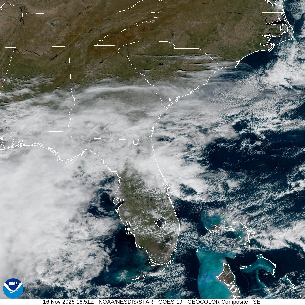
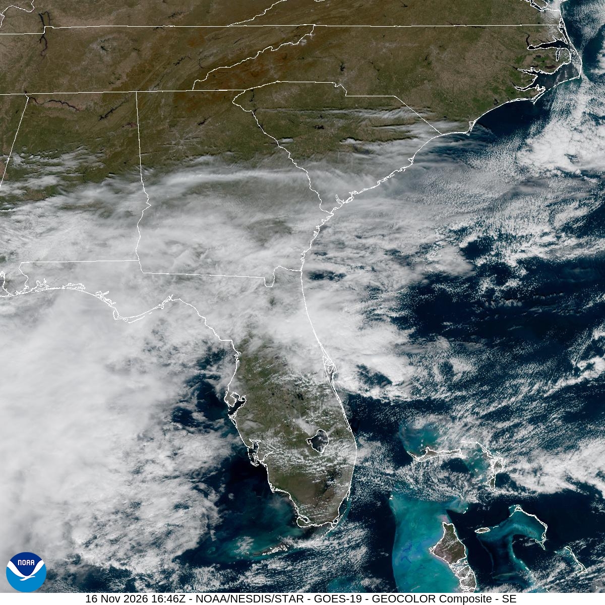
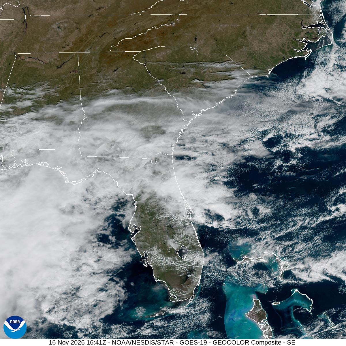
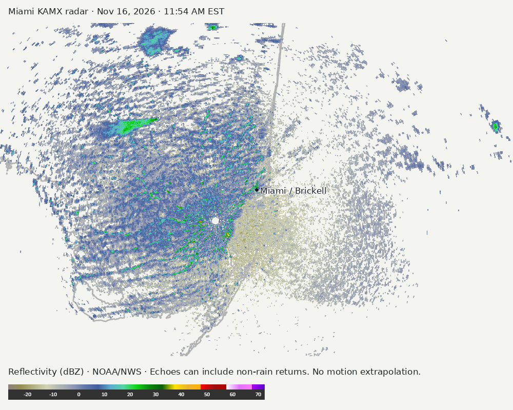
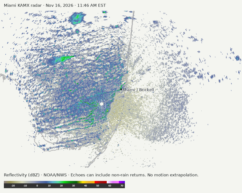
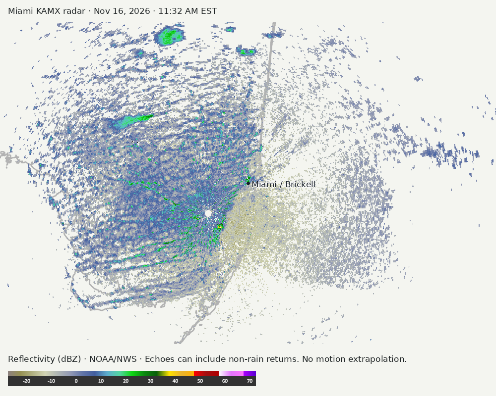
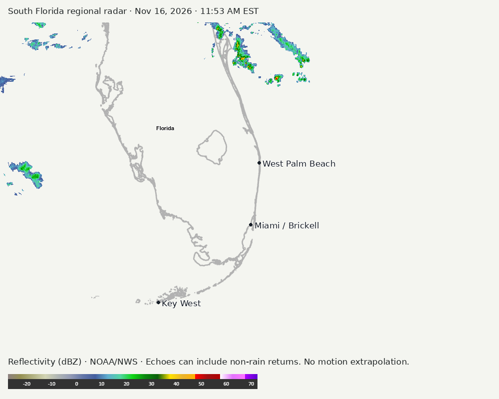
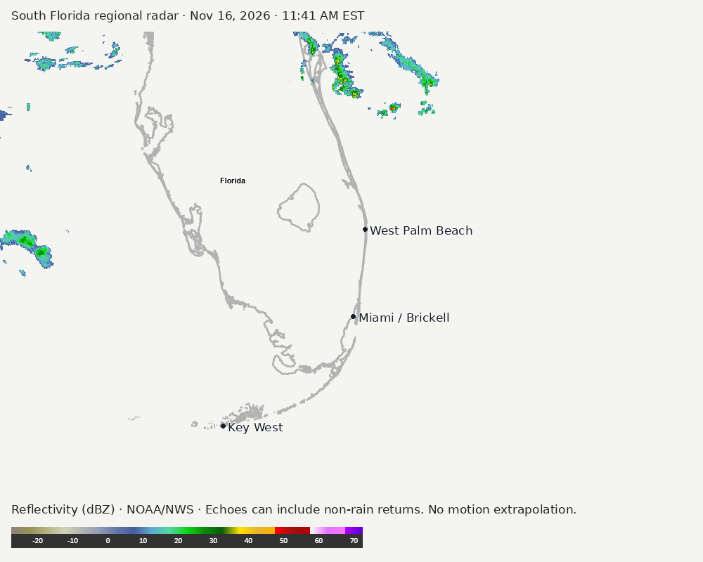
Archived frames show what the instruments captured at their labeled times. Radar echoes can include non-rain returns. No movement or future arrival is inferred automatically from these frames.
Southeast GeoColor satellite
GeoColor shows the Southeast, including Florida. The timestamped sequence below preserves cloud detail without automatically interpreting cloud cover at street level.

Earlier timestamped frames


Detailed Miami radar — official KAMX fallback
Colored reflectivity echoes are concentrated southwest of Miami, northwest of Miami relative to Miami in the latest frame. These are echo locations, not confirmation of rain at the surface.
Earlier timestamped frames
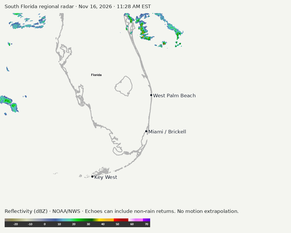
Regional South Florida radar
Colored reflectivity echoes are concentrated north of Miami relative to Miami in the latest frame. These are echo locations, not confirmation of rain at the surface.
Earlier timestamped frames
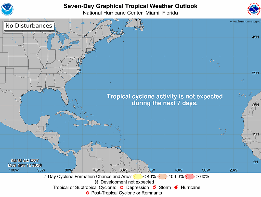
Tropical outlook
The Atlantic outlook describes development potential, not a forecast of impacts in Miami. No local hurricane impact is inferred here.
Read official source text
000
ABNT20 KNHC 161115
TWOAT

Tropical Weather Outlook
NWS National Hurricane Center Miami FL
700 AM EST Mon Nov 16 2026

For the North Atlantic...Caribbean Sea and the Gulf of America:

Tropical cyclone formation is not expected during the next 7 days.

$$
Forecaster Kelly
Miami forecast discussion
Read official source text
000
FXUS62 KMFL 161046
AFDMFL

Area Forecast Discussion
National Weather Service Miami FL
546 AM EST Mon Nov 16 2026

...New AVIATION...

.KEY MESSAGES...
Updated at 545 AM EST Mon Nov 16 2026

  - There is an increased threat of urban flooding along the east
    coast of South Florida this week. If repeated rounds of heavy
    rainfall occur, impactful flash flooding is possible.

  - Dangerous marine conditions are forecast to develop across the
    local Atlantic, Biscayne Bay, and Gulf waters of South Florida this
    afternoon and persist over the next couple of days.

  - Life threatening rip currents and dangerous surf are forecast
    for Miami-Dade, Broward, and Palm Beach beaches this week.

&&

.SHORT TERM...
(Today through Tuesday)
Issued at 313 AM EST Mon Nov 16 2026

OVERVIEW & IMPACTS...

A complex atmospheric pattern will set the stage for an 1) Increased
threat of urban flooding along the east coast of South Florida, 2)
Dangerous marine conditions, and 3) Life-threatening rip currents
and surf at east coast beaches for much of the workweek. Forecast
confidence remains high (60-80%) on the timing and evolution of
marine and beach impacts as gusty northeasterly winds strengthen
today and persist over the next several days. Boaters and beach-
goers alike should be mindful of the upcoming prolonged period of
dangerous conditions and plan accordingly. The main change in the
forecast over the past 24 hours has been a more favorable alignment
of atmospheric features (discussed in great detail below if one
wishes to partake in the nitty-gritty meteorology) that has
supported a greater threat of urban flooding across our east coast
metro during the middle portion of this week. The Weather Prediction
Center has responded accordingly, increasing the risk of excessive
rainfall to a Slight Risk (Level 2 of 4) for Miami, Broward, and
Palm Beach metro areas on Tuesday, Wednesday, and Thursday. Forecast
confidence on exact timing on when the heaviest rainfall could occur
remains low (10-30%) with a slight uptick in forecast confidence for
the overall threat of heavy rainfall to the medium (20-40%) range.
Saturated soils from recent heavy rainfall events could provide a
lower barrier to urban flooding. The main question will be just how
much rainfall occurs and in what time frame as that will determine
the severity of any urban flooding that occurs.

DETAILED SYNOPSIS...

Today will very much so be a transition day between the post frontal
airmass that has dominated the local weather regime across South
Florida over the last several days and a series of synoptic features
(aloft and at the surface) that is forecast to result in an active
pattern during the middle of this week. Boundary layer moisture will
begin to pool across the region as a stationary boundary forms over
the Gulf and builds into the Florida Peninsula. Upstream features
for our upcoming set-up are now not only just in the model guidance
but also present on RTMA and GOES Imagery. 07z Mesoanalysis depicts
a sharp mid-level shortwave digging southward across the northern
Gulf coast as well as a deepening surface low across the western
Gulf this morning, aided by upper level divergence. At the same
time, Expansive surface ridging is forecast to remain in place
across much of the eastern half of the contiguous United States
today. The movement of the surface low and stationary front eastward
across the Gulf will result in the enhancement of a pressure
gradient across South Florida, resulting in an enhancement of
surface winds during the afternoon and early evening hours. Most
locales are forecast to remain dry today with the exception of low
end rain chances across coastal Palm Beach County as low-topped
shower activity could briskly move onshore in the enhancing
northeasterly flow.

Model guidance has trended in the direction of a much slower
propagation of the robust mid-level shortwave across the region
during the middle portion of this week. Guidance has also trended
with a closer passage of a frontal boundary and various surface lows
(both east and west of South Florida) during the mid-week period.
These are important forecast detail as a slower moving mid to upper
level feature would act to provide the necessary upper level
divergence and mid level lapse rates to sustain shower and
thunderstorm activity for a longer duration (both during the day and
overnight). The proximity to a frontal boundary or surface low would
act to provide additional low level ascent and convergence. Synoptic
boundaries often enhance mesoscale phenomena (Coastal Convergence)
setups with historical precedent. At the surface, the aforementioned
frontal boundary which is forecast to remain in the vicinity of our
area on Tuesday will result in a continuation of the pressure
gradient and resultant gusty winds across the region. The highest
wind speeds are projected over the local waters and along the
immediate coastline of southeastern Florida before surface friction
acts to reduce wind speeds at the surface further inland. This
enhancement of onshore winds coupled with the pooling of moisture
along the boundary across South Florida could set the stage for
increasing spatial and temporal coverage of showers (and heavy
rainfall) along the east coast of South Florida beginning on
Tuesday.

The implications of friction will also play a role in any threat of
heavy rainfall during this period that will primarily focus across
Miami-Dade, Broward, and Palm Beach metro areas. As air slows along
the coast due to increased friction, ascent is maximized as air
parcels converge and are forced to rise. Combining this mesoscale
forcing with a potential gradient of instability along the immediate
coastline, sufficient boundary layer moisture, and the synoptic
kinematics (discussed in the totality of this synopsis) could set
the stage for repeated rounds of showers and thunderstorms across
our east coast metro locales beginning on Tuesday and continuing
into the extended period. Forecast model soundings have been
persistent in showing a classic skinny CAPE profile, good low to
middle level saturation (>80%), and opposing 1km to 6km wind
directions. Mesoscale models (CAMs) should give us a better
indication of precipitation patterns over the next 24-48 hours as
upstream features approach South Florida. Even so, the
predictability of the placement of higher end rainfall maxima's
remains low.

&&

.LONG TERM...
(Tuesday night through Sunday)
Issued at 313 AM EST Mon Nov 16 2026

IMPACTS CONTINUE...

With a stationary boundary directly overhead of the region,
frictional convergence (surface trough) directly along the east
coast, and a saturated vertical profile, the heavy rainfall threat
(and setup) discussed above will persist across the east coast of
South Florida on Wednesday and Thursday. But there may be light at
the end of the proverbial tunnel as the atmospheric log-jam finally
begins to give way during the second half of the week.

The placement of the right entrance region of a poleward sub-
tropical jet streak over the western Atlantic waters and
northwestern Bahamas will set the stage for an area of favorable
upper level divergence. Model guidance (ECWMF & GEFS) has come into
better agreement for the gradual development of a surface low along
a stationary frontal boundary in close proximity to South Florida
during this time frame as low level convergence is maximized. Model
solutions now depict a gradual deepening of the surface low pressure
system with the low gradually lifting northwards beginning on
Thursday and continuing into the upcoming weekend. The development
of a surface low to our southeast could eventually usher in a
reinforcing surge of continental dry air via cyclonic flow around
the feature as it lifts further away from the region late in the
work week into the upcoming weekend. This may act to lift the
greatest threat of heavy rainfall to the north of the region by
Friday and return the region to low end rain chances during the
upcoming weekend. A gradual warming trend across the region with
maximum temperatures is forecast to continue during the second half
of the week as temperatures are forecast to reach the low to mid 80s
each afternoon through the upcoming weekend.

&&

.AVIATION...
(12Z TAFS)
Issued at 545 AM EST Mon Nov 16 2026

Mainly VFR this morning with NE winds 5-10 kts. NE winds increase
to 10-15 kts with gusts around 20 kts this afternoon. Scattered
coastal showers are possible late in the day along the east coast.

&&

.MARINE...
Issued at 313 AM EST Mon Nov 16 2026

Strengthening northeasterly winds will result in a deterioration of
conditions across all local waters of South Florida today. Gusty
conditions will remain in place for much of this week which will
result in a prolonged duration of hazardous marine conditions across
the Atlantic, Biscayne Bay, and Gulf waters. Moderate to fresh winds
during the day will enhance to the fresh to strong range by this
evening, especially across the local Atlantic waters. As winds
enhance over the Gulfstream waters, a rapid onset of increasing wave
heights may materialize tonight with wave heights quick increasing to
the 7-10+ feet tonight. The addition of northeasterly swell during
the middle of the week may result in even higher wave heights across
the Gulfstream waters with wave heights potentially reaching 12-14+
feet at times. Small Craft Advisories are scheduled to go into
effect this afternoon and may remain in place over the next several
days.

&&

.BEACHES...
Issued at 313 AM EST Mon Nov 16 2026

Gusty onshore winds are forecast to increase in strength today,
resulting in a persistent risk of life-threatening rip currents at
Miami-Dade, Broward, and Palm Beach beaches for much of this week.
As surface winds increase in intensity, wave heights will also
increase in the surf zone at east coast beaches overnight into
Tuesday. Surf heights could near High Surf Advisory criteria at
times during the middle portion of this week and a High Surf
Advisory may need to be issued in subsequent forecast updates. While
astronomical tides are not as conducive for coastal flooding
compared to recent setups, significant beach erosion is possible
along the east coast of South Florida with a potential multi-day
duration of rough surf.

&&

.HYDROLOGY...
Issued at 313 AM EST Mon Nov 16 2026

A complex atmospheric setup could provide the necessary ingredients
for an increased urban flood threat across portions of the Miami-
Dade, Broward, and Palm Beach metro during the middle portion of
this week. With a trend of increasing forecasted rainfall totals
over the past 24 hours, the Weather Prediction Center (WPC) now
highlights a large portion of the east coast metro areas in a Slight
Risk (Level 2 of 4) for excessive rainfall beginning on Tuesday and
continuing daily through Thursday. This means that within the Slight
Risk area, there is a 15-39% probability of excessive rainfall
leading to flash flooding within 25 miles of a given point. At the
same time, soils remain very saturated across the eastern half of
South Florida with NASA SPoRT-LIS percentiles still in the 80-99th
percentile range. Repeated rounds of heavy rainfall due to the
synoptic and mesoscale phenomena (discussed above) could have a
lower threshold/barrier than usual to cause urban flooding across
these areas. As model guidance shifts from run to run,
considerable variability exists within the projected range of rainfall
totals. This is especially important with the upcoming setup as
coastal convergence can often overperform (or alternatively,
underperform) the forecast.

Rather than anchor to a specific range of rainfall values that will
be discussed below, the main takeaway from this section is that
several inches of rainfall are a noteworthy possibility across
portions of the east coast of South Florida this week. As of the
latest forecast guidance, most likely accumulations (widespread)
of 2-4" are forecast across the Miami-Dade, Broward, and Palm
Beach metro through Friday morning. A reasonable worst case
scenario (90th percentile, 1 in 10 chance of exceedance) suggests
that the potential exists for localized pockets of 6-8"+ inches
of rainfall through Friday morning. Contextualizing the values
above with impacts, 2-4" of rainfall (most likely scenario) in a
short period of time could result in localized urban flooding. If
the higher end scenario amounts pan out then there is a greater
concern for impactful urban flash flooding.

Ensemble guidance continues to depict uncertainty regarding the
greatest signal (Central Florida vs South Florida) for the highest
rainfall totals with a wide assortment of potential solutions
amongst ECWMF and GEFS members. In simple terms, additional
fluctuations (up or down) in forecasted rainfall totals remains
possible as uncertainty remains high.

&&

.PRELIMINARY POINT TEMPS/POPS...
Miami            82  73  81  73 /  10  20  80  70
West Kendall     82  73  81  73 /  10  20  80  60
Opa-Locka        82  72  81  72 /  10  20  80  70
Homestead        82  73  81  73 /  10  20  80  70
Fort Lauderdale  81  72  80  72 /  10  20  70  80
N Ft Lauderdale  81  73  79  72 /  10  20  70  80
Pembroke Pines   83  71  81  71 /  10  20  80  70
West Palm Beach  79  72  78  72 /  20  20  50  70
Boca Raton       80  72  79  72 /  10  20  60  80
Naples           82  69  80  69 /   0   0  60  50

&&

.MFL WATCHES/WARNINGS/ADVISORIES...
FL...High Rip Current Risk through Wednesday evening for FLZ168-172-
     173.

AM...Small Craft Advisory from 1 PM this afternoon to 7 PM EST
     Wednesday for AMZ630-650-651-670-671.

GM...Small Craft Advisory from 4 PM this afternoon to 7 PM EST
     Wednesday for GMZ656-657-676.

&&

$$

SHORT TERM...Hadi
LONG TERM....Hadi
AVIATION...CMF
Sources and freshness
Supplementary failures do not replace missing data with reassuring conclusions. All source times below are Eastern; source metadata and original downloads are archived with this report.
Alerts · available
Source. Retrieved Nov 16, 2026 · 11:57 AM EST.
Beach · available
Source. Retrieved Nov 16, 2026 · 11:57 AM EST. Issued Nov 16, 2026 · 3:31 AM EST.
Coastal Alerts · available
Source. Retrieved Nov 16, 2026 · 11:57 AM EST.
Discussion · available
Source. Retrieved Nov 16, 2026 · 11:57 AM EST. Issued Nov 16, 2026 · 5:46 AM EST.
Forecast · available
Source. Retrieved Nov 16, 2026 · 11:57 AM EST. Issued Nov 16, 2026 · 3:32 AM EST.
Hourly · available
Source. Retrieved Nov 16, 2026 · 11:57 AM EST. Issued Nov 16, 2026 · 3:32 AM EST.
Local Radar · available
Source. Retrieved Nov 16, 2026 · 11:57 AM EST. Issued Nov 16, 2026 · 11:54 AM EST.
Marine · available
Source. Retrieved Nov 16, 2026 · 11:57 AM EST. Issued Nov 16, 2026 · 2:36 AM EST.
Mcnoldy · link-only
Source. Retrieved Nov 16, 2026 · 11:57 AM EST. Original image reuse has not been authorized; official KAMX imagery is used instead.
Nhc · available
Source. Retrieved Nov 16, 2026 · 11:57 AM EST. Issued Nov 16, 2026 · 6:15 AM EST.
Observation · available
Source. Retrieved Nov 16, 2026 · 11:57 AM EST. Issued Nov 16, 2026 · 11:35 AM EST.
Regional Radar · available
Source. Retrieved Nov 16, 2026 · 11:57 AM EST. Issued Nov 16, 2026 · 11:53 AM EST.
Satellite · available
Source. Retrieved Nov 16, 2026 · 11:57 AM EST. Issued Nov 16, 2026 · 11:51 AM EST.
Tropical Tidbits · not-used
Source. Retrieved not retrieved. No current tropical context requiring this supplementary source, or the NHC input is unavailable.