Morning Miami Weather Report
Miami, November 18 — Showers And Thunderstorms Likely
Automated weather summary from official sources; factual templates with validated source timestamps. Follow NWS Miami and NHC for current guidance.
Late report: current weather data were collected at the publication time below, rather than early this morning.
Forecast for Miami / Brickell
Today: 78°F. Showers And Thunderstorms Likely. Wind 20 to 23 mph E. Rain chance: 78%.
A chance of rain showers before 7am, then showers and thunderstorms likely between 7am and 1pm, then a chance of showers and thunderstorms between 1pm and 2pm, then showers and thunderstorms. Mostly cloudy, with a high near 78. East wind 20 to 23 mph, with gusts as high as 30 mph. Chance of precipitation is 80%. New rainfall amounts between a half and three quarters of an inch possible.
Tonight: Showers and thunderstorms likely. Partly cloudy, with a low around 76. East wind 16 to 21 mph, with gusts as high as 28 mph. Chance of precipitation is 70%. New rainfall amounts between a half and three quarters of an inch possible.
Hourly forecast — rain chances and timing
| Eastern time | Temperature | Rain chance | Wind | Forecast |
|---|---|---|---|---|
| Nov 18, 2026 · 11:00 AM EST | 77°F | 70% | 21 mph E | Showers And Thunderstorms Likely |
| Nov 18, 2026 · 12:00 PM EST | 77°F | 60% | 22 mph E | Showers And Thunderstorms Likely |
| Nov 18, 2026 · 1:00 PM EST | 76°F | 51% | 22 mph E | Chance Showers And Thunderstorms |
| Nov 18, 2026 · 2:00 PM EST | 76°F | 61% | 22 mph E | Showers And Thunderstorms Likely |
| Nov 18, 2026 · 3:00 PM EST | 77°F | 78% | 21 mph E | Showers And Thunderstorms |
| Nov 18, 2026 · 4:00 PM EST | 76°F | 72% | 20 mph E | Showers And Thunderstorms Likely |
| Nov 18, 2026 · 5:00 PM EST | 77°F | 73% | 21 mph E | Showers And Thunderstorms Likely |
| Nov 18, 2026 · 6:00 PM EST | 77°F | 70% | 20 mph E | Showers And Thunderstorms Likely |
| Nov 18, 2026 · 7:00 PM EST | 76°F | 70% | 18 mph E | Showers And Thunderstorms Likely |
| Nov 18, 2026 · 8:00 PM EST | 76°F | 69% | 20 mph E | Showers And Thunderstorms Likely |
| Nov 18, 2026 · 9:00 PM EST | 76°F | 67% | 21 mph E | Showers And Thunderstorms Likely |
| Nov 18, 2026 · 10:00 PM EST | 76°F | 64% | 20 mph E | Showers And Thunderstorms Likely |
| Nov 18, 2026 · 11:00 PM EST | 77°F | 57% | 20 mph E | Showers And Thunderstorms Likely |
Observed nearby
Miami International Airport (KMIA), Nov 18, 2026 · 11:30 AM EST: Rain and Fog/Mist. Temperature 72°F; wind not supplied. This airport observation does not measure conditions at your exact location in Brickell.
Alerts and outdoor plans
Turn around, don't drown when encountering flooded roads. Most flood deaths occur in vehicles. Be aware of your surroundings and do not drive on flooded roads.
Move to safe harbor until hazardous weather passes. Report severe weather to the Coast Guard or the National Weather Service. You can also share your report with NWS Miami on Facebook and Twitter.
You should monitor later forecasts and be prepared to take action should Flash Flood Warnings be issued.
Swim near a lifeguard. If caught in a rip current, relax and float. Don't swim against the current. If able, swim in a direction following the shoreline. If unable to escape, face the shore and call or wave for help.
Move to safe harbor until hazardous weather passes. Report severe weather to the Coast Guard or the National Weather Service. You can also share your report with NWS Miami on Facebook and Twitter.
Move to safe harbor until hazardous weather passes. Report severe weather to the Coast Guard or the National Weather Service. You can also share your report with NWS Miami on Facebook and Twitter.
You should monitor later forecasts and be prepared to take action should Flash Flood Warnings be issued.
Swim near a lifeguard. If caught in a rip current, relax and float. Don't swim against the current. If able, swim in a direction following the shoreline. If unable to escape, face the shore and call or wave for help.
Inexperienced mariners, especially those operating smaller vessels, should avoid navigating in hazardous conditions.
Inexperienced mariners, especially those operating smaller vessels, should avoid navigating in hazardous conditions.
Running: Use the temperature, rain and wind forecast above to plan your window. If thunderstorms are forecast or you hear thunder, postpone outdoor activity and seek a substantial building. This briefing does not certify a safe running window.
Paddleboarding — official Biscayne Bay forecast
Today: E winds 20 to 25 kt (29 mph). Rough. Showers likely. A slight chance of tstms this morning, then a chance of tstms this afternoon.
Tonight: E winds 20 to 25 kt (29 mph), diminishing to 15 to 20 kt (23 mph) after midnight. Rough. A chance of tstms early in the evening. Showers likely in the evening. A chance of showers after midnight.
Thu: E winds 10 to 15 kt (17 mph) with gusts up to 20 kt (23 mph). A moderate chop. A chance of showers.
Wind speeds in the source use knots (1 knot = 1.151 mph). Check current marine alerts and local conditions before launching; no safe launch window is inferred.
Official coastal Miami-Dade beach and rip-current guidance
FLZ173-182200-
Coastal Miami-Dade-
Including the beaches of Miami
306 AM EST Wed Nov 18 2026

...HIGH RIP CURRENT RISK IN EFFECT THROUGH FRIDAY EVENING...

.TODAY...
Rip Current Risk*...........High.
Surf Height.................5 to 7 feet.
Thunderstorm Potential**....Moderate.
UV Index**..................Low.
Water Temperature...........In the mid 70s.
Weather.....................Mostly cloudy. Showers likely and a
                            chance of thunderstorms.
High Temperature............In the upper 70s.
Winds.......................East winds around 20 mph.
Tides...
   Miami Harbor Entrance....Low at 08:29 AM EST.
                            High at 02:56 PM EST.
Sunrise.....................6:40 AM.
Sunset......................5:31 PM.

.THURSDAY...
Rip Current Risk*...........High.
Surf Height.................3 to 5 feet.
Thunderstorm Potential**....Low.
Weather.....................Mostly sunny. Showers and a slight
                            chance of thunderstorms.
High Temperature............In the lower 80s.
Winds.......................East winds around 15 mph.
Tides...
   Miami Harbor Entrance....Low at 09:28 AM EST.
                            High at 03:49 PM EST.
Sunrise.....................6:41 AM.
Sunset......................5:31 PM.

&&

Rip Current Risk Category
* Low Risk - The risk for rip currents is low, however,
life-threatening rip currents often occur in the vicinity of groins,
jetties, reefs, and piers.
* Moderate Risk - Life-threatening rip currents are possible in the
surf zone.
* High Risk - Life-threatening rip currents are likely in the surf
zone.

** For thunderstorm, waterspout, and UV definitions see:
https://www.weather.gov/beach/mfl
Satellite and radar
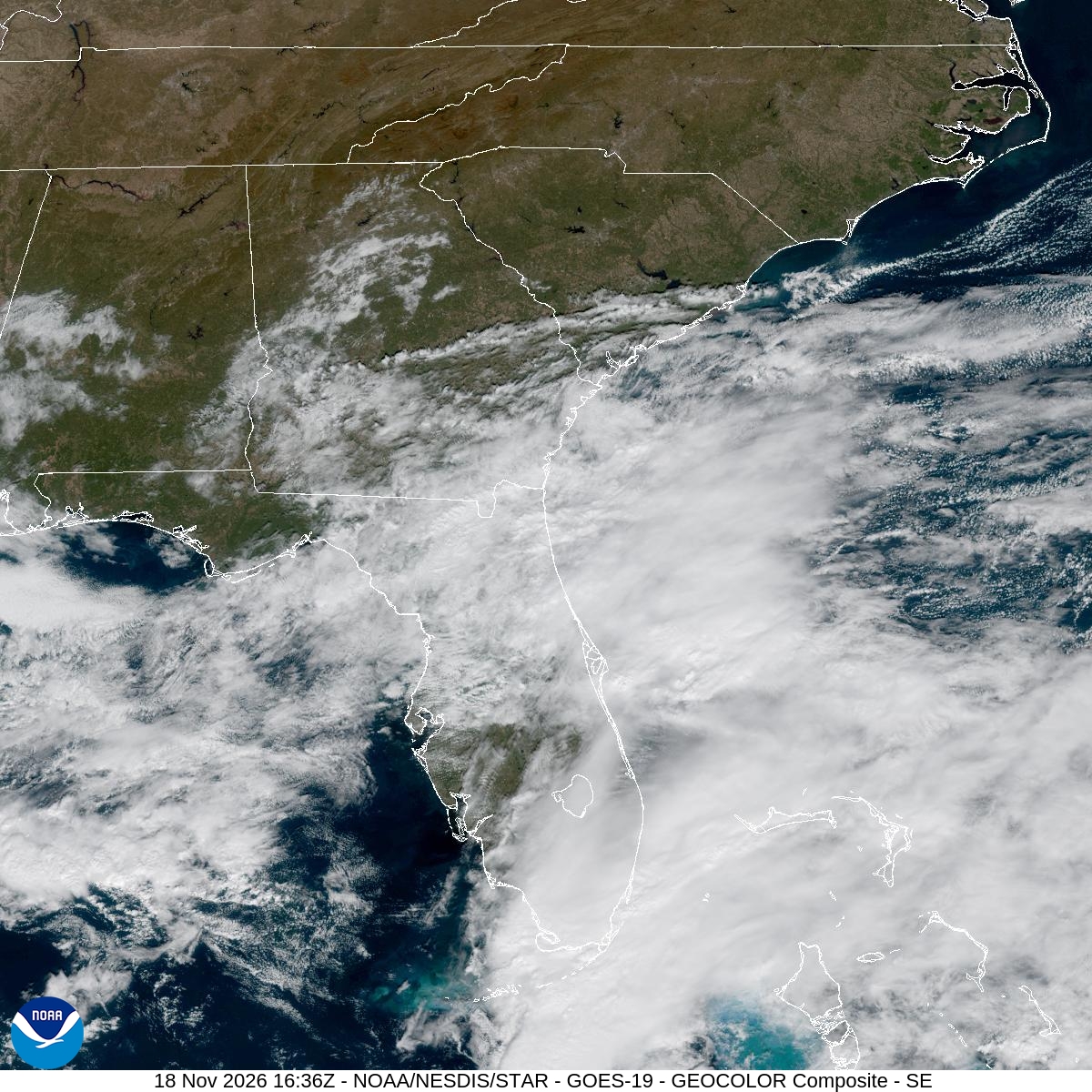
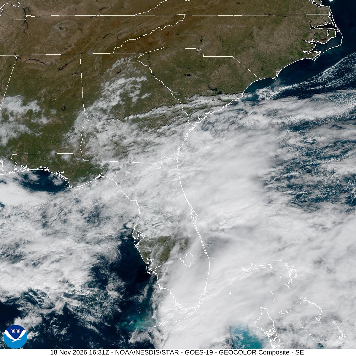
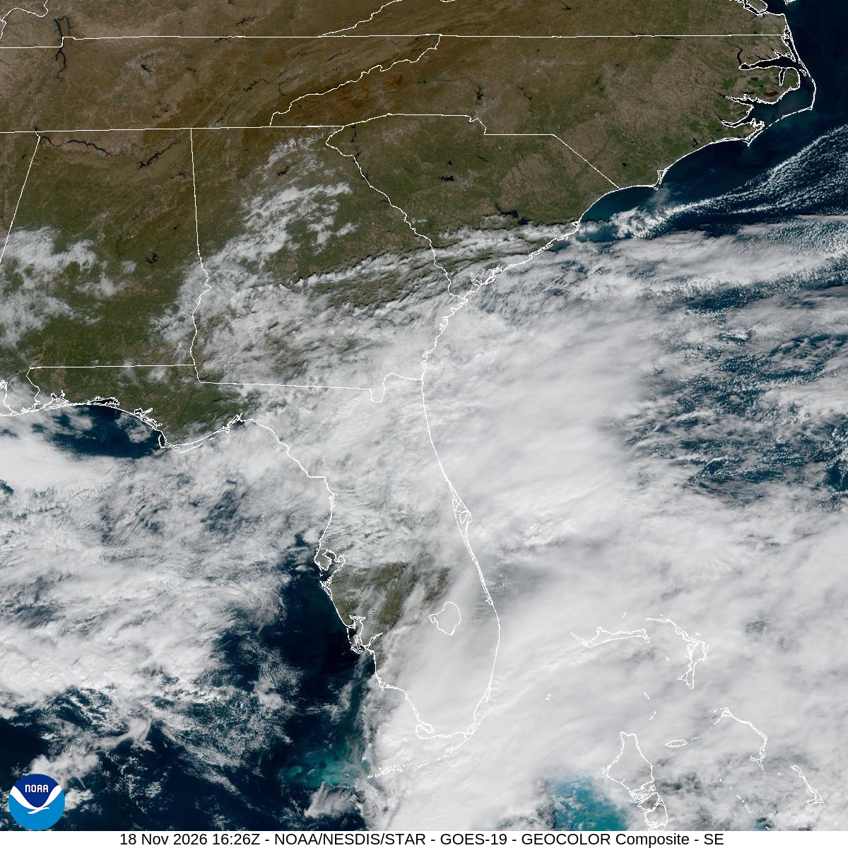
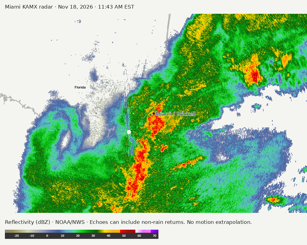
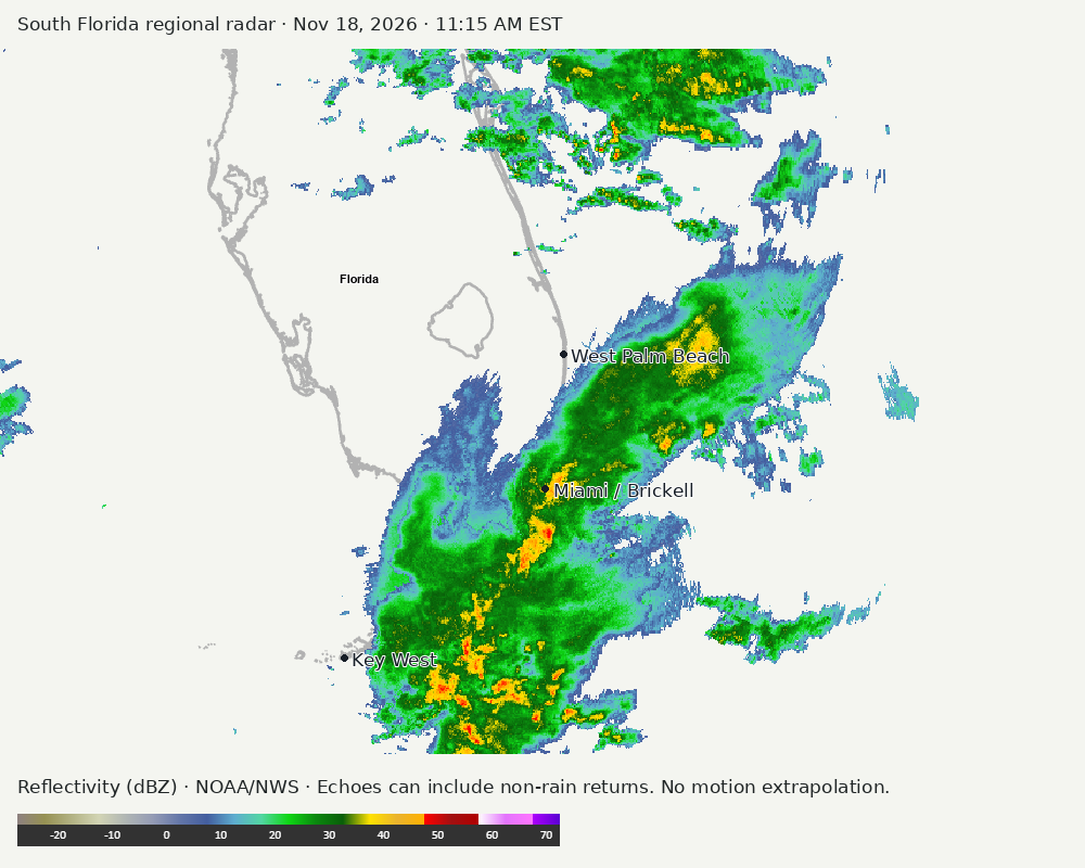
Archived frames show what the instruments captured at their labeled times. Radar echoes can include non-rain returns. No movement or future arrival is inferred automatically from these frames.
Southeast GeoColor satellite
GeoColor shows the Southeast, including Florida. The timestamped sequence below preserves cloud detail without automatically interpreting cloud cover at street level.

Earlier timestamped frames


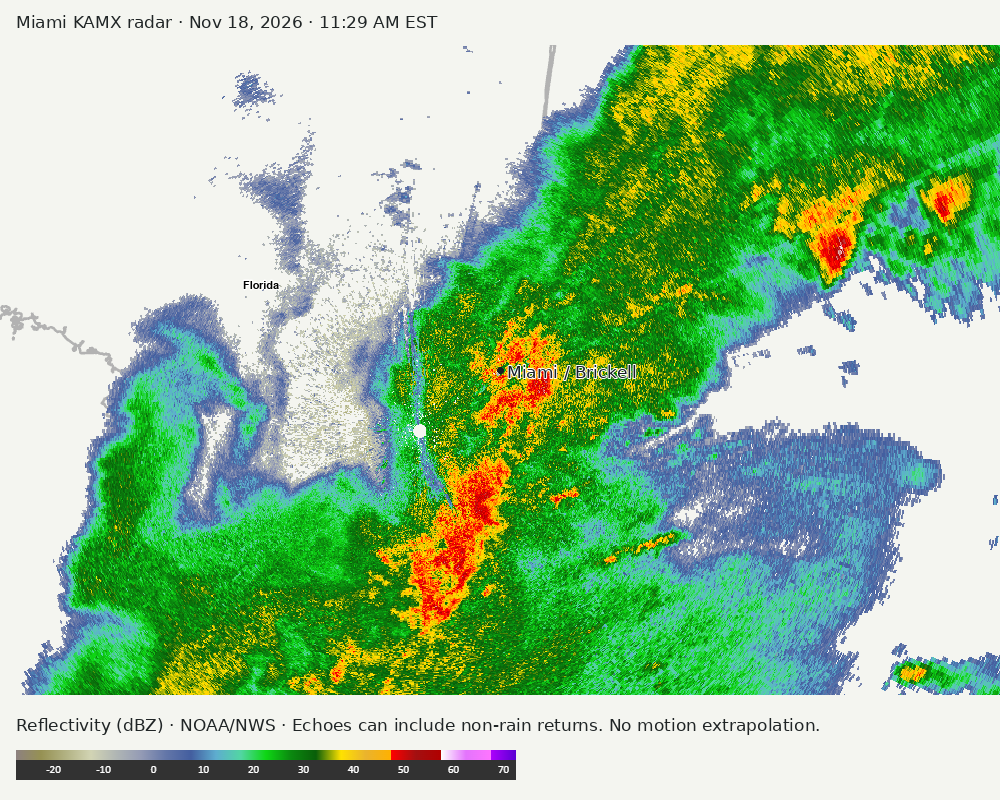
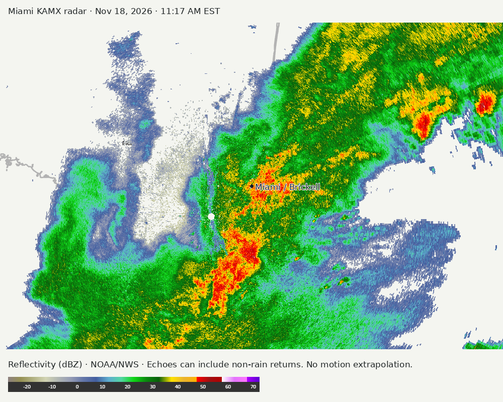
Detailed Miami radar — official KAMX fallback
Colored reflectivity echoes are concentrated northeast of Miami, southwest of Miami, south of Miami relative to Miami in the latest frame. These are echo locations, not confirmation of rain at the surface.
Earlier timestamped frames
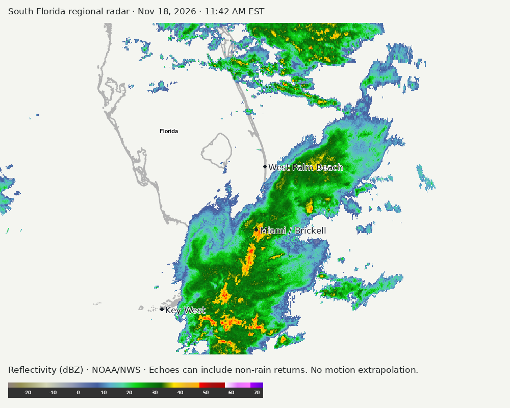
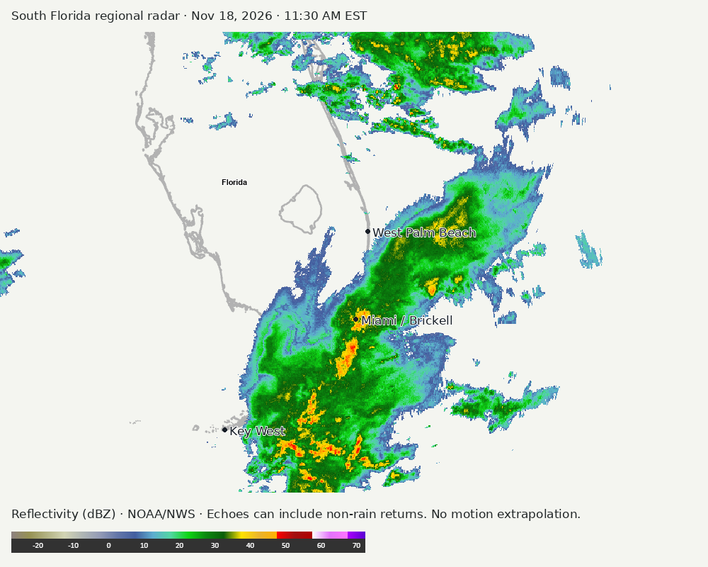
Regional South Florida radar
Colored reflectivity echoes are concentrated northeast of Miami, south of Miami, north of Miami relative to Miami in the latest frame. These are echo locations, not confirmation of rain at the surface.
Earlier timestamped frames
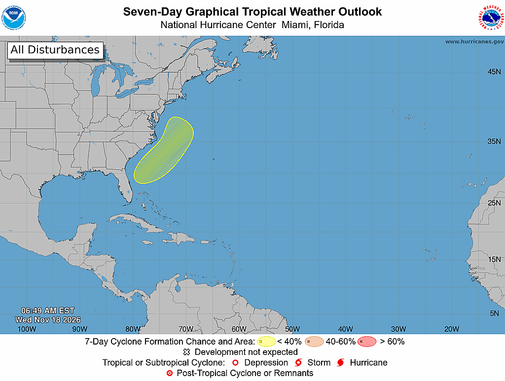
Tropical outlook
The Atlantic outlook describes development potential, not a forecast of impacts in Miami. No local hurricane impact is inferred here.
Read official source text
000
ABNT20 KNHC 181149
TWOAT

Tropical Weather Outlook
NWS National Hurricane Center Miami FL
700 AM EST Wed Nov 18 2026

For the North Atlantic...Caribbean Sea and the Gulf of America:

A non-tropical low pressure system is expected to form near the
northern Bahamas by this weekend.  This system has some potential
for subtropical development while it moves northward or
northeastward near or offshore of the southeastern  U.S. coast
through the weekend.
* Formation chance through 48 hours...low...near 0 percent.
* Formation chance through 7 days...low...20 percent.

$$
Forecaster Pasch/Katz
Miami forecast discussion
Read official source text
000
FXUS62 KMFL 181120
AFDMFL

Area Forecast Discussion
National Weather Service Miami FL
620 AM EST Wed Nov 18 2026

...New AVIATION...

.KEY MESSAGES...
Updated at 617 AM EST Wed Nov 18 2026

  - There is an increased threat of urban flooding along the east
    coast of South Florida the next few days. Impactful flash
    flooding is ongoing across portions of SE Florida and this
    risk is expected to continue over the coming days.

  - Flood Watch in effect for all of Southeast Florida through
    Thursday evening.

  - Dangerous marine conditions continue across local waters with
    sustained winds between 20-30 kts with isolated gusts to 35
    kts. Atlantic seas are expected to climb to 8-12 feet through
    Thursday, with 4-6 feet across Gulf waters.

  - Life threatening rip currents and dangerous surf are forecast
    for Miami-Dade, Broward, and Palm Beach beaches through the
    remainder of this week.

&&

.SHORT TERM...
(Today through Thursday)
Issued at 1232 AM EST Wed Nov 18 2026

Heavy rainfall remains the main concern through the short term
period as a complex and somewhat uncertain weather pattern continues
to play out. At the surface, high pressure remains entrenched across
the eastern seaboard north of Florida, while a weak area of low
pressure continues to meander across the Gulf. Higher up in the
atmosphere, a shortwave continues to slowly progress eastward across
the Gulf coast states which could aid to maintain the surface low,
or even lead to a gradual strengthening over the next couple of
days. A stationary boundary associated with this system remains
draped across the Florida peninsula today and likely tomorrow as
well which will act to maintain a quite impressive plume of moisture
across the Southern Florida peninsula. PWATs from the 00Z MFL
sounding were 1.74 inches which sits just at about the 90th
percentile for this time of year, although modeled PWATs rise into
the 1.8-2.0" range over the coming 24 hours, which would be
extremely impressive for November. In the past 24 hours, portions of
coastal SE Florida have received between 3-5" with coastal Broward
and NE Miami-Dade receiving the highest totals. While we are
currently in a lull during the late overnight hours tonight, the
stage remains set for additional heavy rainfall today and Thursday,
with coastal convergence being the primary concern which could lead
to training cells and flash flooding across urban areas.

Global models still remain a bit confused on the evolution of this
surface low, and latest GFS/EURO runs show an additional surface low
deepening  across the western Atlantic late on Thursday. The exact
progression of this feature will determine where the stationary
boundary meanders over the coming days, which will determine exactly
where the highest rainfall totals will fall. Despite this, I can
speak broadly that the eastern coastal areas of South Florida will
continue to be favored today and tomorrow for periods of heavy
rainfall. Rainfall totals over the next 48 hours will broadly be in
the 2-4" range across most areas of SE Florida, although a
reasonable worst case could bring an additional 5-8" especially for
areas that receive repeated rounds of rainfall. A Flood Watch
remains in effect through Thursday evening.

&&

.LONG TERM...
(Thursday night through Tuesday)
Issued at 1232 AM EST Wed Nov 18 2026

On Friday, global models depict multiple areas of low pressure
across the Gulf and western Atlantic. Our original area of low
pressure remains in the Gulf while an additional lobe of
vorticity is able to break off into the western Atlantic and
becomes the dominant feature. Across the eastern CONUS, high
pressure at the surface begins to breakdown as a cold front sweeps
across the central United States. Before the arrival of drier air for
the weekend, perhaps one additional day of heavy rainfall
potential on Friday, especially earlier in the day as PWATs remain
maximized and will still approach 2". Exact forecast for Friday
will be heavily dependent on the evolution of the surface lows,
however, so I would place confidence on this portion of the
forecast on the lower end for now. The cold front sweeping across
the central CONUS and retreat of high pressure will help pull the
low over the western Atlantic towards the north and finally usher
in drier air across the area through the weekend timeframe. As
this system deepens and races off to the north, PWATs drop into
the 1.2-1.3" range and Saturday and continue to fall to perhaps
below 1" on Sunday and Monday. This should help limit rain chances
through the weekend, although there will still be a chance
(10-20%) for scattered shower activity each day through the
weekend and early next week.

Moisture begins to return heading towards the middle portion of the
week as an area of low pressure slides across the Gulf states. This
will likely be our next shot for more significant rainfall although
details will become clearer over the coming days.

&&

.AVIATION...
(12Z TAFS)
Issued at 617 AM EST Wed Nov 18 2026

Periods of sub-VFR conditions will be likely through the period as
repeated bands of SHRA/TSRA move across the area. Timing remains
uncertain, but TEMPOs and PROB30 groups are in place for all
sites between 16-20Z, and later on from 00-06Z. Winds will remain
brisk, with sustained winds up to 20 kts and gusts up to 30 kts
through the day.

&&

.MARINE...
Issued at 1232 AM EST Wed Nov 18 2026

Strong northeasterly winds will result in hazardous conditions
across all local waters of South Florida through the next couple
of days. Easterly winds between 25-30 kts will be likely through
the day with isolated gusts to 35 kts possible. 8-12 foot seas are
possible across Atlantic waters over the next couple of days with
4-6 feet across Gulf waters. Small Craft Advisories are in effect
through Thursday night.

&&

.BEACHES...
Issued at 1232 AM EST Wed Nov 18 2026

High risk of rip currents across SE Florida beaches as gusty
onshore flow continues. A High Surf Advisory is in effect for
Palm Beach County beaches and Broward County beaches as surf
height could reach 7-10 feet through Thursday.

&&

.PRELIMINARY POINT TEMPS/POPS...
Miami            78  73  81  73 /  70  70  70  30
West Kendall     77  73  81  73 /  60  60  50  20
Opa-Locka        78  72  81  72 /  70  70  80  30
Homestead        79  72  82  72 /  70  60  40  20
Fort Lauderdale  78  72  80  72 /  80  80  80  40
N Ft Lauderdale  78  72  80  72 /  80  80  90  40
Pembroke Pines   79  70  82  71 /  70  70  80  40
West Palm Beach  78  72  80  72 /  80  90  90  50
Boca Raton       78  72  80  72 /  90  90  90  50
Naples           78  68  81  70 /  80  20  30  10

&&

.MFL WATCHES/WARNINGS/ADVISORIES...
FL...Flood Watch through Thursday evening for FLZ067-068-071>074-168-
     172>174.

     High Rip Current Risk through Friday evening for FLZ168-172-173.

     High Surf Advisory until 7 AM EST Friday for FLZ168.

     High Surf Advisory until 7 PM EST Thursday for FLZ172.

AM...Small Craft Advisory until 4 PM EST Thursday for AMZ630.

     Small Craft Advisory until 1 PM EST Friday for AMZ650-651-670-
     671.

GM...Small Craft Advisory until 11 AM EST Thursday for GMZ656-657-676.

&&

$$

SHORT TERM...99
LONG TERM....99
AVIATION...ATV
Sources and freshness
Supplementary failures do not replace missing data with reassuring conclusions. All source times below are Eastern; source metadata and original downloads are archived with this report.
Alerts · available
Source. Retrieved Nov 18, 2026 · 11:45 AM EST.
Beach · available
Source. Retrieved Nov 18, 2026 · 11:45 AM EST. Issued Nov 18, 2026 · 3:06 AM EST.
Coastal Alerts · available
Source. Retrieved Nov 18, 2026 · 11:45 AM EST.
Discussion · available
Source. Retrieved Nov 18, 2026 · 11:45 AM EST. Issued Nov 18, 2026 · 6:20 AM EST.
Forecast · available
Source. Retrieved Nov 18, 2026 · 11:45 AM EST. Issued Nov 18, 2026 · 3:06 AM EST.
Hourly · available
Source. Retrieved Nov 18, 2026 · 11:45 AM EST. Issued Nov 18, 2026 · 3:06 AM EST.
Local Radar · available
Source. Retrieved Nov 18, 2026 · 11:45 AM EST. Issued Nov 18, 2026 · 11:43 AM EST.
Marine · available
Source. Retrieved Nov 18, 2026 · 11:45 AM EST. Issued Nov 18, 2026 · 2:41 AM EST.
Mcnoldy · link-only
Source. Retrieved Nov 18, 2026 · 11:45 AM EST. Original image reuse has not been authorized; official KAMX imagery is used instead.
Nhc · available
Source. Retrieved Nov 18, 2026 · 11:45 AM EST. Issued Nov 18, 2026 · 6:49 AM EST.
Observation · available
Source. Retrieved Nov 18, 2026 · 11:45 AM EST. Issued Nov 18, 2026 · 11:30 AM EST.
Regional Radar · available
Source. Retrieved Nov 18, 2026 · 11:45 AM EST. Issued Nov 18, 2026 · 11:42 AM EST.
Satellite · available
Source. Retrieved Nov 18, 2026 · 11:45 AM EST. Issued Nov 18, 2026 · 11:36 AM EST.
Tropical Tidbits · link-only
Source. Retrieved Nov 18, 2026 · 11:45 AM EST. Optional context only. Imagery is not copied: Tropical Tidbits reserves reuse rights.