Morning Miami Weather Report
Miami, November 19 — Chance Showers And Thunderstorms
Automated weather summary from official sources; factual templates with validated source timestamps. Follow NWS Miami and NHC for current guidance.
Forecast for Miami / Brickell
Today: 80°F. Chance Showers And Thunderstorms. Wind 10 to 15 mph E. Rain chance: 52%.
A chance of showers and thunderstorms. Mostly sunny, with a high near 80. East wind 10 to 15 mph, with gusts as high as 20 mph. Chance of precipitation is 50%. New rainfall amounts between a tenth and quarter of an inch possible.
Tonight: A chance of showers and thunderstorms. Mostly cloudy, with a low around 74. North wind around 9 mph. Chance of precipitation is 40%. New rainfall amounts between a tenth and quarter of an inch possible.
Hourly forecast — rain chances and timing
| Eastern time | Temperature | Rain chance | Wind | Forecast |
|---|---|---|---|---|
| Nov 19, 2026 · 8:00 AM EST | 77°F | 50% | 15 mph E | Chance Showers And Thunderstorms |
| Nov 19, 2026 · 9:00 AM EST | 78°F | 43% | 15 mph E | Chance Showers And Thunderstorms |
| Nov 19, 2026 · 10:00 AM EST | 78°F | 45% | 15 mph E | Chance Showers And Thunderstorms |
| Nov 19, 2026 · 11:00 AM EST | 79°F | 49% | 15 mph E | Chance Showers And Thunderstorms |
| Nov 19, 2026 · 12:00 PM EST | 79°F | 47% | 15 mph E | Chance Showers And Thunderstorms |
| Nov 19, 2026 · 1:00 PM EST | 78°F | 38% | 14 mph E | Chance Showers And Thunderstorms |
| Nov 19, 2026 · 2:00 PM EST | 79°F | 42% | 14 mph E | Chance Showers And Thunderstorms |
| Nov 19, 2026 · 3:00 PM EST | 79°F | 52% | 13 mph E | Chance Showers And Thunderstorms |
| Nov 19, 2026 · 4:00 PM EST | 80°F | 45% | 12 mph E | Chance Showers And Thunderstorms |
| Nov 19, 2026 · 5:00 PM EST | 78°F | 47% | 10 mph E | Chance Showers And Thunderstorms |
| Nov 19, 2026 · 6:00 PM EST | 78°F | 35% | 9 mph NE | Chance Showers And Thunderstorms |
| Nov 19, 2026 · 7:00 PM EST | 78°F | 35% | 9 mph NE | Chance Rain Showers |
| Nov 19, 2026 · 8:00 PM EST | 78°F | 37% | 9 mph NE | Chance Rain Showers |
| Nov 19, 2026 · 9:00 PM EST | 78°F | 36% | 8 mph NE | Chance Rain Showers |
| Nov 19, 2026 · 10:00 PM EST | 77°F | 38% | 8 mph N | Chance Rain Showers |
| Nov 19, 2026 · 11:00 PM EST | 77°F | 30% | 7 mph N | Chance Rain Showers |
Observed nearby
Miami International Airport (KMIA), Nov 19, 2026 · 7:41 AM EST: Mostly Cloudy. Temperature 77°F; wind 10 mph. This airport observation does not measure conditions at your exact location in Brickell.
Alerts and outdoor plans
You should monitor later forecasts and be prepared to take action should Flash Flood Warnings be issued.
Swim near a lifeguard. If caught in a rip current, relax and float. Don't swim against the current. If able, swim in a direction following the shoreline. If unable to escape, face the shore and call or wave for help.
You should monitor later forecasts and be prepared to take action should Flash Flood Warnings be issued.
Swim near a lifeguard. If caught in a rip current, relax and float. Don't swim against the current. If able, swim in a direction following the shoreline. If unable to escape, face the shore and call or wave for help.
Inexperienced mariners, especially those operating smaller vessels, should avoid navigating in hazardous conditions.
Inexperienced mariners, especially those operating smaller vessels, should avoid navigating in hazardous conditions.
Running: Use the temperature, rain and wind forecast above to plan your window. If thunderstorms are forecast or you hear thunder, postpone outdoor activity and seek a substantial building. This briefing does not certify a safe running window.
Paddleboarding — official Biscayne Bay forecast
Today: E winds 10 to 15 kt (17 mph). A moderate chop. Showers likely with a chance of tstms early this morning, then a chance of showers late this morning and afternoon. A slight chance of tstms this afternoon.
Tonight: N winds 5 to 10 kt (12 mph). Light chop.
Fri: NW winds 5 to 10 kt (12 mph). Light chop.
Wind speeds in the source use knots (1 knot = 1.151 mph). Check current marine alerts and local conditions before launching; no safe launch window is inferred.
Official coastal Miami-Dade beach and rip-current guidance
FLZ173-192200-
Coastal Miami-Dade-
Including the beaches of Miami
316 AM EST Thu Nov 19 2026

...HIGH RIP CURRENT RISK IN EFFECT THROUGH FRIDAY EVENING...

.TODAY...
Rip Current Risk*...........High.
Surf Height.................3 to 5 feet.
Thunderstorm Potential**....Moderate.
Waterspout Risk**...........None.
UV Index**..................Moderate.
Water Temperature...........In the mid 70s.
Weather.....................Mostly sunny. Showers likely and a
                            chance of thunderstorms.
High Temperature............Around 80.
Winds.......................East winds around 15 mph.
Tides...
   Miami Harbor Entrance....Low at 09:28 AM EST.
                            High at 03:49 PM EST.
Sunrise.....................6:41 AM.
Sunset......................5:31 PM.

.FRIDAY...
Rip Current Risk*...........High.
Surf Height.................1 foot or less.
Thunderstorm Potential**....None.
Waterspout Risk**...........None.
Weather.....................Partly sunny. A chance of showers.
High Temperature............In the lower 80s.
Winds.......................Northwest winds around 10 mph.
Tides...
   Miami Harbor Entrance....Low at 10:22 AM EST.
                            High at 04:41 PM EST.
Sunrise.....................6:41 AM.
Sunset......................5:31 PM.

&&

Rip Current Risk Category
* Low Risk - The risk for rip currents is low, however,
life-threatening rip currents often occur in the vicinity of groins,
jetties, reefs, and piers.
* Moderate Risk - Life-threatening rip currents are possible in the
surf zone.
* High Risk - Life-threatening rip currents are likely in the surf
zone.

** For thunderstorm, waterspout, and UV definitions see:
https://www.weather.gov/beach/mfl
Satellite and radar
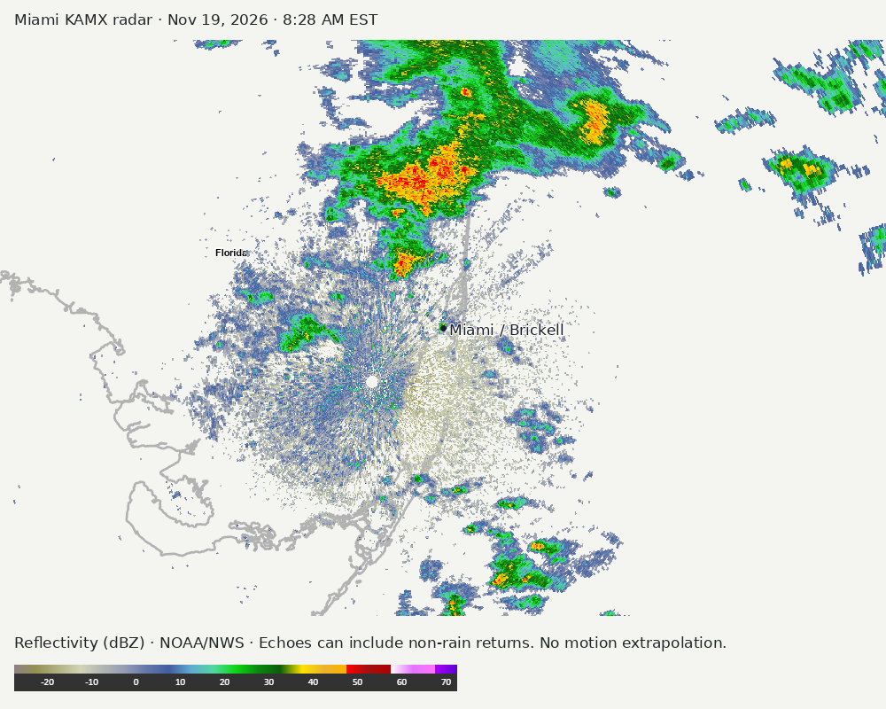
Archived frames show what the instruments captured at their labeled times. Radar echoes can include non-rain returns. No movement or future arrival is inferred automatically from these frames.
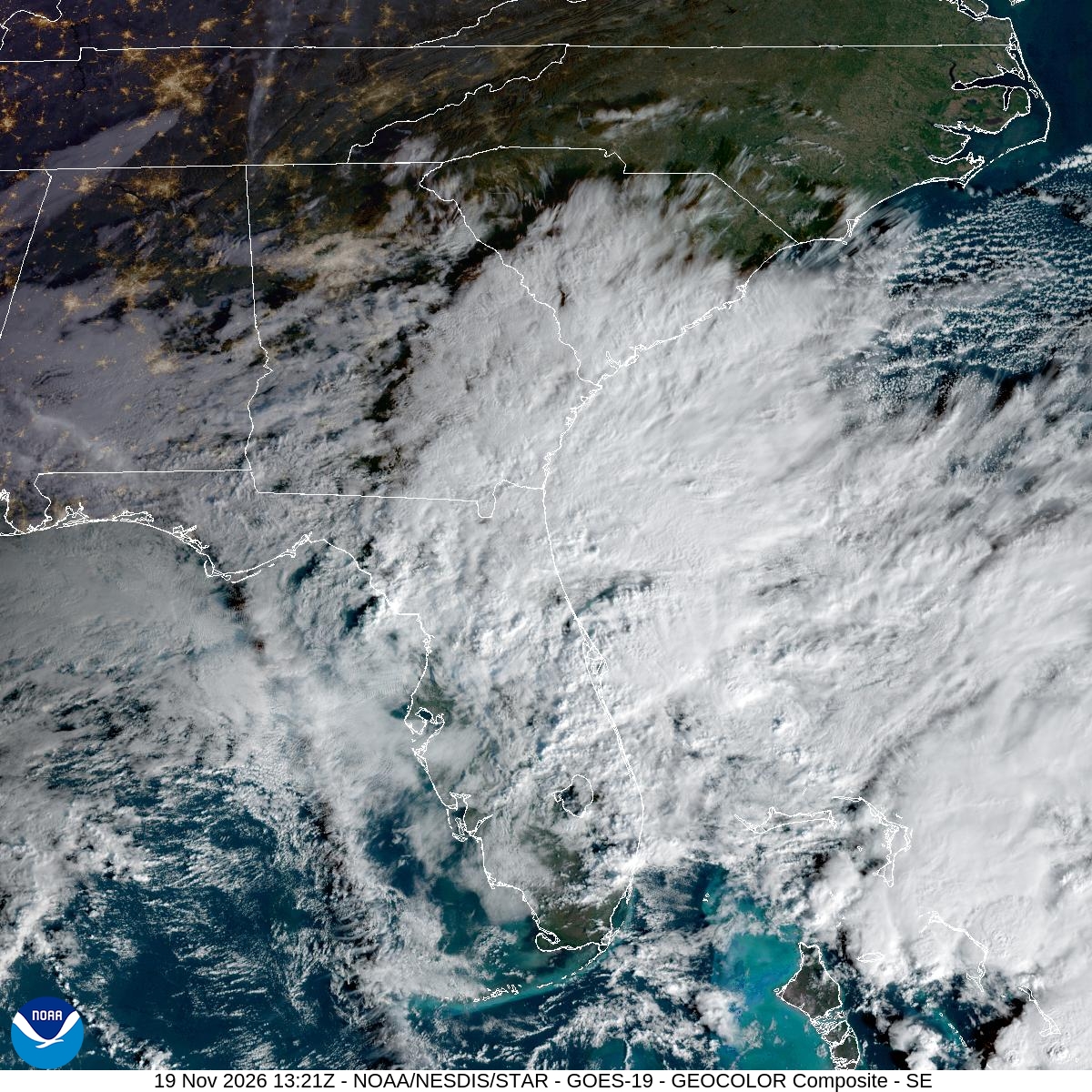
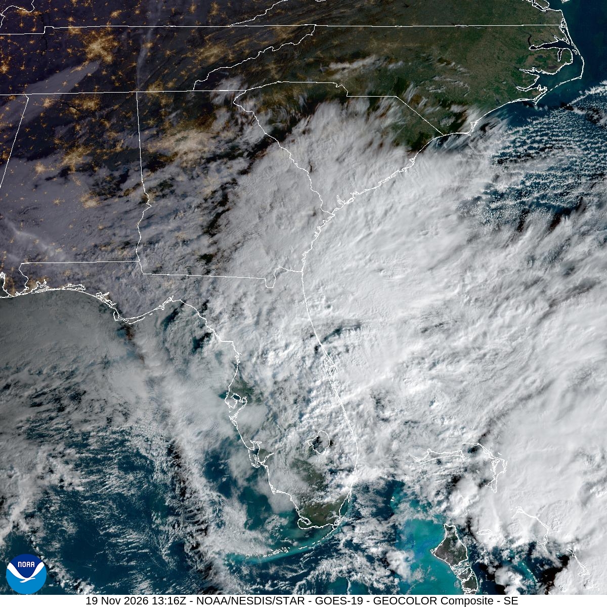
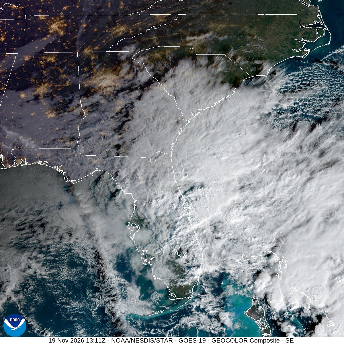
Southeast GeoColor satellite
GeoColor shows the Southeast, including Florida. The timestamped sequence below preserves cloud detail without automatically interpreting cloud cover at street level.

Earlier timestamped frames


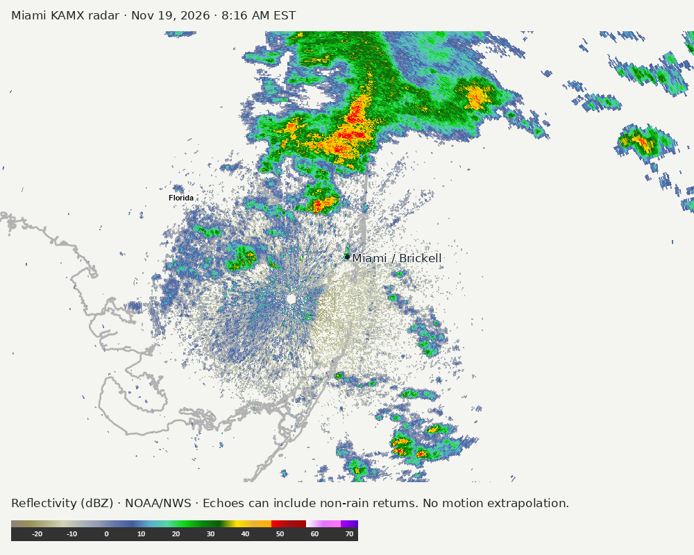
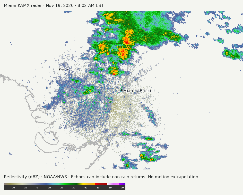
Detailed Miami radar — official KAMX fallback
Colored reflectivity echoes are concentrated north of Miami, northeast of Miami, northwest of Miami relative to Miami in the latest frame. These are echo locations, not confirmation of rain at the surface.
Earlier timestamped frames
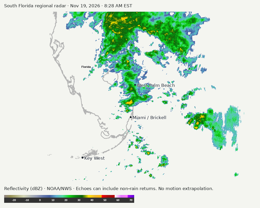
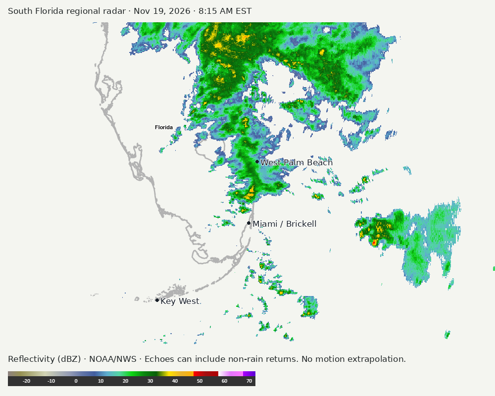
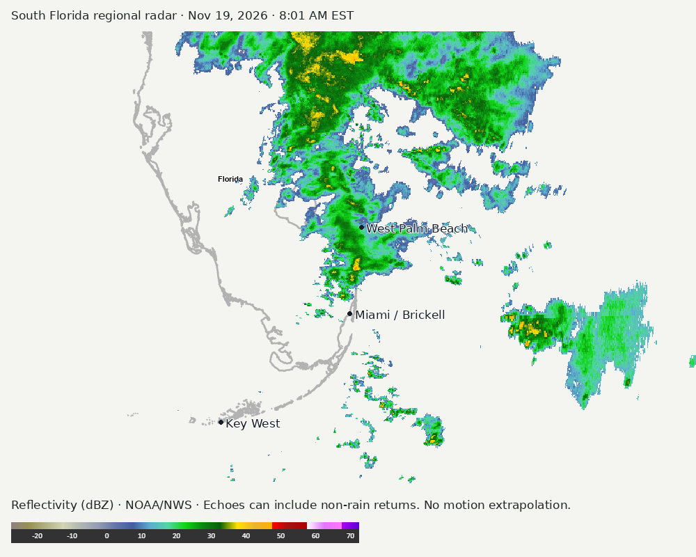
Regional South Florida radar
Colored reflectivity echoes are concentrated north of Miami, northeast of Miami, east of Miami relative to Miami in the latest frame. These are echo locations, not confirmation of rain at the surface.
Earlier timestamped frames
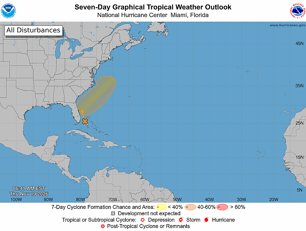
Tropical outlook
The Atlantic outlook describes development potential, not a forecast of impacts in Miami. No local hurricane impact is inferred here.
Read official source text
000
ABNT20 KNHC 191148
TWOAT

Tropical Weather Outlook
NWS National Hurricane Center Miami FL
700 AM EST Thu Nov 19 2026

For the North Atlantic...Caribbean Sea and the Gulf of America:

Offshore of the Southeast U.S. Coast:
Disorganized showers and thunderstorms near the northwestern Bahamas
and Florida are associated with a frontal system.  A non-tropical
low pressure system is expected to form along the front near the
northwest Bahamas on Friday.  This system could become a subtropical
or tropical storm while it moves northward or northeastward near or
just offshore of the southeastern U.S. coast through the weekend.
Regardless of development, strong winds, dangerous surf, and coastal
flooding are likely along portions of the southeast and mid-Atlantic
coasts into early next week.  Interests along the eastern U.S. coast
should monitor the progress of this system.  For more information
on this system, including Gale Warnings, please see High Seas
Forecasts issued by the National Weather Service.
* Formation chance through 48 hours...low...20 percent.
* Formation chance through 7 days...medium...60 percent.

&&

High Seas Forecasts issued by the National Weather Service can be
found under AWIPS header NFDHSFAT1, WMO header FZNT01 KWBC, and
online at ocean.weather.gov/shtml/NFDHSFAT1.php

$$
Forecaster Hagen
Miami forecast discussion
Read official source text
000
FXUS62 KMFL 191145
AFDMFL

Area Forecast Discussion
National Weather Service Miami FL
645 AM EST Thu Nov 19 2026

...New AVIATION...

.KEY MESSAGES...
Updated at 636 AM EST Thu Nov 19 2026

  - Flash flood threat continues along the east coast, with
    isolated high end amounts lowering into the 3 to 5" range.

  - Widespread flood threat lowers by Friday, with drying expected
    this weekend.

  - Hazardous marine and beach conditions expected to continue
    into the weekend along the Atlantic coast.

&&

.SYNOPSIS...
Issued at 218 AM EST Thu Nov 19 2026

Over the past couple of days, a northern stream shortwave moved out
of the Lower MS valley and across the northern Gulf while a southern
stream shortwave moved from southern TX through the central Gulf.
These features merged into a mid/upper trough across the eastern
Gulf. The merging of these features resulted in what is now a cutoff
mid-level low, with an upper-level trough axis that bends through
the Mid-Atlantic and Southeast, and then down the spine of Florida.
At the surface, we've remained at the base of the eastern CONUS
ridge, with broad Gulf troughing in response to the features aloft.
The strong easterly flow across the Atlantic SST front along the
Gulf Stream favors banding convection that typically has nocturnal
peaks. This surface forcing has been aided by the aforementioned
features aloft to result in robust training convection that brought
considerable flooding to locations across south Florida.

Water vapor imagery this morning depicts a sliver of dry air moving
from the Florida Straits into south Florida. While it wasn't quite
in place at the time of the 00z sounding this evening, it was at
KEY, with a large area of dry air present above 700mb. A 04z hand
analysis depicts the persistent east coast trough in the thermal and
pressure fields.

&&

.SHORT TERM...
(Today through Friday)
Issued at 218 AM EST Thu Nov 19 2026

While the generalized picture of the synoptic evolution is well
agreed upon by the global ensembles, there are some differences in
the smaller details which could have an impact on precip coverage
today. Generally speaking, the mid-level low will absorb into the
northern stream as a large shortwave moves through the center of the
country. At the same time, the upper trough will continue its drift
into the western Atlantic as another southern stream wave moves out
of south Texas into the western Gulf. The subtleties are just how
amplified the surface pattern becomes through the day which has to
do with two separate features (1) western Gulf wave (2) the east
coast cutoff. A slightly more amplified west Gulf wave may illicit a
more amplified trough in the Gulf which could take away a bit of the
direct onshore flow locally. A larger or further south east coast
wave could support more robust surface response near the Bahamas
which could also remove some of the direct onshore flow. The wetter
solutions tend to preserve the more direct onshore flow and
persistent east coast surface trough. CAM guidance hasn't been a
huge help as they've tended to have quite a bit of misplaced
convection compared to the current conditions. I can find a few HRRR
runs that have a decent grasp on the current picture, and those tend
to be a little drier today on the widespread average (though still
have bands of rain passing through the area). Global guidance with a
larger mid-level low seem to match a little closer to an objective
SPC analysis of 500mb heights from 00z radiosondes. This plus the
dry air on satellite imagery and noted in the soundings steer me in
the direction of a gradual pattern shift today.

Less upper-level support, a north/south PWAT gradient, but continued
low-level easterly flow seem to favor a pattern of bands of precip
affecting mainly Palm Beach and Broward counties with slightly lower
rain rates than the past couple of days. Across these locations
expect that showers could quickly produce 1 to 2 inches of rainfall,
with the localized higher amounts being on the order of 3 to 5
inches. The signal for isolated amounts of 8", 10", or above appear
to move north of South Florida today. In many locations, however,
the damage has already been done and any additional rainfall could
aggravate ongoing flooding, and even 1 to 2 inches could result in
quite impactful consequences. Thus, the flood watch will remain in
place today and our bar for Flash Flood warnings lowered a bit in
the hardest hit areas.

How things play out on Friday will depend on the evolution of the
surface low in the western Atlantic. The general idea is that the
upper wave today will assist in the early formation of the low, and
by Friday the eastern Gulf shortwave will reach the western Atlantic
and influence further development of the low. The GEFS and ECMWF ENS
support this with varying position and strength solutions while the
GEPS favors very little development and continued onshore flow
(we'll count this as an outlier for now). Depending on how strong
and how far west the low tracks, Palm Beach county may remain under
the threat for heavy rainfall for another day. While it'll be most
common for an inch or two of rain in passing storms, there is a low
end chance that an isolated location could pick up 2-4" over a short
period of time. For now, any extension of the flood watch will be
passed on to our day shift for further consideration based on
rainfall today and model trends over the next 12 hours. While it's
unlikely that it'll be completely dry elsewhere across the south
Florida, only light inconsequential showers are anticipated at this
time.

&&

.LONG TERM...
(Friday night through Wednesday)
Issued at 218 AM EST Thu Nov 19 2026

As we start the weekend, the aforementioned surface low is expected
to move up the Eastern Seaboard, removing its influence from the
local area. The southern stream is forecast to shift north across
the southern third of the CONUS resulting, locally, in mostly zonal
flow aloft at the base of a broad full CONUS trough. Global
ensembles are in rather good agreement in this evolution through
early next week. They begin to diverge a bit around mid-week when
the pattern amplifies a bit and a shortwave moves across the
country bringing our next best chance of rain. We should be able
to squeeze out 2 or 3 relatively dry days before then though.
Seasonable temperatures are expected late this weekend through
early next week.

&&

.AVIATION...
(12Z TAFS)
Issued at 636 AM EST Thu Nov 19 2026

SUB-VFR conditions will be likely across all sites today as
scattered SHRA/TSRA moves across the area. A fog bank is also
impinging on KAPF early this morning, resulting in lower cigs.
TEMPOs are in place. Otherwise, brisk easterly winds 10-15 kts
with gusts up to 25 kts remain likely through the day.

&&

.MARINE...
Issued at 218 AM EST Thu Nov 19 2026

Hazardous marine conditions are expected to continue across
Atlantic waters through the weekend as an area of low pressure
develops near the Bahamas and slowly lifts northward. While
advisory level winds may subside by Friday, seas likely won't fall
below advisory levels for our Atlantic waters until the end of
the weekend. Scattered storms with heavy rain will continue
through Friday, with rain chances lowering this weekend.

&&

.BEACHES...
Issued at 218 AM EST Thu Nov 19 2026

Moderate to strong onshore flow will continue through at least
today before turning more longshore by Friday. Life threatening
rip currents and dangerous surf will continue today, with the high
rip current risk likely persisting through Saturday.

&&

.PRELIMINARY POINT TEMPS/POPS...
Miami            81  72  83  71 /  60  30  30  20
West Kendall     81  72  83  71 /  40  20  20  10
Opa-Locka        82  71  84  70 /  60  40  40  20
Homestead        82  71  84  70 /  40  20  20  10
Fort Lauderdale  80  71  82  70 /  80  60  40  30
N Ft Lauderdale  80  72  82  70 /  80  60  50  30
Pembroke Pines   82  70  84  69 /  70  50  40  20
West Palm Beach  80  71  81  70 /  90  60  80  40
Boca Raton       80  73  82  71 /  90  60  70  30
Naples           82  70  81  70 /  20   0  20  10

&&

.MFL WATCHES/WARNINGS/ADVISORIES...
FL...Flood Watch through this evening for FLZ067-068-071>074-168-
     172>174.

     High Rip Current Risk through Friday evening for FLZ168-172-173.

     High Surf Advisory until 7 AM EST Friday for FLZ168.

     High Surf Advisory until 7 PM EST this evening for FLZ172.

AM...Small Craft Advisory until 4 PM EST this afternoon for AMZ630.

     Small Craft Advisory until 1 PM EST Friday for AMZ650-651-670-
     671.

GM...Small Craft Advisory until 11 AM EST this morning for GMZ656-657-
     676.

&&

$$

SHORT TERM...Harrigan
LONG TERM....Harrigan
AVIATION...ATV
Sources and freshness
Supplementary failures do not replace missing data with reassuring conclusions. All source times below are Eastern; source metadata and original downloads are archived with this report.
Alerts · available
Source. Retrieved Nov 19, 2026 · 8:31 AM EST.
Beach · available
Source. Retrieved Nov 19, 2026 · 8:31 AM EST. Issued Nov 19, 2026 · 3:16 AM EST.
Coastal Alerts · available
Source. Retrieved Nov 19, 2026 · 8:31 AM EST.
Discussion · available
Source. Retrieved Nov 19, 2026 · 8:31 AM EST. Issued Nov 19, 2026 · 6:45 AM EST.
Forecast · available
Source. Retrieved Nov 19, 2026 · 8:31 AM EST. Issued Nov 19, 2026 · 3:17 AM EST.
Hourly · available
Source. Retrieved Nov 19, 2026 · 8:31 AM EST. Issued Nov 19, 2026 · 3:17 AM EST.
Local Radar · available
Source. Retrieved Nov 19, 2026 · 8:31 AM EST. Issued Nov 19, 2026 · 8:28 AM EST.
Marine · available
Source. Retrieved Nov 19, 2026 · 8:31 AM EST. Issued Nov 19, 2026 · 2:41 AM EST.
Mcnoldy · link-only
Source. Retrieved Nov 19, 2026 · 8:31 AM EST. Original image reuse has not been authorized; official KAMX imagery is used instead.
Nhc · available
Source. Retrieved Nov 19, 2026 · 8:31 AM EST. Issued Nov 19, 2026 · 6:48 AM EST.
Observation · available
Source. Retrieved Nov 19, 2026 · 8:31 AM EST. Issued Nov 19, 2026 · 7:41 AM EST.
Regional Radar · available
Source. Retrieved Nov 19, 2026 · 8:31 AM EST. Issued Nov 19, 2026 · 8:28 AM EST.
Satellite · available
Source. Retrieved Nov 19, 2026 · 8:31 AM EST. Issued Nov 19, 2026 · 8:21 AM EST.
Tropical Tidbits · link-only
Source. Retrieved Nov 19, 2026 · 8:31 AM EST. Optional context only. Imagery is not copied: Tropical Tidbits reserves reuse rights.